
 |
 |
 |
| 70-mm magazine B - AS09-21-3178 to 3323 |
Photography Index | 70-mm magazine D - AS09-23-3475 to 3618 |
No copyright is asserted for NASA photographs. If a recognizable person appears in a photo, use for commercial purposes may infringe a right of privacy or publicity. Photos may not be used to state or imply the endorsement by NASA or by any NASA employee of a commercial product, process or service, or used in any other manner that might mislead. Accordingly, it is requested that if a NASA photograph is used in advertising and other commercial promotion, layout and copy be submitted to NASA prior to release. NASA photos reproduced from this archive should include photo credit to "NASA" or "National Aeronautics and Space Administration" and should include scanning credit to the appropriate individuals or agencies as noted in the captions.
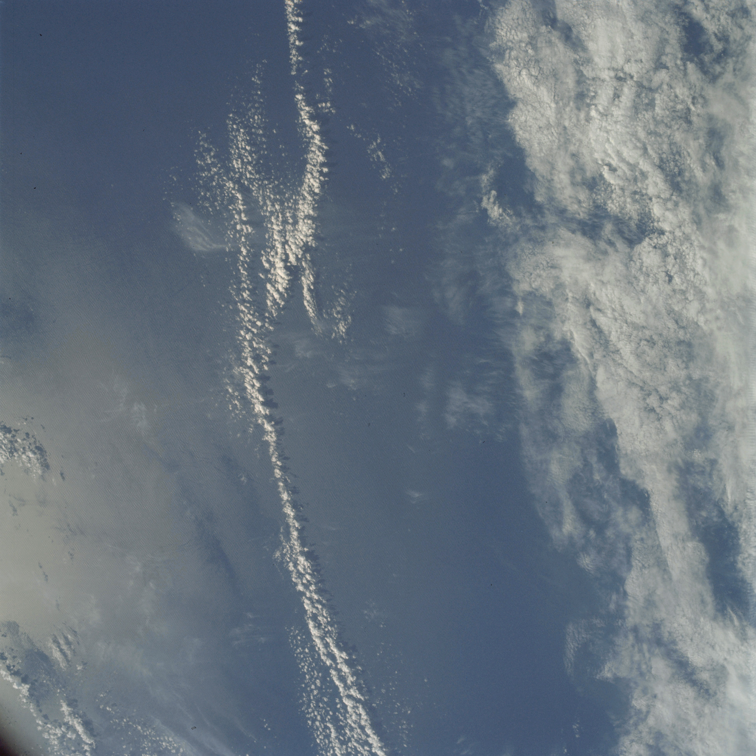 | AS09-22-3324 METEOROLOGY: Cirrus fibratus, cumulus humilis, alto-cumulus. OCEANOGRAPHY: Swell patterns visible in sun glint area. Image credit: Image Science and Analysis Laboratory, NASA-Johnson Space Center. |
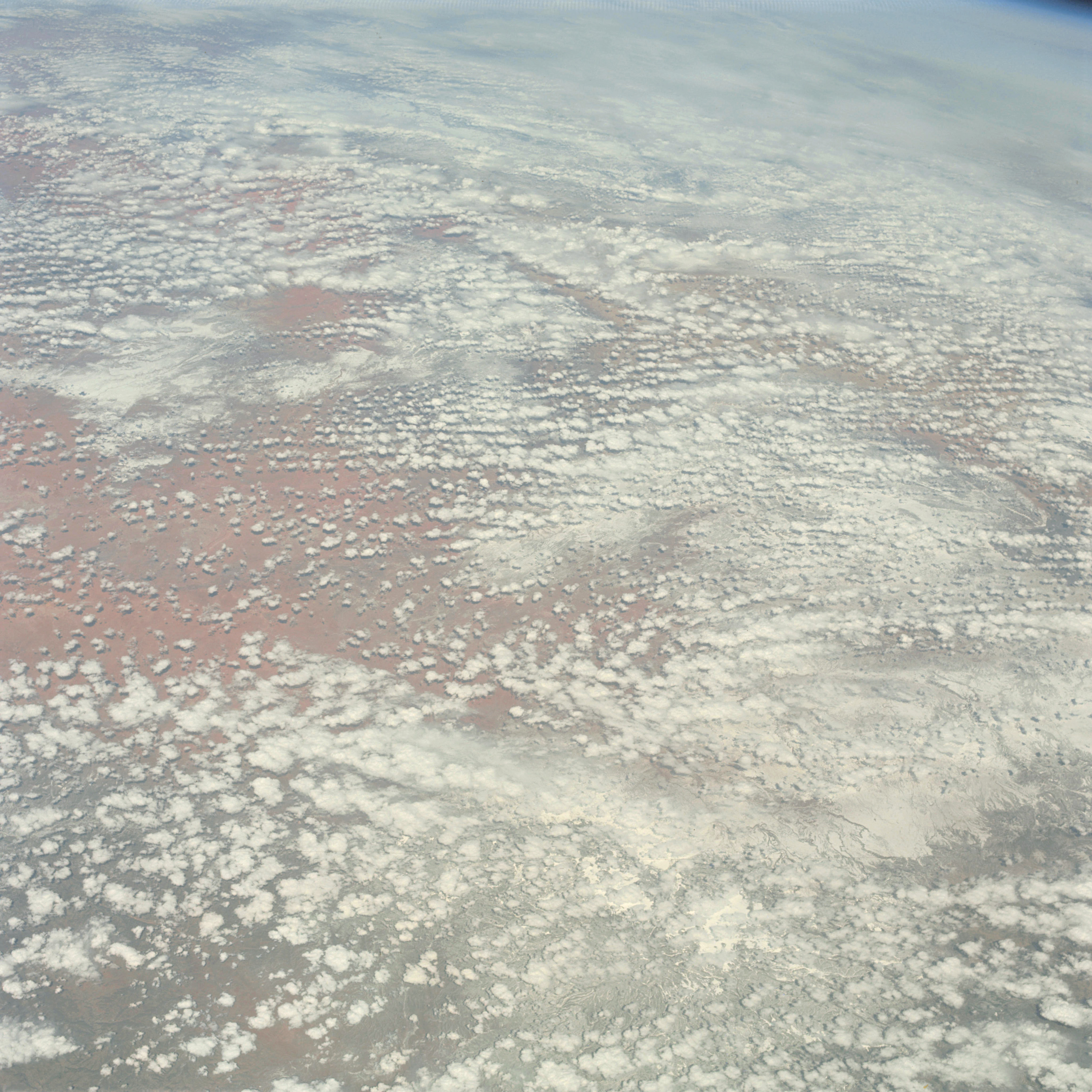 | AS09-22-3325 * 1112 O2W 10 Normal 2001 (105 GEOGRAPHY/CARTOGRAPHY: United States; Arizona, Utah. GEOLOGY/HYDROLOGY: Basin and range province. METEOROLOGY: Cumulus humilis, snow cover in mountain and high plateau areas. Image credit: Image Science and Analysis Laboratory, NASA-Johnson Space Center. |
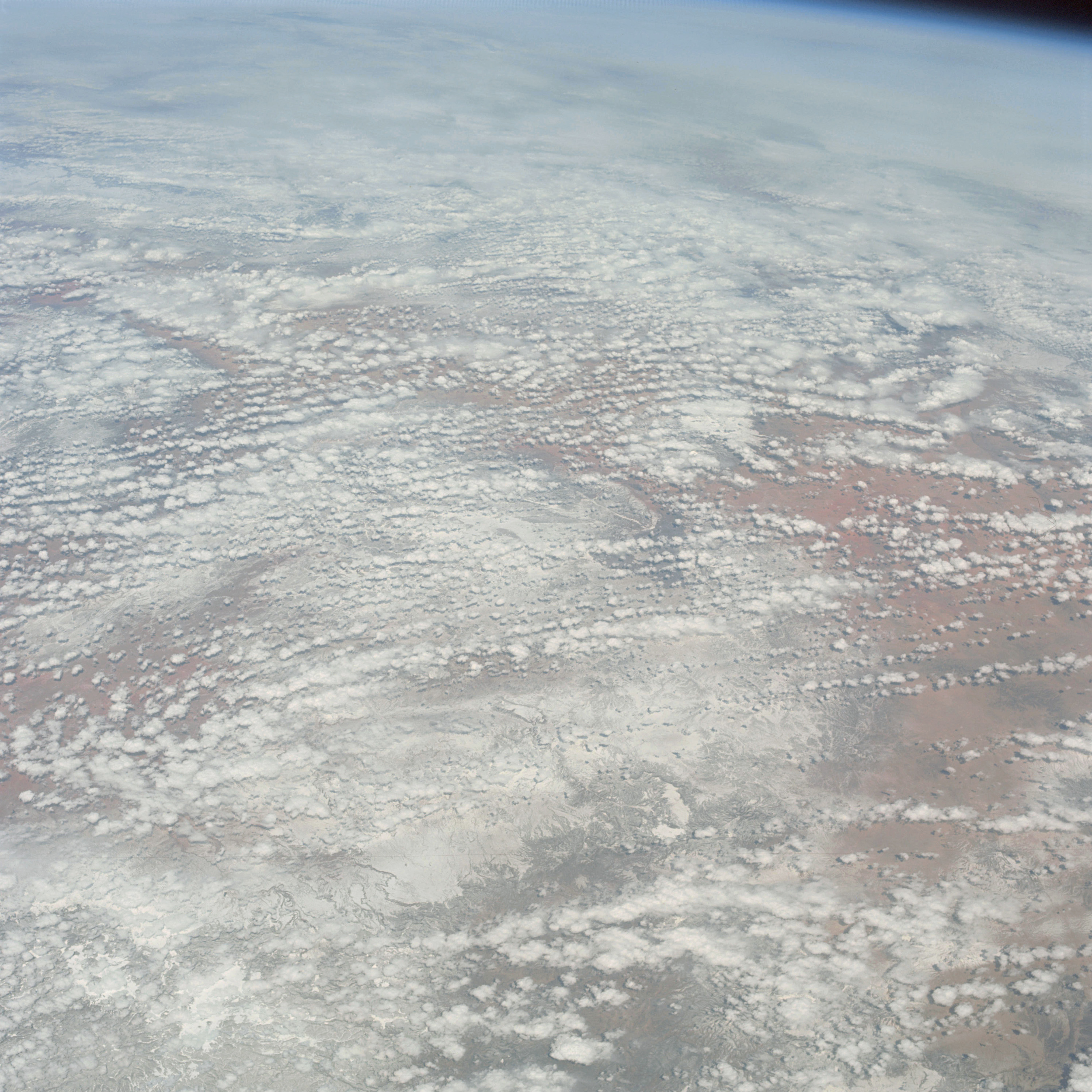 | AS09-22-3326 GEOGRAPHY/CARTOGRAPHY: United States; Arizona, Utah, New Mexico. GEOLOGY/HYDROLOGY: Basin and Range Province and Southern Rocky Mountain complex. METEOROLOGY: Cumulus humilis, snow cover in mountain and high plateau areas. Image credit: Image Science and Analysis Laboratory, NASA-Johnson Space Center. |
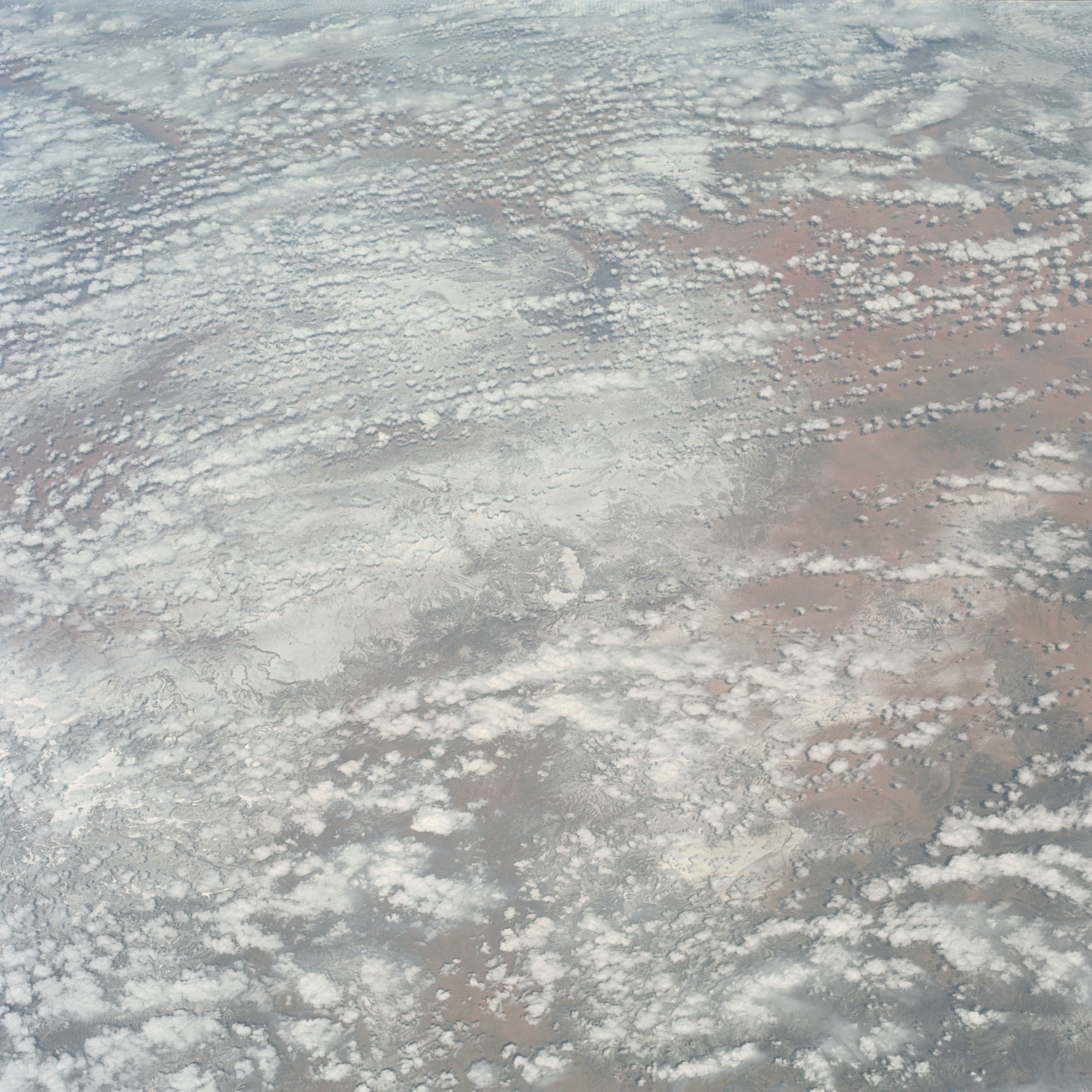 | AS09-22-3327 GEOGRAPHY/CARTOGRAPHY: United States; Arizona, New Mexico, Colorado. GEOLOGY/HYDROLOGY: Basin and Range Province, METEOROLOGY: Cumulus humilis, snow cover in mountain and high plateau areas. Image credit: Image Science and Analysis Laboratory, NASA-Johnson Space Center. |
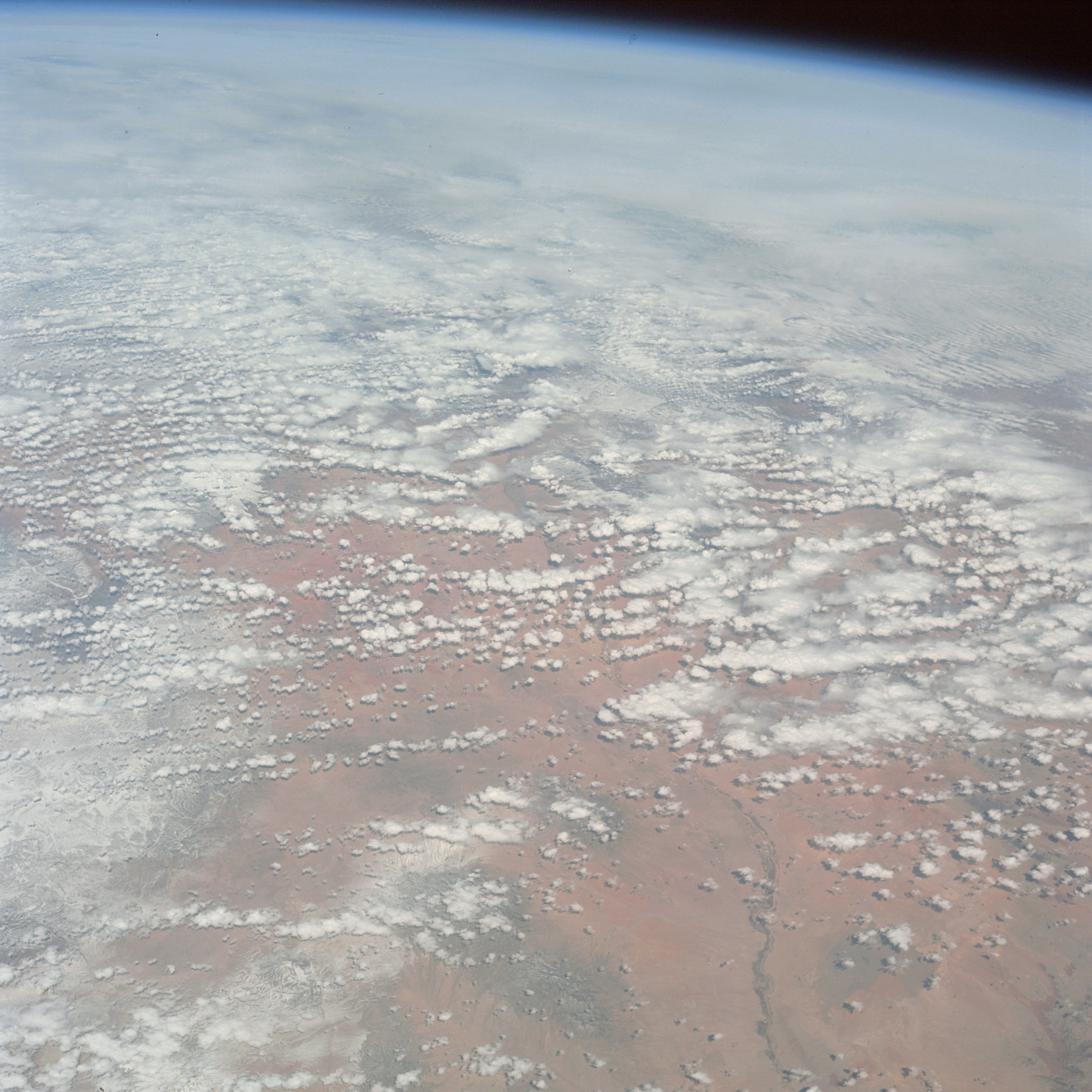 | AS09-22-3328 GEOGRAPHY/CARTOGRAPHY: United States, New Mexico, Colorado, Black Mountains, Rio Grande, Elephant Butte Reservoir. GEOLOGY/HYDROLOGY: Basin and Range Province, quaternary alluvium and volcanic mountains. FORESTRY: Mixed conifers at higher elevations, desert shrubform with deciduous shrubform at lower elevations. METEOROLOGY: Cumulus humilis, alto-cumulus, cumulus fractus. Image credit: Image Science and Analysis Laboratory, NASA-Johnson Space Center. |
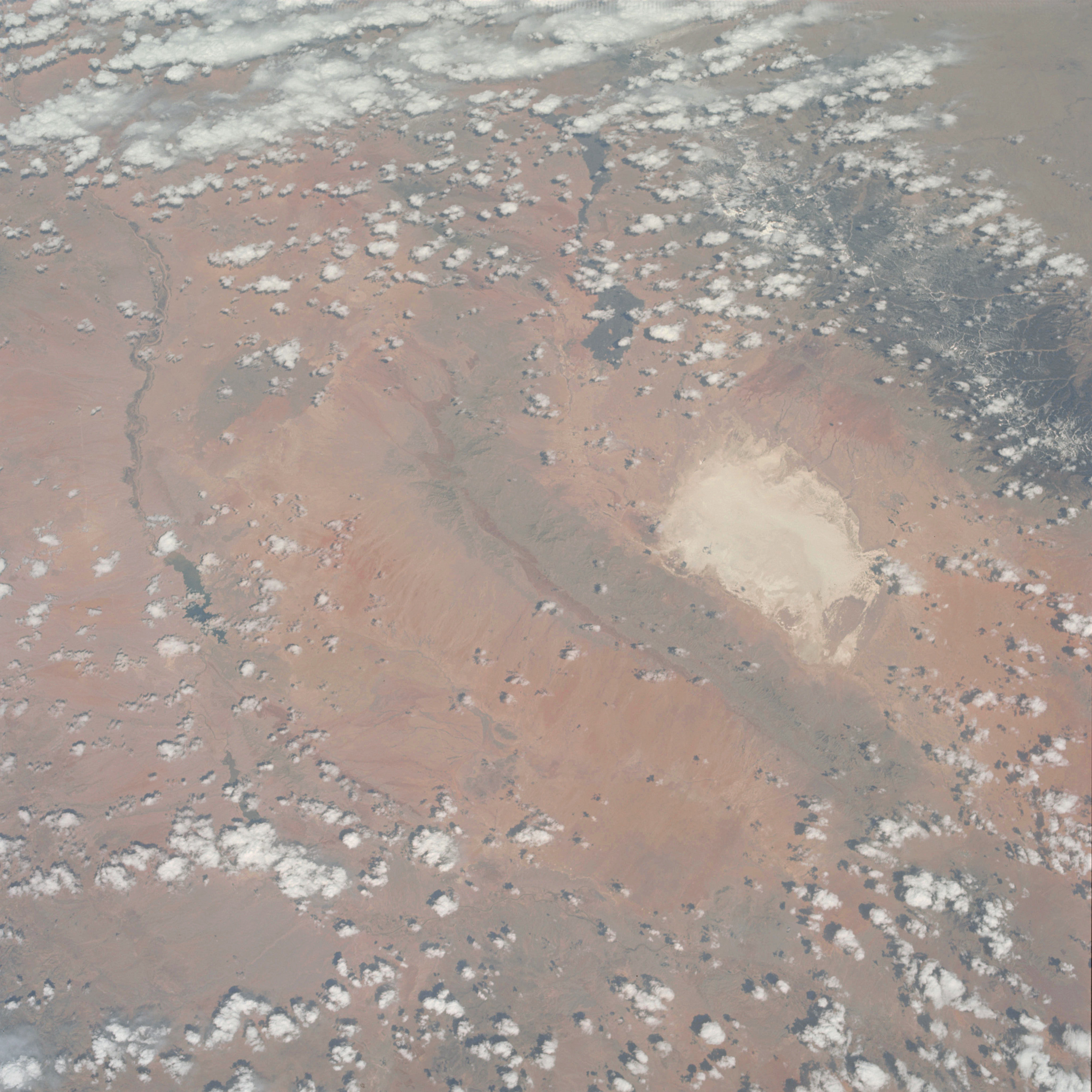 | AS09-22-3329 GEOGRAPHY/CARTOGRAPHY: United States, New Mexico, White Sands, Rio Grands, Elephant Butte Reservoir, San Andres and Sacramento Mountains, Tularosa Valley, Town of Alamogordo. GEOLOGY/HYDROLOGY: Basin and Range Province of sedimentary mountains and alluvium deposits. AGRICULTURE: Cultivation patterns along Rio Grande River. FORESTRY: Conifers in Sacramento Mountains, scattered desert shrubform at lover elevations. METEOROLOGY: Cumulus humilis, cumulus congestus. Image credit: Image Science and Analysis Laboratory, NASA-Johnson Space Center. |
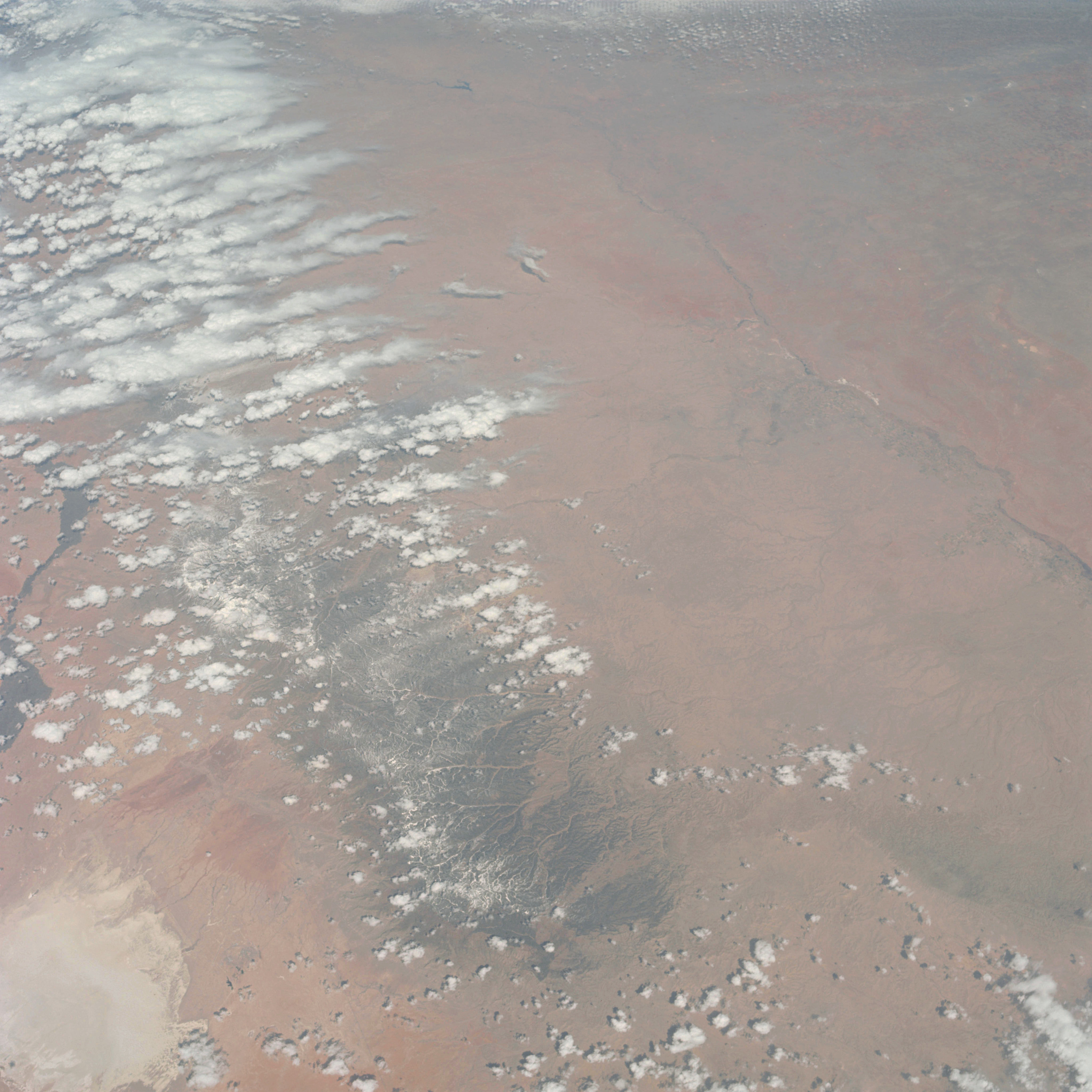 | AS09-22-3330 GEOGRAPHY/CARTOGRAPHY: United States, New Mexico, Texas, Sacramento Mountains, Pecos River, Estacado Plains, Town of Roswell. GEOLOGY/HYDROLOGY: Basin and Range Province adjacent to the Great Sedimentary Plains Region. AGRICULTURE: Intense irrigation along Pecos River near Roswell New Mexico, Extensive field pattern configuration in Texas. FORESTRY: Scattered desert shrubform. METEOROLOGY: Cumulus humilis, cumulus congestus, cumulus fractus. Image credit: Image Science and Analysis Laboratory, NASA-Johnson Space Center. |
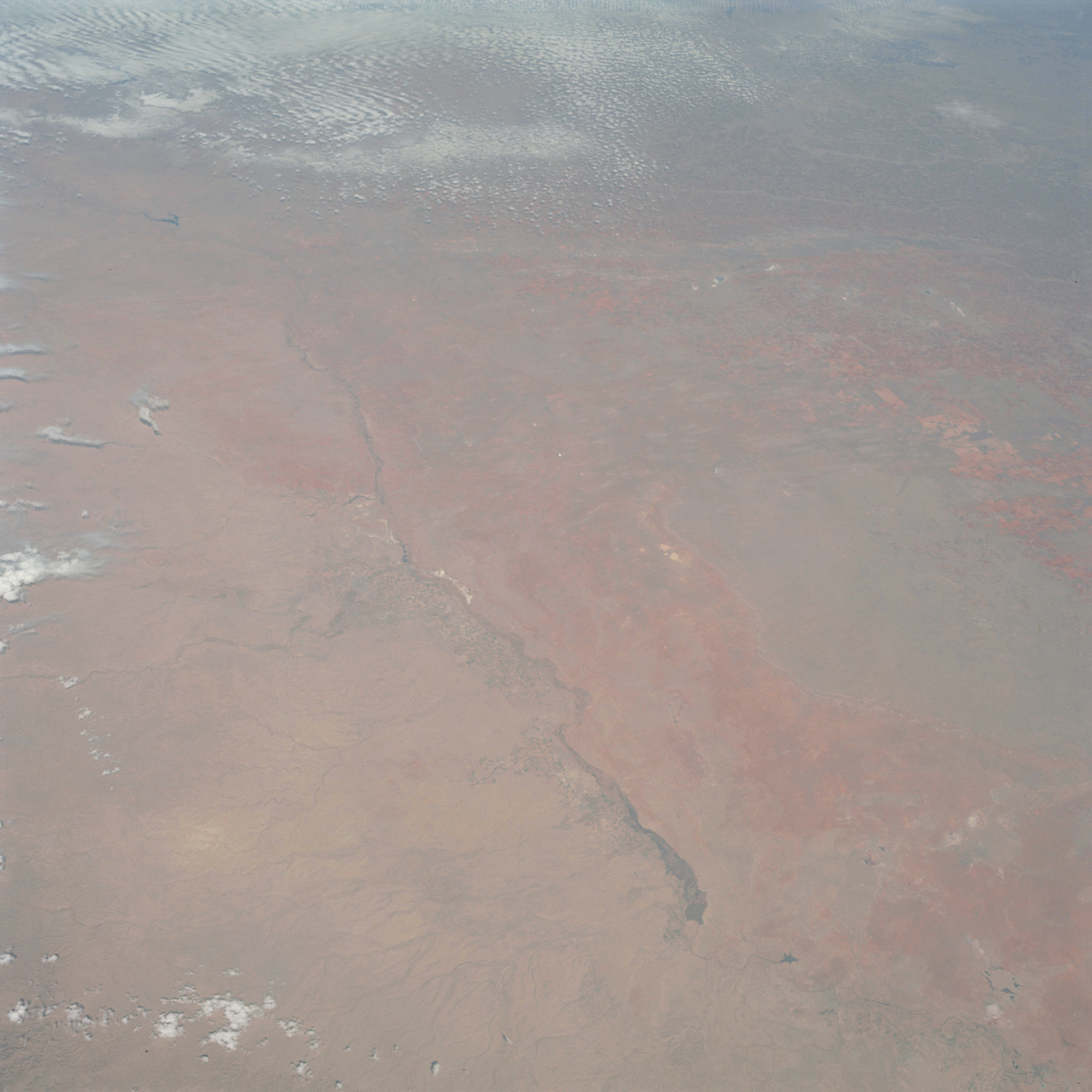 | AS09-22-3331 GEOGRAPHY/CARTOGRAPHY: United States, New Mexico, Texas, Pacos River, Lake McMillan, Estacado Plains, Towns of Roswell and Carlsbad. GEOLOGY/HYDROLOGY: Central basin platform and sedimentary plains region. AGRICULTURE: Very extensive, field patterns easily definable. FORESTRY: Scattered desert shrubform and grass. METEOROLOGY: Cirro-cumulus. Image credit: Image Science and Analysis Laboratory, NASA-Johnson Space Center. |
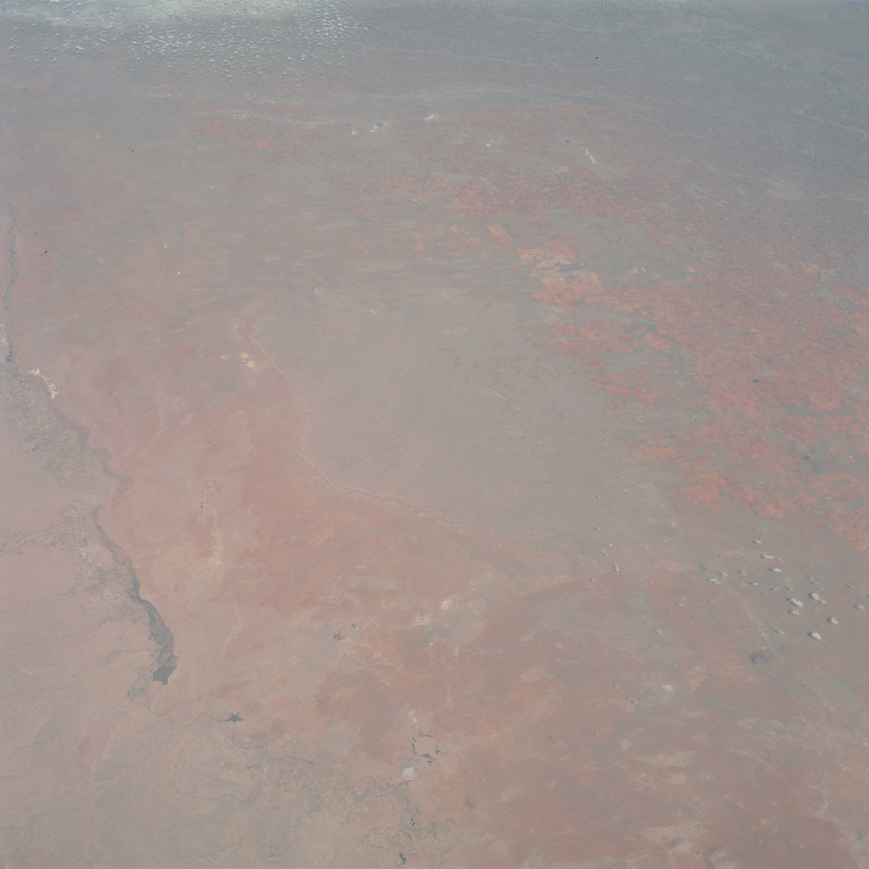 | AS09-22-3332 GEOGRAPHY/CARTOGRAPHY: United States, Texas, New Mexico, Pecos River, Lake McMillan, Estaceado Plains, Towns of Roswell, Carlsbad, Hobbs, Portales and Amarillo. GEOLOGY/HYDROLOGY: Central basin platform and great plains of limestone and sandstones. AGRICULTURE: Prominent field patterns along Pecos River and in Texas Plains. FORESTRY: Scattered shrubform and grass. METEOROLOGY: Cirro-cumulus. Image credit: Image Science and Analysis Laboratory, NASA-Johnson Space Center. |
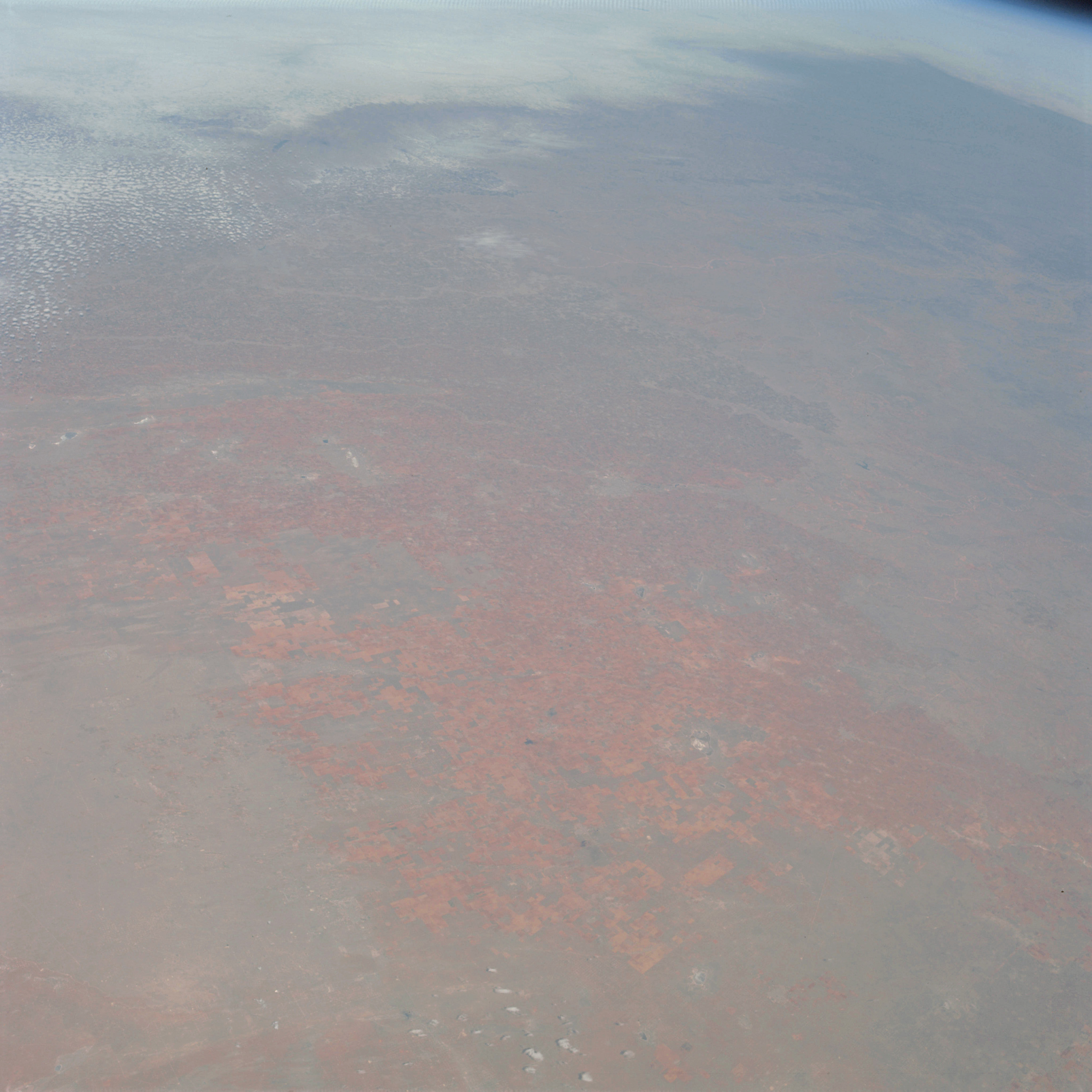 | AS09-22-3333 GEOGRAPHY/CARTOGRAPHY: United States, Texas, : New Mexico, Estacado Plains, Towns of Hobbs, Amarillo, Plainview and Lubbock. GEOLOGY/HYDROLOGY: Central basin limestone platform and plains region. AGRICULTURE: Very intense cultivation as well as extensive range lands. FORESTRY: Shrubform and grass. METEOROLOGY: Cirro-cumulus, snow cover in northern portions of plains. Image credit: Image Science and Analysis Laboratory, NASA-Johnson Space Center. |
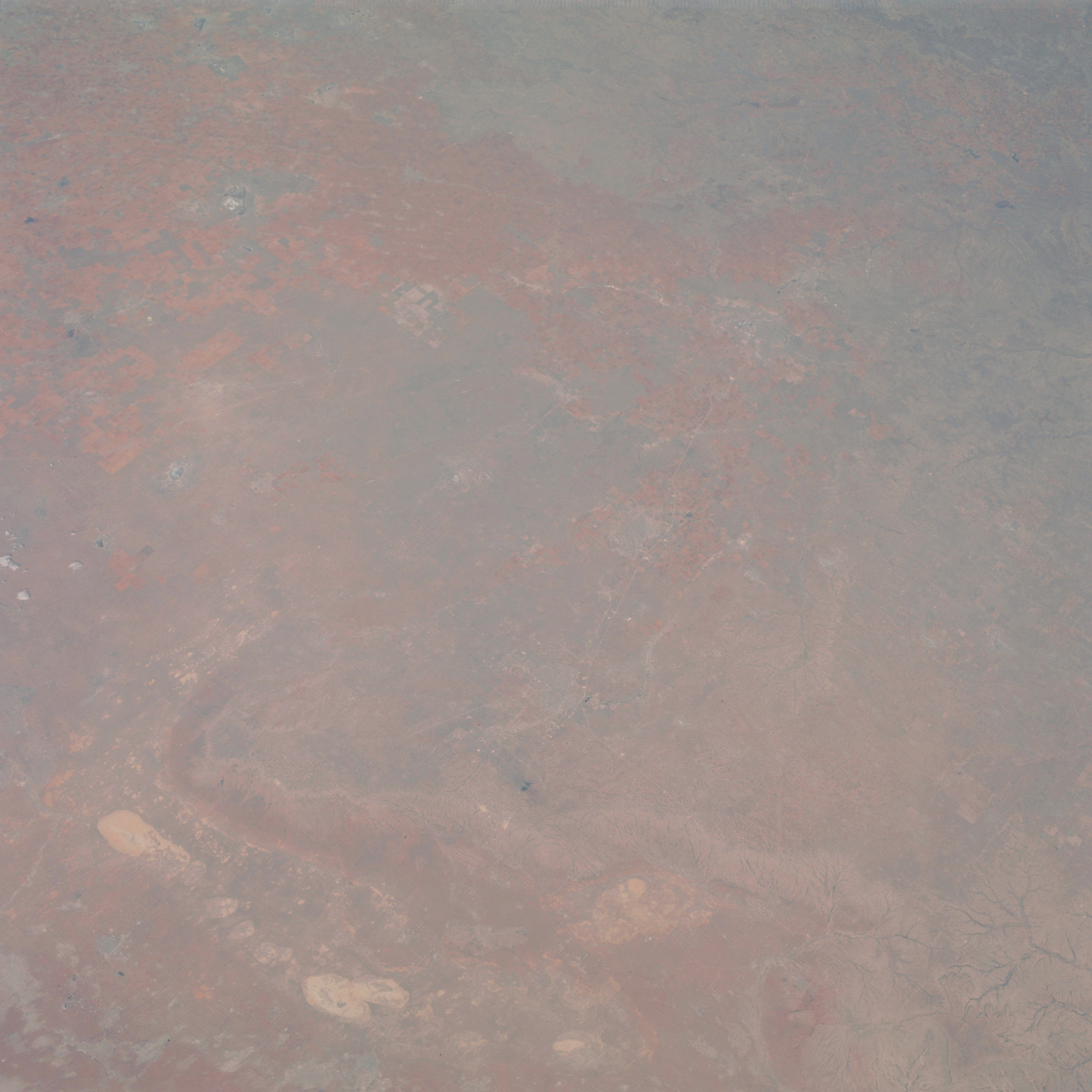 | AS09-22-3334 GEOGRAPHY/CARTOGRAPHY:. United States, Texas, Caprock Escarpment, Estacado Plains, Towns of Odessa, Midland, Big Springs and Lamesa. GEOLOGY/HYDROLOGY: Central basin platform and plains with numerous dry lake deposits. AGRICULTURE: Very intense cultivation. FORESTRY: Scattered shrubform. Image credit: Image Science and Analysis Laboratory, NASA-Johnson Space Center. |
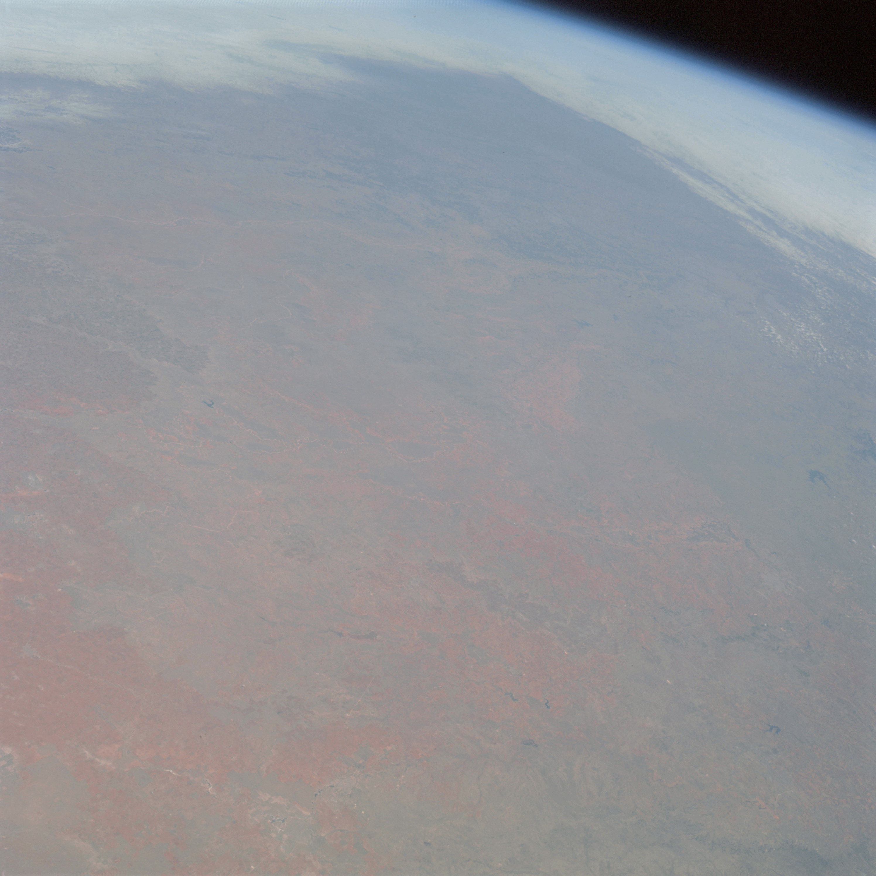 | AS09-22-3335 GEOGRAPHY/CARTOGRAPHY: United States, Texas, Oklahoma, Caprock Escarpment, Towns of Big Springs, Lubbock and Wichita Falls. GEOLOGY/HYDROLOGY: Limestone Caprock Plateau and central plains. AGRICULTURE: Very extensive cultivation. FORESTRY: Scattered shrubform and grass. METEOROLOGY: Snow cover in northern plains area. Image credit: Image Science and Analysis Laboratory, NASA-Johnson Space Center. |
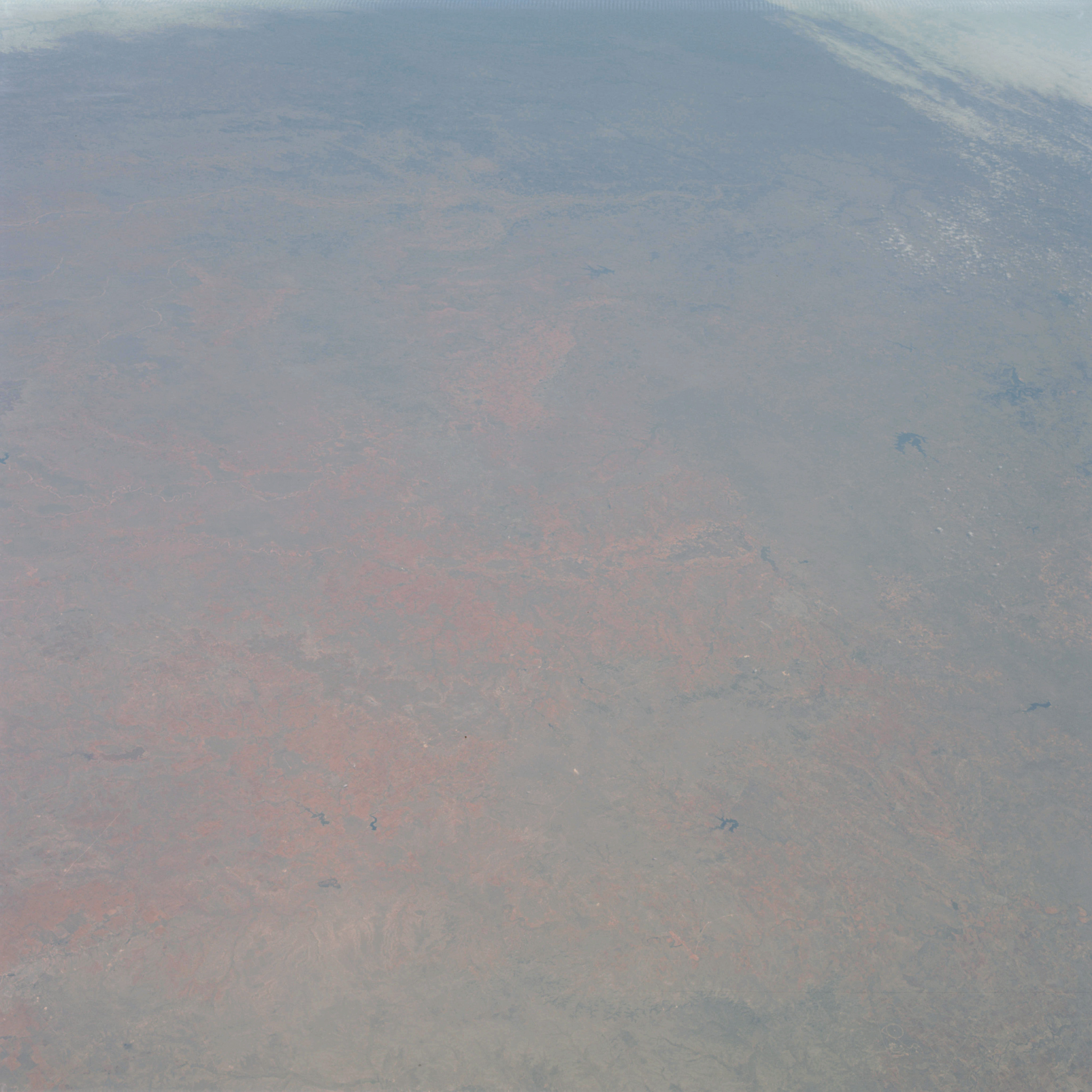 | AS09-22-3336 GEOGRAPHY/CARTOGRAPHY: United States, Colorado River, Towns of Big Springs, Sweetwater, Abilene, and Newcastle, Possum Kingdom Reservoir, Lakes Fort Phantom Hill, Coleman and Thomas. GEOLOGY/HYDROLOGY: Sedimentary plateau and elevated plains region. AGRICULTURE: Scattered areas of intense cultivation. FORESTRY: Scattered shrubform grading to low deciduous forest stands to east. METEOROLOGY: Cirrus, snow cover in northern plains area. Image credit: Image Science and Analysis Laboratory, NASA-Johnson Space Center. |
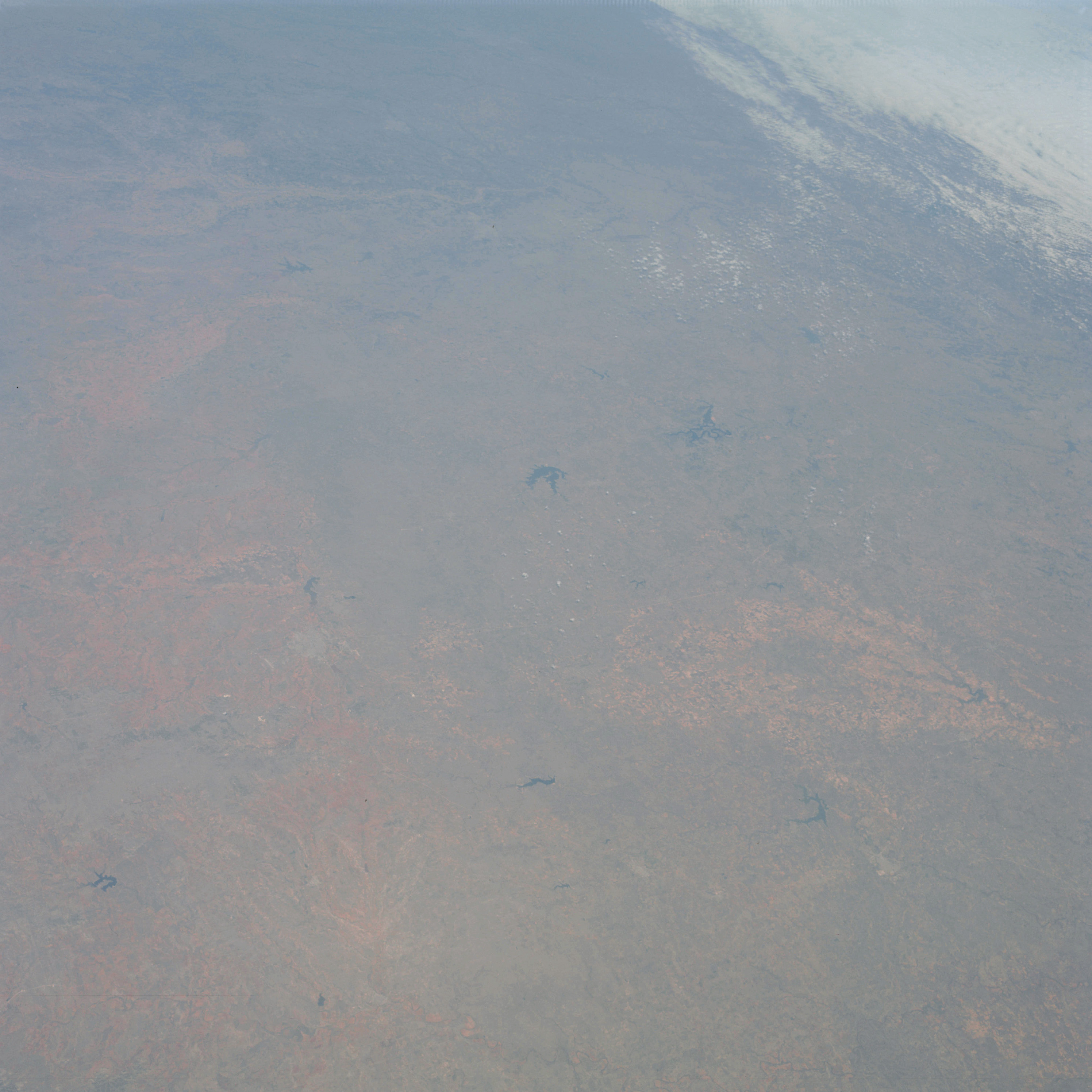 | AS09-22-3337 GEOGRAPHY/CARTOGRAPHY: United States, Texas, Oklahoma, Lakes Fort Phantom Hill, Coleman, Brownwood, Bridgeport, Kemp and Kackapoo, Possum Kingdom Reservoir, Towns of Abilene, Wichita Falls, Newcastle and Breckenridge. GEOLOGY/HYDROLOGY: Elevated plains region. AGRICULTURE: Scattered areas of intense cultivation. FORESTRY: Shrubform changing to mixed conifer, hardwood stands of little commercial value. METEOROLOGY: Strato-cumulus, cirrus. Image credit: Image Science and Analysis Laboratory, NASA-Johnson Space Center. |
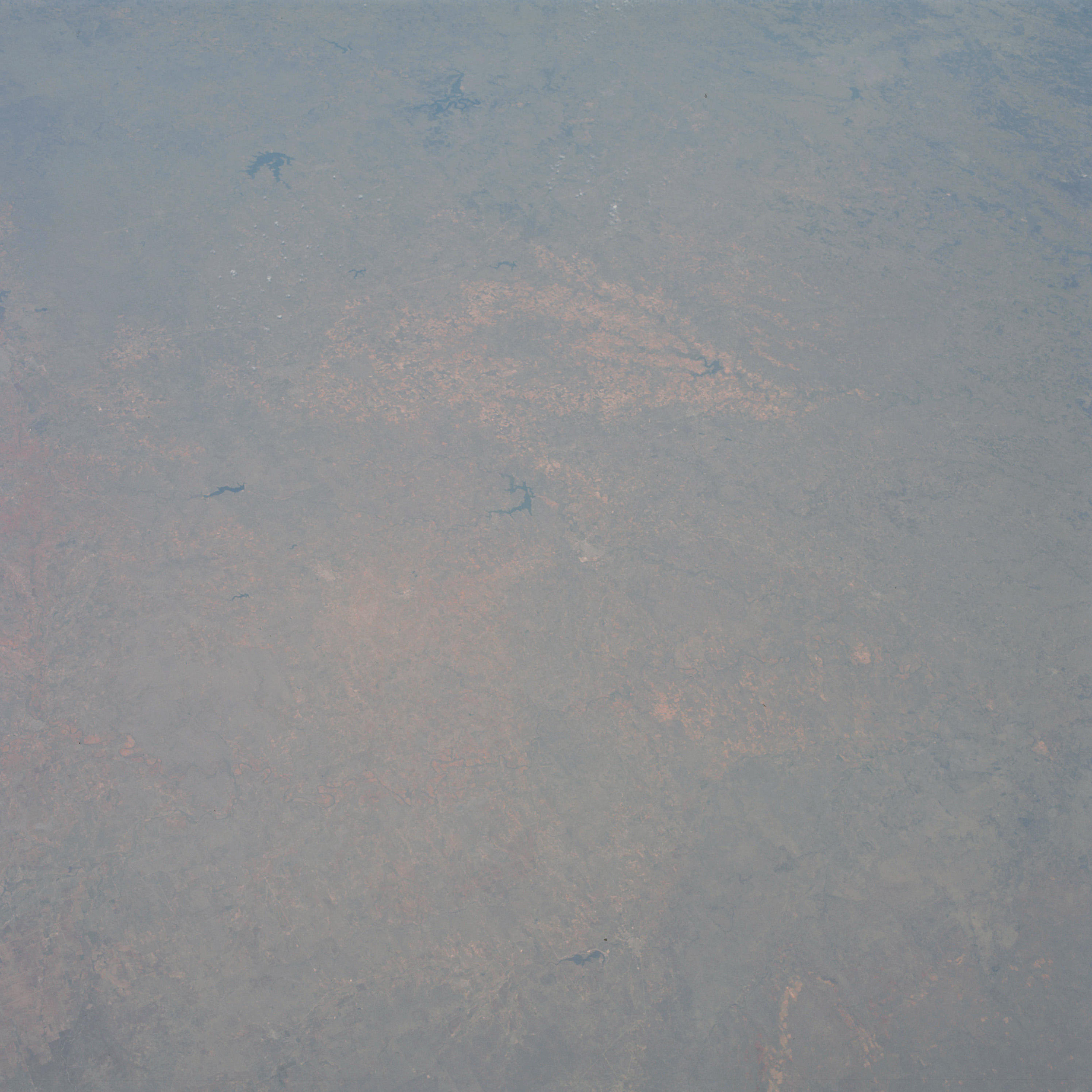 | AS09-22-3338 GEOGRAPHY/ CARTOGRAPHY : United States, Lakes Brownwood and Coleman, Possum Kingdom and Hubbard Creek Reservoirs, Towns of Abilene, Brownswood and Graham. GEOLOGY/HYDROLOGY: Limestone belt and central elevated plains region. AGRICULTURE: Intense cultivation, primarily along drainage. FORESTRY: Non commercial hardwood forests and deciduous shrubform. Image credit: Image Science and Analysis Laboratory, NASA-Johnson Space Center. |
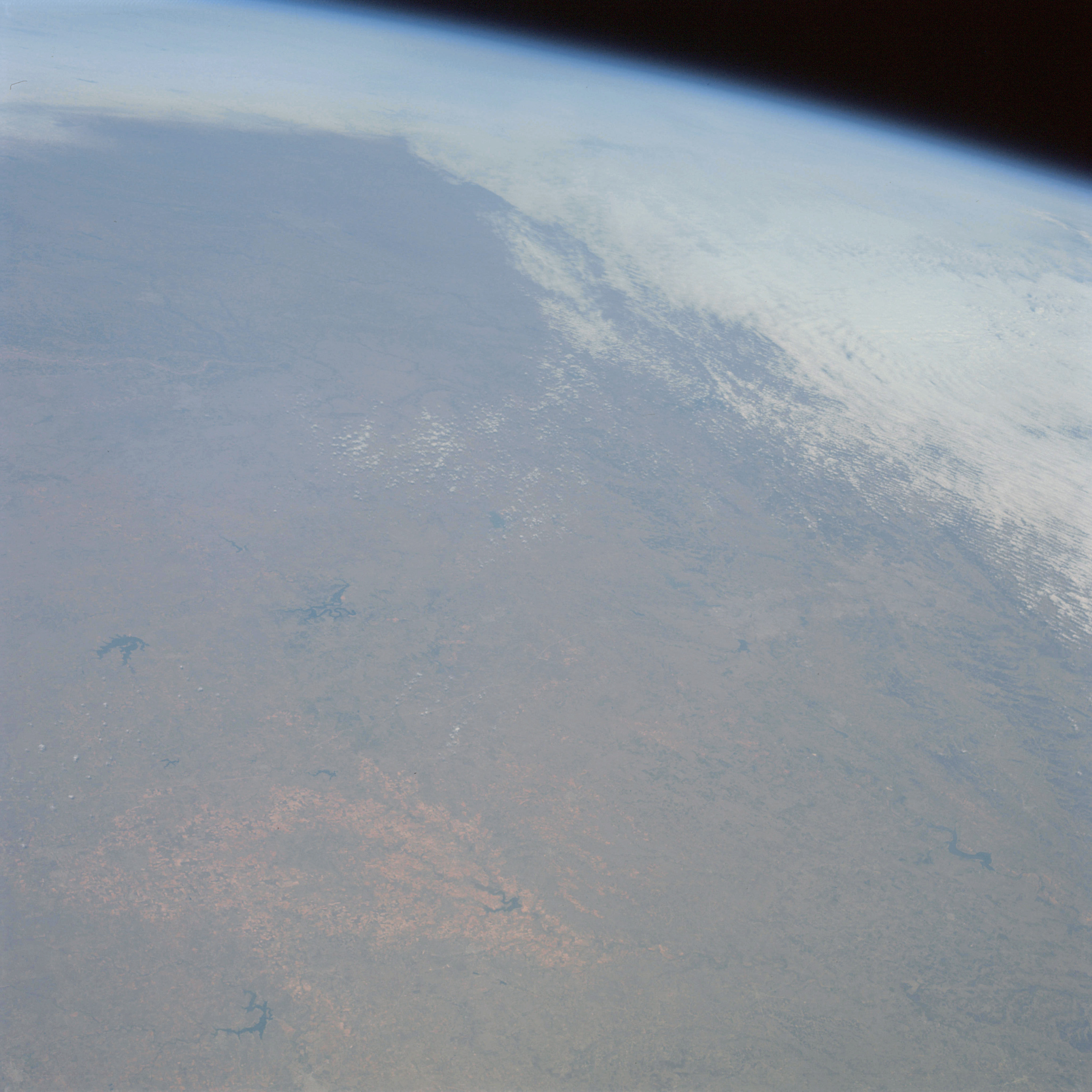 | AS09-22-3339 GEOGRAPHY/CARTOGRAPHY: United States, Texas, Oklahoma, Hubbard Creek and Possum Kingdom Reservoirs, Dallas-Fort Worth. GEOLOGY/ HYDROLOGY: Elevated plains regions of fertile sedimentary beds. AGRICULTURE: Moderate to heavy cultivation along drainage. FORESTRY: Non commercial stands of mixed conifer hardwood. METEOROLOGY: Cirrus, strato-cumulus. Image credit: Image Science and Analysis Laboratory, NASA-Johnson Space Center. |
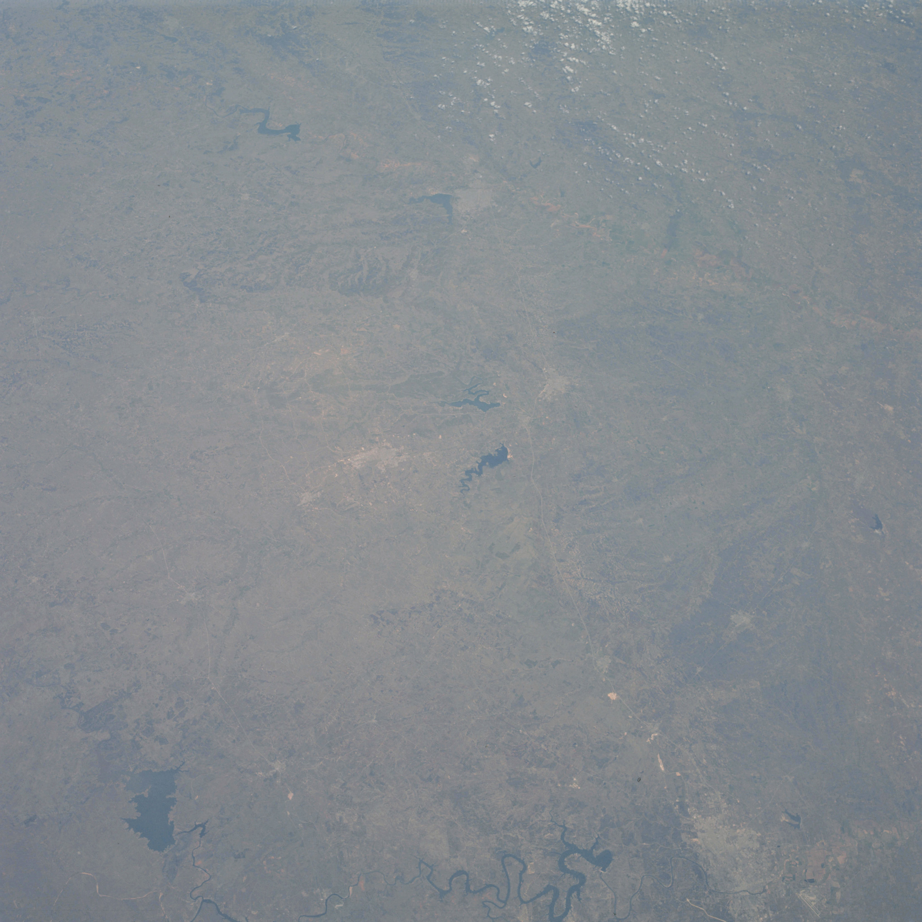 | AS09-22-3340 GEOGRAPHY/CARTOGRAPHY: United States, Texas, Lakes Waco, Austin and Buchanan, Stillhouse Hollow and Balton Raservoir, Cities of Waco, Temple, Killeen and Austin, Interstate Highway 30. GEOLOGY/HYDROLOGY: Boundary of dissected plateau and central elevated plains. AGRICULTURE: Moderate to heavy cultivation. Field patterns variable in size and shape. FORESTRY: Non commercial stands of mixed conifer hardwoods. METEOROLOGY: Cirrus. Image credit: Image Science and Analysis Laboratory, NASA-Johnson Space Center. |
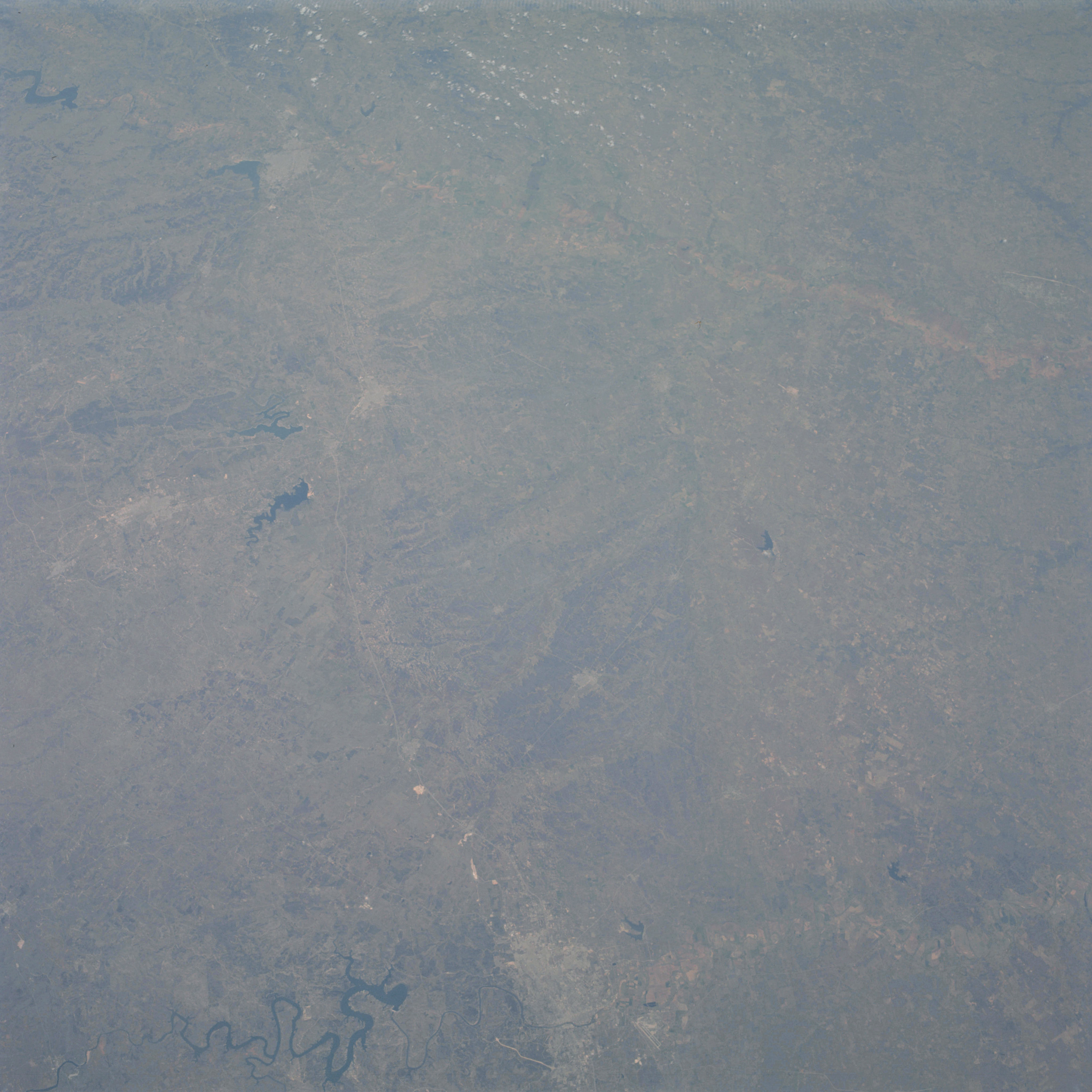 | AS09-22-3341 GEOGRAPHY/CARTOGRAPHY: United States, Texas, Lake Whitney, Waco, and Travis, Stillhouse Hollow and Belton Reservoirs, Brazos River, Cities of Waco, Temple, Killeen, Austin and Bryan. GEOLOGY/HYDROLOGY: Boundary of dissected plateau and central elevated plains. AGRICULTURE: Scattered field patterns, congested in areas. FORESTRY: Mixed shrubform and non commercial hardwoods. Image credit: Image Science and Analysis Laboratory, NASA-Johnson Space Center. |
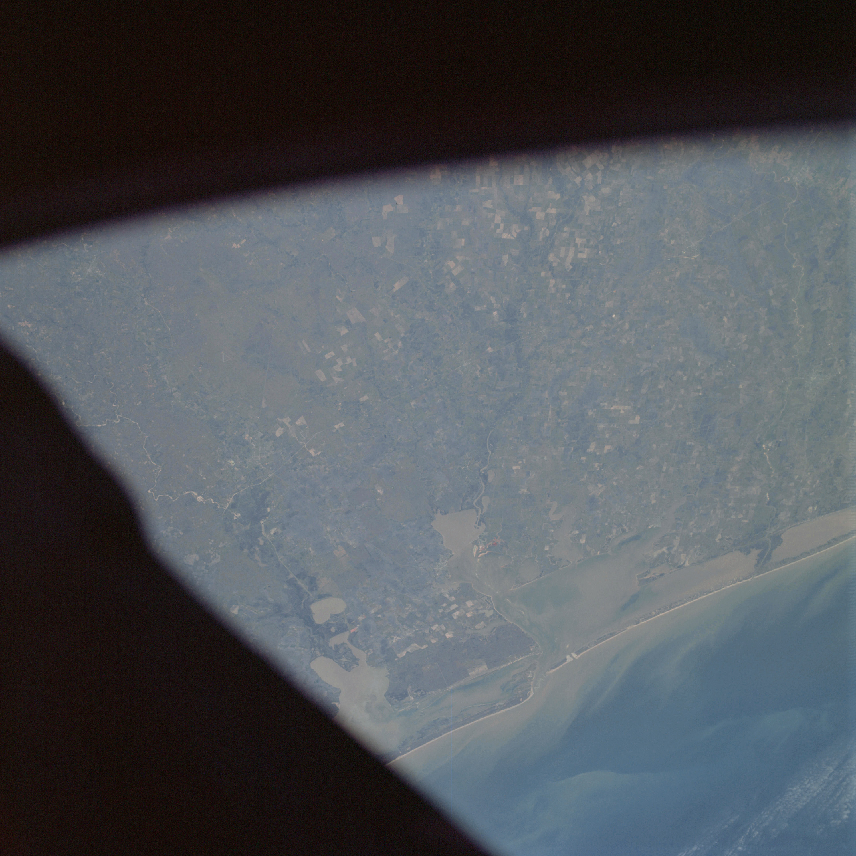 | AS09-22-3342 GEOGRAPHY/CARTOGRAPHY: United States, Texas, Matagorda and San Antonio Bay, Cavallo Pass, Town of Victoria. GEOLOGY/HYDROLOGY: Sedimentary coastal plain region with lagoons and sand bars. AGRICULTURE: Intense cultivation, numerous, field patterns. FORESTRY: Mixed shrubform and non commercial hardwoods, coastal grasslands. OCEANOGRAPHY: Gulf of Mexico, a southerly longshore current indicated by sediments in the nearshore zone. Image credit: Image Science and Analysis Laboratory, NASA-Johnson Space Center. |
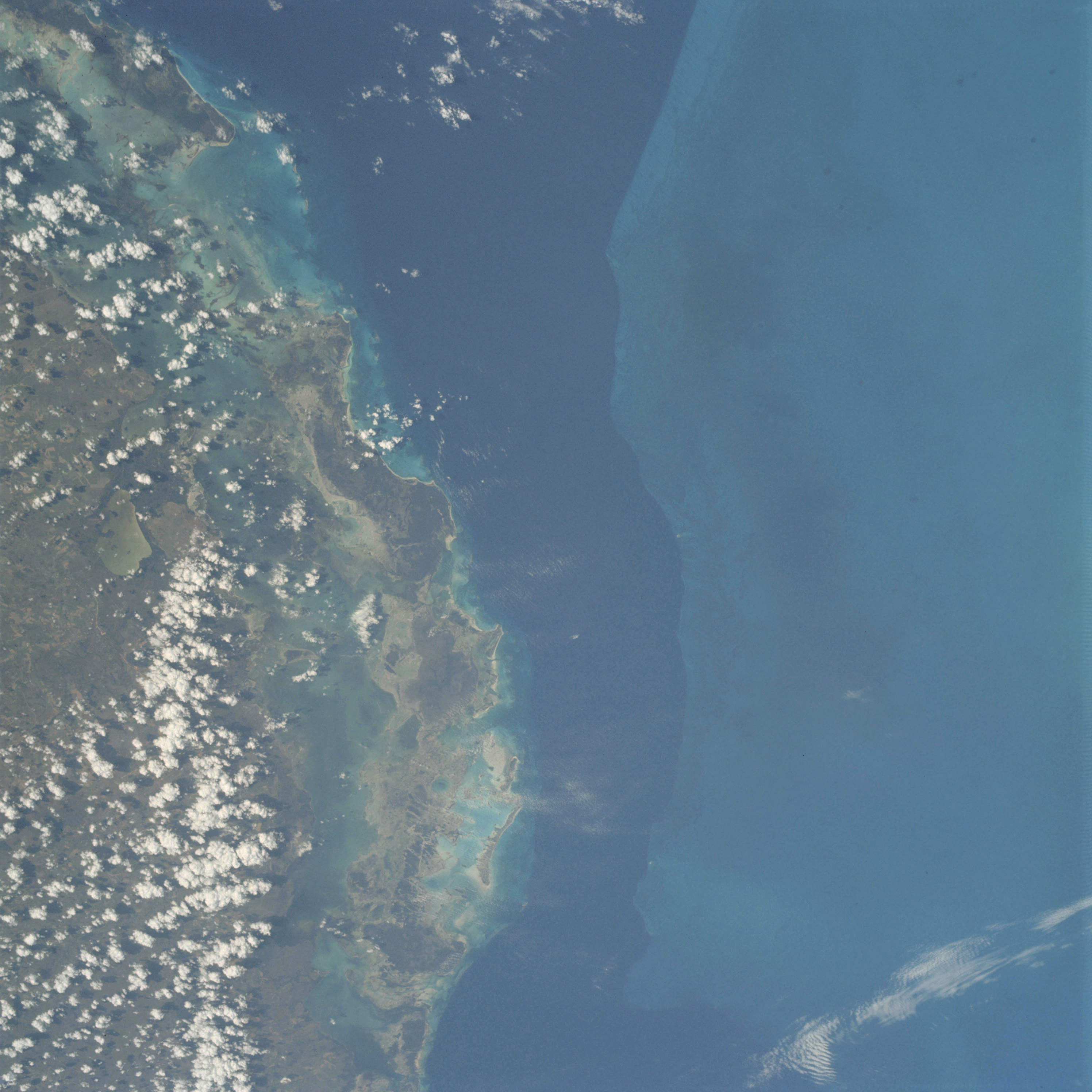 | AS09-22-3343 GEOGRAPHY/CARTOGRAPHY: Cuba, Camaguey Archipelago, Bay of Jigusy, Great Bahama Bank. GEOLOGY/HYDROLOGY: Rolling plains regions with offshore reef deposits. AGRICULTURE: Scattered field patterns on mainland, moderate to heavy cultivation. FORESTRY: Tropical rainforest and coastal mangrove. METEOROLOGY: Cirrus, cumulus humilis. OCEANOGRAPHY: Old Bahama Channel, submarine topography is clearly visible, coral and coral reefs, turbidity channels, and color changes with increasing depths. Image credit: Image Science and Analysis Laboratory, NASA-Johnson Space Center. |
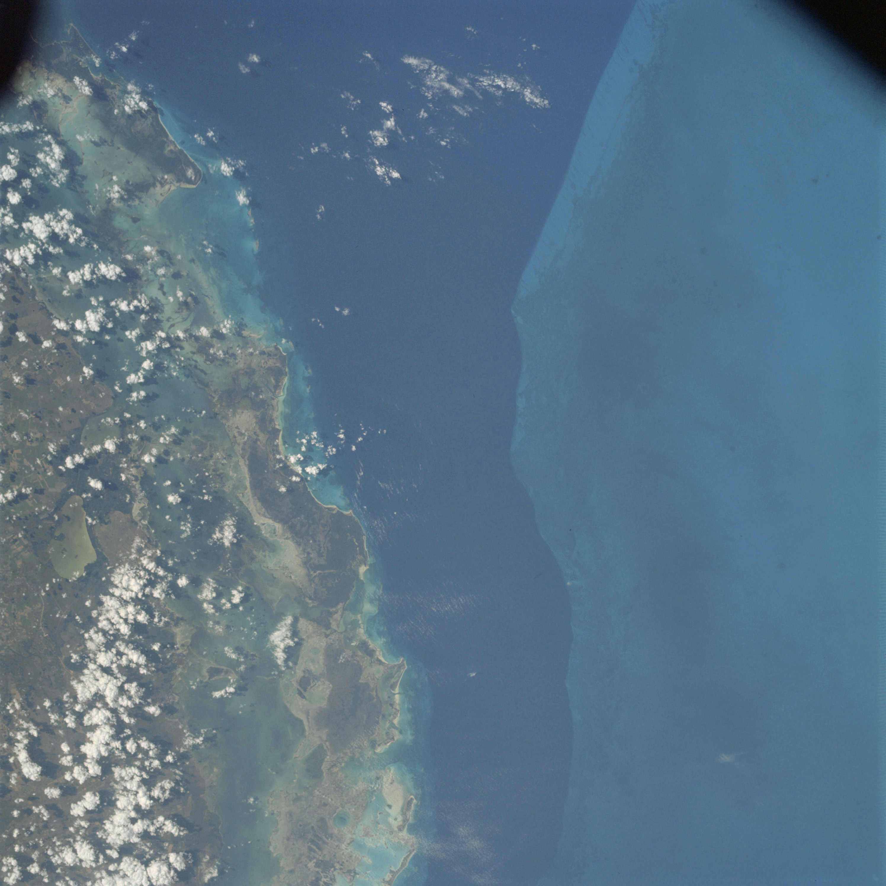 | AS09-22-3344 GEOGRAPHY/CARTOGRAPHY: Cuba, Camaguey Archipelago, Bay of Jigusy, Great Bahama Bank. GEOLOGY/HYDROLOGY: Elevated coastal plains region. AGRICULTURE: Scattered field patterns on mainland, moderate to heavy cultivation. FORESTRY: Tropical rainforests and coastal mangrove. METEOROLOGY: Cumulus humilis. OCEANOGRAPHY: Caribbean Sea, Old Bahama Channel, submarine topography including coral and coral reefs, turbidity current channels, depth variations. Image credit: Image Science and Analysis Laboratory, NASA-Johnson Space Center. |
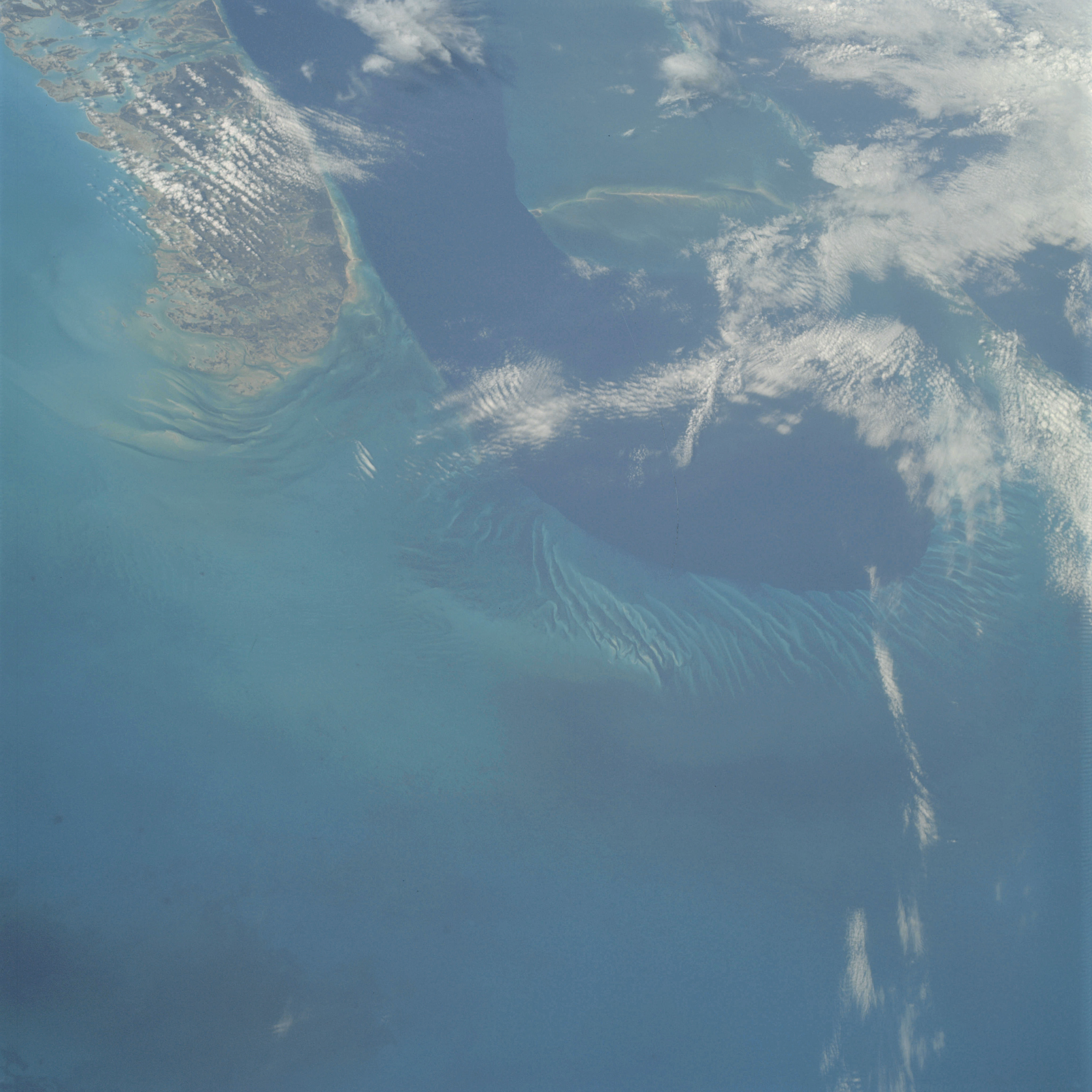 | AS09-22-3345 GEOGRAPHY/CARTOGRAPHY: Bahama Islands, Andros Island, Snap Point, Village of Kemp's Bay. GEOLOGY/HYDROLOGY: Elevated plains of marine origin. FORESTRY: Tropical rainforests, coastal mangrove and grasses. METEOROLOGY: Alto-cumulus, cirro-cumulus. OCEANOGRAPHY: Caribbean Sea, Tongue of the Ocean, bottom topography of areas adjacent to the deep clearly visible. Image credit: Image Science and Analysis Laboratory, NASA-Johnson Space Center. |
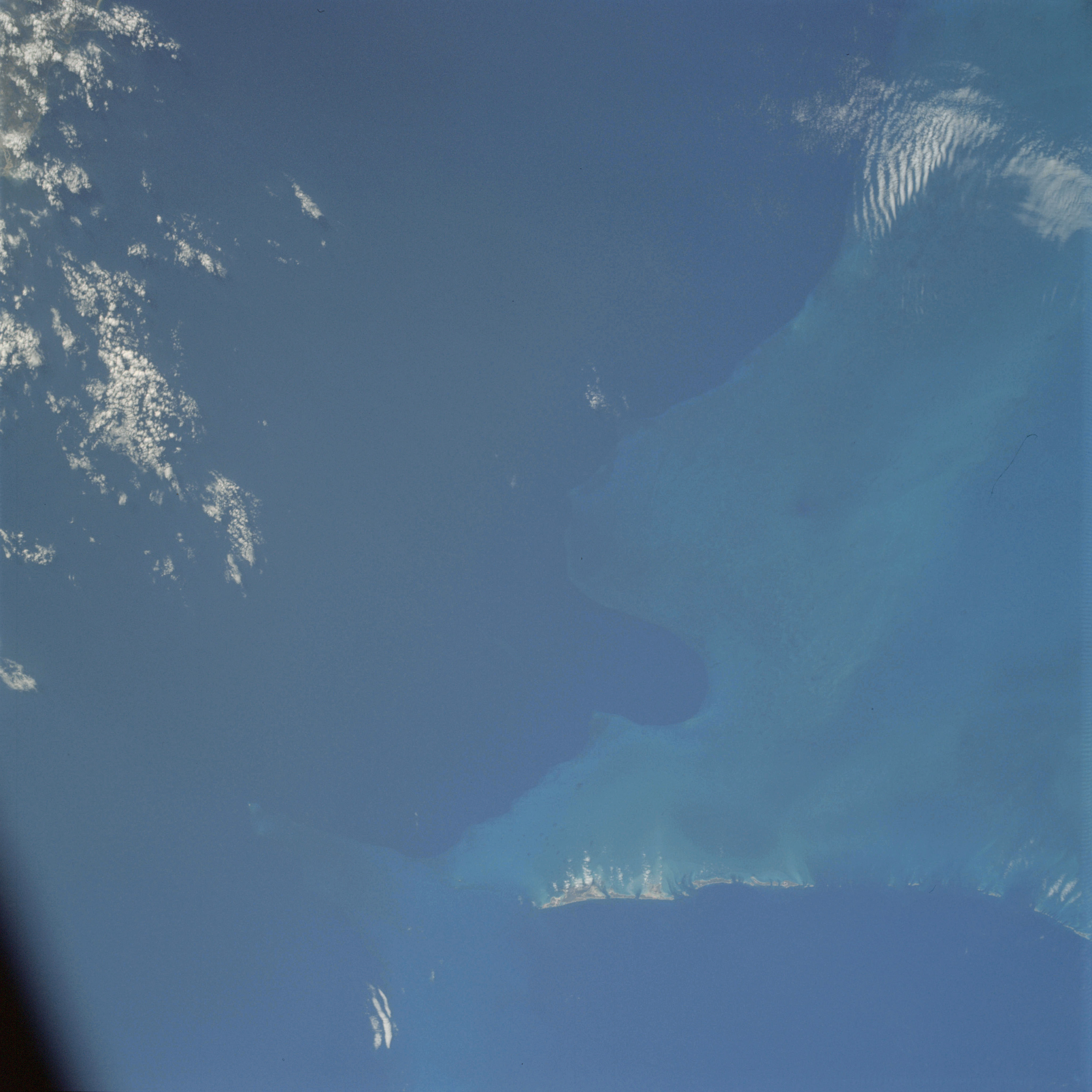 | AS09-22-3346 GEOGRAPHY/CARTOGRAPHY: Bahama Islands, Great Ragged Island. GEOLOGY/HYDROLOGY: Elevated plains of marine origin. FORESTRY: Tropical rainforests. METEOROLOGY: Cirro-cumulus. OCEANOGRAPHY: Caribbean Sea, bottom configuration of shallow area visible with color variation in relation to depth. Image credit: Image Science and Analysis Laboratory, NASA-Johnson Space Center. |
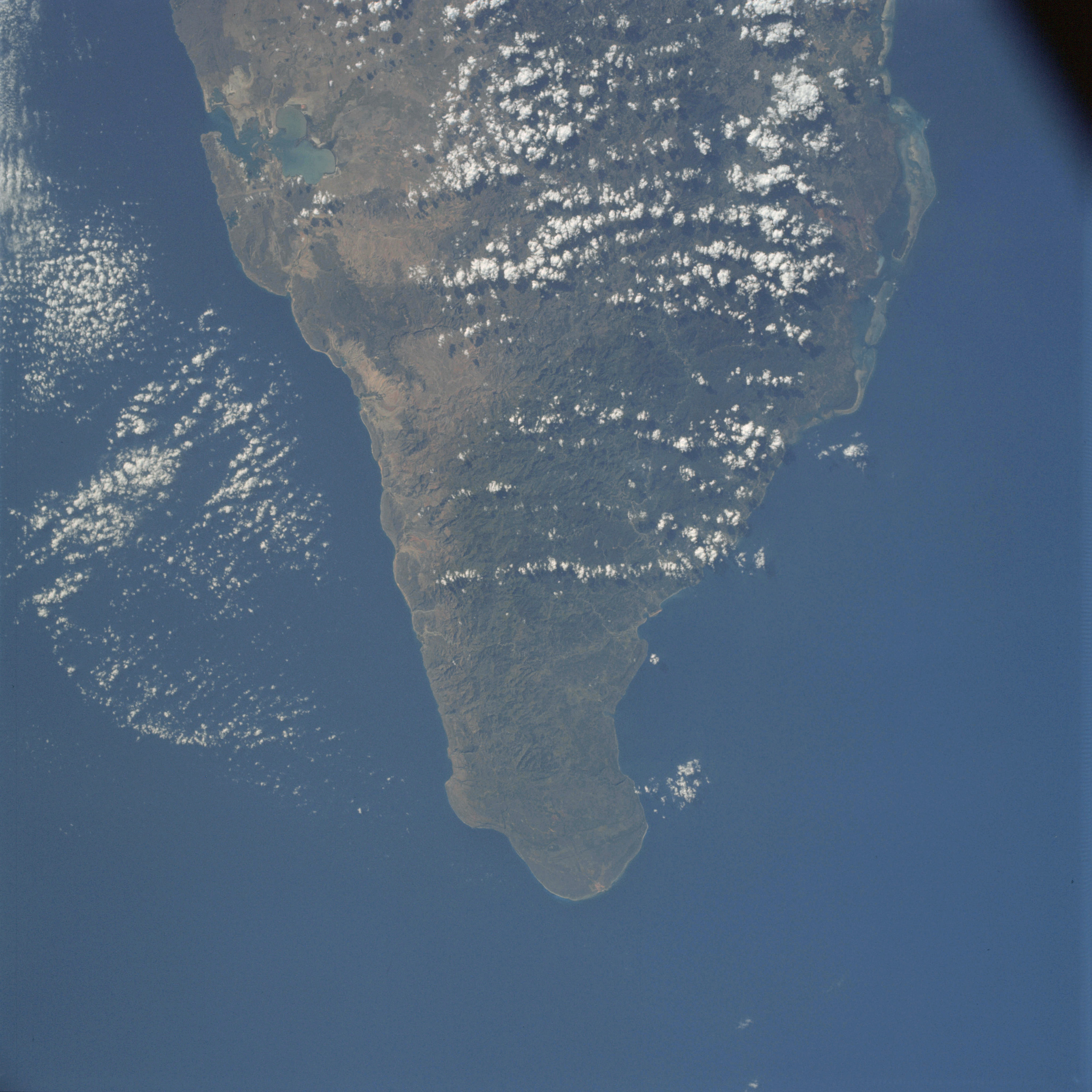 | AS09-22-3347 GEOGRAPHY/CARTOGRAPHY: Cube, Oriente Province, Point Maisi, Guantanamo Bay, Towns of Guantanamo and Baracoa. GEOLOGY/HYDROLOGY: Complex mountains and hills region of basement origin. AGRICULTURE: Field patterns visible along southern coast. FORESTRY: Tropical rainforests and mangrove. METEOROLOGY: Cumulus humilis, cumulus congestus. OCEANOGRAPHY: Caribbean Sea, color variations over reefs in nearshore area. Image credit: Image Science and Analysis Laboratory, NASA-Johnson Space Center. |
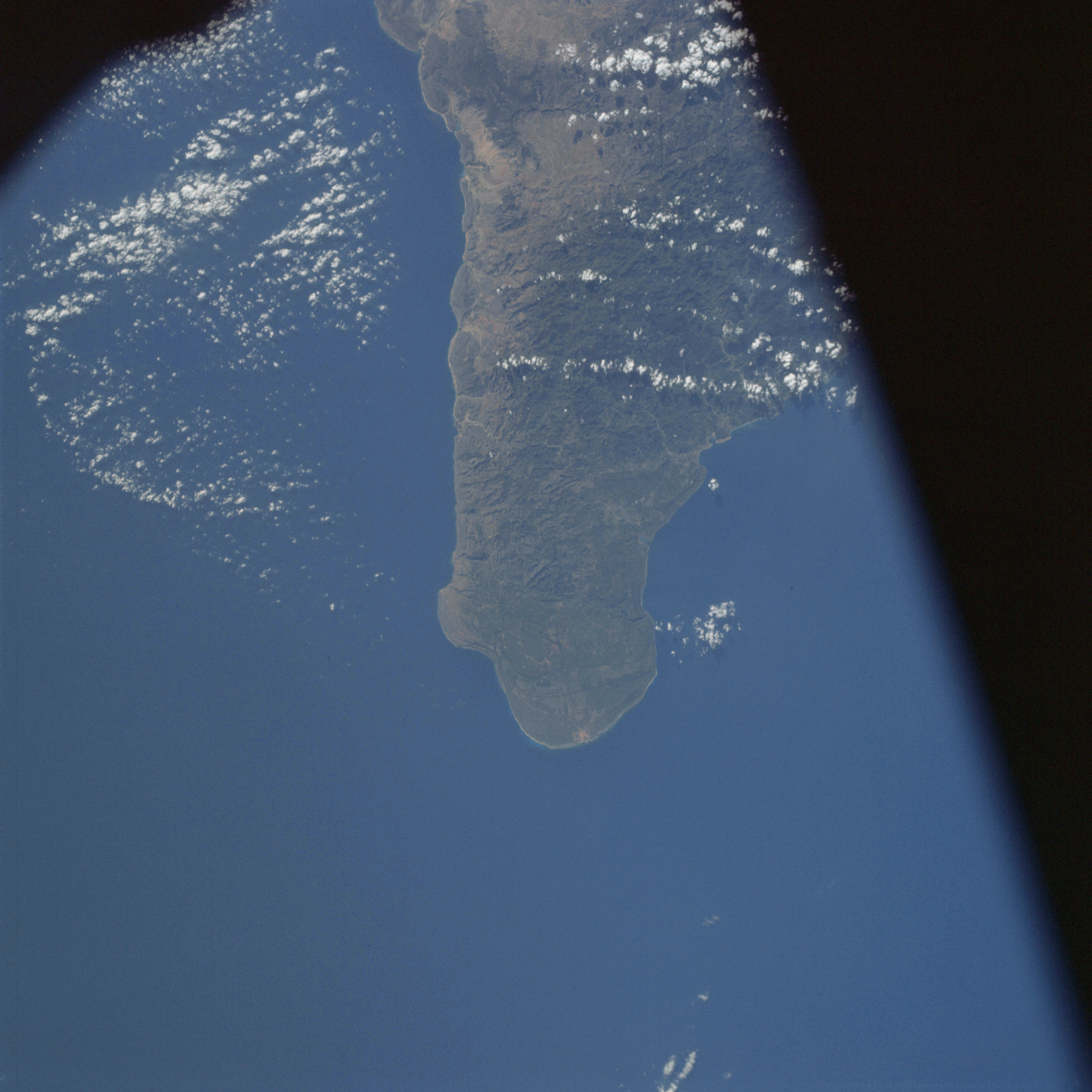 | AS09-22-3348 GEOGRAPHY/CARTOGRAPHY: Cuba, Oriente Province, Point Maisi, Windward Passage, Town of Baracoa. GEOLOGY/HYDROLOGY: Basement complex hills and mountains. AGRICULTURE: Field patterns on east end of island. FORESTRY: Tropical rainforests. METEOROLOGY: Cumulus humilis. OCEANOGRAPHY: Caribbean Sea, no color variations visible. Image credit: Image Science and Analysis Laboratory, NASA-Johnson Space Center. |
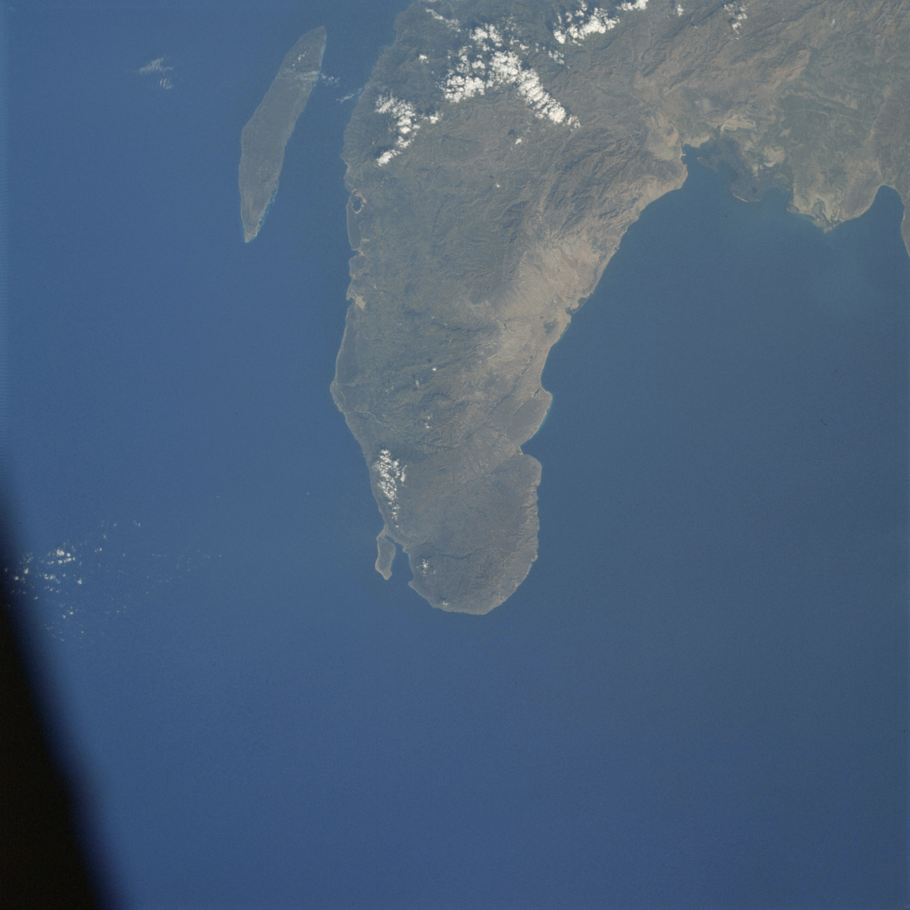 | AS09-22-3349 GEOGRAPHY/CARTOGRAPHY: Haiti, Cape A-Foux, Torture Island, Windward Passage, Gulf of Gonave, Town of Port De Paix. GEOLOGY/HYDROLOGY: Basement complex mountain region. AGRICULTURE: Small area of field patterns. FORESTRY: Broadleaf evergreen forests or tropical rainforest. METEOROLOGY: Cumulus humilis. OCEANOGRAPHY: Caribbean Sea, no color variations, nearshore zone very narrow. Image credit: Image Science and Analysis Laboratory, NASA-Johnson Space Center. |
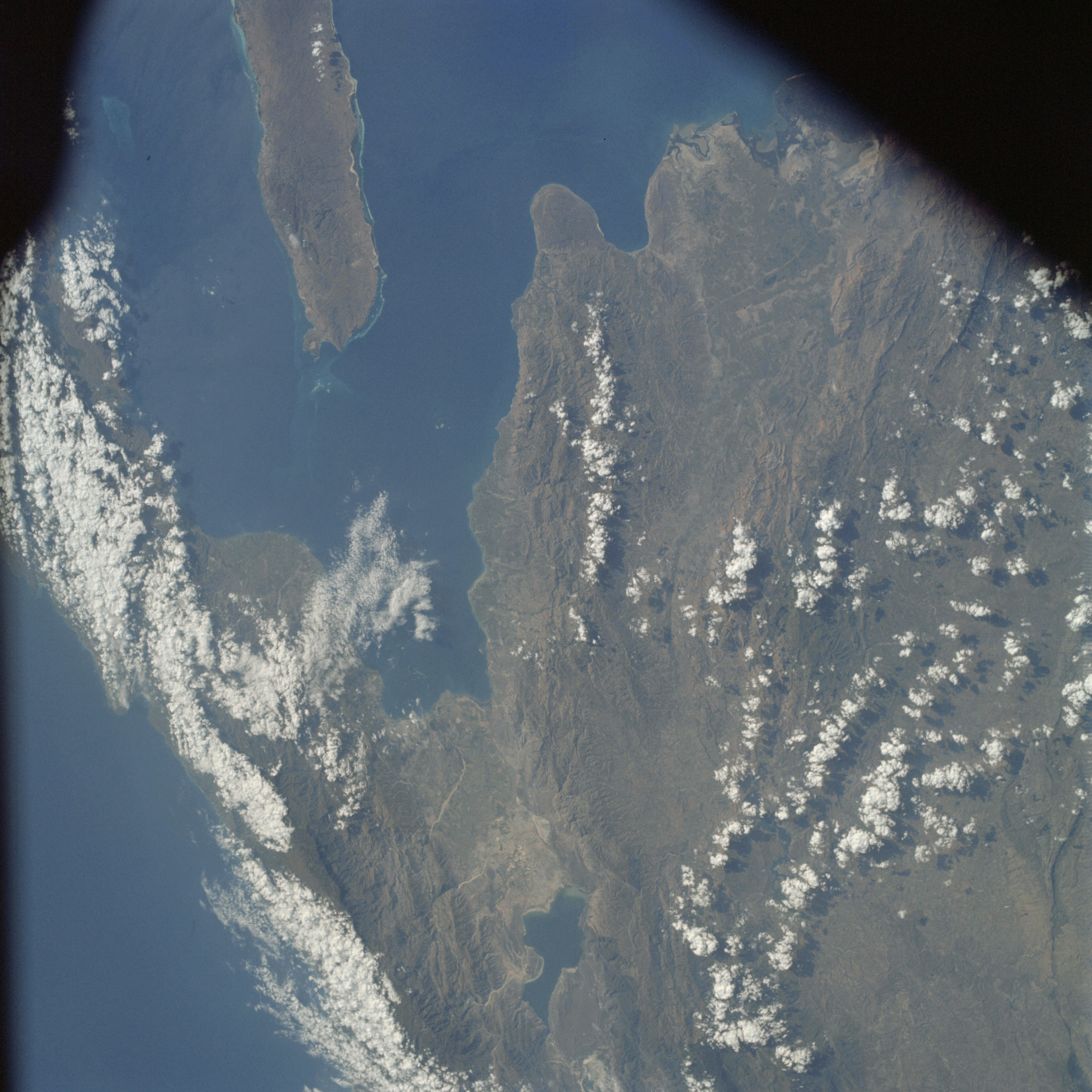 | AS09-22-3350 GEOGRAPHY/CARTOGRAPHY: Haiti, Dominican Republic, Gonave Island, St. Mark Canal, Sud Canal, City of Port au Prince, Town of St. Mark. GEOLOGY/HYDROLOGY: Basement complex, mountain region. AGRICULTURE: Some cultivation in Port au Prince area. FORESTRY: Broadleaf evergreen forests. METEOROLOGY: Cirro-cumulus, cumulus congestus, cumulus humilis. OCEANOGRAPHY: Caribbean Sea, nearshore sone is narrow and steep except in coves or embayments. Image credit: Image Science and Analysis Laboratory, NASA-Johnson Space Center. |
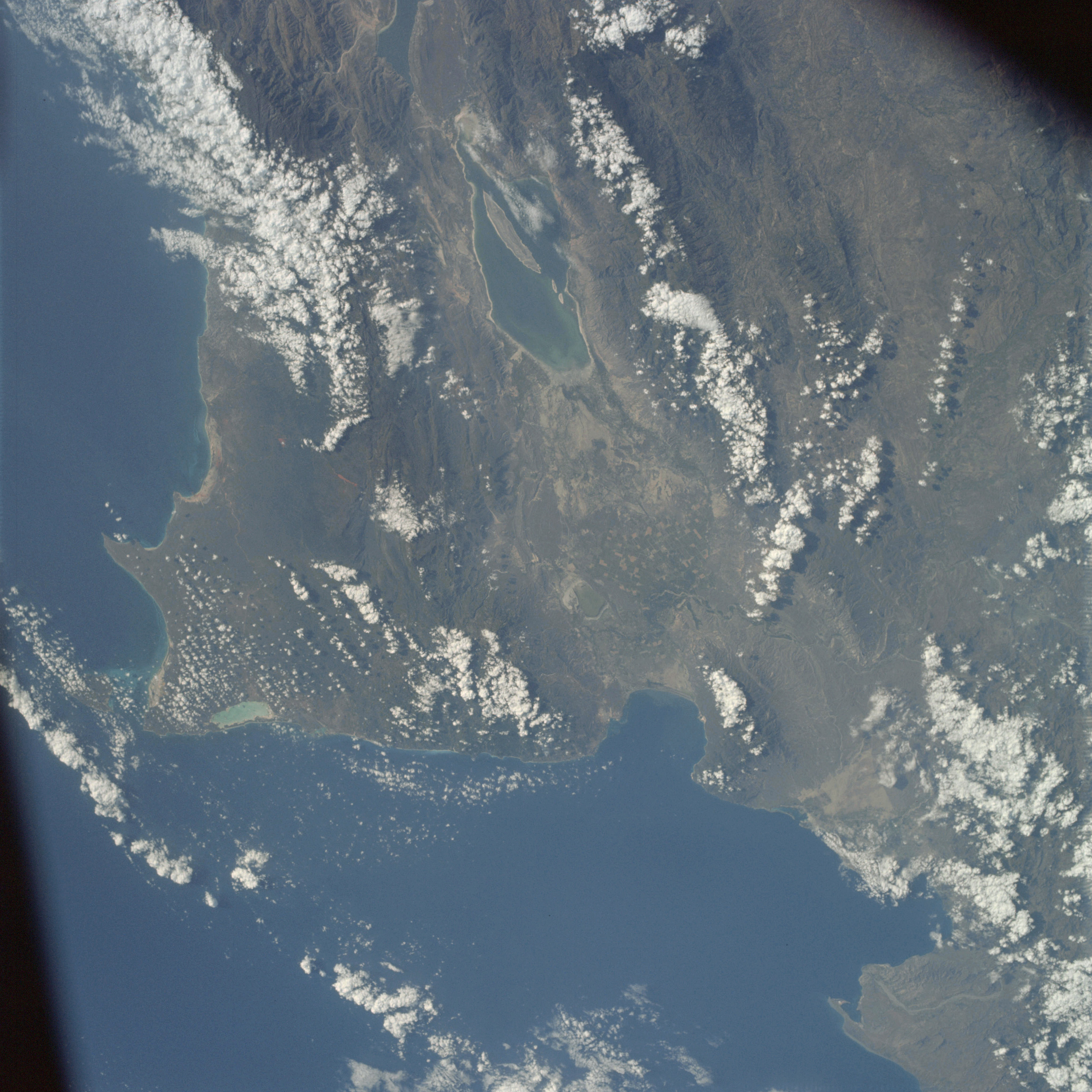 | AS09-22-3351 GEOGRAPHY/CARTOGRAPHY: Dominican Republic, Lake Enriquillo, Capes Beata and Falso, Town of Barahona, GEOLOGY/HYDROLOGY: Complex mountain structure of igneous and metamorphic formations. AGRICULTURE: Heavy concentration of field patterns near Lake Enriquillo. FORESTRY: Broadleaf evergreen forests. METEOROLOGY: Cumulus congestus, cumulus humilis. OCEANOGRAPHY: Caribbean Sea, nearshore zones is narrow and steep except in coves of embayments. Image credit: Image Science and Analysis Laboratory, NASA-Johnson Space Center. |
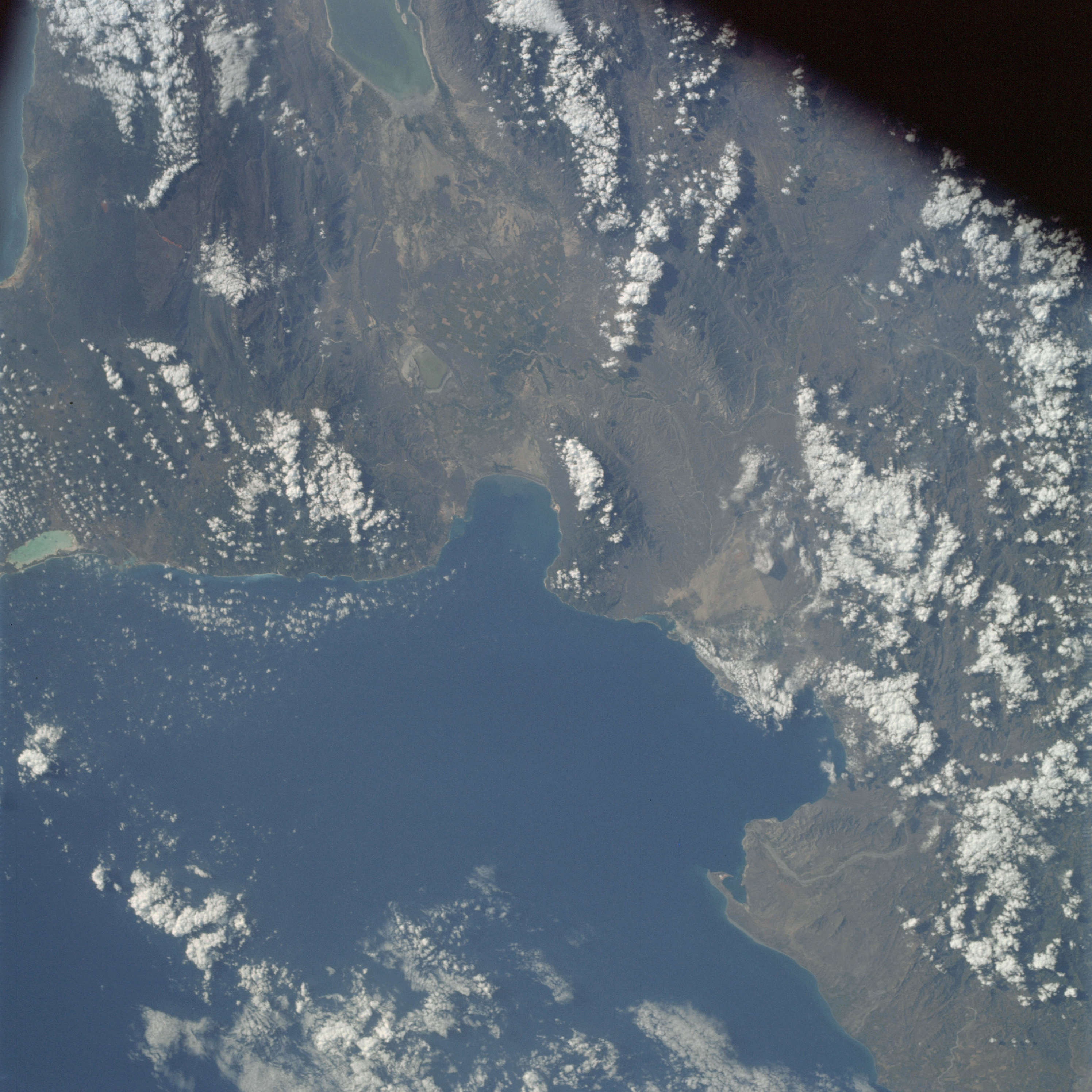 | AS09-22-3352 GEOGRAPHY/CARTOGRAPHY: Dominican Repuiblic, Ocean Bay, Lake Enriquilla, Towns of Barahona and Bani. GEOLOGY/HYDROLOGY: Complex mountain region of igneous and metamorphic formations. AGRICULTURE: Heavy concentration of field patterns near Lake Enriquilla. FORESTRY: Broadleaf evergreen forests. METEOROLOGY: Cumulus congestus, cumulo-nimbus, cumulus humilis. OCEANOGRAPHY: Caribbean Sea, nearshore zone is narrow and steep except in coves or embayments. Image credit: Image Science and Analysis Laboratory, NASA-Johnson Space Center. |
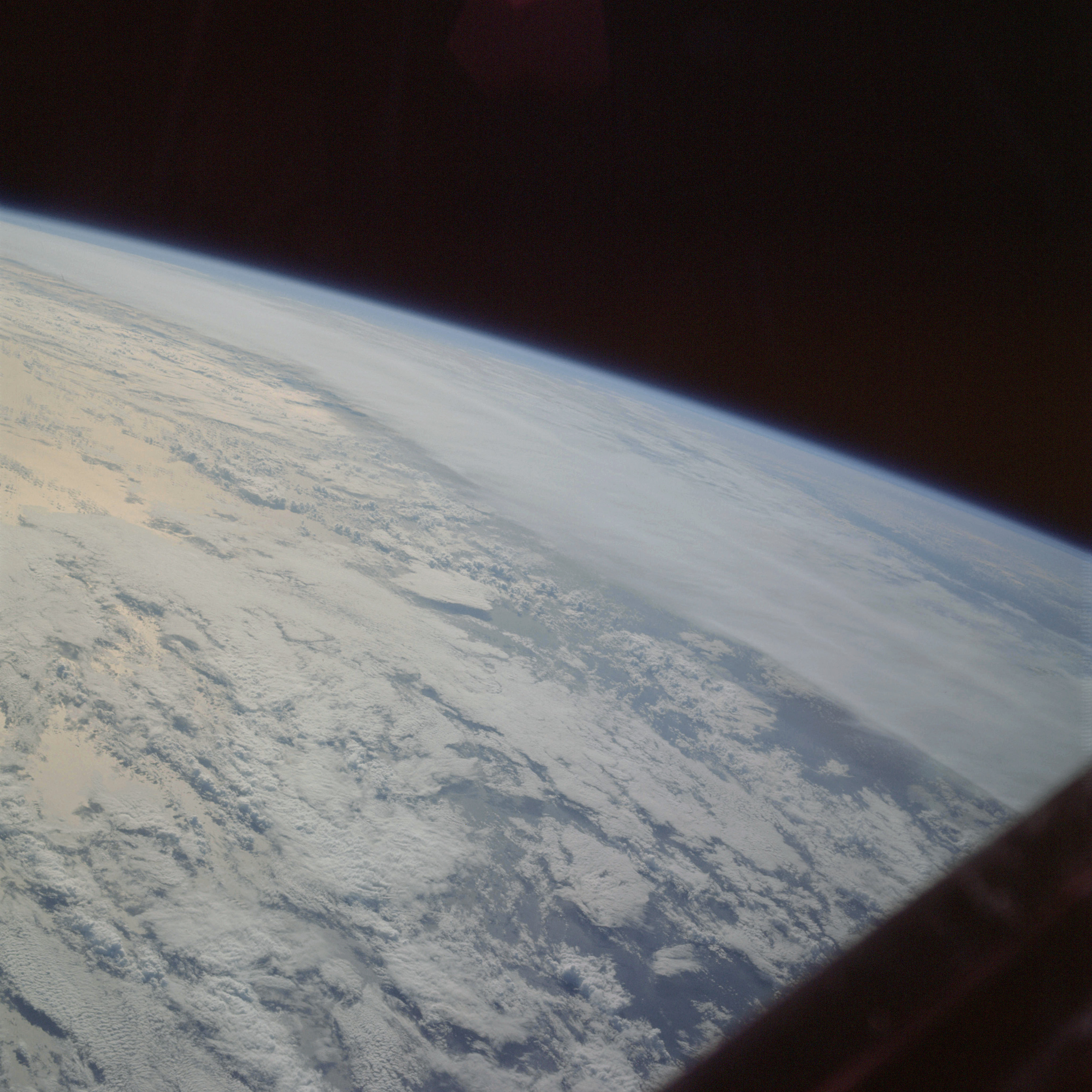 | AS09-22-3353 METEOROLOGY: Stratus, strato-cumulus, alto-cumulus, cumulo-nimbus. OCEANOGRAPHY: Pacific Ocean, sun glint. Image credit: Image Science and Analysis Laboratory, NASA-Johnson Space Center. |
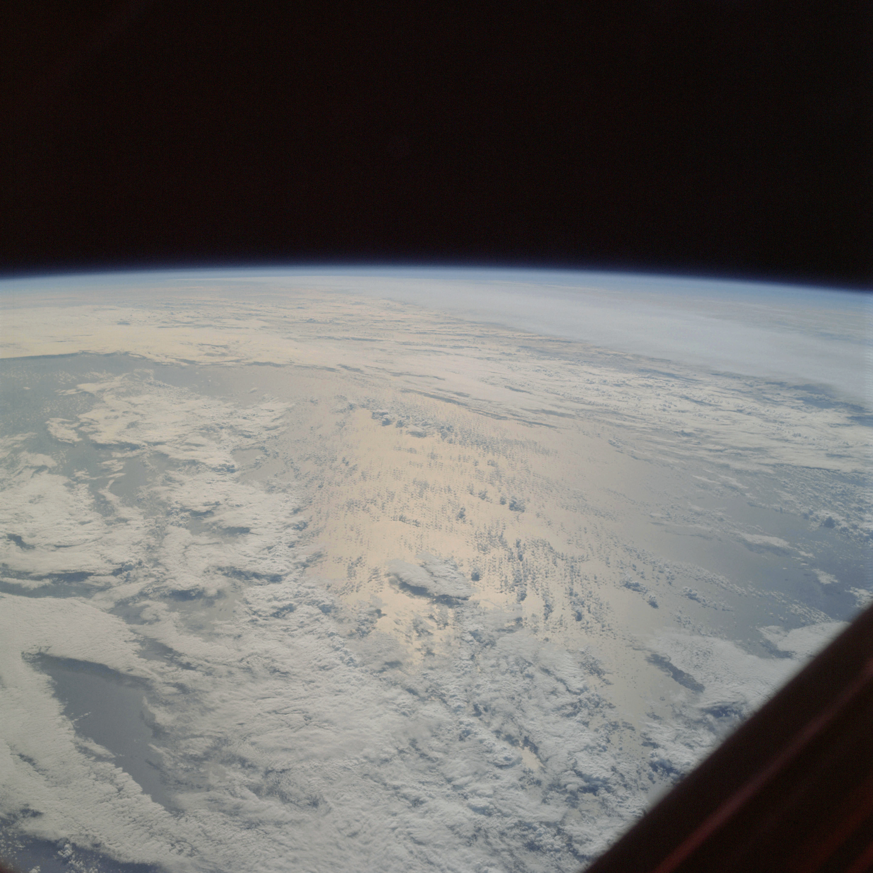 | AS09-22-3354 METEOROLOGY: Cirrus, cumulo-nimbus, strato-cumulus, alto-cumulus. OCEANOGRAPHY: Pacific Ocean, sun glint. Image credit: Image Science and Analysis Laboratory, NASA-Johnson Space Center. |
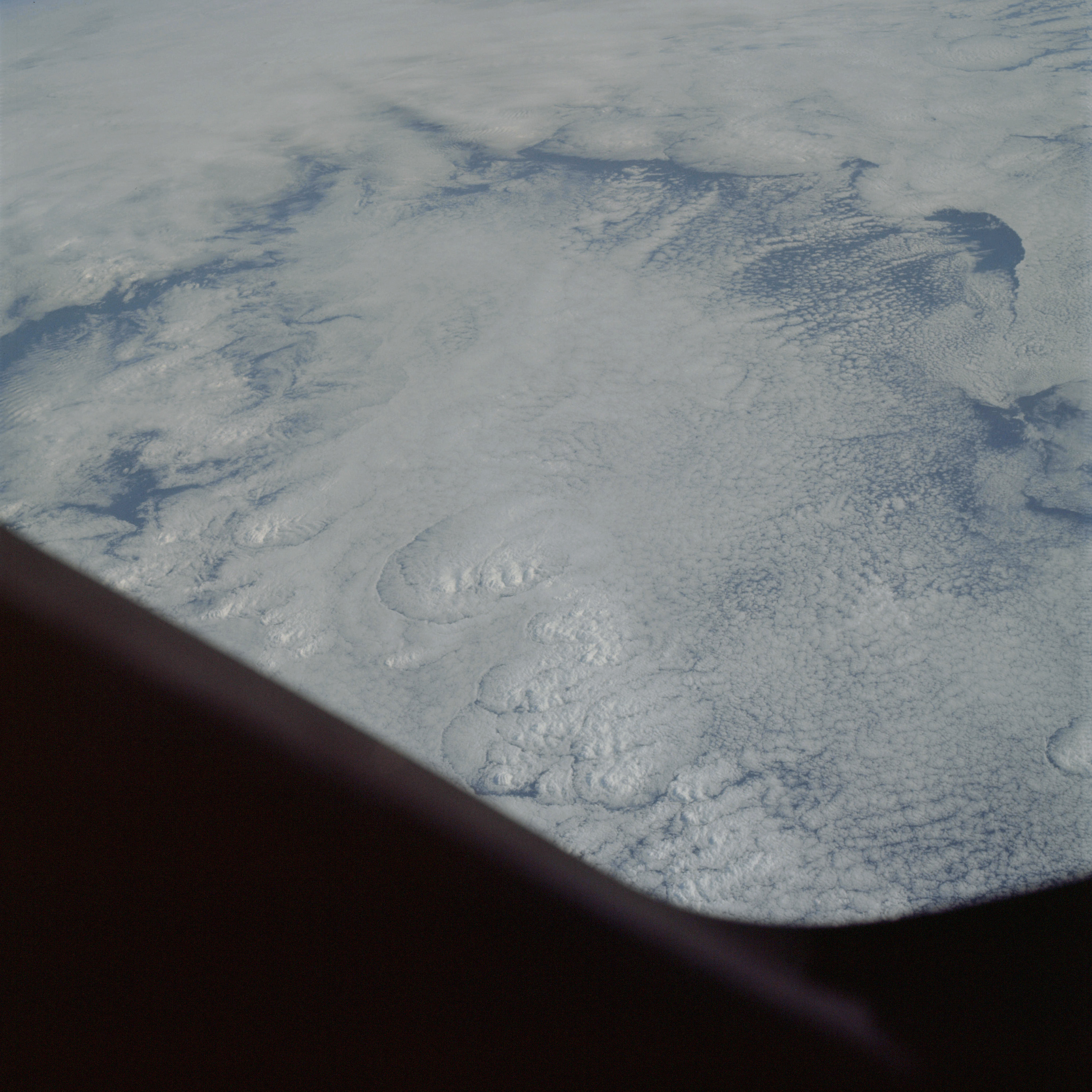 | AS09-22-3355 METEOROLOGY: Strato-cumulus, alto-cumulus, cirrus. OCEANOGRAPHY: Pacific Ocean. Image credit: Image Science and Analysis Laboratory, NASA-Johnson Space Center. |
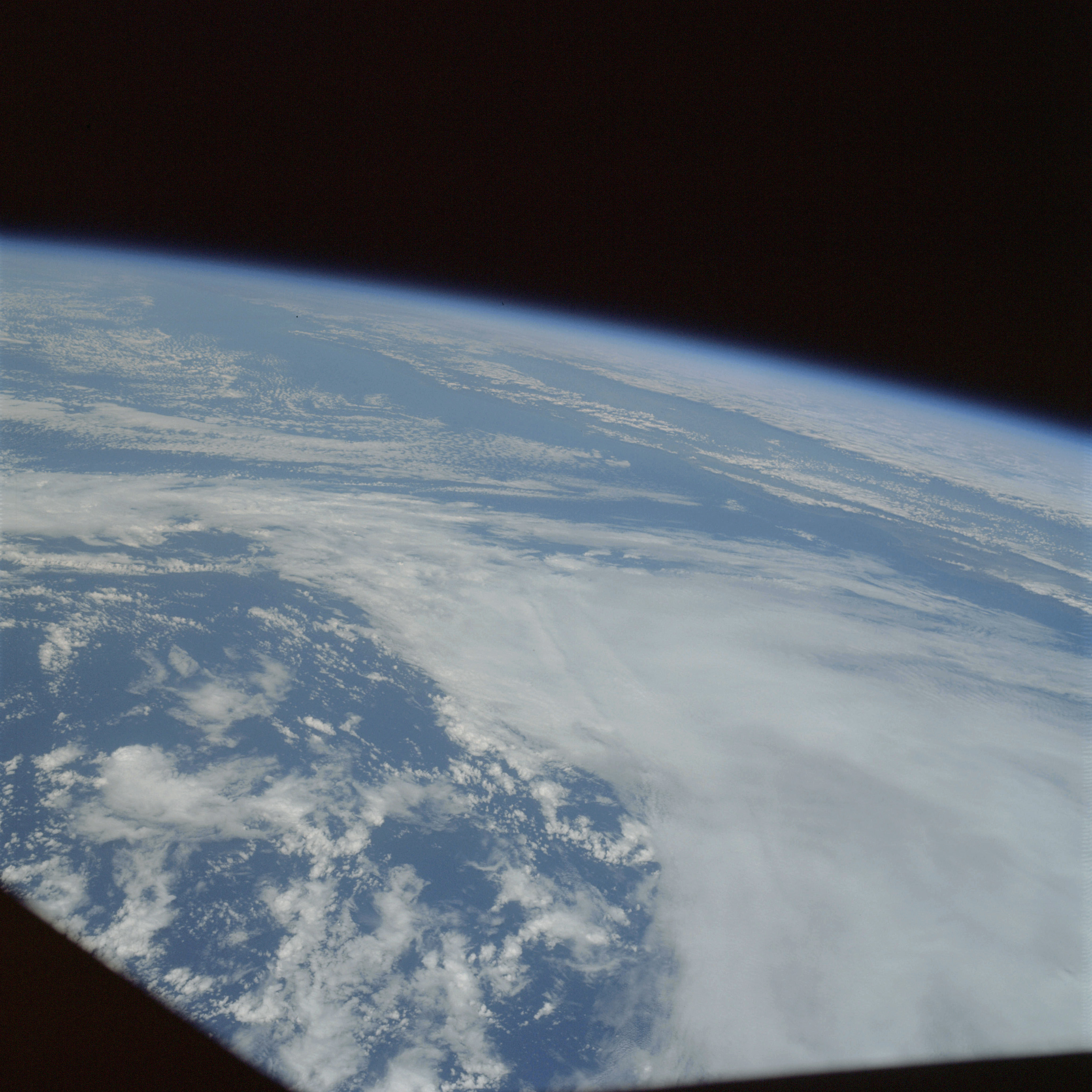 | AS09-22-3356 GEOGRAPHY/CARTOGRAPHY: California Coast. METEOROLOGY: Cumulo-nimbus with anvil, cirrus, alto-cumulus, cumulus congestus. OCEANOGRAPHY: Pacific Ocean, water color variation near the coast. Image credit: Image Science and Analysis Laboratory, NASA-Johnson Space Center. |
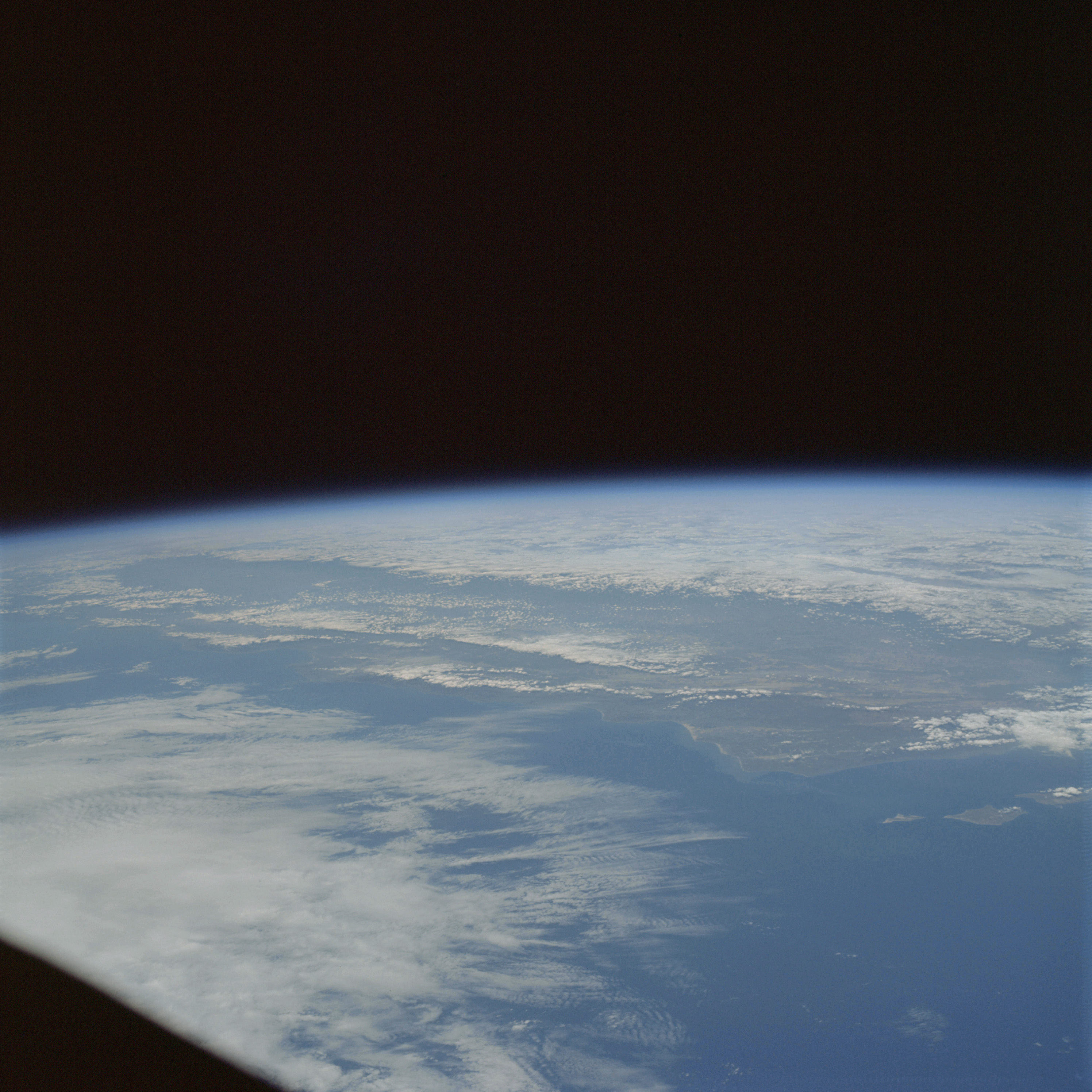 | AS09-22-3357 GEOGRAPHY/CARTOGRAPHY: United States, California, San Miguel and Santa Rosa Islands, Points Conception, Arguello, Buchon, Lobos and Pinos; Santa Lucia Range, San Rafael Mountains. GEOLOGY/HYDROLOGY: Complex Pacific Mountain Ranges. FORESTRY: Deciduous shrubform. METEOROLOGY: Cirrus, alto-cumulus, stratus. OCEANOGRAPHY: Pacific Ocean, water color variations near coastline. Image credit: Image Science and Analysis Laboratory, NASA-Johnson Space Center. |
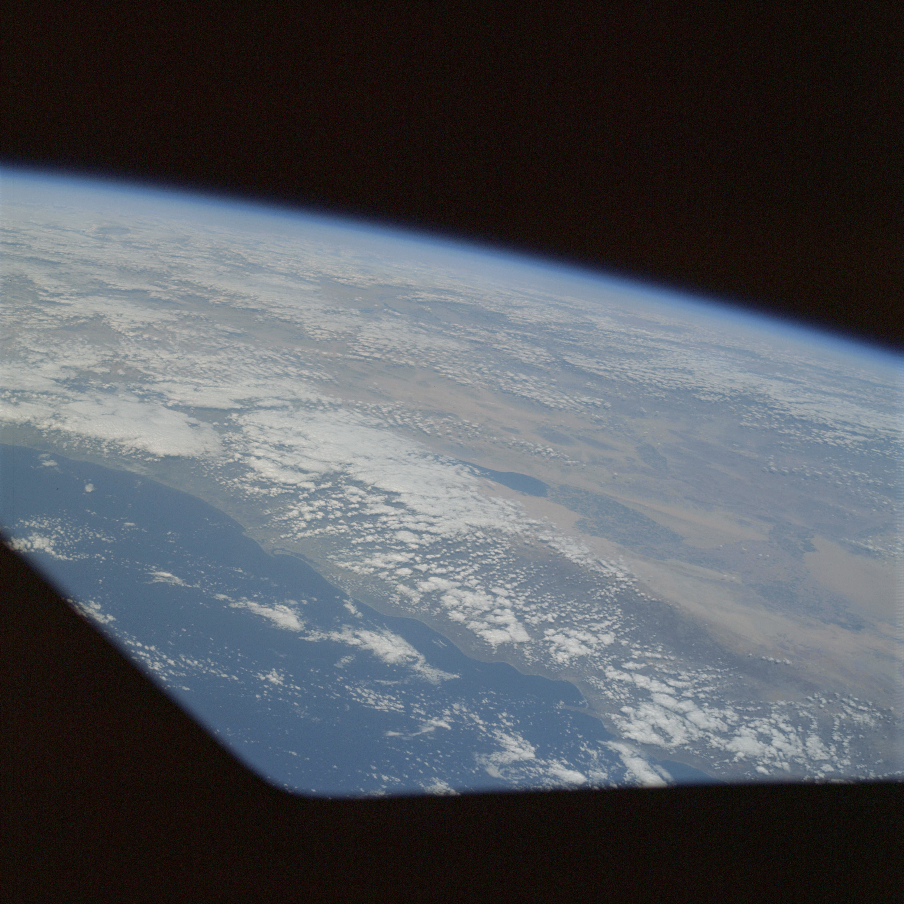 | AS09-22-3358 GEOGRAPHY/CARTOGRAPHY: United States, California, Salton Sea, imperial Valley, Santa Rosa Mountains, City of San Diego, Towns of Oceanside and Tijuana GEOLOGY/HYDROLOGY: Basin and Range Province, tertiary lacustrine beds and quaternary alluvium. AGRICULTURE: Imperial Valley, extensive cultivation. FORESTRY: Desert shrubform. METEOROLOGY: Strato-cumulus OCEANOGRAPHY: Pacific Ocean, water color variation near coastline. Image credit: Image Science and Analysis Laboratory, NASA-Johnson Space Center. |
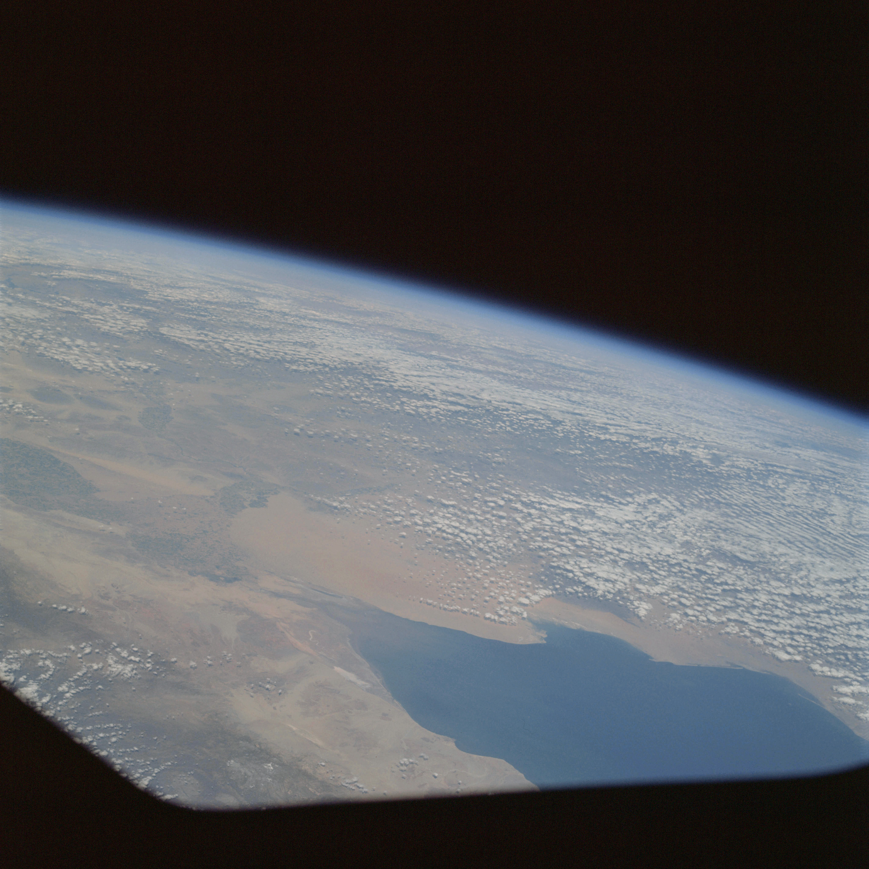 | AS09-22-3359 GEOGRAPHY/CARTOGRAPHY: United States, Baja California, Arizona, Imperial Valley, Colorado River Delta, Gulf of California, City of Yuma, Towns of Calexico and El Centro. GEOLOGY/HYDROLOGY: Basin and Range Province, erg plains and volcanics. AGRICULTURE: Heavy cultivation along Colorado River. FORESTRY: Desert shrubform. METEOROLOGY: Alto-cumulus. OCEANOGRAPHY: Gulf of California, water color variation extending into the Gulf from the Colorado River mouth. Image credit: Image Science and Analysis Laboratory, NASA-Johnson Space Center. |
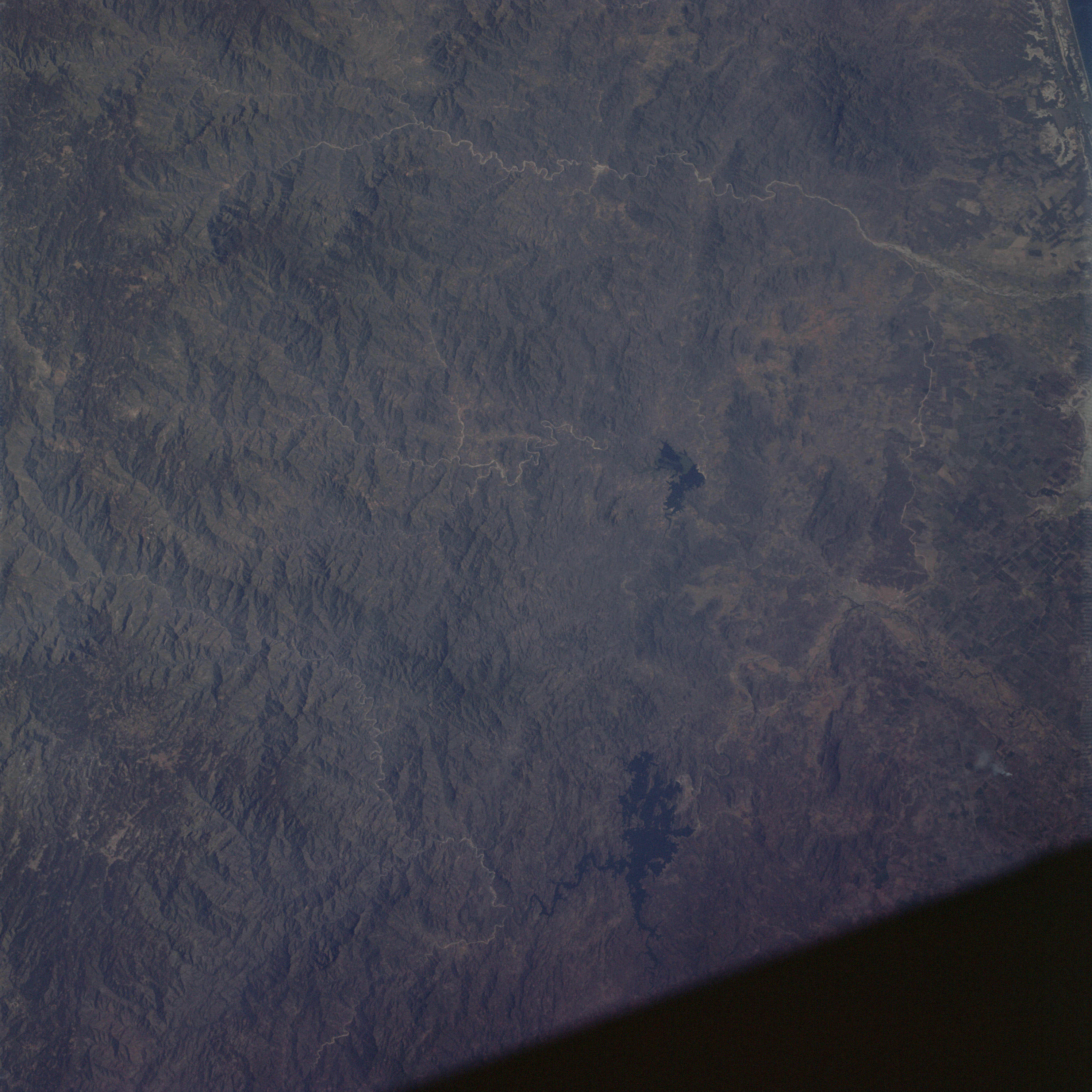 | AS09-22-3360 GEOGRAPHY/CARTOGRAPHY: Mexico, Sierra Madre Occidental. City of Culiacan. GEOLOGY/HYDROLOGY: Complex mountain region. Image credit: Image Science and Analysis Laboratory, NASA-Johnson Space Center. |
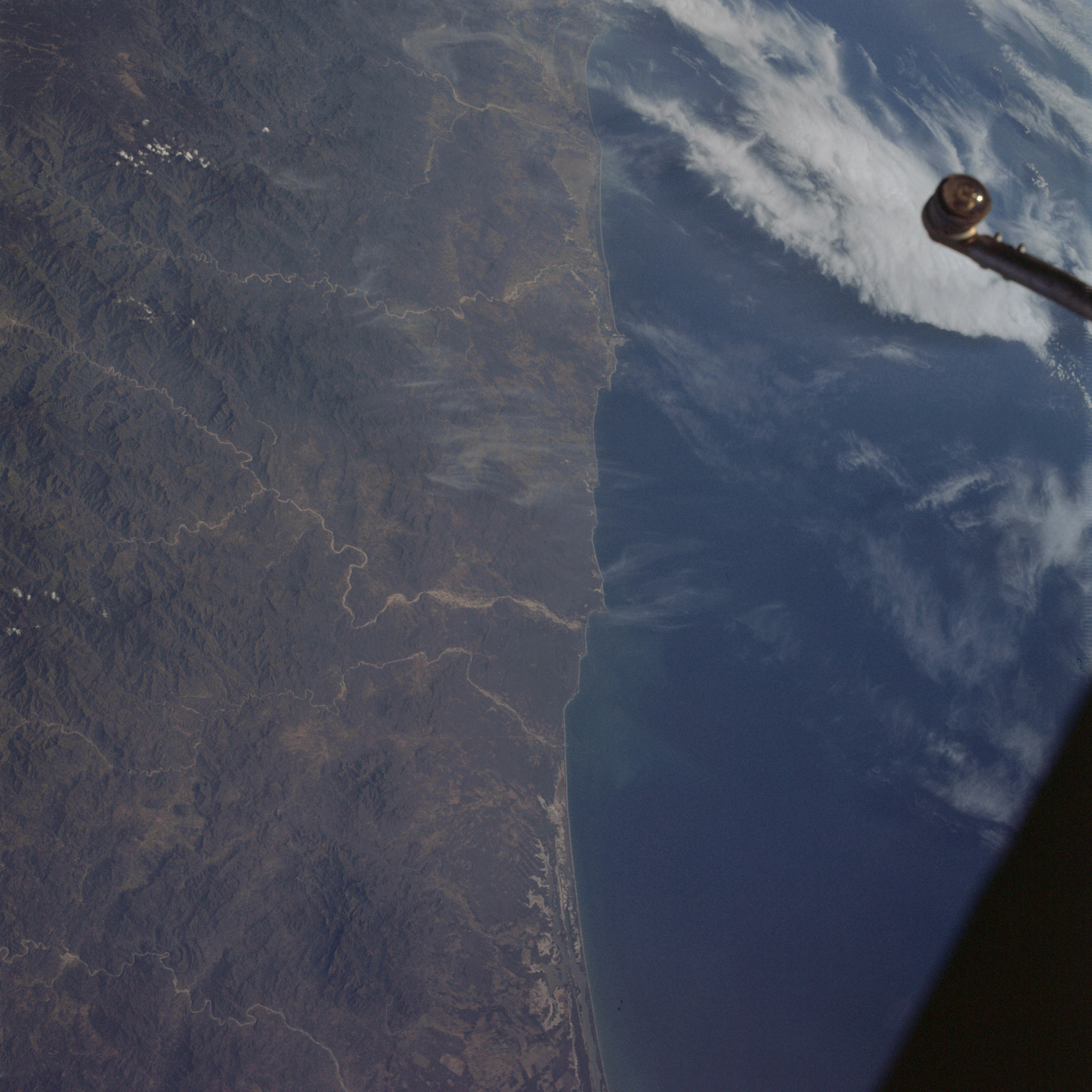 | AS09-22-3361 GEOGRAPHY/CARTOGRAPHY: Mexico, Sinaloa Province, Presidio River, City of Mazatlan. GEOLOGY/HYDROLOGY: Complex mountains and consequent drainage. AGRICULTURE: Possible field patterns scattered and isolated. FORESTRY: Semi-desert shrubform. METEOROLOGY: Cirrus fibratus, strato-cumulus. Image credit: Image Science and Analysis Laboratory, NASA-Johnson Space Center. |
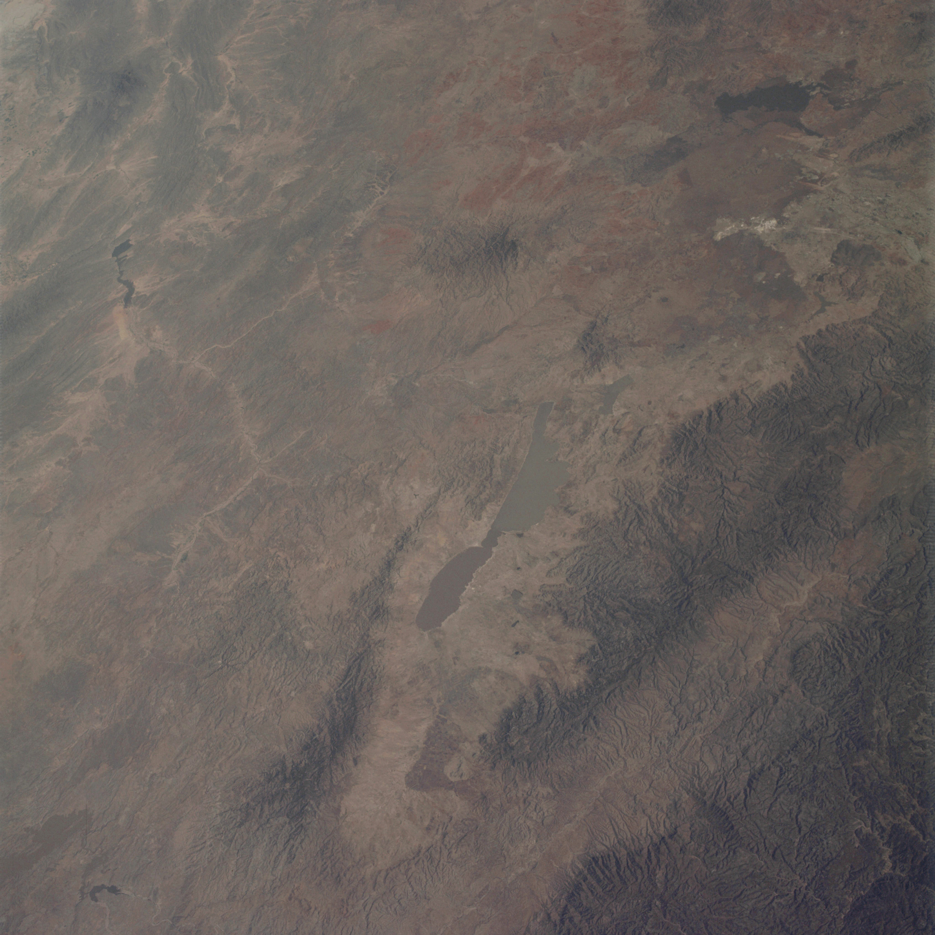 | AS09-22-3362 GEOGRAPHY/CARTOGRAPHY: Mexico, Durango Province, Sentiaguillo Lagoon, Sierra Madre Occidental, Village of Ideal. GEOLOGY/HYDROLOGY: Complex and folded mountains. AGRICULTURE: Scattered field patterns FORESTRY: Semi~desert shrubform with some dwarf conifers at higher elevations. Image credit: Image Science and Analysis Laboratory, NASA-Johnson Space Center. |
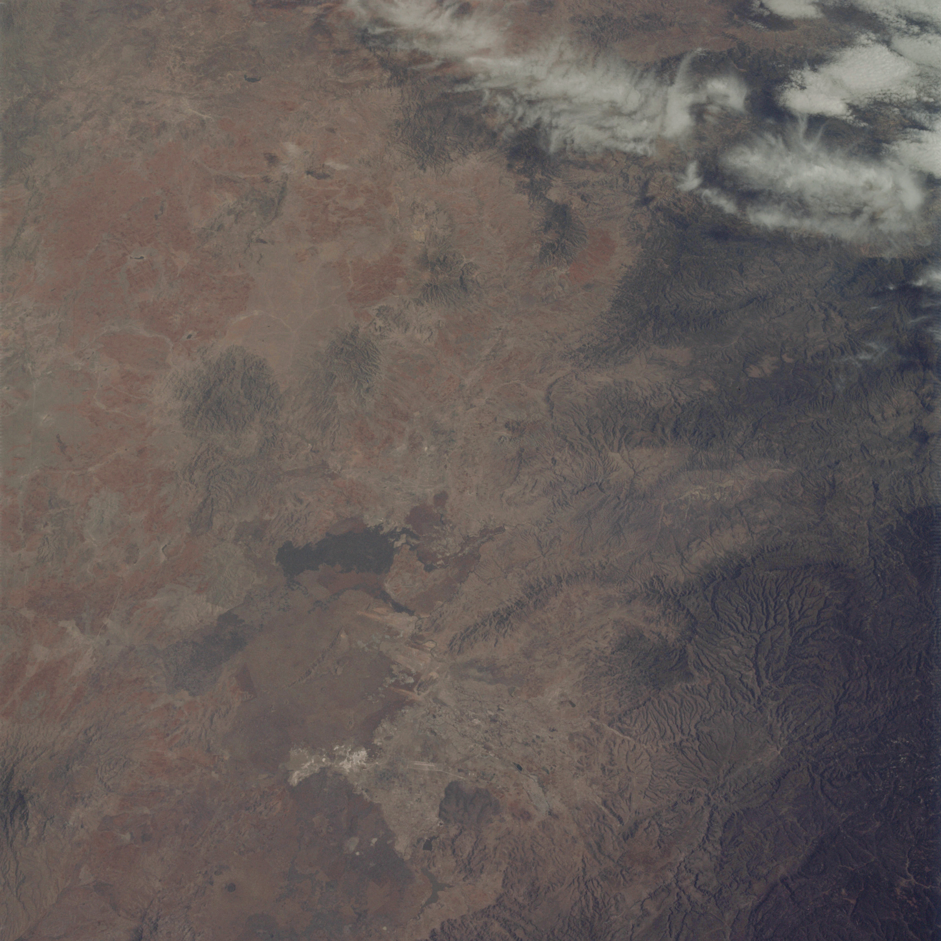 | AS09-22-3363 GEOGRAPHY/CARTOGRAPHY: Mexico, Durango Province, City of Durango. GEOLOGY/HYDROLOGY: Complex mountain region. AGRICULTURE: Heavy field pattern concentration near Durango. FORESTRY: Deciduous shrubform with some dwarf conifers at higher elevations. METEOROLOGY: Cirro-cumulus. Image credit: Image Science and Analysis Laboratory, NASA-Johnson Space Center. |
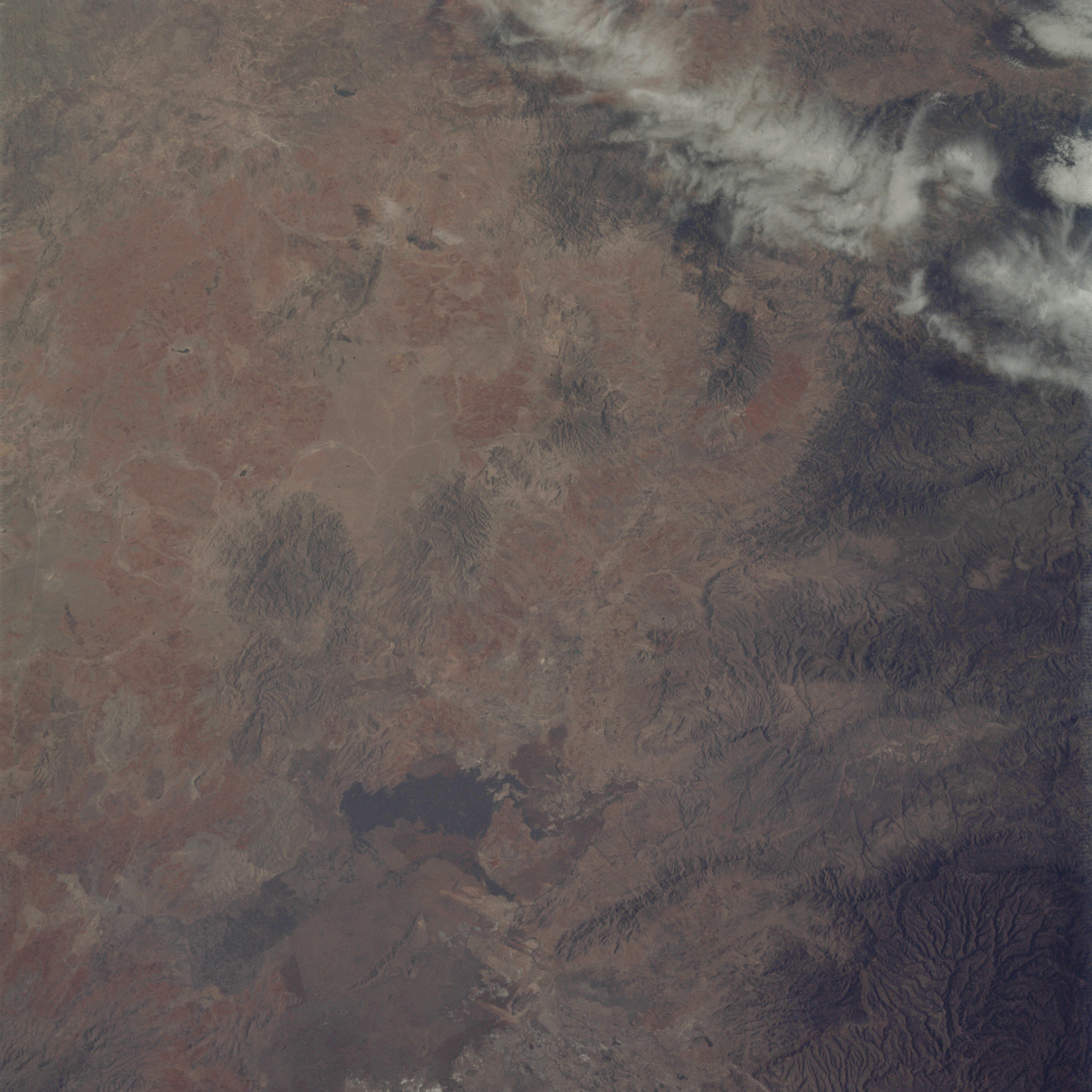 | AS09-22-3364 GEOGRAPHY/CARTOGRAPHY: Mexico, Durango Province, City of Durango. GEOLOGY/HYDROLOGY: Complex mountain region. AGRICULTURE: Heavy field pattern concentration near Durango. FORESTRY: Deciduous shrubform with some conifers at higher elevations. METEOROLOGY: Cirro-cumulus. Image credit: Image Science and Analysis Laboratory, NASA-Johnson Space Center. |
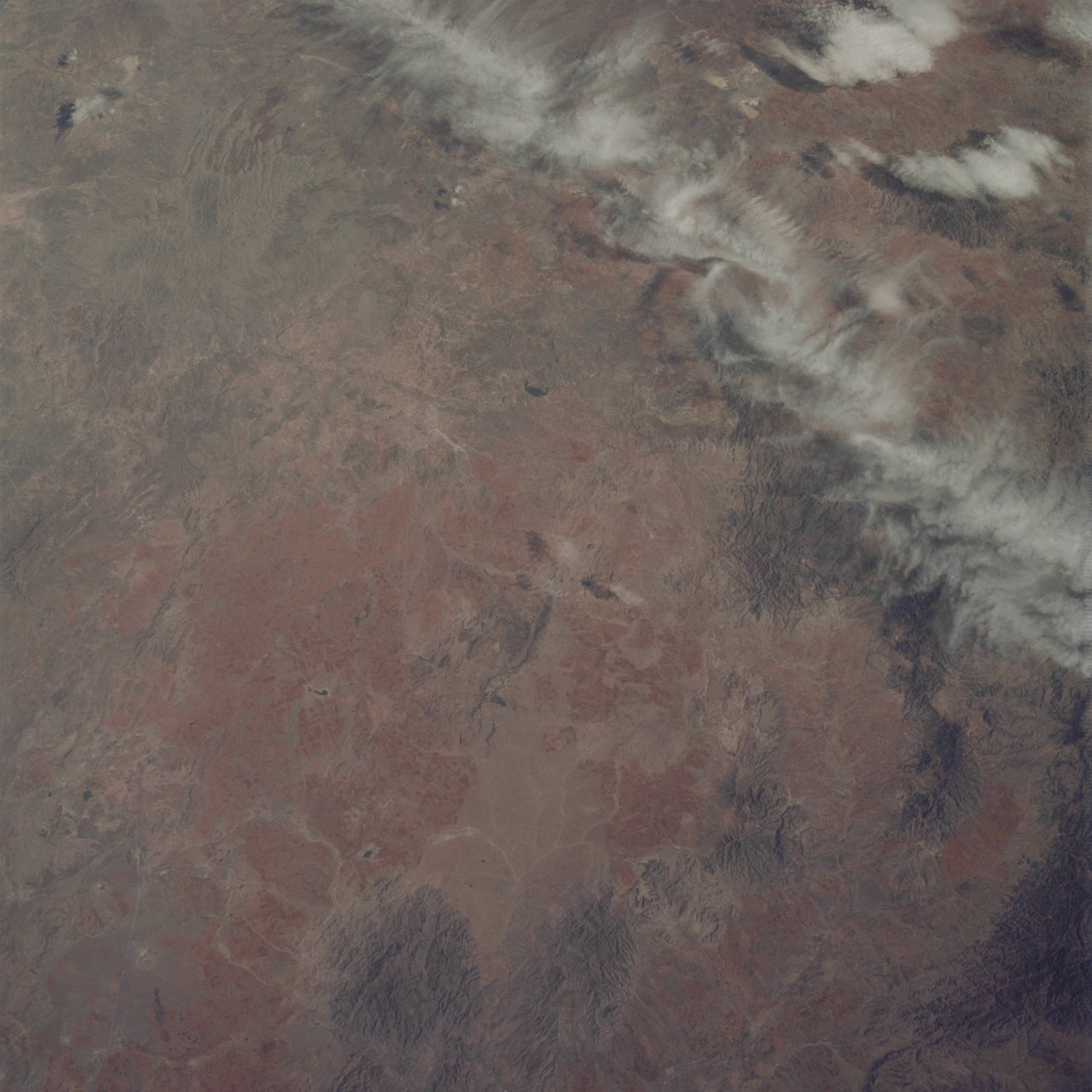 | AS09-22-3365 GEOGRAPHY/CARTOGRAPHY: Mexico, Durango, Zacatecas Provinces, Sierra Madre Occidental. GEOLOGY/HYDROLOGY: Complex mountain region. AGRICULTURE: Large area of cultivation, distinct field patterns, color contrast. FORESTRY: Deciduous shrubform with some conifers at higher elevations. METEOROLOGY: Cirro-cumulus. Image credit: Image Science and Analysis Laboratory, NASA-Johnson Space Center. |
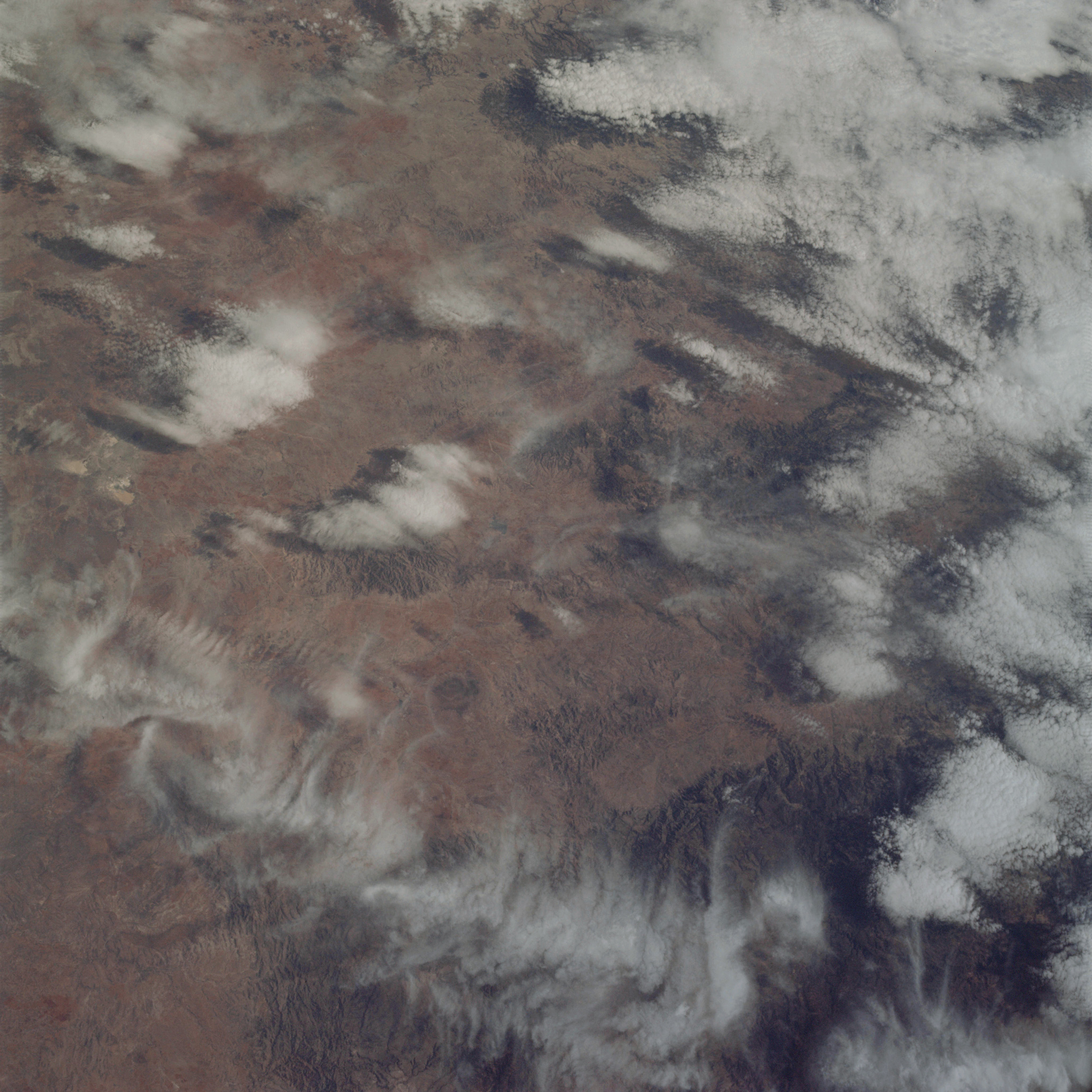 | AS09-22-3366 GEOGRAPHY/CARTOGRAPHY: Mexico, Zacatecas Province, City of Zacatecas. GEOLOGY/HYDROLOGY: Complex mountain region. AGRICULTURE: Scattered field patterns, some highly congested areas of cultivation. FORESTRY: Deciduous shrubform with some conifers at higher elevations. METEOROLOGY: Cirro-cumulus, alto-cumulus. Image credit: Image Science and Analysis Laboratory, NASA-Johnson Space Center. |
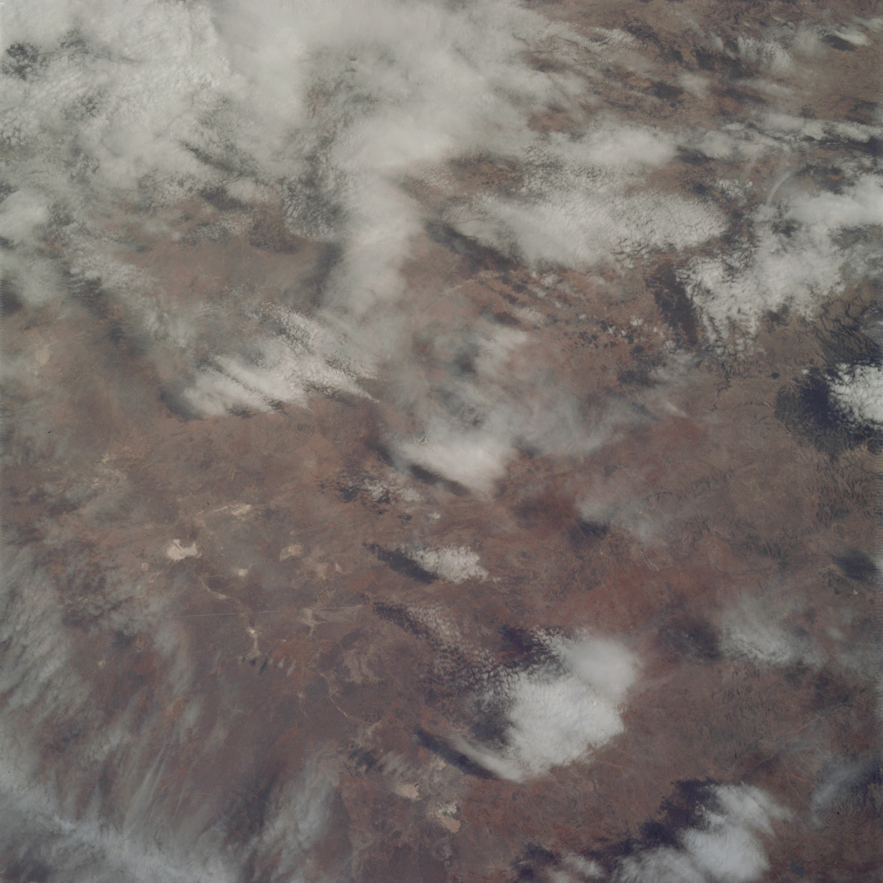 | AS09-22-3367 GEOGRAPHY/CARTOGRAPHY: Mexico, Zacatecas and San Luis Potosi Provinces, City of Zacatecas. GEOLOGY/HYDROLOGY: Complex mountain region. AGRICULTURE: Scattered areas of cultivation. FORESTRY: Deciduous shrubform with some conifers at higher elevations. METEOROLOGY: Cirro-cumulus, alto-cumulus, strato-cumulus. Image credit: Image Science and Analysis Laboratory, NASA-Johnson Space Center. |
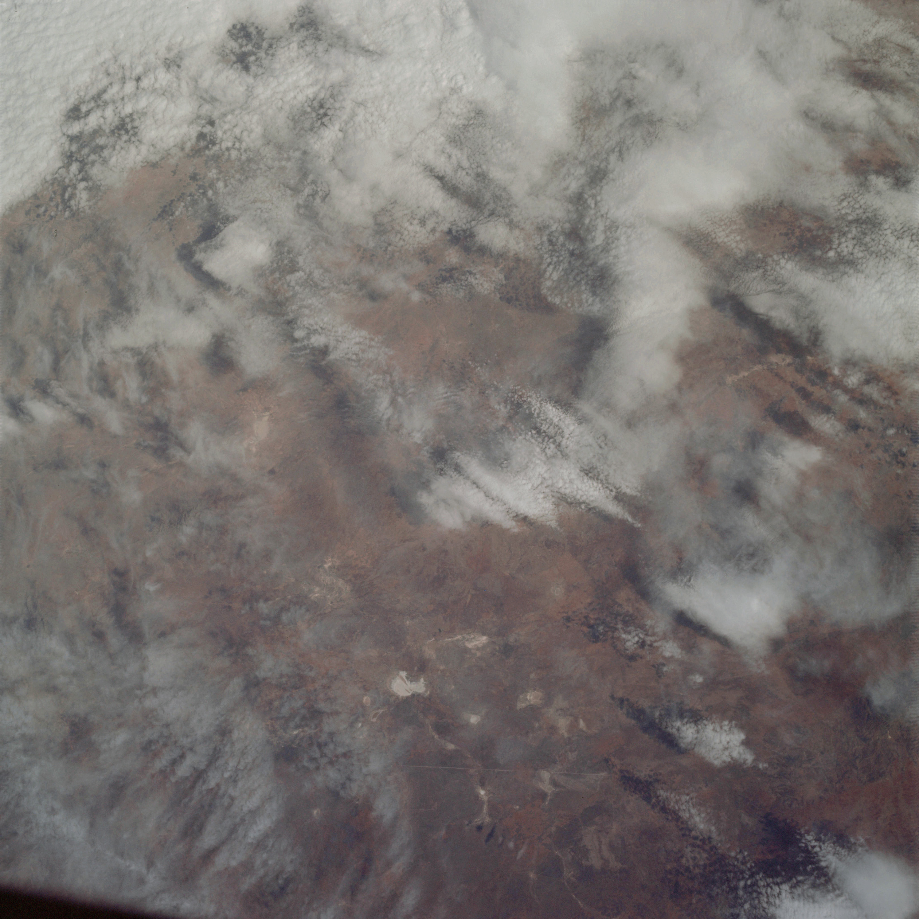 | AS09-22-3368 GEOGRAPHY/CARTOGRAPHY: Mexico, Zacatecas and San Luis Potosi Provinces, Village of Santa Domingo. GEOLOGY/HYDROLOGY: Complex mountain regions. AGRICULTURE: Isolated, irregular shaped, field patterns. FORESTRY: Deciduous shrubform with some conifers at higher elevations. METEOROLOGY: Cirro-cumulus, strato-cumulus, cirrus fibratus. Image credit: Image Science and Analysis Laboratory, NASA-Johnson Space Center. |
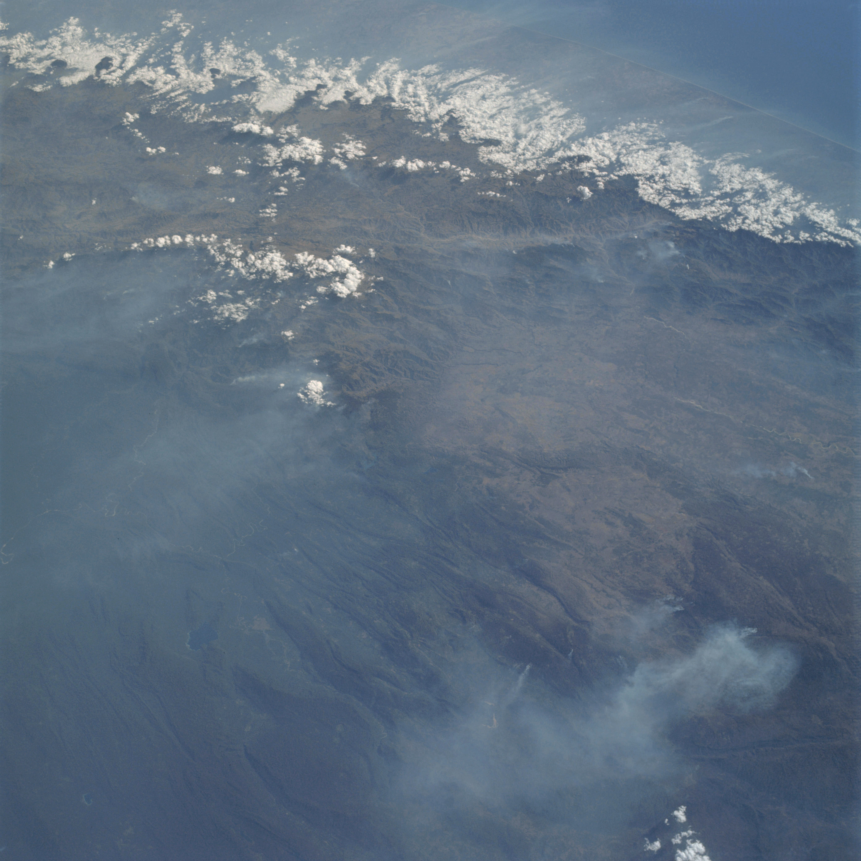 | AS09-22-3369 GEOGRAPHY/CARTOGRAPHY: Guatemala, Sierra Madre, Guatemala City. GEOLOGY/HYDROLOGY: Complex and folded mountain region. AGRICULTURE: Isolated field patterns. FORESTRY: Mixed deciduous and evergreen forest, primarily broadleaf evergreen. Numerous smoke plumes. METEOROLOGY: Cumulo-nimbus, cumulus congestus, haze or smoke. Image credit: Image Science and Analysis Laboratory, NASA-Johnson Space Center. |
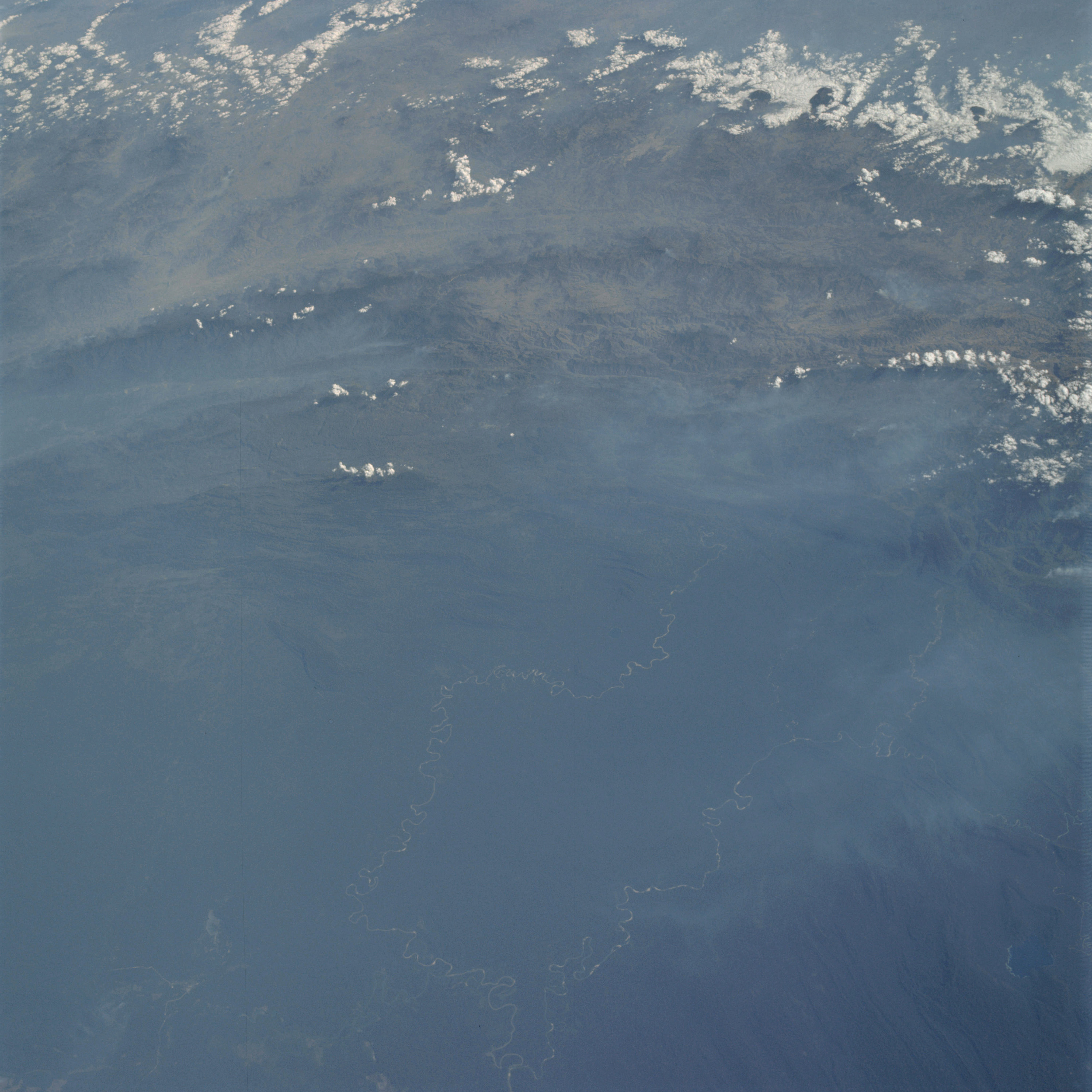 | AS09-22-3370 GEOGRAPHY/CARTOGRAPHY: Guatemala, Mountain of The Mines, Salinas and Locatum River. GEOLOGY/HYDROLOGY: Folded and complex mountain region. AGRICULTURE: Isolated field patterns. FORESTRY: Mixed deciduous and evergreen, primarily broadleaf evergreen, numerous smoke plumes. METEOROLOGY: Cumulo-nimbus, cumulus congestus, smoke or haze. Image credit: Image Science and Analysis Laboratory, NASA-Johnson Space Center. |
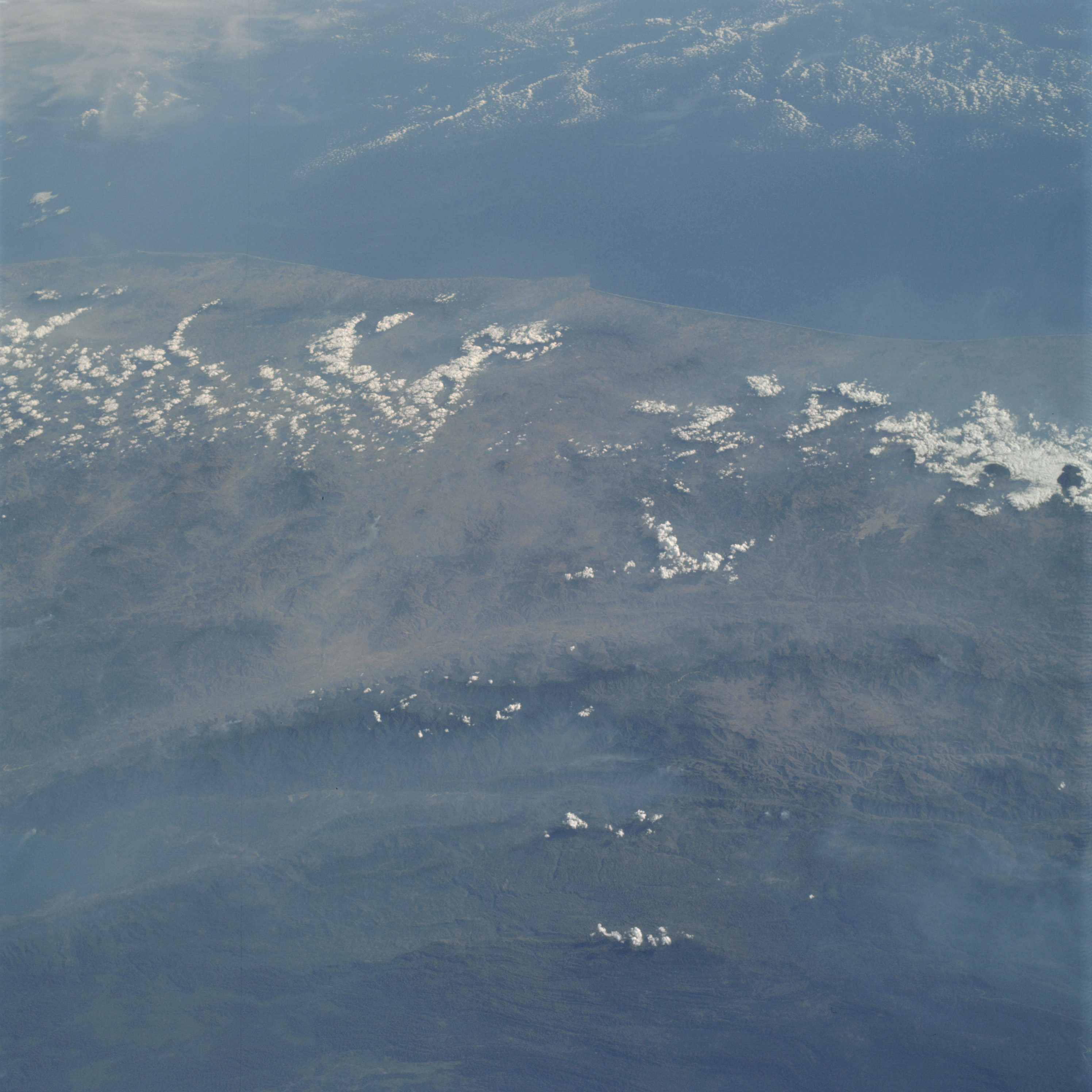 | AS09-22-3371 GEOGRAPHY/CARTOGRAPHY: Guatemala, El Salvador, Honduras, Point Remedious, City of San Salvador. GEOLOGY/HYDROLOGY: Complex mountain region. AGRICULTURE; Isolated field patterns. FORESTRY: Mixed deciduous and evergreen changing to pure broadleaf evergreen inland, numerous smoke plumes. METEOROLOGY: Cumulus congestus, smoke or haze. OCEANOGRAPHY: Pacific Ocean. Image credit: Image Science and Analysis Laboratory, NASA-Johnson Space Center. |
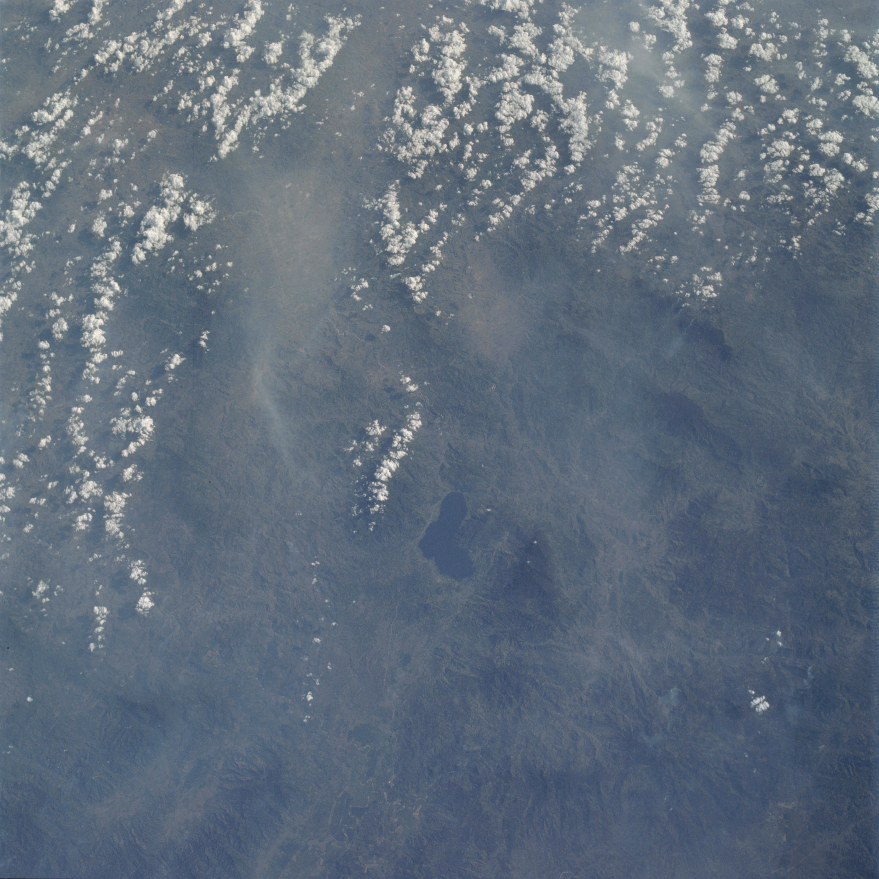 | AS09-22-3372 GEOGRAPHY/CARTOGRAPHY: Honduras, Lake Yojoa, Ulua River. GEOLOGY/HYDROLOGY: Complex mountain region. AGRICULTURE: Field patterns evident along river valley. FORESTRY: Mixed deciduous and evergreen forests; numerous smoke plumes. METEOROLOGY: Cumulus congestus, cumulus humilis, smoke or haze. Image credit: Image Science and Analysis Laboratory, NASA-Johnson Space Center. |
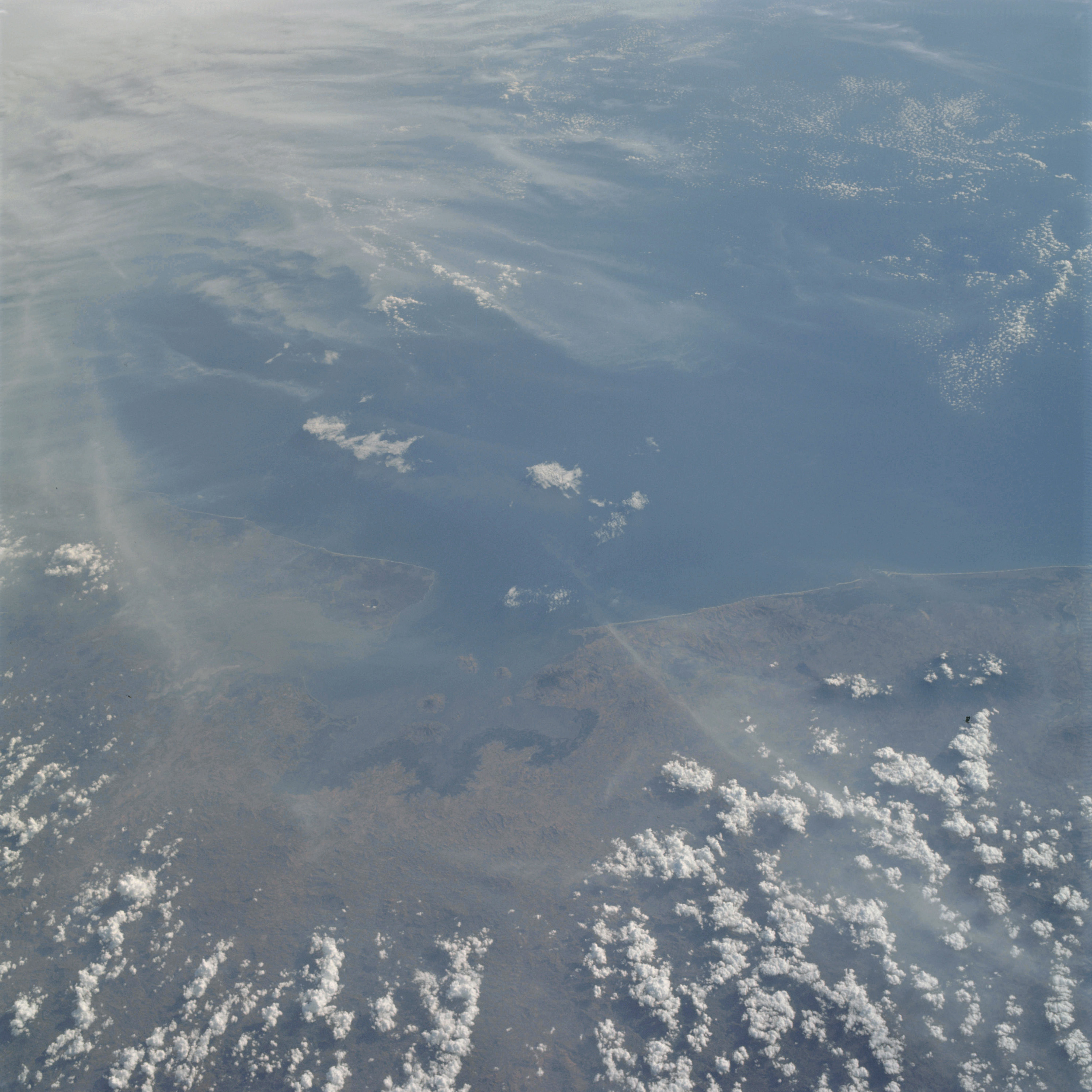 | AS09-22-3373 GEOGRAPHY/CARTOGRAPHY: El Salvador, Honduras, Nicaragua, Gulf of Fonseca, Points Amapala and Cosiguina, Bay of San Lorenzo, City of San Miguel. GEOLOGY/HYDROLOGY: Rugged plains and elevated plateau region. AGRICULTURE: Scattered isolated field patterns. FORESTRY: Mixed deciduous and evergreen forests with coastal grasses. METEOROLOGY: Cumulus congestus, cirrus fibratus. OCEANOGRAPHY: Pacific Ocean, Gulf of Fonseca, water depth variations within the Gulf of Fonseca. Image credit: Image Science and Analysis Laboratory, NASA-Johnson Space Center. |
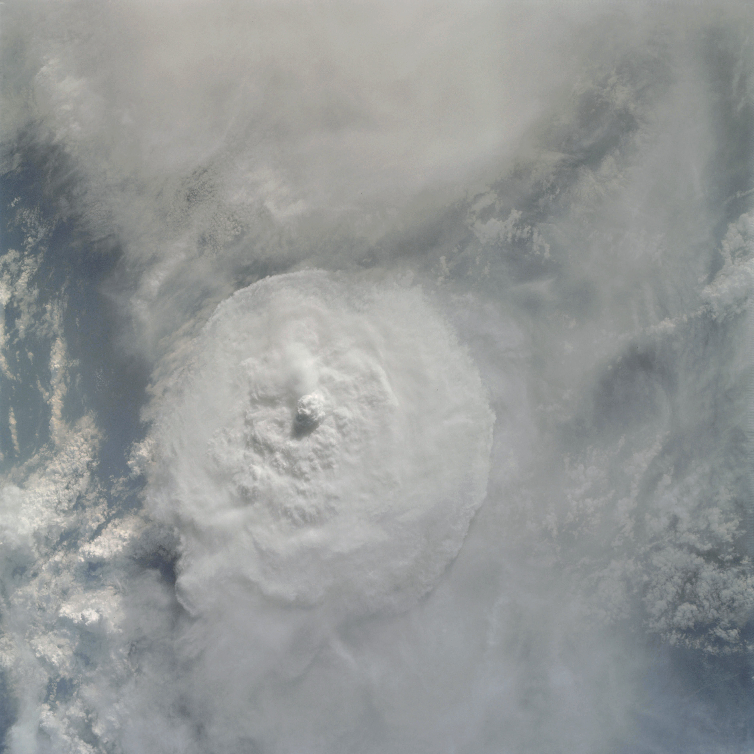 | AS09-22-3374 METEOROLOGY: Large cumulo-nimbus, cirrus spissatus, cumulus congestus. Image credit: Image Science and Analysis Laboratory, NASA-Johnson Space Center. |
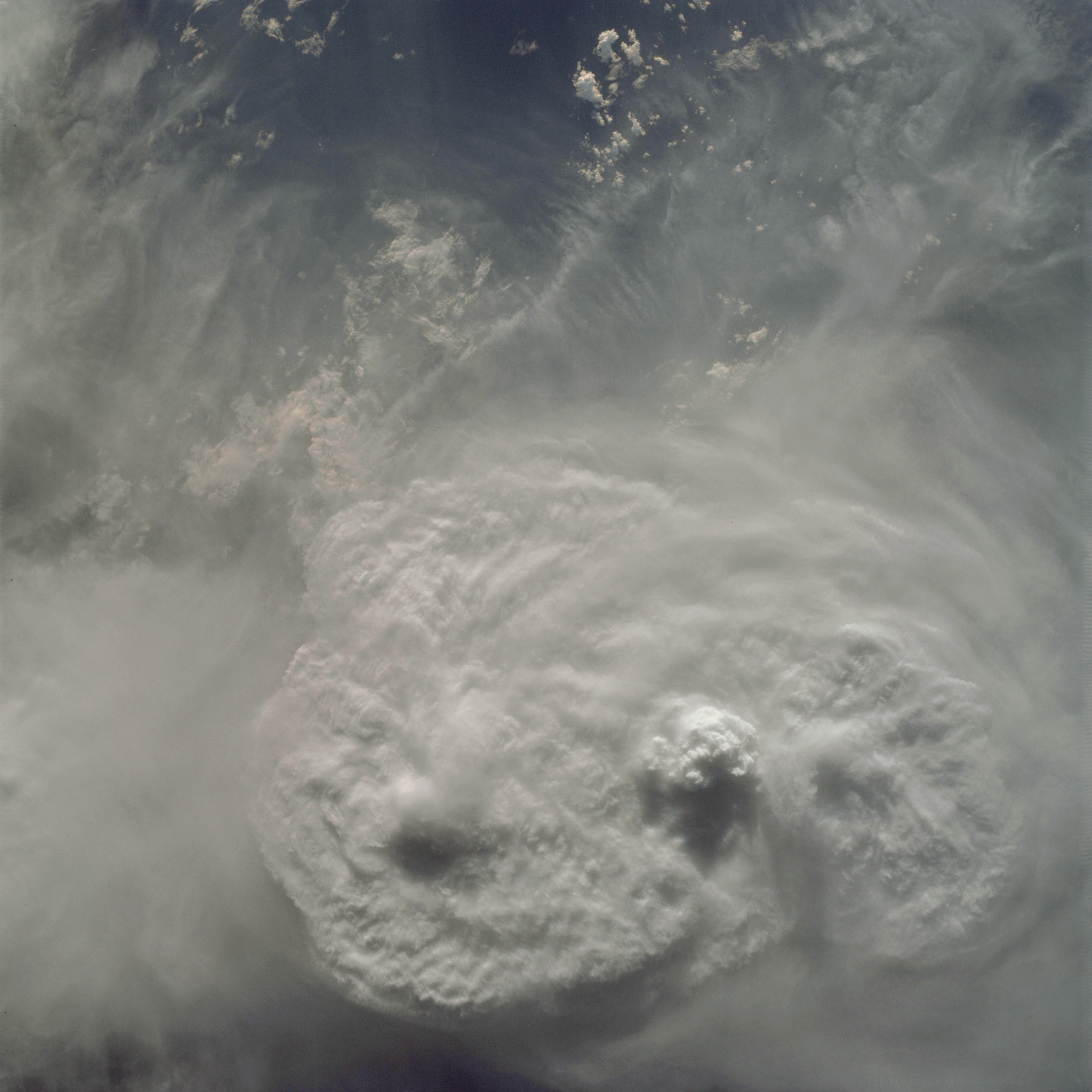 | AS09-22-3375 METEOROLOGY: Cumulo-nimbus with anvils, cirrus cumulus congestus. Image credit: Image Science and Analysis Laboratory, NASA-Johnson Space Center. |
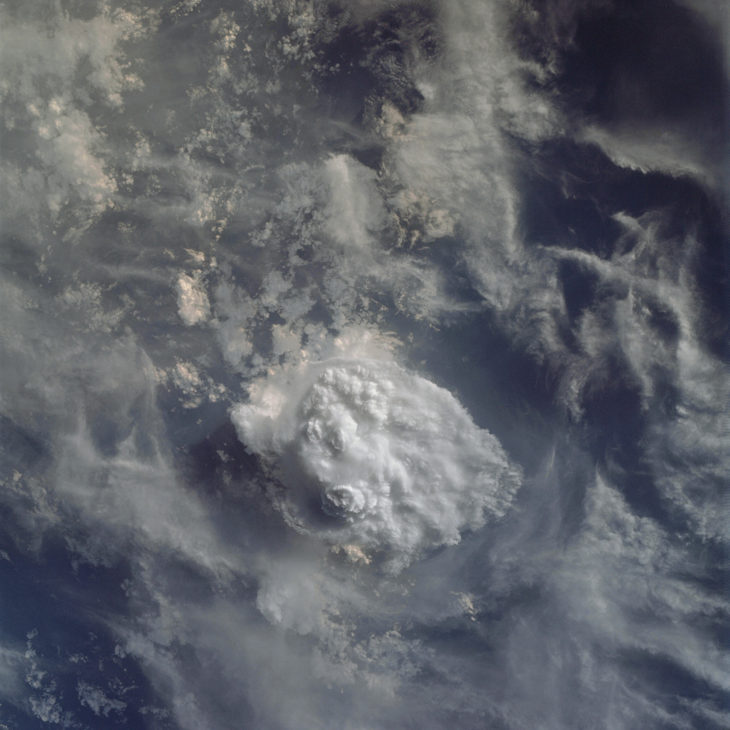 | AS09-22-3376 METEOROLOGY: cumulo-nimbus with anvil, cumulus congestus. Image credit: Image Science and Analysis Laboratory, NASA-Johnson Space Center. |
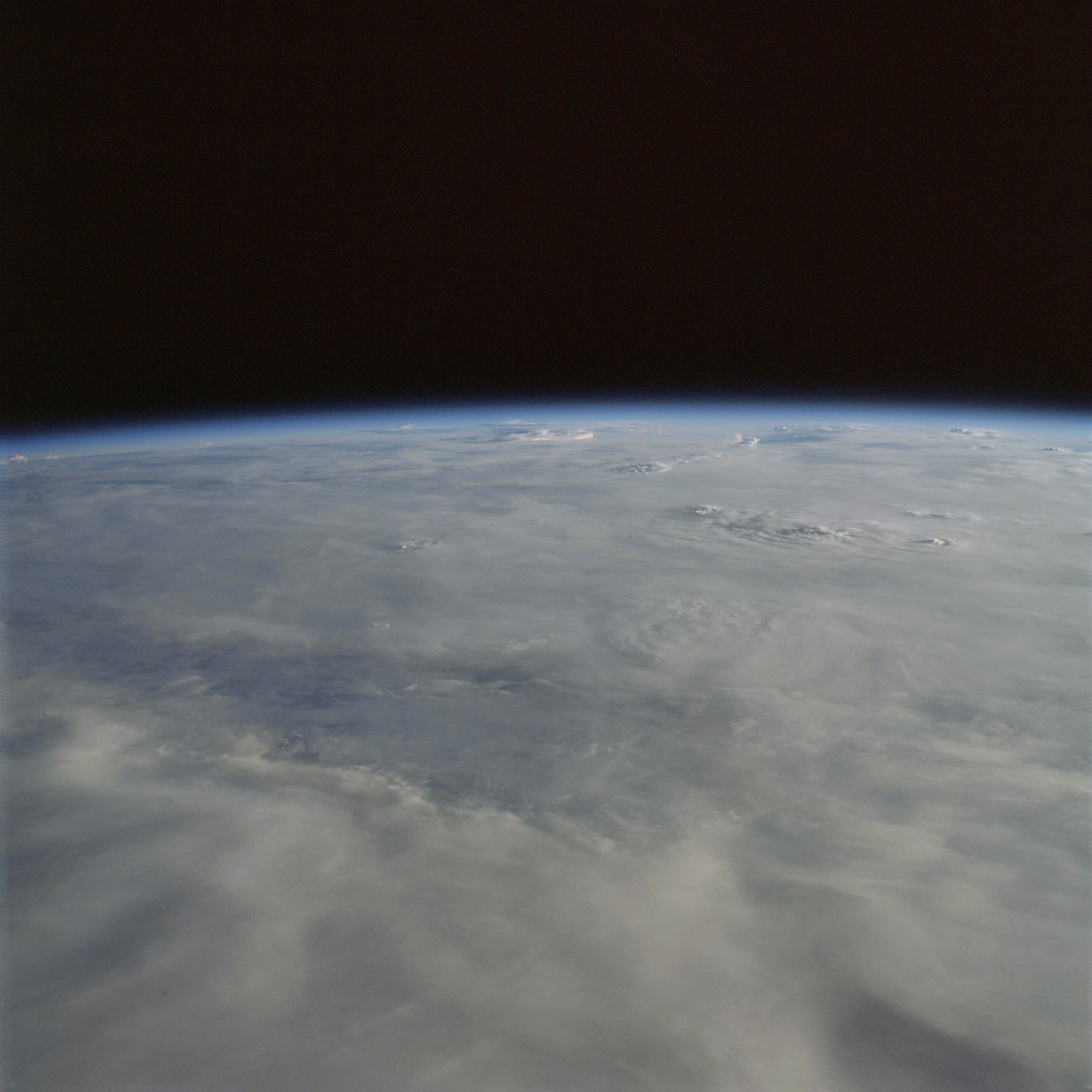 | AS09-22-3377 METEOROLOGY: Strato-cumulus, cumulo-nimbus. Image credit: Image Science and Analysis Laboratory, NASA-Johnson Space Center. |
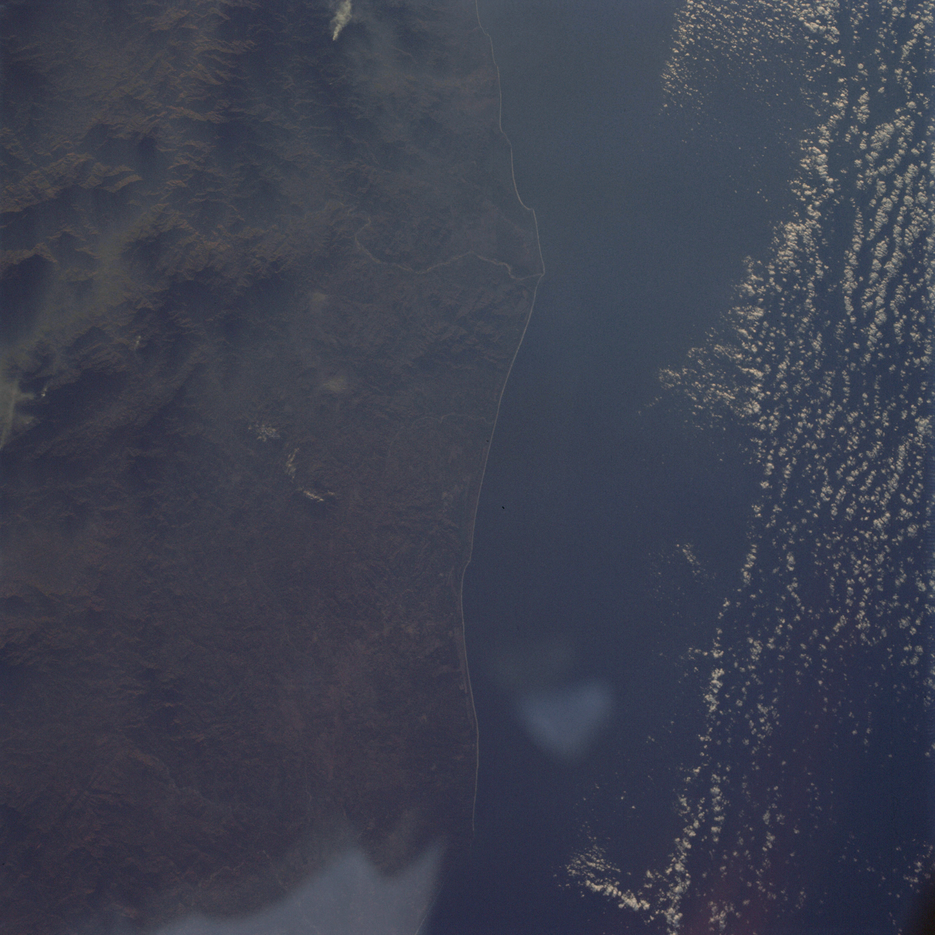 | AS09-22-3378 GEOGRAPHY/CARTOGRAPHY: Mexico, Oaxaca Province, Sierra Madre Del Mur, Verde River, Pastoria Lagoon, Village of Tututepec. METEOROLOGY: Cumulus humilis. Image credit: Image Science and Analysis Laboratory, NASA-Johnson Space Center. |
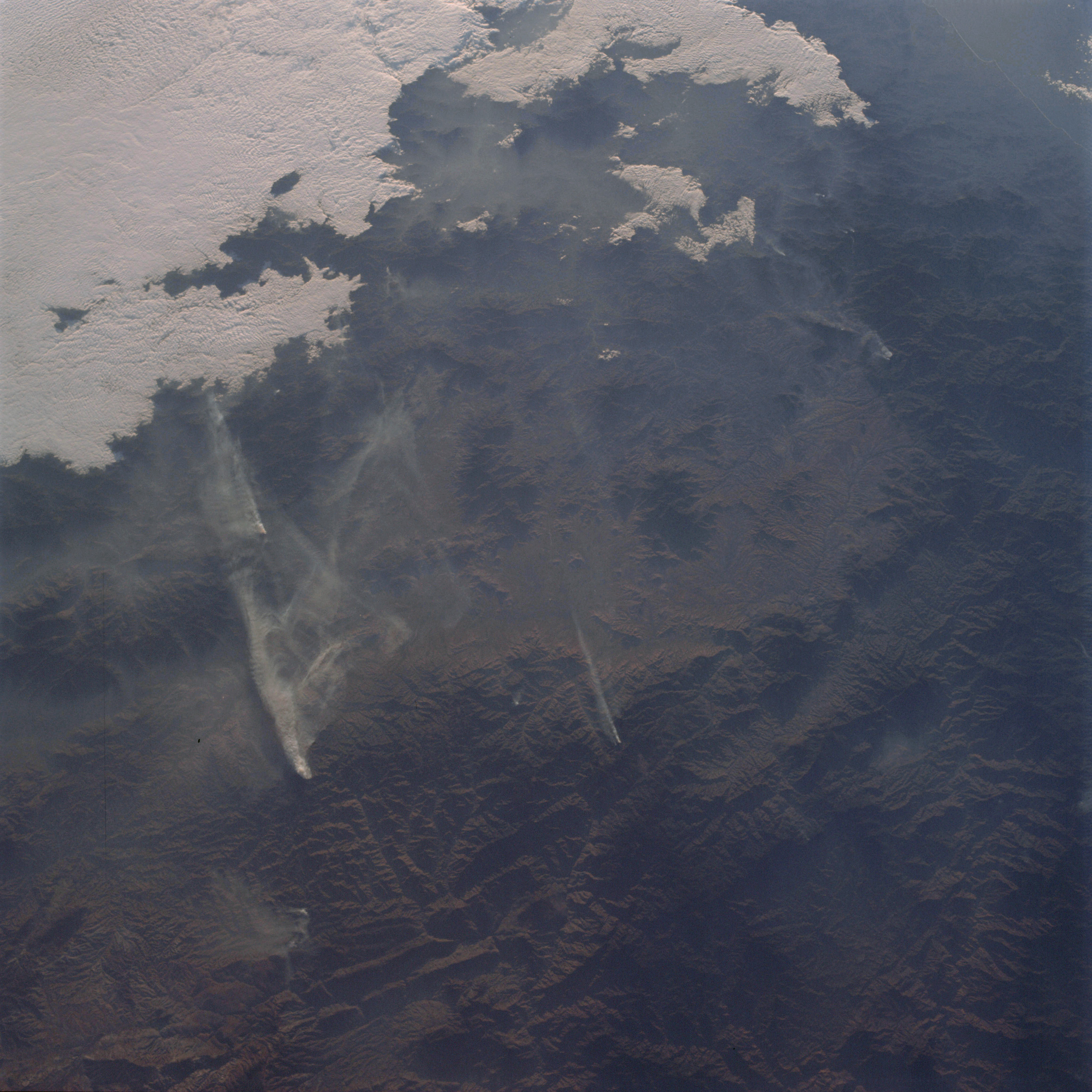 | AS09-22-3379 GEOGRAPHY/CARTOGRAPHY: Mexico, Oaxaca Province, Sarabia River, Village of San Juan Lajarcia. GEOLOGY/HYDROLOGY: Complex mountains. FORESTRY: Forest fires, mixed deciduous and evergreen forests. METEOROLOGY: Strato-cumulus, smoke. Image credit: Image Science and Analysis Laboratory, NASA-Johnson Space Center. |
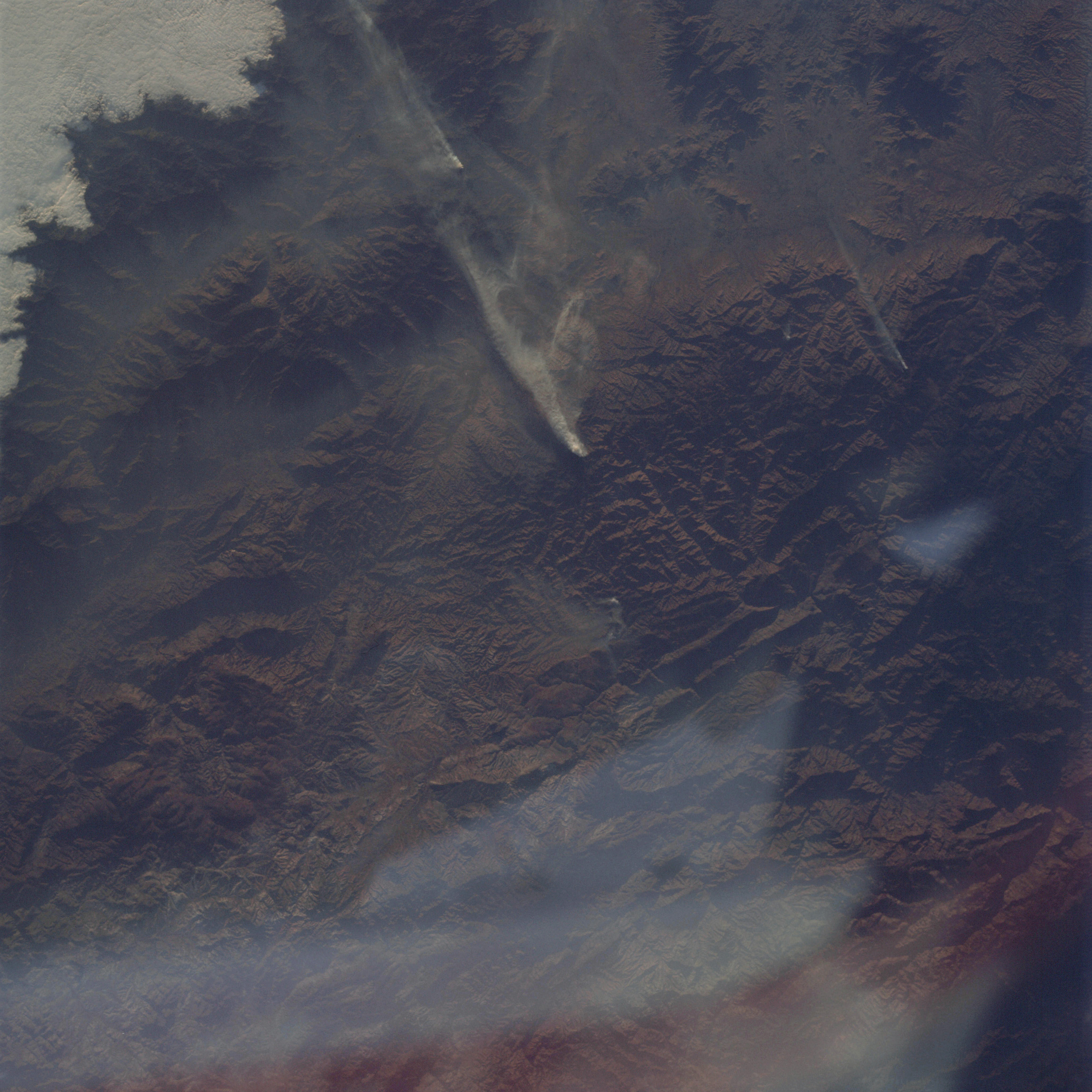 | AS09-22-3380 GEOGRAPHY /CARTOGRAPHY: Mexico, Oaxaca Province, Villages of Ejutla and San Juan Lajarcia. GEOLOGY/HYDROLOGY: Complex mountains. FORESTRY: Forest fires, mixed deciduous and evergreen forests. METEOROLOGY: Strato-cumulus. Image credit: Image Science and Analysis Laboratory, NASA-Johnson Space Center. |
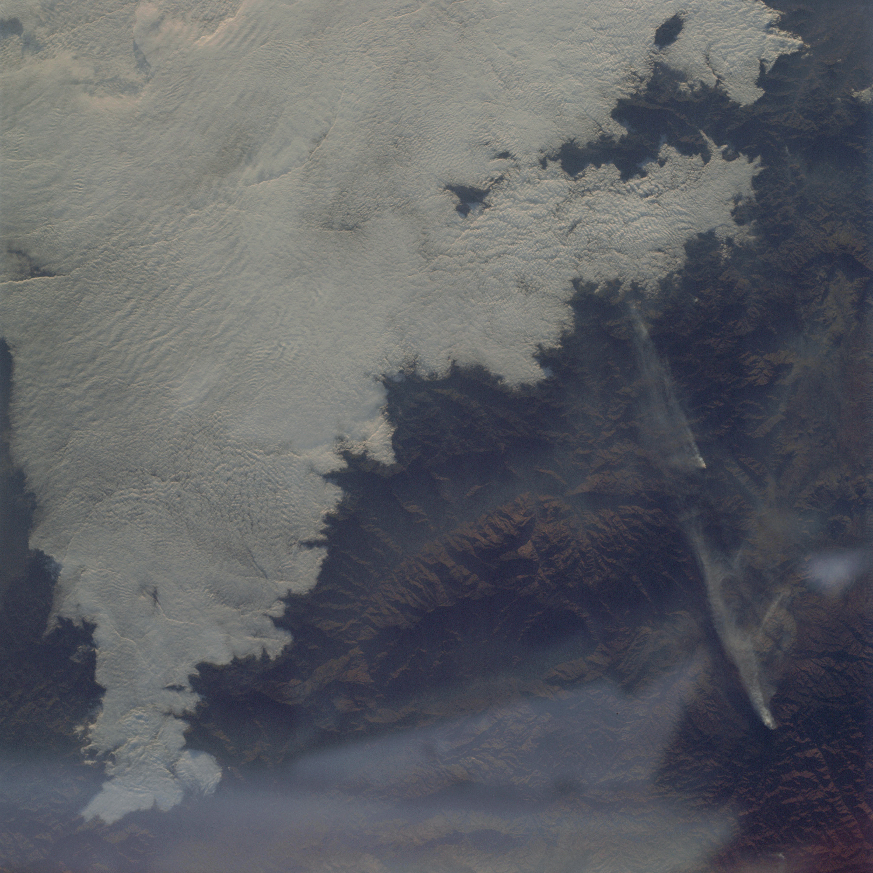 | AS09-22-3381 GEOGRAPHY/CARTOGRAPHY: Mexico, Oaxaca Province. GEOLOGY/HYDROLOGY: Complex mountains. FORESTRY: Forest fires, mixed deciduous and evergreen forests. METEOROLOGY: Strato-cumulus. Image credit: Image Science and Analysis Laboratory, NASA-Johnson Space Center. |
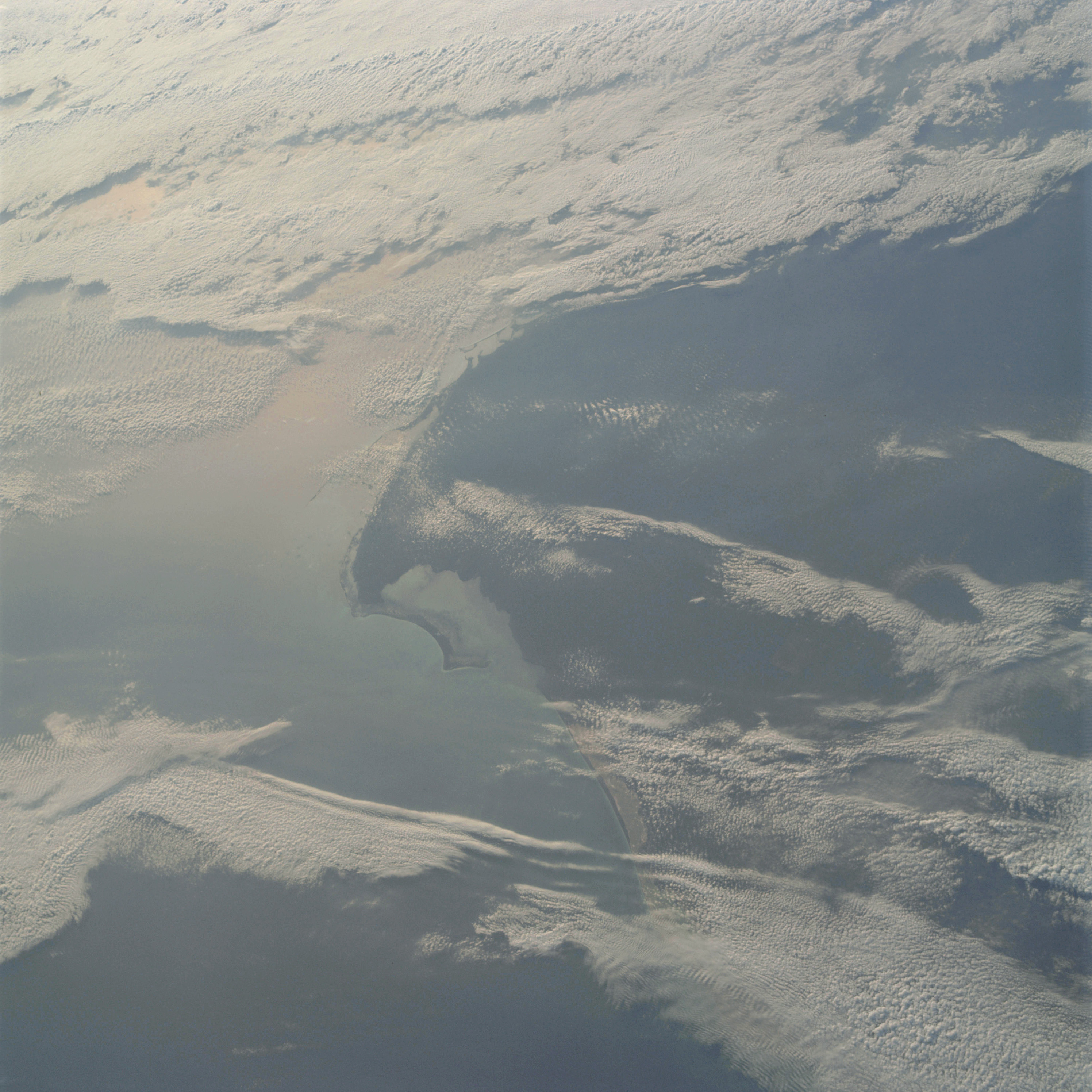 | AS09-22-3382 GEOGRAPHY/CARTOGRAPHY: Mexico, Yucatan Peninsula, Quintana Roo Province, Contoy Island, Village of Puerto Juarez. GEOLOGY/HYDROLOGY: Low plains region. METEOROLOGY: Cirro-cumulus, alto-cumulus. OCEANOGRAPHY: Gulf of Mexico, sun glint. Image credit: Image Science and Analysis Laboratory, NASA-Johnson Space Center. |
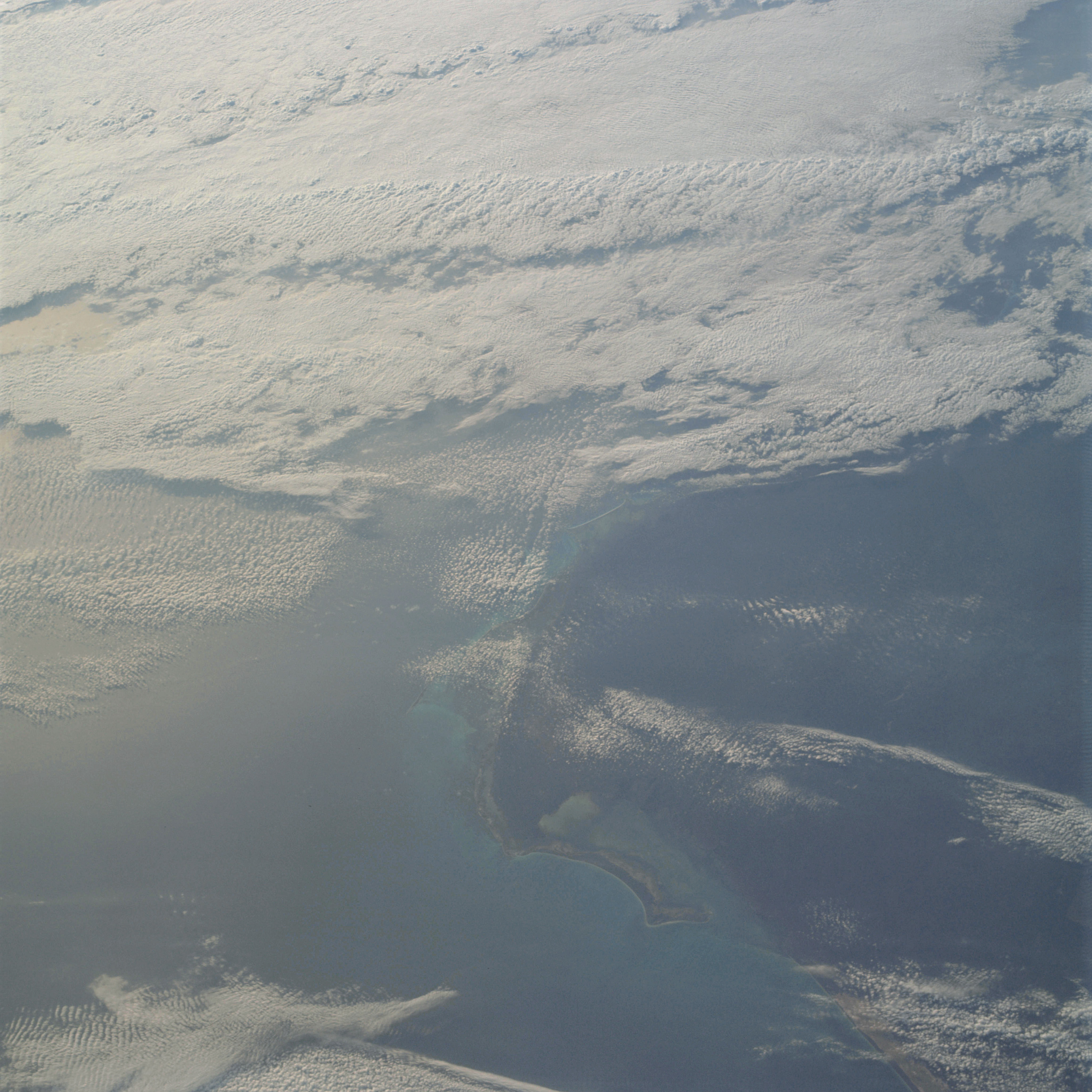 | AS09-22-3383 GEOGRAPHY/CARTOGRAPHY: Mexico, Yucatan Peninsula, Quintana Roo Province, Contoy Island, Village of Puerto Juarez. GEOLOGY/HYDROLOGY: Low plains region. METEOROLOGY: Cirro-cumulus, alto-cumulus. OCEANOGRAPHY: Gulf of Mexico, sun glint. Image credit: Image Science and Analysis Laboratory, NASA-Johnson Space Center. |
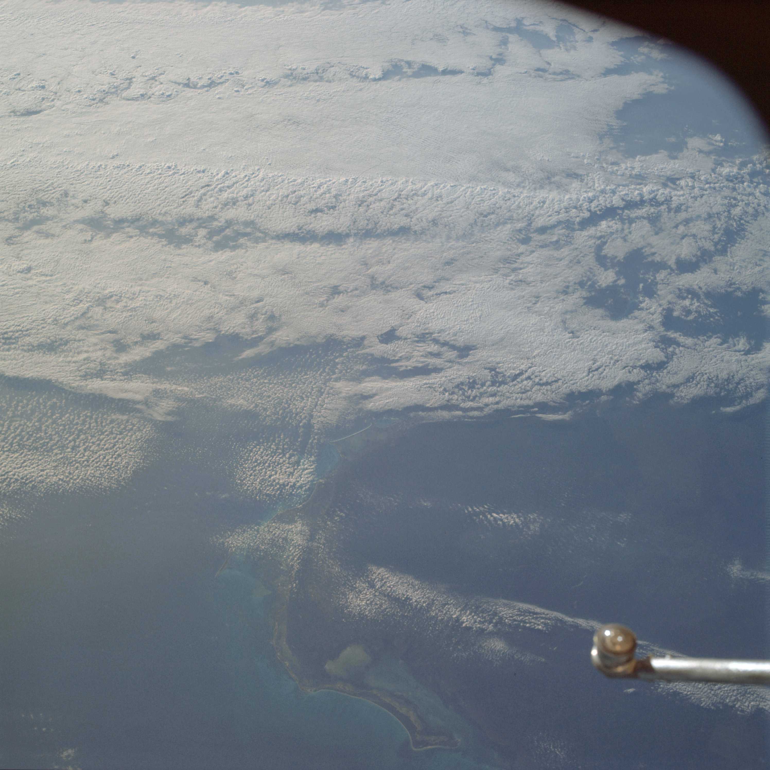 | AS09-22-3384 GEOGRAPHY/CARTOGRAPHY: Mexico, Yucatan Peninsula, Quintana Roo Province, Contoy Island, Village of Puerto Juarez. GEOLOGY/HYDROLOGY: Low plains region. METEOROLOGY: Cirro-cumulus, alto-cumulus. OCEANOGRAPHY: Gulf of Mexico, nearshore zone shows depth variations. Image credit: Image Science and Analysis Laboratory, NASA-Johnson Space Center. |
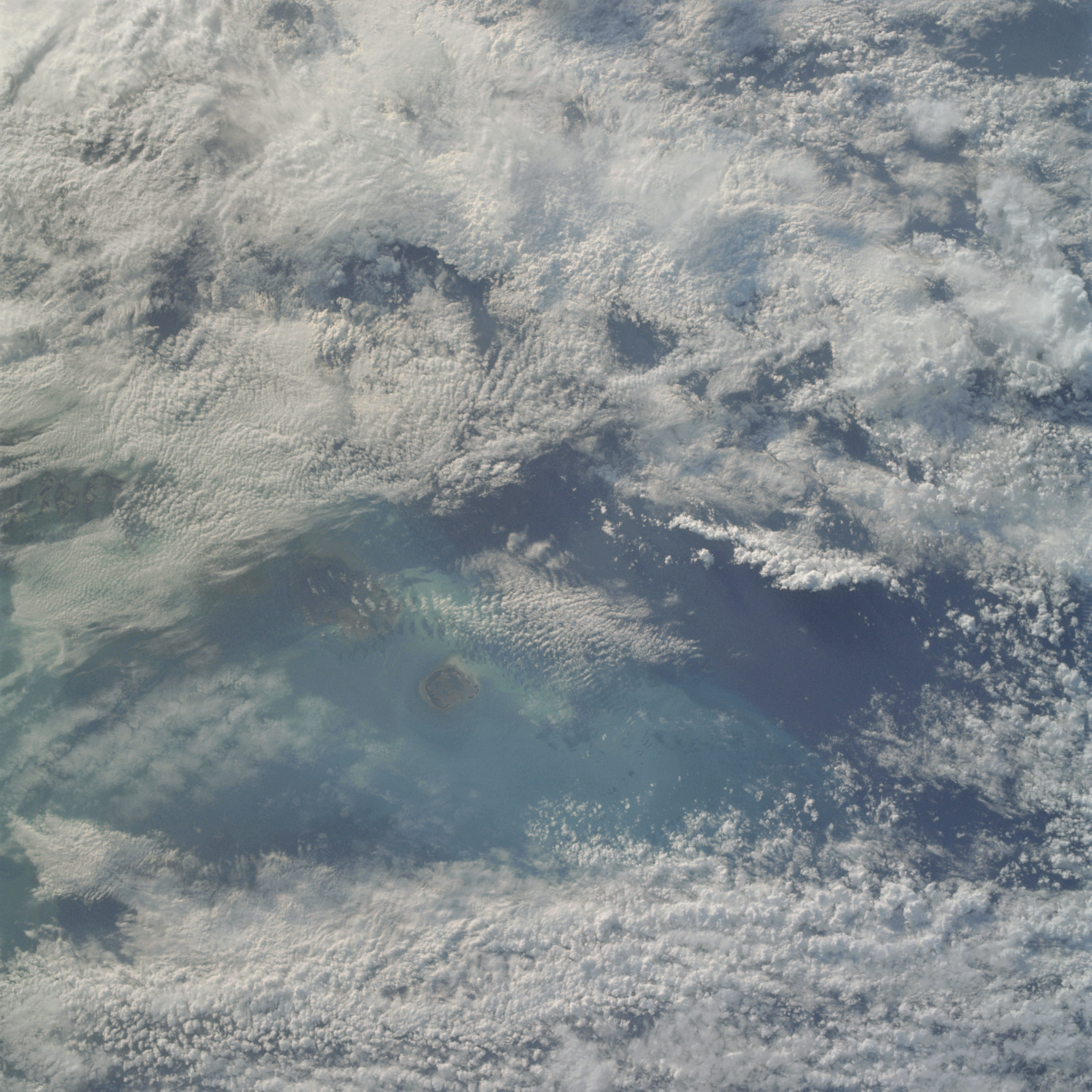 | AS09-22-3385 GEOGRAPHY/CARTOGRAPHY: United States, Florida Keys, Marquesas Keys, Boca Grande Key. GEOLOGY/HYDROLOGY: Low plains region. METEOROLOGY: Alto-cumulus, cumulus congestus, cumulo-nimbus. OCEANOGRAPHY: Gulf of Mexico, some current patterns visible near island. Image credit: Image Science and Analysis Laboratory, NASA-Johnson Space Center. |
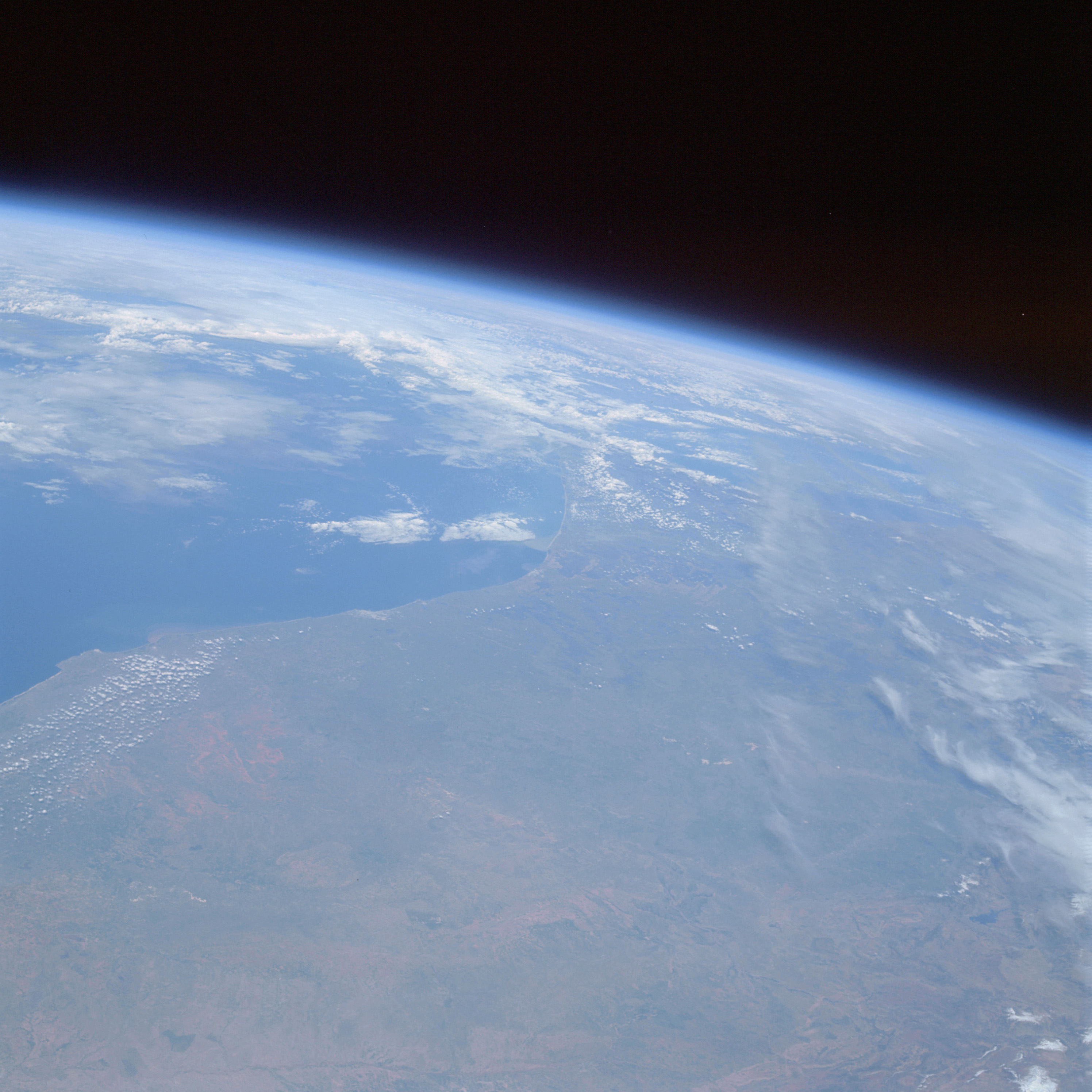 | AS09-22-3386 GEOGRAPHY/CARTOGRAPHY: Africa, Morocco, Atlas Mountains, Cities of El Jarida, Casablanca, Rabat, and Meknes. GEOLOGY/HYDROLOGY: Complex plateau and coastal plain. AGRICULTURE: Isolated field patterns. METEOROLOGY: Cumulus humilis, cirrus fibratus, cumulus congestus. Image credit: Image Science and Analysis Laboratory, NASA-Johnson Space Center. |
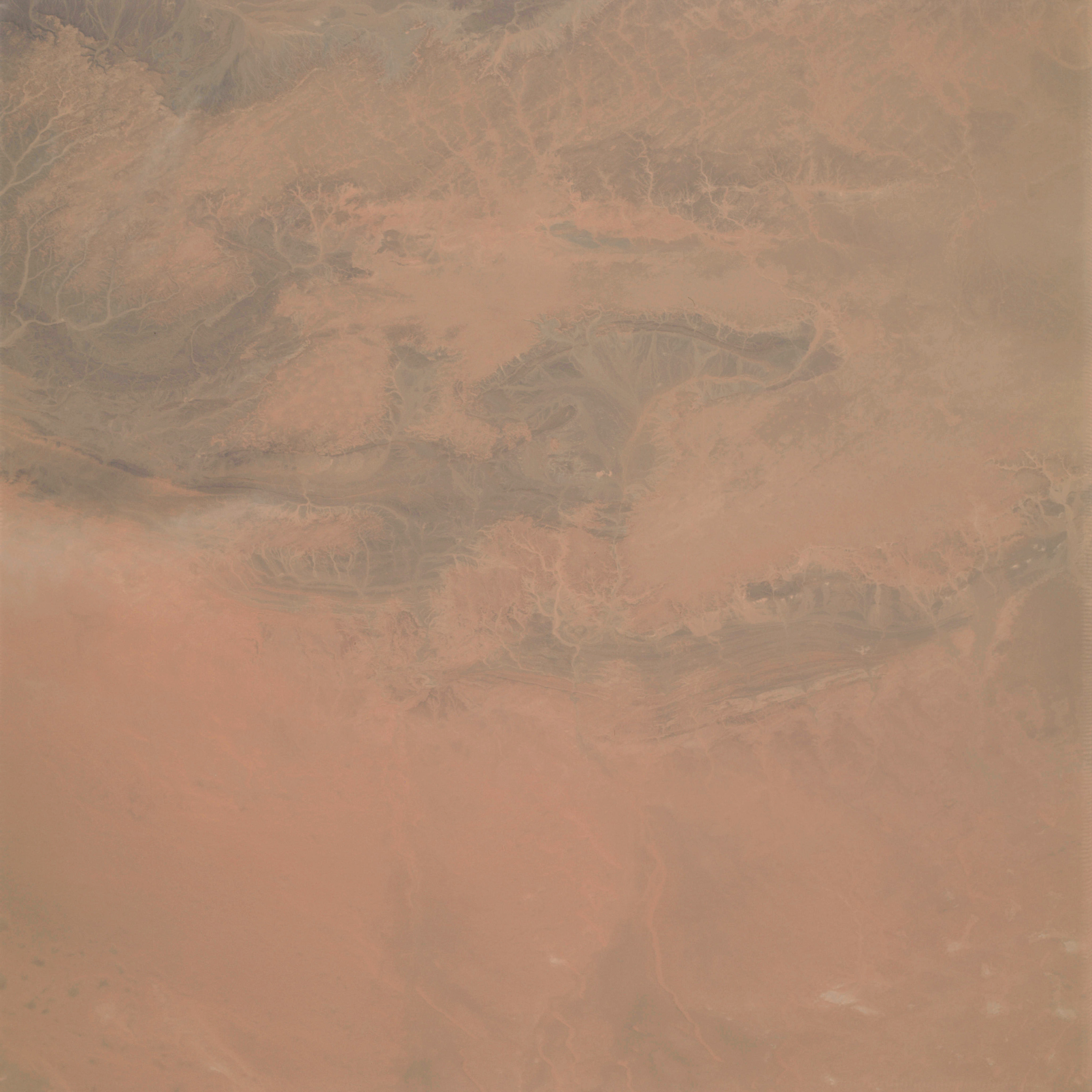 | AS09-22-3387 GEOGRAPHY/CARTOGRAPHY: Africa, Morocco, Algeria, Village of EL Khrait. GEOLOGY/HYDROLOGY: Folded sedimentary mountains and elevated plateau region. Image credit: Image Science and Analysis Laboratory, NASA-Johnson Space Center. |
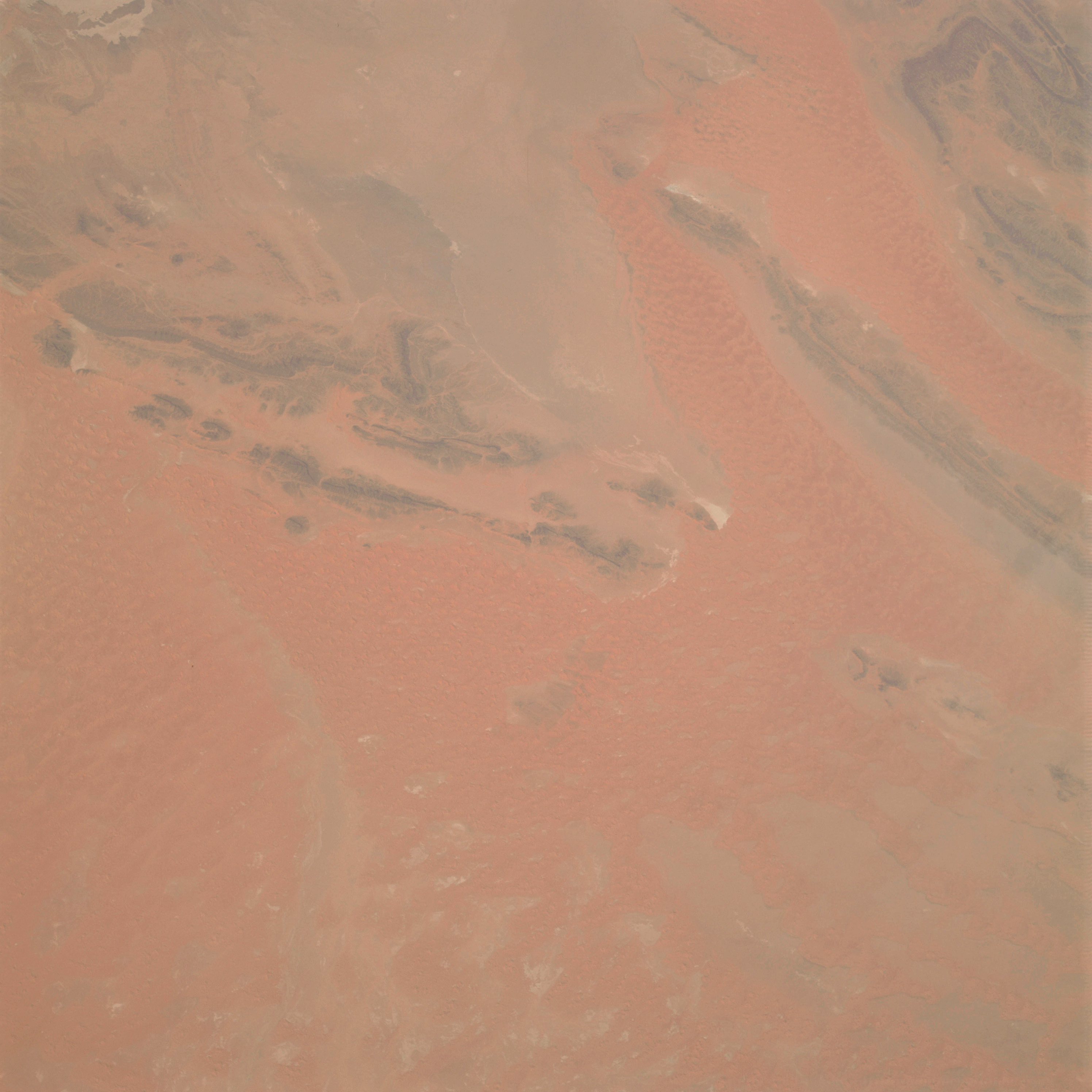 | AS09-22-3388 GEOGRAPHY/CARTOGRAPHY: Africa, Algeria, Erg Er Raoul, Village of Tebelbala. GEOLOGY/HYDROLOGY: Folded mountains and elevated plateau erg region. Image credit: Image Science and Analysis Laboratory, NASA-Johnson Space Center. |
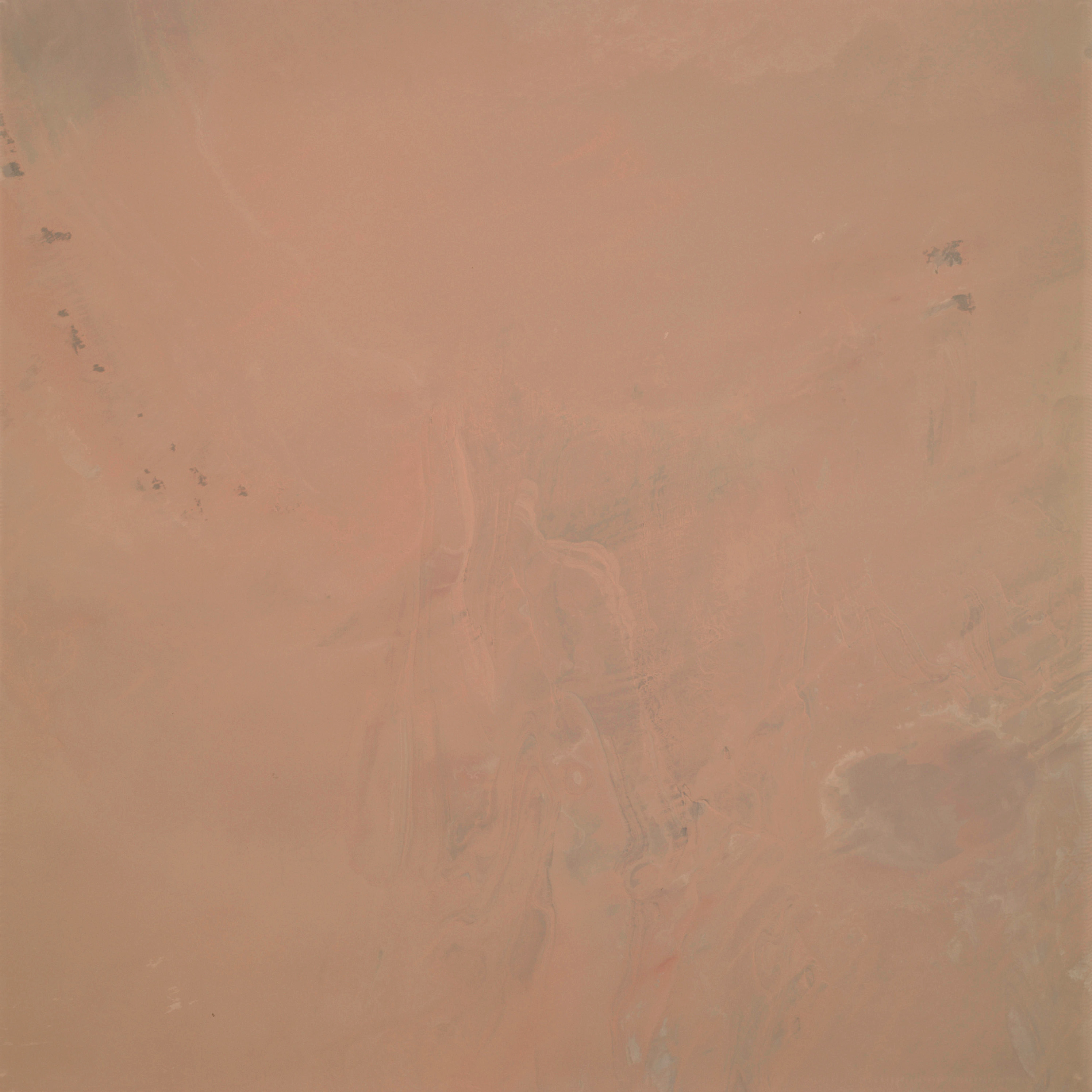 | AS09-22-3389 GEOGRAPHY/CARTOGRAPHY: Africa, Algeria, Erg Chech, Villages of Borj Rene Estienne and Azarafil. GEOLOGY/HYDROLOGY: Elevated plateau of folded formations. Image credit: Image Science and Analysis Laboratory, NASA-Johnson Space Center. |
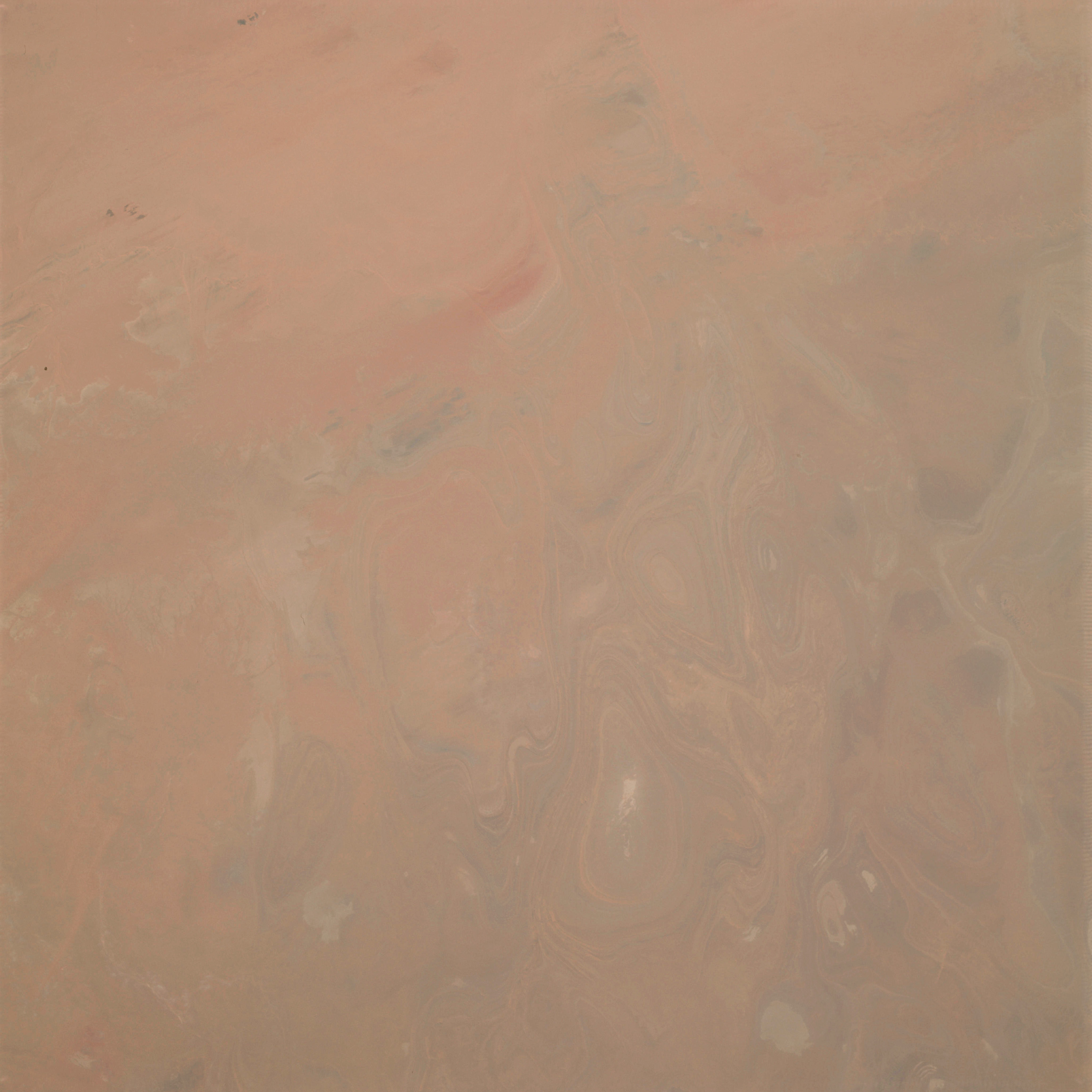 | AS09-22-3390 GEOGRAPHY/CARTOGRAPHY: Africa, Algeria, Tidikelt, Villages of Hassi El Bachir and Sebkha Mekerrhane. GEOLOGY/HYDROLOGY: Folded formations of an elevated plateau. Image credit: Image Science and Analysis Laboratory, NASA-Johnson Space Center. |
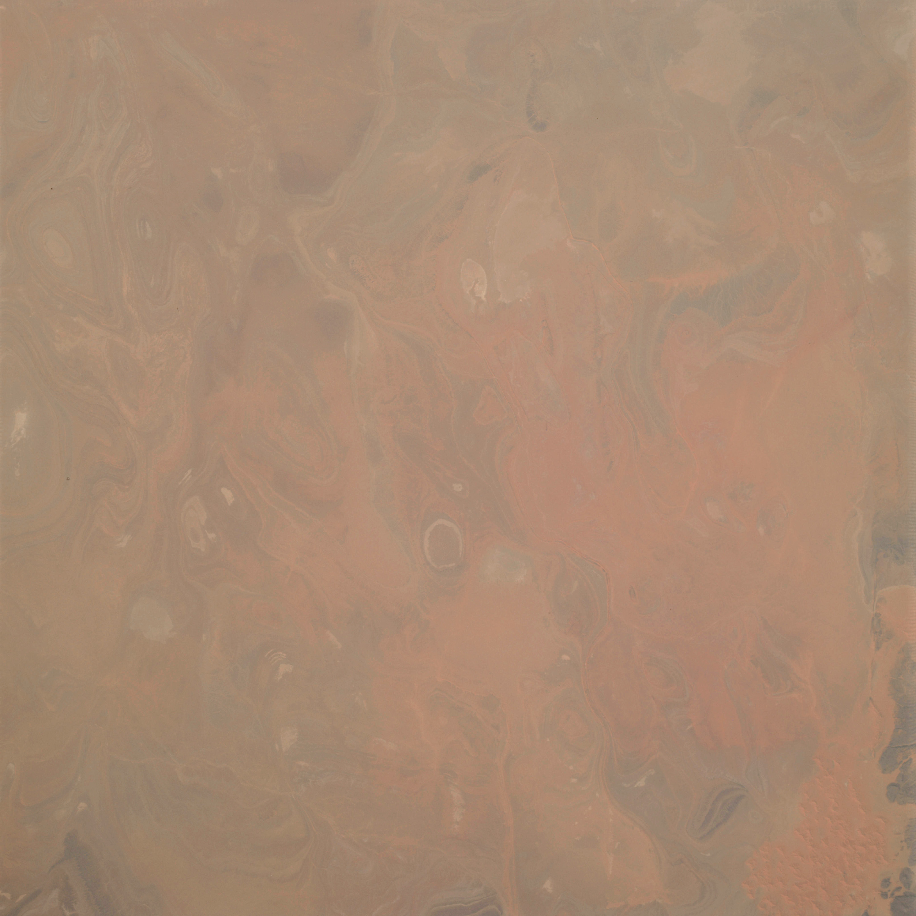 | AS09-22-3391 GEOGRAPHY/CARTOGRAPHY: Africa, Algeria, area south of Ain Salah. GEOLOGY/HYDROLOGY: Folded formations of a plateau and erg region. Image credit: Image Science and Analysis Laboratory, NASA-Johnson Space Center. |
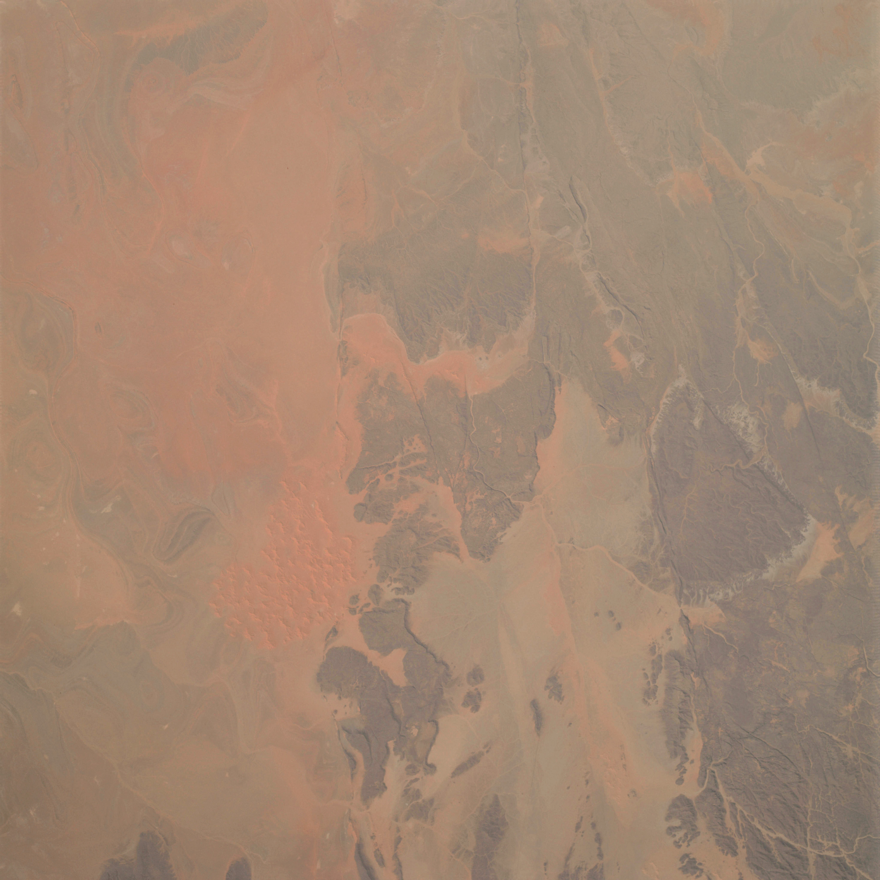 | AS09-22-3392 GEOGRAPHY/CARTOGRAPHY: Africa, Algeria, Ahnet Mountains, Villages of Tadjemout and Arak. GEOLOGY/HYDROLOGY: Complex and folded mountains region. Image credit: Image Science and Analysis Laboratory, NASA-Johnson Space Center. |
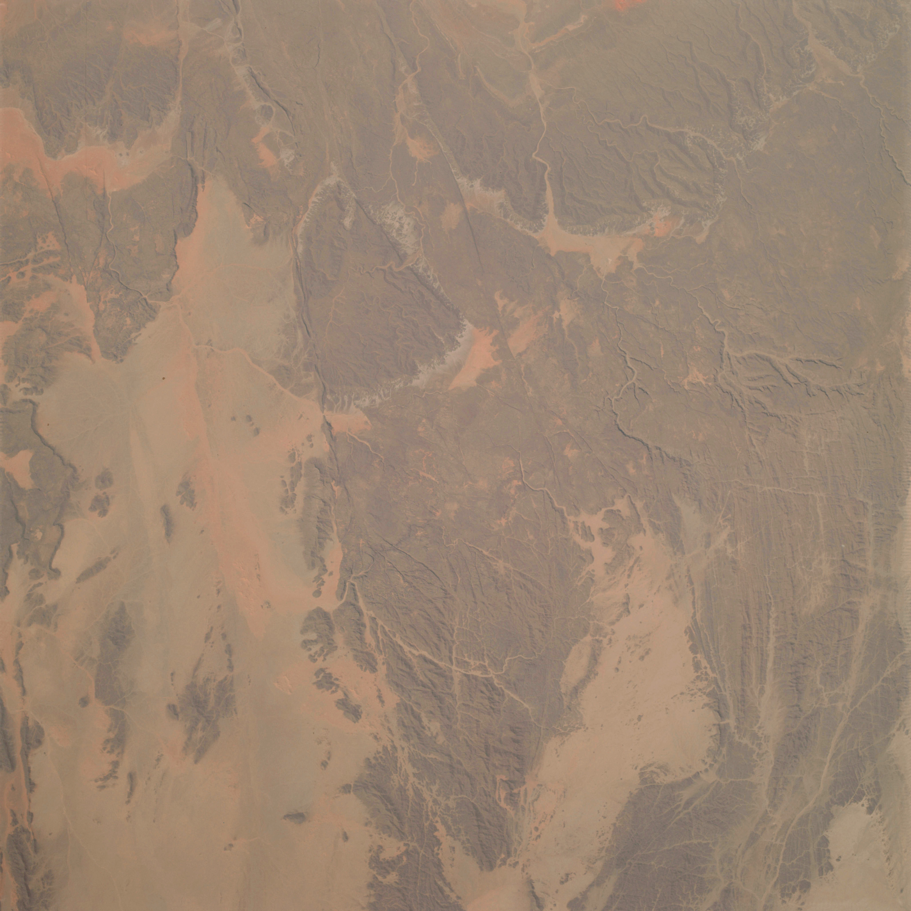 | AS09-22-3393 GEOGRAPHY/CARTOGRAPHY: Africa, Algeria, Ahnet Mountains, Villages of Tadjemout and Arak. GEOLOGY/HYDROLOGY: Complex and folded mountain. Image credit: Image Science and Analysis Laboratory, NASA-Johnson Space Center. |
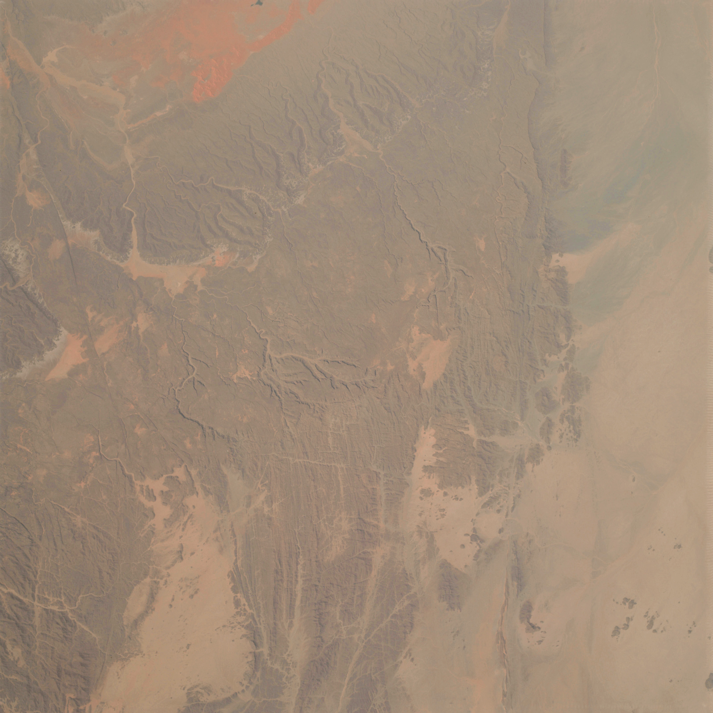 | AS09-22-3394 GEOGRAPHY/CARTOGRAPHY: Africa, Algeria, Village of Anou Maniet. GEOLOGY/HYDROLOGY: Complex mountain and erg region. Image credit: Image Science and Analysis Laboratory, NASA-Johnson Space Center. |
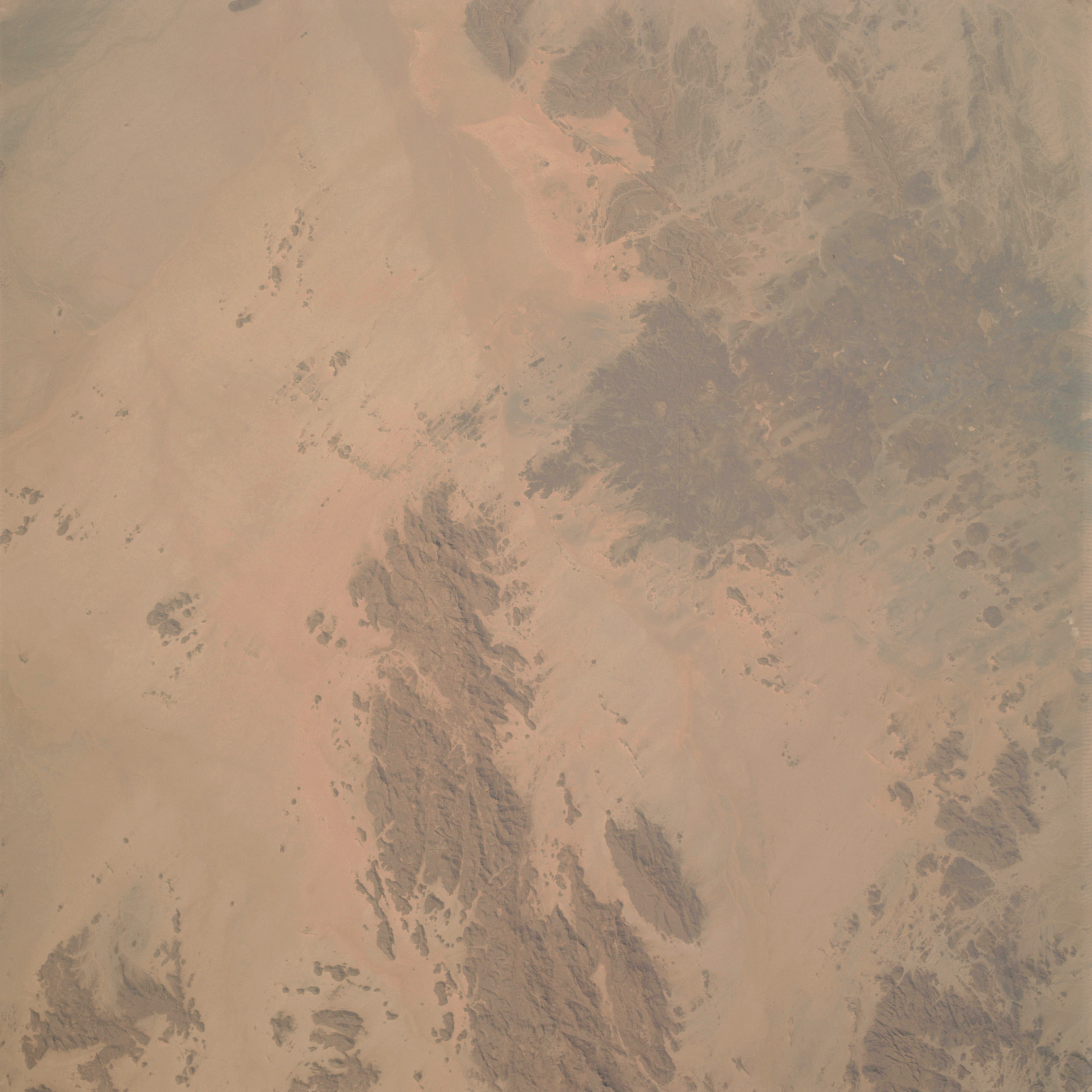 | AS09-22-3395 GEOGRAPHY/CARTOGRAPHY: Africa, Algeria, Ahaggar Mountains, Garat El Djenounpeak, Village of Quhet Hassi. GEOLOGY/HYDROLOGY: Complex mountains and erg region. Image credit: Image Science and Analysis Laboratory, NASA-Johnson Space Center. |
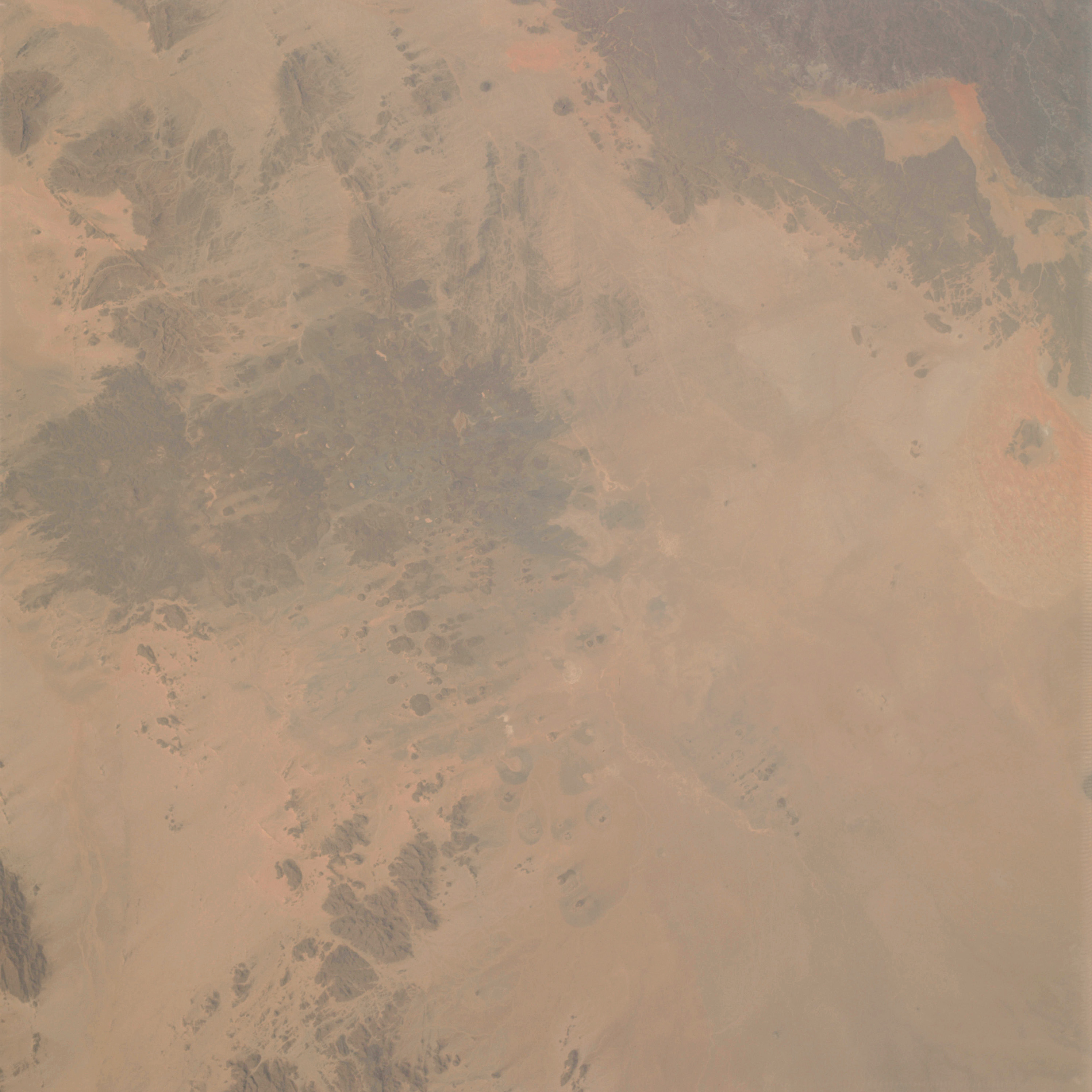 | AS09-22-3396 GEOGRAPHY/CARTOGRAPHY: Africa, Algeria, Village of Toukmatine. GEOLOGY/HYDROLOGY Complex and volcanic mountain with surrounding erg region. Image credit: Image Science and Analysis Laboratory, NASA-Johnson Space Center. |
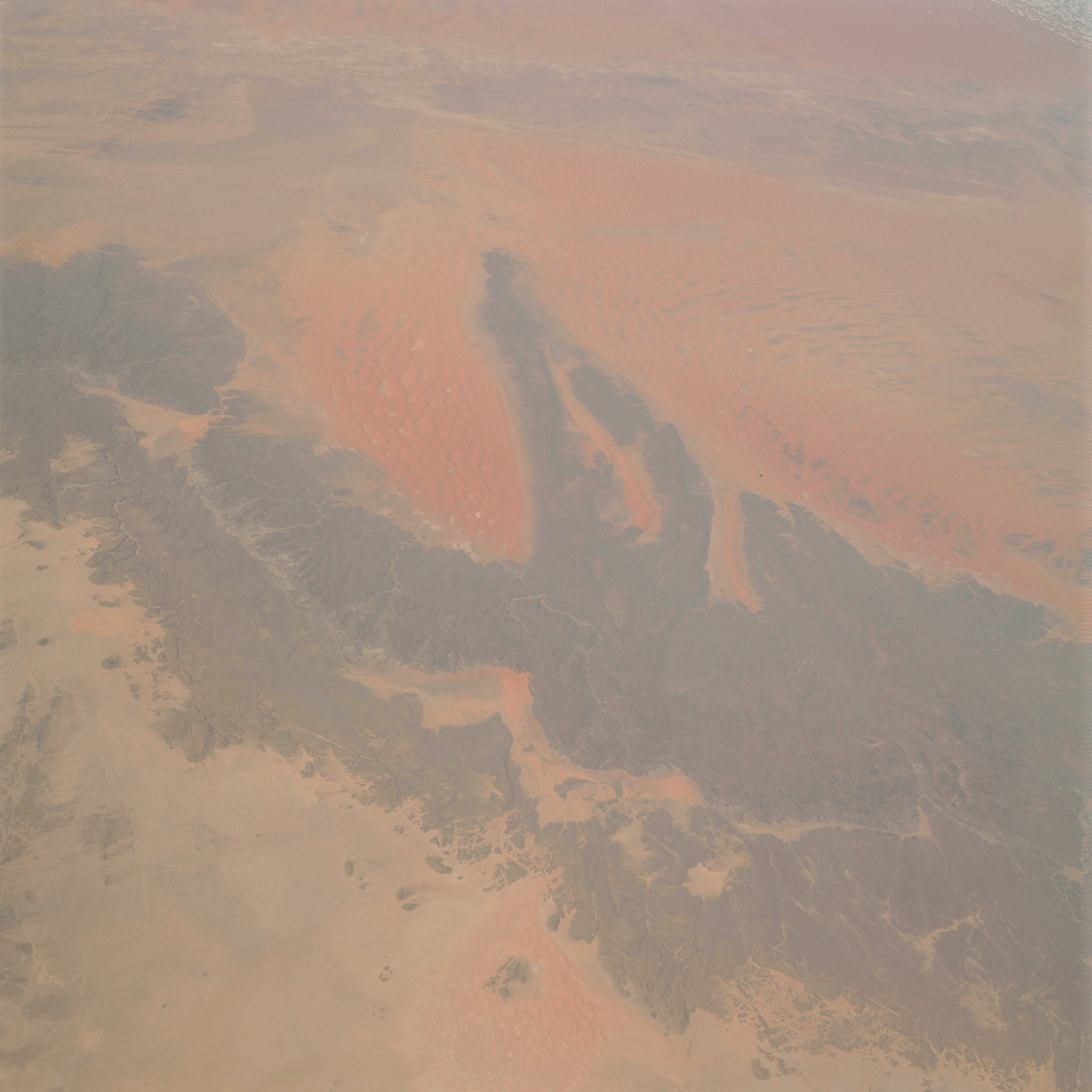 | AS09-22-3397 GEOGRAPHY/CARTOGRAPHY: Africa, Algeria, Essaoui Mellene Mountains, Village of Issaoune N Tifernine. GEOLOGY/HYDROLOGY: Complex and sedimentary mountains with erg regions. Image credit: Image Science and Analysis Laboratory, NASA-Johnson Space Center. |
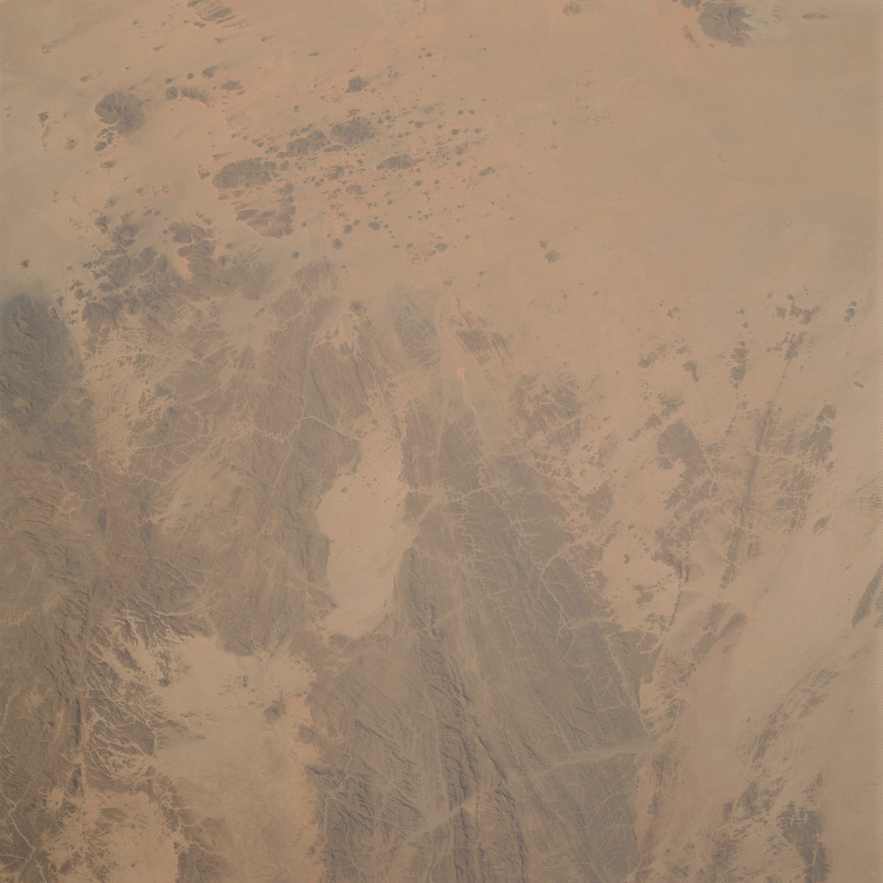 | AS09-22-3398 GEOGRAPHY/CARTOGRAPHY: Algeria, Ahaggar Mountains. GEOLOGY/HYDROLOGY: Complex fractured mountain and erg complex. Image credit: Image Science and Analysis Laboratory, NASA-Johnson Space Center. |
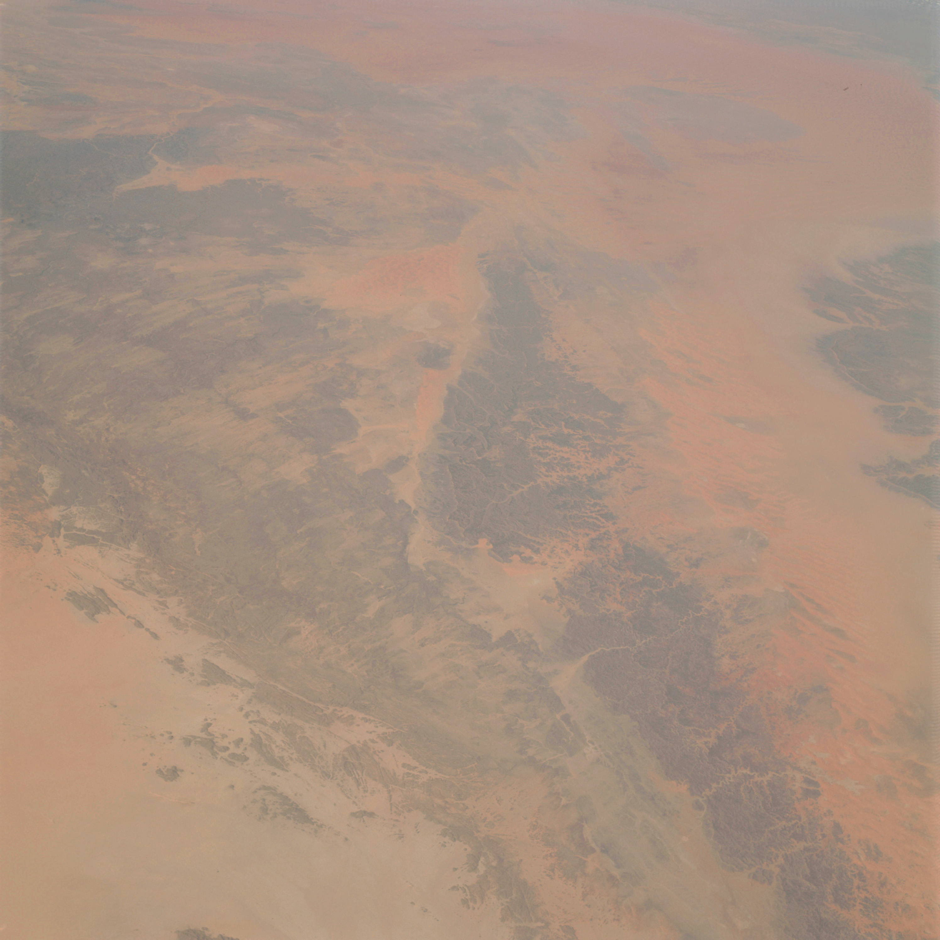 | AS09-22-3399 GEOGRAPHY/CARTOGRAPHY: Africa, Algeria, Libya, Niger, Mesach Mellet Mountains, Villages of Ghat, Feust, Al Barkat and Sardalas. GEOLOGY/HYDROLOGY: Complex mountains and erg region Image credit: Image Science and Analysis Laboratory, NASA-Johnson Space Center. |
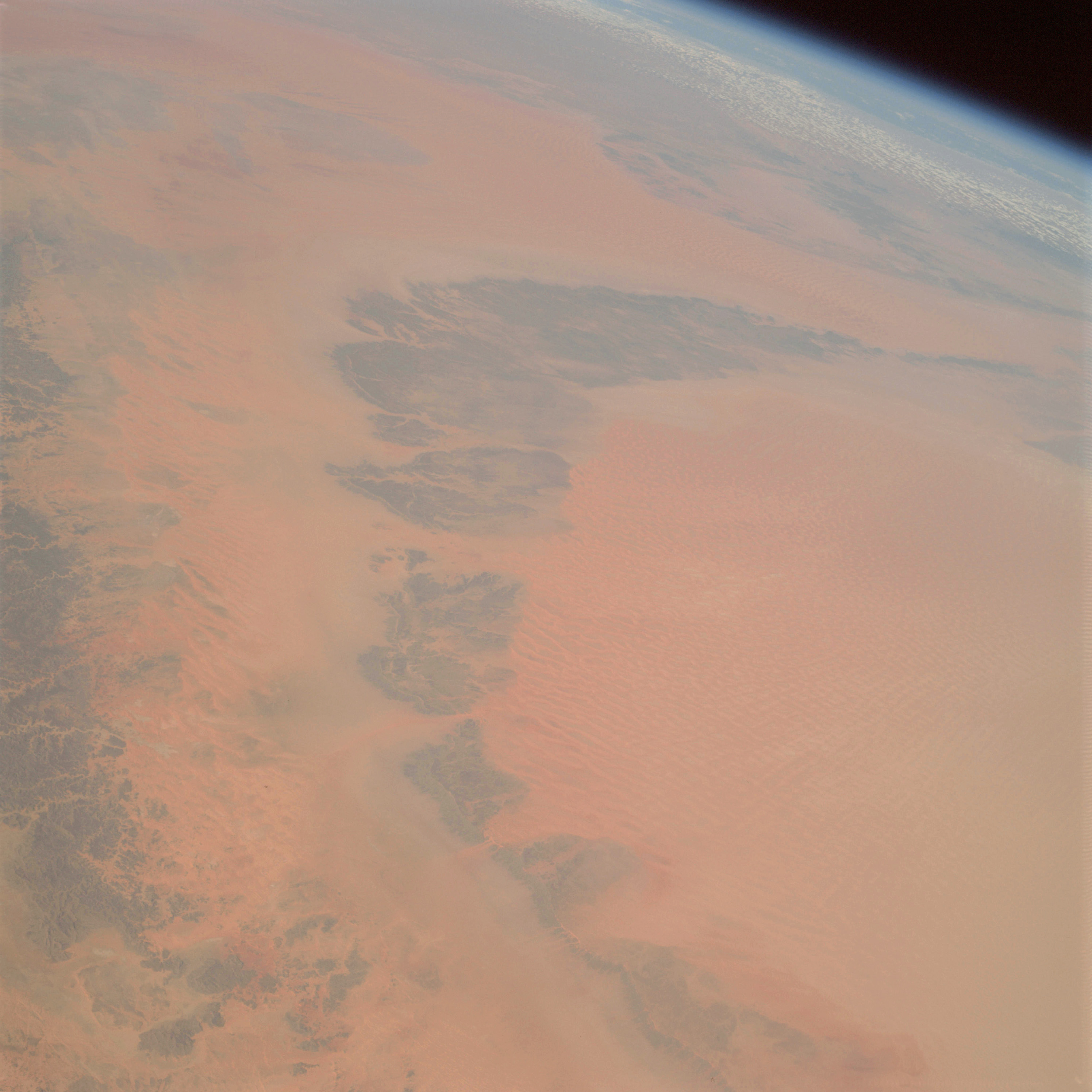 | AS09-22-3400 GEOGRAPHY/CARTOGRAPHY: Africa, Algeria, Libya, Niger,Mesach Mellet, Idehan Marzuq. GEOLOGY/HYDROLOGY: Complex plateau and erg region. Image credit: Image Science and Analysis Laboratory, NASA-Johnson Space Center. |
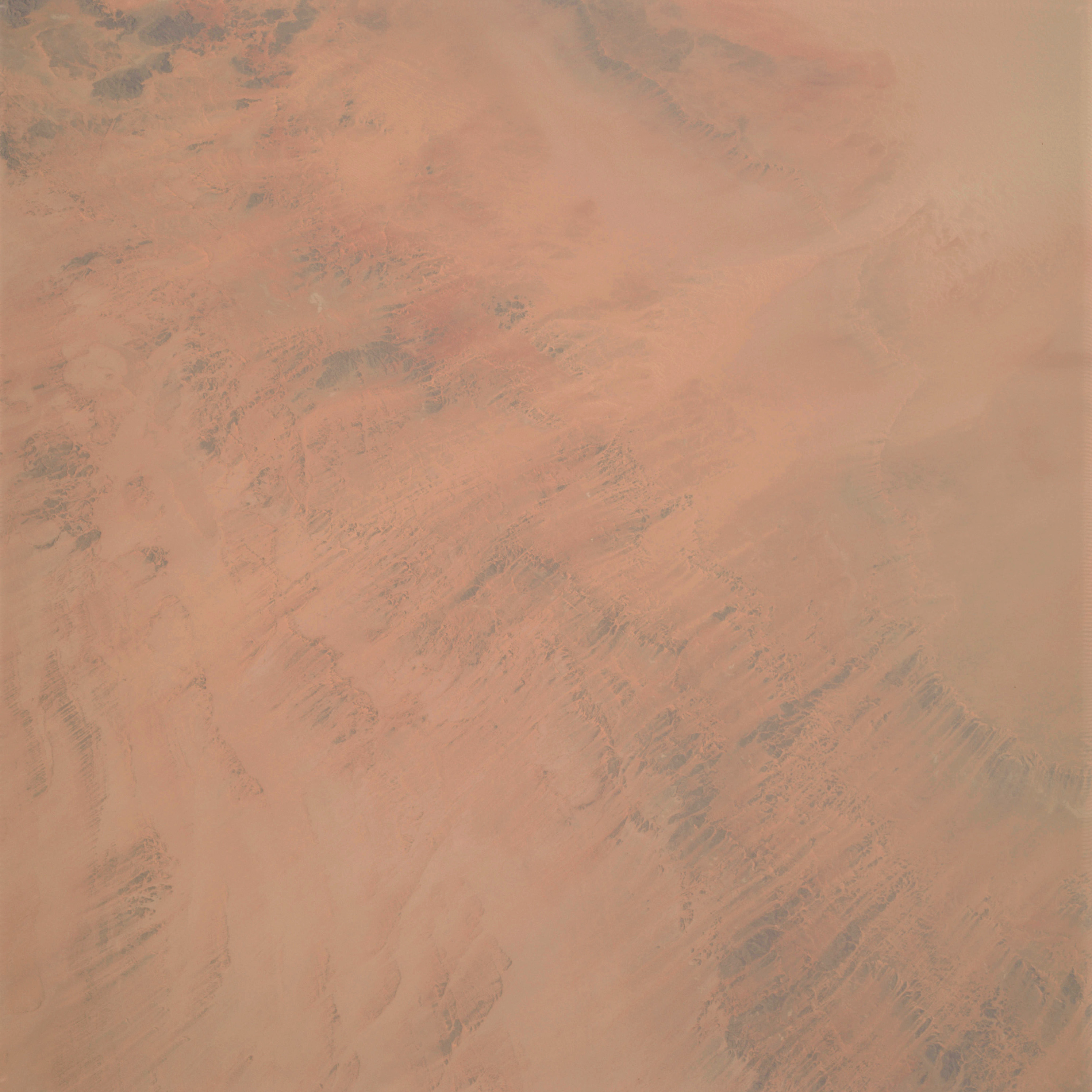 | AS09-22-3401 GEOGRAPHY/CARTOGRAPHY: Africa, Niger, Libya, Mangueni Plateau. GEOLOGY/HYDROLOGY: Complex Hamada Plateau with dissected longitudinal dunes. Image credit: Image Science and Analysis Laboratory, NASA-Johnson Space Center. |
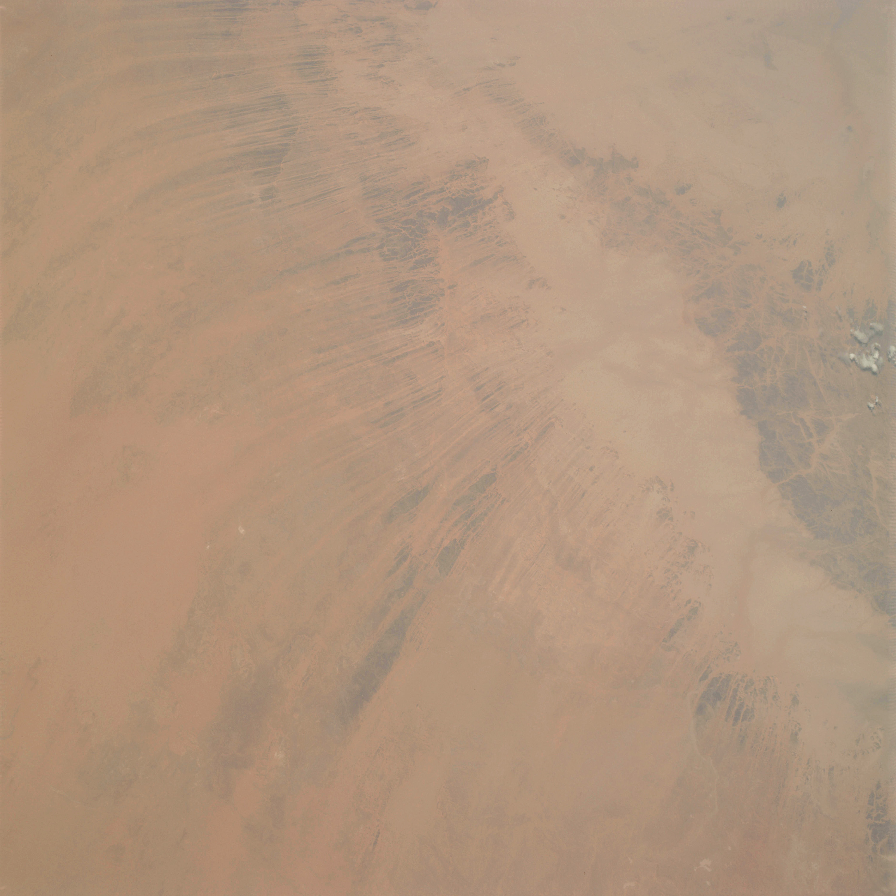 | AS09-22-3402 GEOGRAPHY/CARTOGRAPHY: Africa, Niger, Djado Plateau, Villages of Djado and Chirfa. GEOLOGY/HYDROLOGY: Hamada Plateau and erg region. METEOROLOGY: Cumulus. Image credit: Image Science and Analysis Laboratory, NASA-Johnson Space Center. |
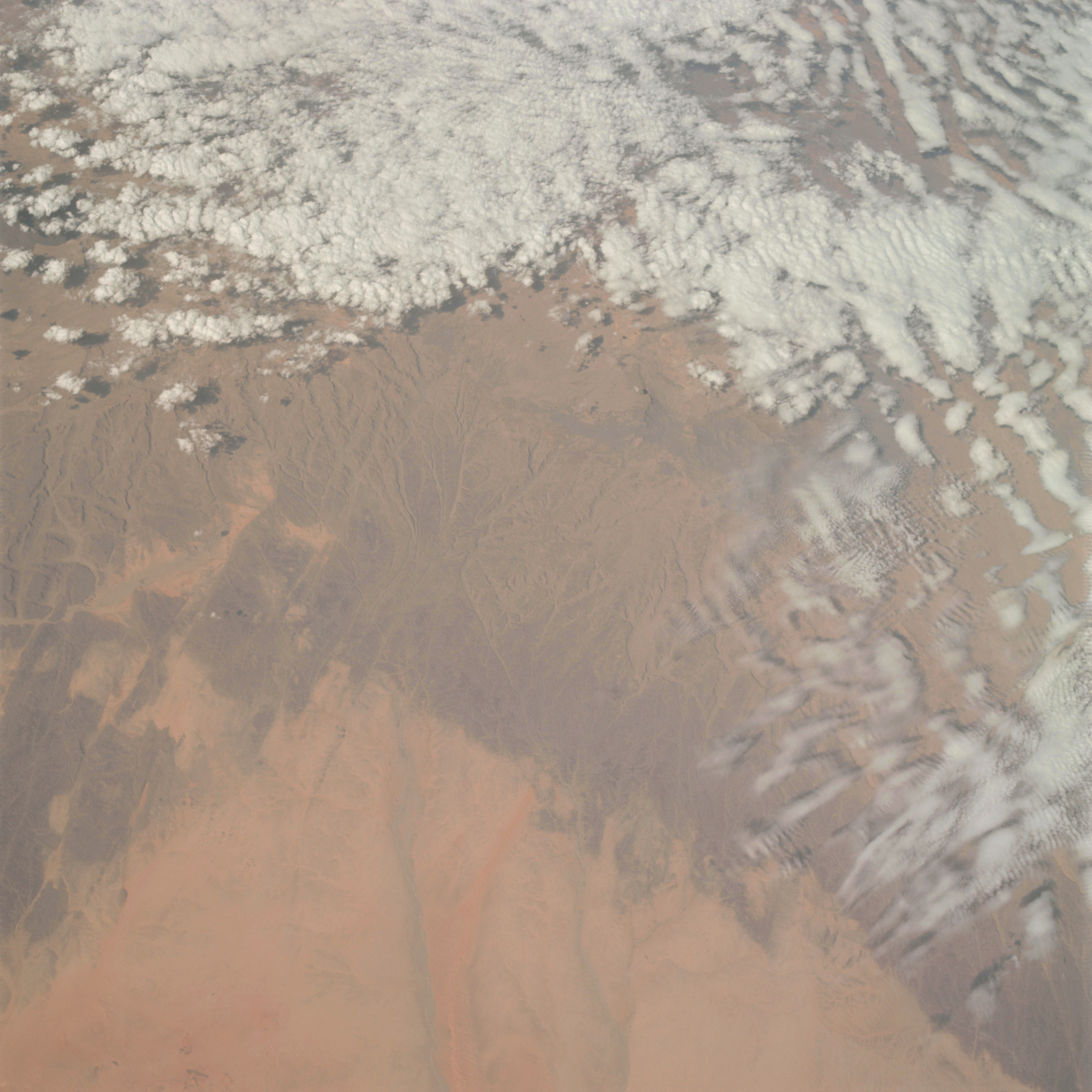 | AS09-22-3403 GEOGRAPHY/CARTOGRAPHY: Africa, Chad, Tibesti Mountains, Villages of Zouar, Sharda and Ediguer. GEOLOGY/HYDROLOGY: Complex plateau region of sedimentary beds. METEOROLOGY: Alto-cumulus, cirro-cumulus. Image credit: Image Science and Analysis Laboratory, NASA-Johnson Space Center. |
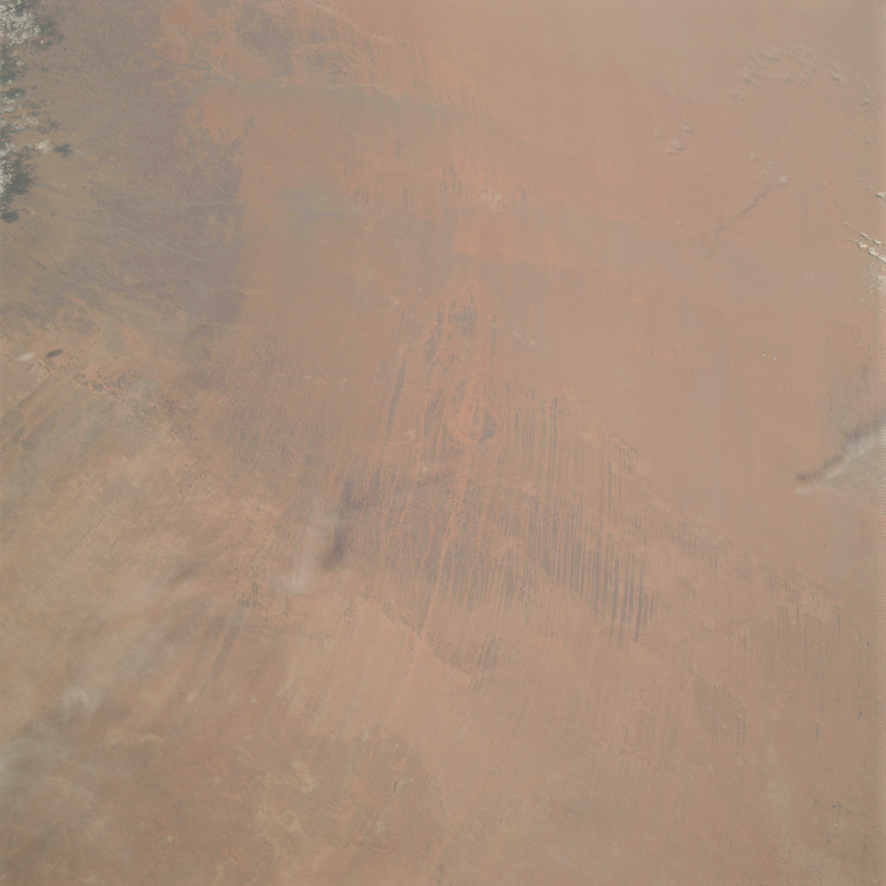 | AS09-22-3404 GEOGRAPHY/CARTOGRAPHY: Africa, Chad, Tibesti Mountains, East slope of Emi Koussi, Villages of Guoro Ano Kada. GEOLOGY/HYDROLOGY: Complex plateau and Hamada, erg region. METEOROLOGY: Cirrus. Image credit: Image Science and Analysis Laboratory, NASA-Johnson Space Center. |
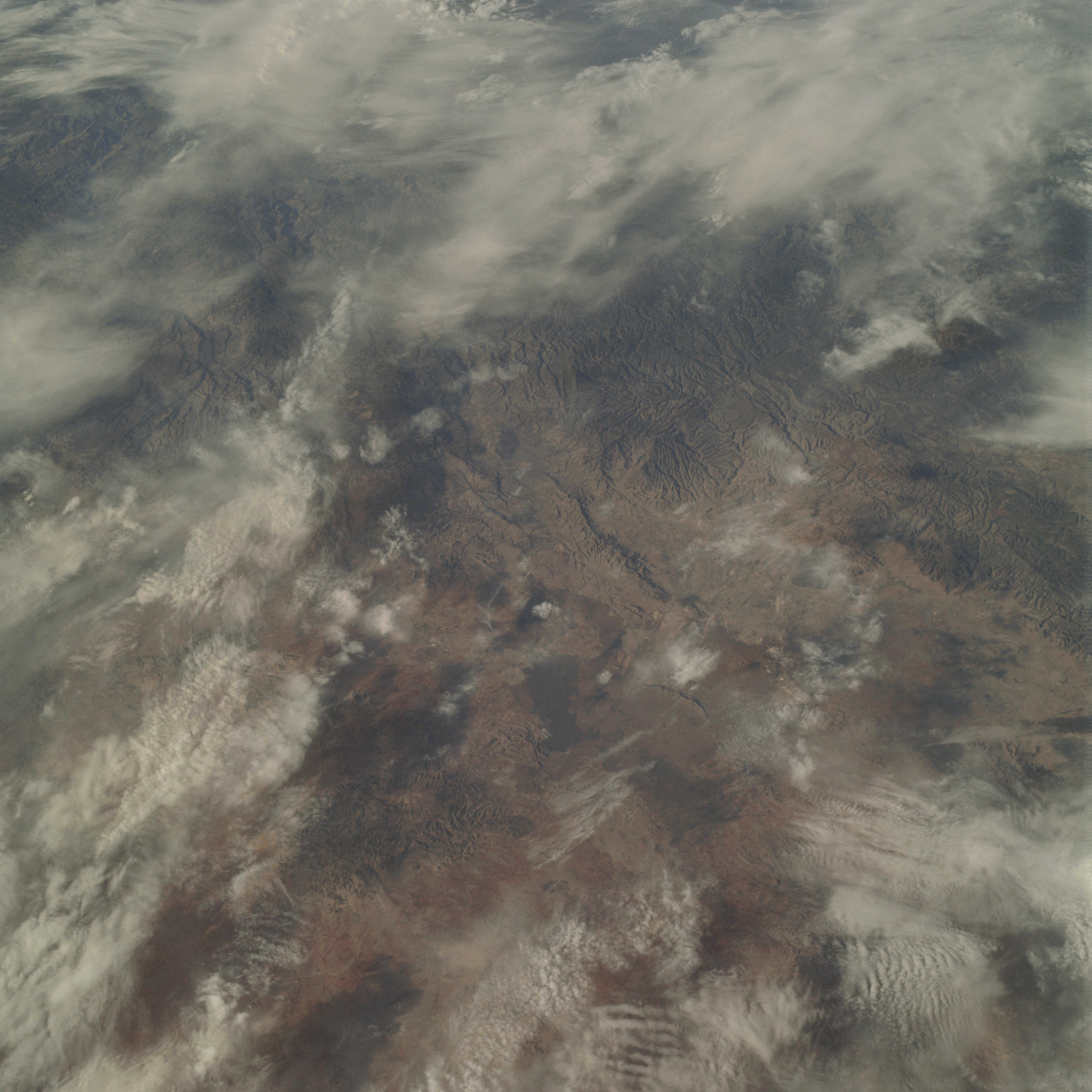 | AS09-22-3405 GEOGRAPHY/CARTOGRAPHY: Mexico, Durango Province, Sierra Madre Occidental, City of Durango. GEOLOGY/HYDROLOGY: Complex mountains. AGRICULTURE: Field patterns near Durango. FORESTRY: Scattered deciduous shrubform, with some conifers at higher elevations. METEOROLOGY: Cirrus uncinus, cirro-cumulus. Image credit: Image Science and Analysis Laboratory, NASA-Johnson Space Center. |
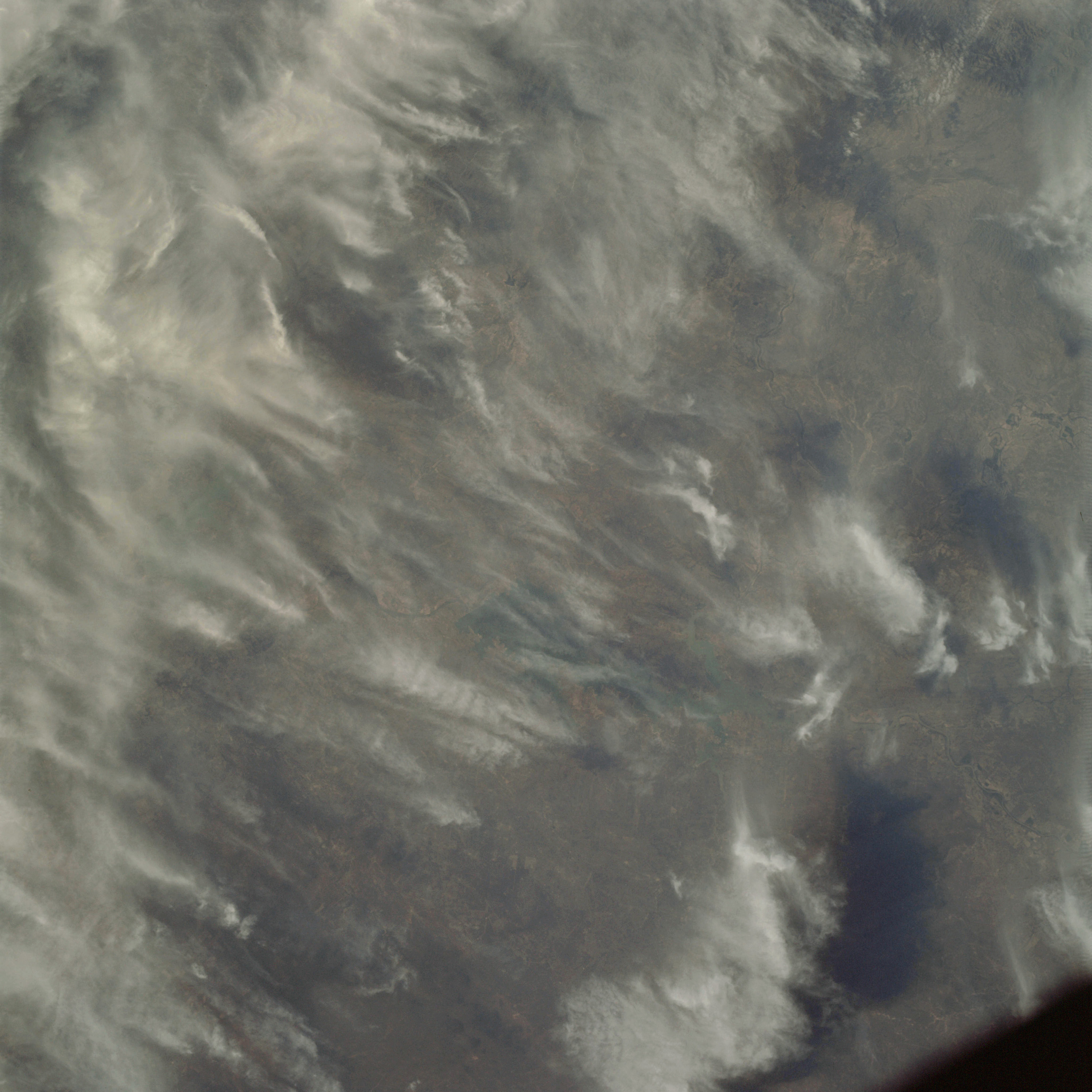 | AS09-22-3406 GEOGRAPHY/CARTOGRAPHY: United States, Mexico, Texas, Rio Grande, Falcon Reservoir. GEOLOGY/HYDROLOGY: Complex mountains. AGRICULTURE: Field patterns visible along Rio Grande River. FORESTRY: Scattered deciduous shrubform. METEOROLOGY: Cirrus uncinus. Image credit: Image Science and Analysis Laboratory, NASA-Johnson Space Center. |
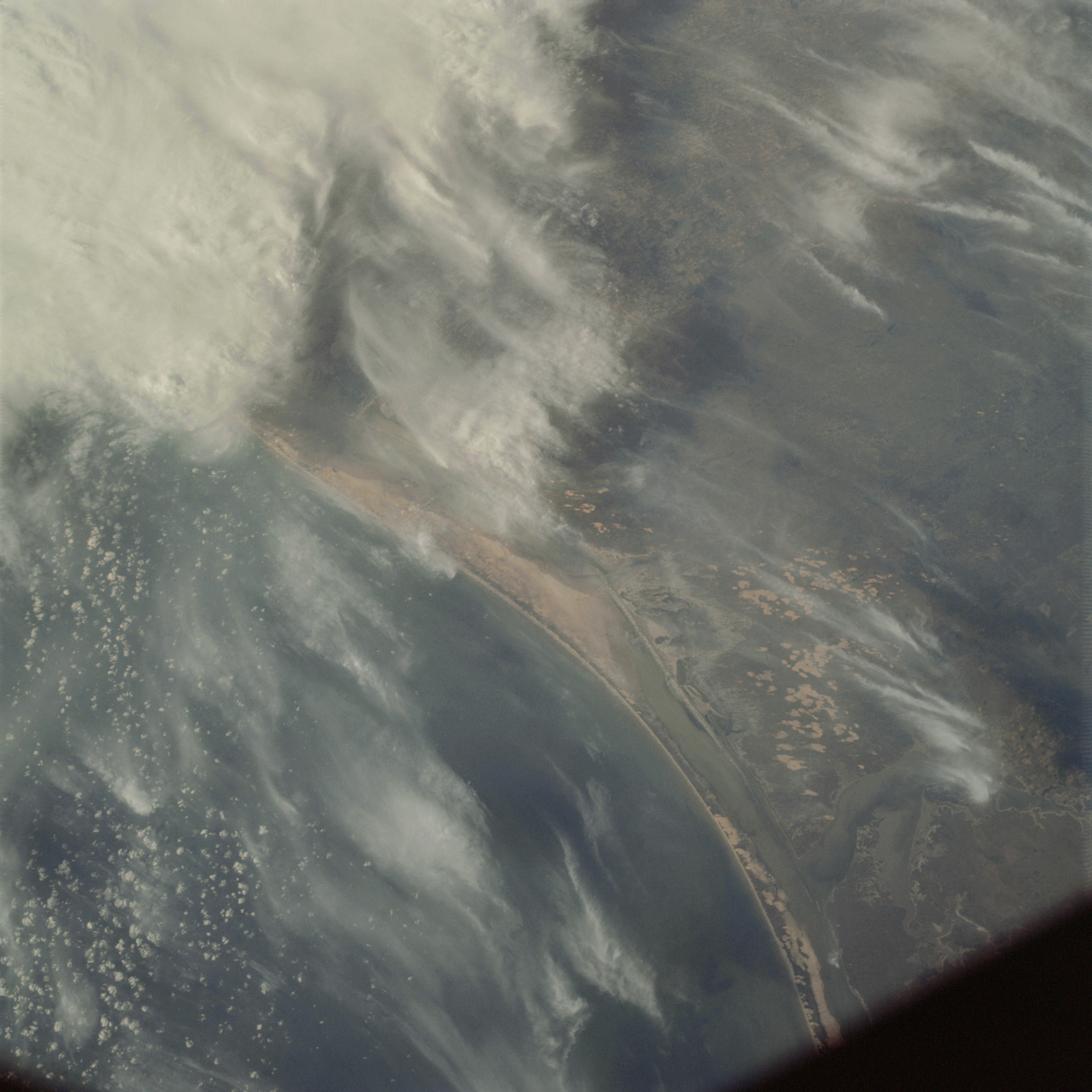 | AS09-22-3407 GEOGRAPHY/CARTOGRAPHY: United States, Texas, Padre Island, Madre Lagoon, Baffin and Alezan Bays, Towns of Kingsville and Riviera. GEOLOGY/HYDROLOGY: Coastal plains, lagoon and sandbars along shoreline. AGRICULTURE: Small, irregular shaped field patterns. FORESTRY: Deciduous shrubform with some evergreen shrubform. METEOROLOGY: Alto-stratus, cirrus uncinus. Image credit: Image Science and Analysis Laboratory, NASA-Johnson Space Center. |
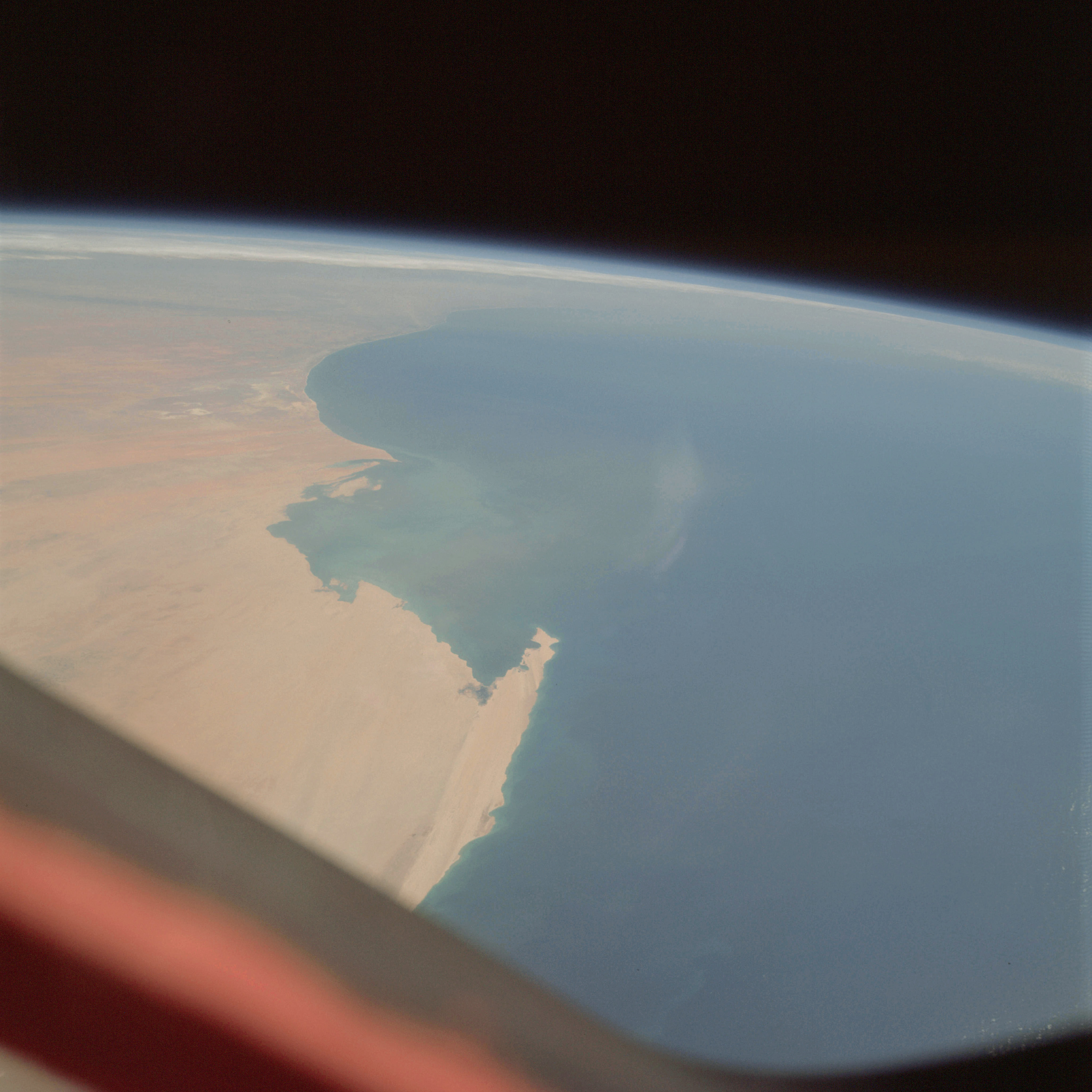 | AS09-22-3408 GEOGRAPHY/CARTOGRAPHY: Africa, Spanish Sahara, Mauritania, Senegal, Capes Barbas, Corbiero, Blanc, and Timiris, Azefel Dunes, Akchar Desert, Towns of Port Etienne, Toulk, El Mamrhar, Nouakchott and St. Louis. GEOLOGY/HYDROLOGY: Erg coastal plain OCEANOGRAPHY: Atlantic Ocean, terrigeneous sediments prominent in nearshore and offshore zones. Image credit: Image Science and Analysis Laboratory, NASA-Johnson Space Center. |
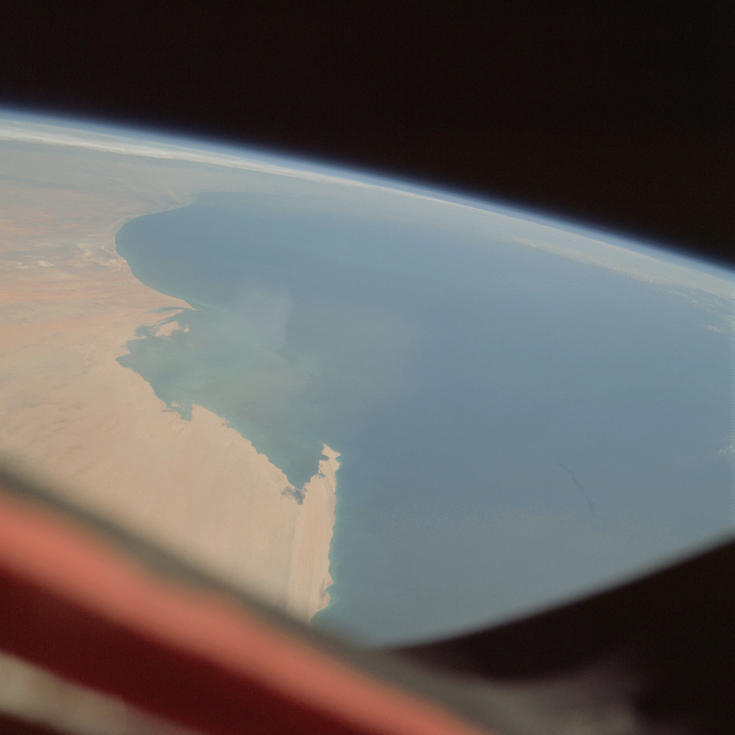 | AS09-22-3409 GEOGRAPHY/CARTOGRAPHY: Africa, Mauritania, Spanish Sahara, Senegal, Capes Blanc and Timiris, Levrier Bay, Azefel Dunes, Akchar and Trarza Deserts, Towns of Port Etienne, El Memrhar, and Nouakchott. GEOLOGY/HYDROLOGY: Erg coastal plain. OCEANOGRAPHY: Atlantic Ocean, terrigeneous sediments are prominent in nearshore and offshore zones. Image credit: Image Science and Analysis Laboratory, NASA-Johnson Space Center. |
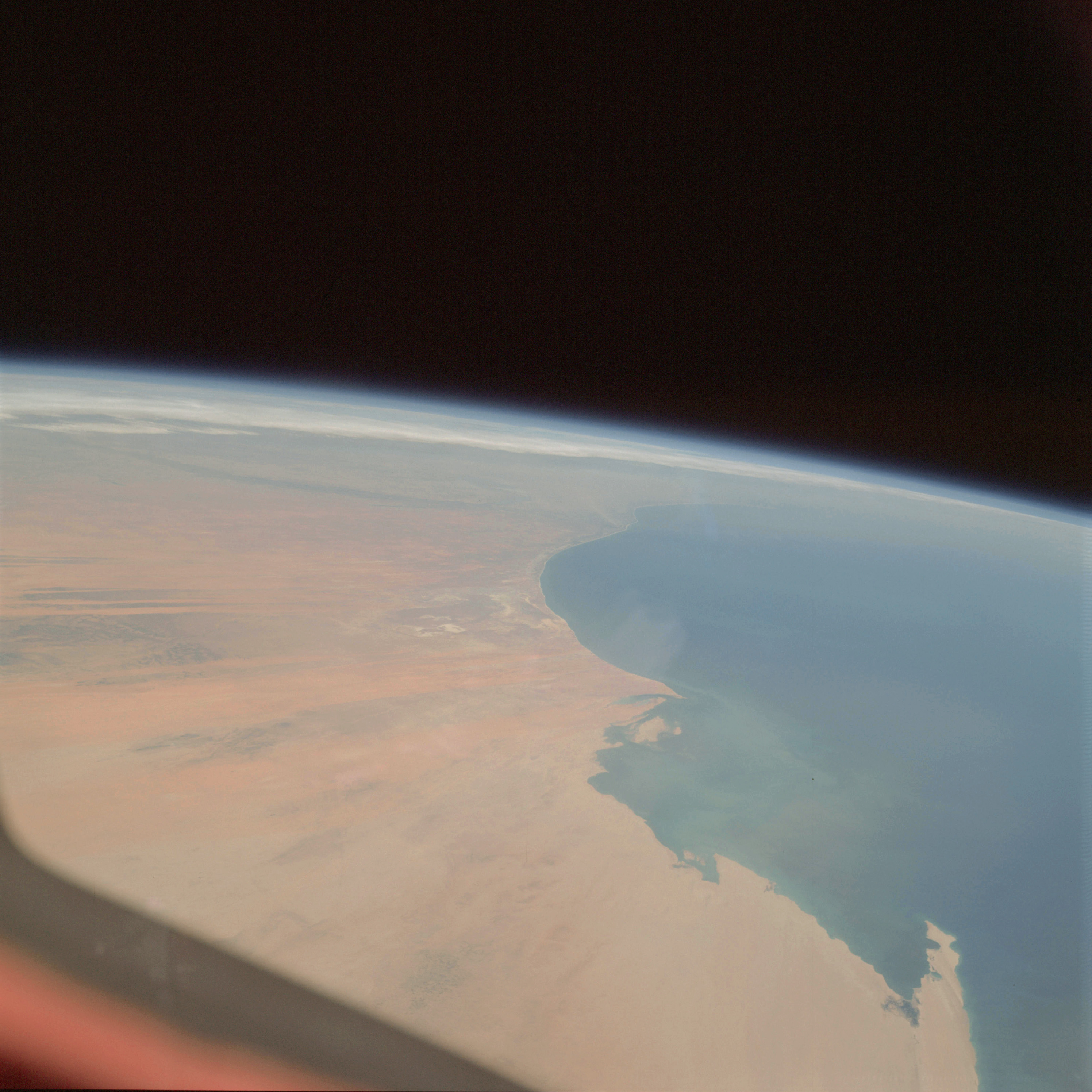 | AS09-22-3410 GEOGRAPHY/CARTOGRAPHY: Africa, Mauritania, Senegal, Capes Blanc and Timiris, Azefal Dunes, Akchar and Trarza Deserts, Dhar Adrar Mountains, Towns of Port Etienne, El Memrhar, Nouakchott, Atar, Tentane and Talorza. GEOLOGY/HYDROLOGY: Erg coastal plain. OCEANOGRAPHY: Atlantic Ocean, terrigeneous sediments extends into offshore zone. Image credit: Image Science and Analysis Laboratory, NASA-Johnson Space Center. |
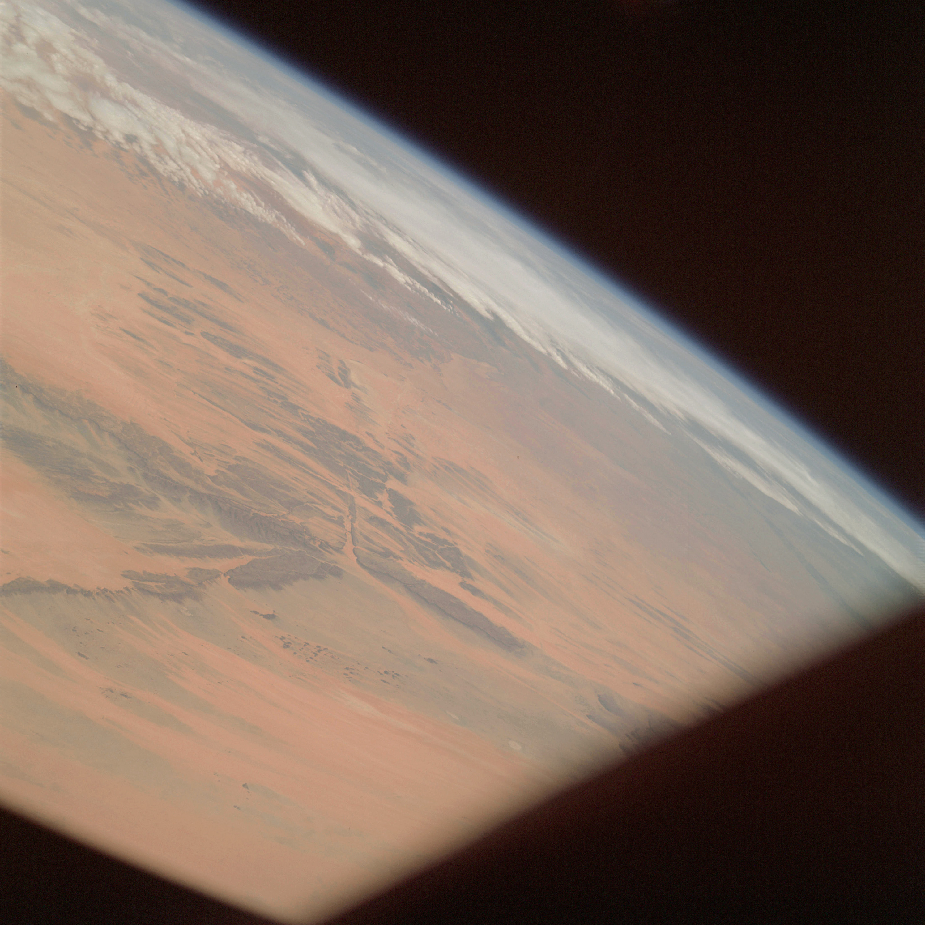 | AS09-22-3411 GEOGRAPHY/CARTOGRAPHY: Africa, Mauritania, Dhar Adrar Mountains, Quarane Desert, Towns of Atar, Oujeft, Chingvetti and Tentane. GEOLOGY/HYDROLOGY: Hamada complex plateau and erg region. METEOROLOGY: Strato-cumulus. Image credit: Image Science and Analysis Laboratory, NASA-Johnson Space Center. |
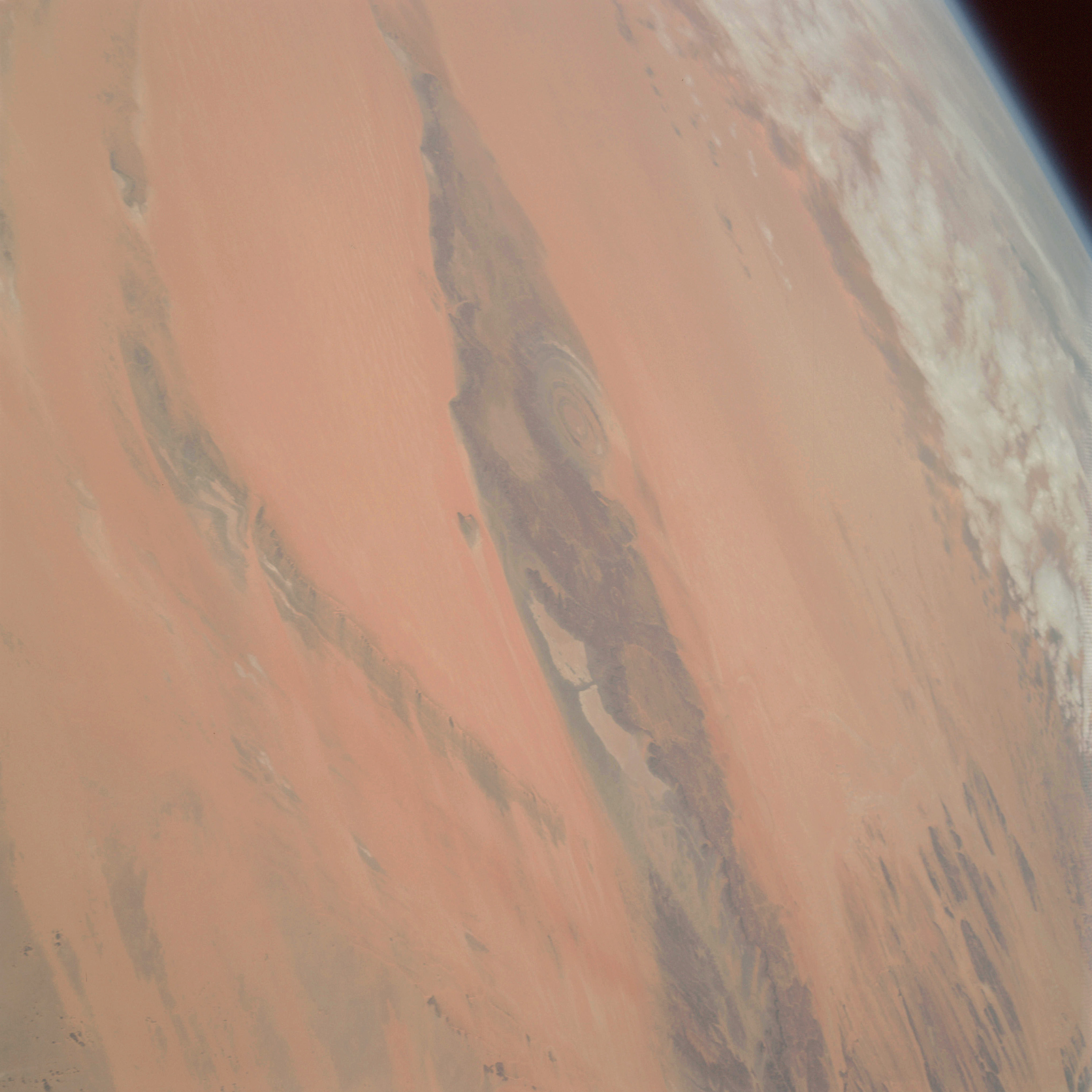 | AS09-22-3412 GEOGRAPHY/CARTOGRAPHY: Africa, Mauritania, Dhar Adrar Mountains, Maktier Desert, Village of Et Tellia. GEOLOGY/HYDROLOGY: Complex plateau, dome, and erg interior elevated desert. METEOROLOGY: Alto-stratus. Image credit: Image Science and Analysis Laboratory, NASA-Johnson Space Center. |
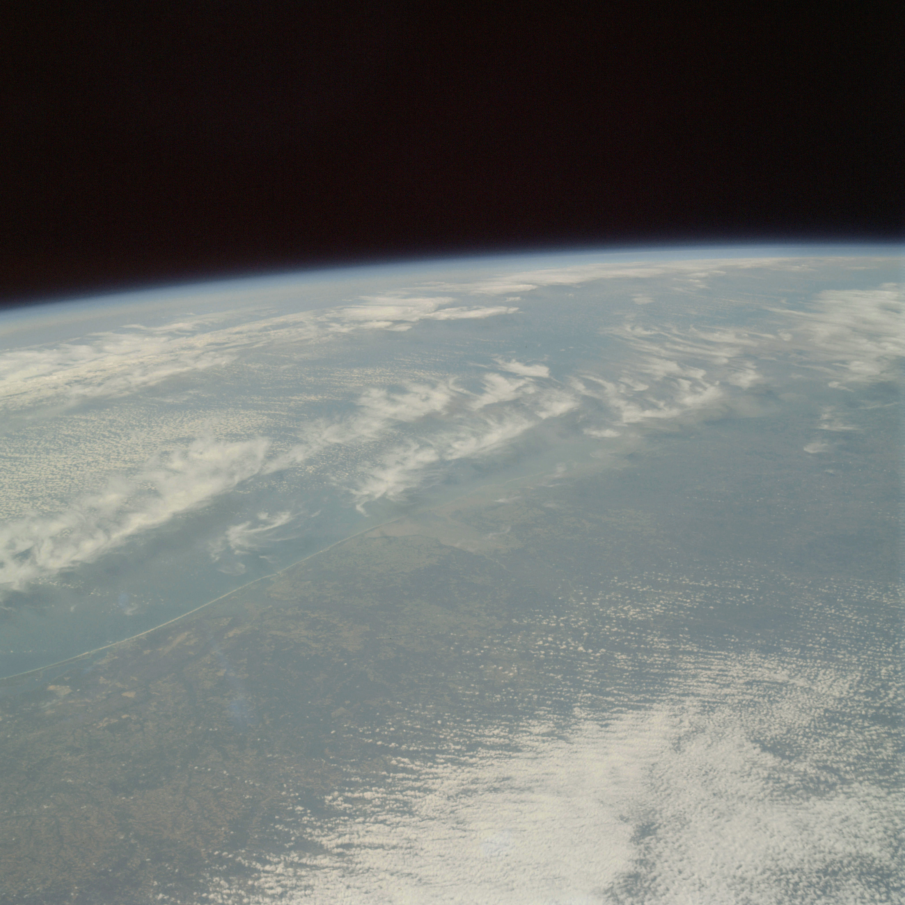 | AS09-22-3413 GEOGRAPHY/ CARTOGRAPHY: United States, Florida, Alabama, Mobile Bay, Choctawhatchee Bay, Cities of Mobile and Pensacola, Town of Fort Walton Beach. GEOLOGY/HYDROLOGY: Coastal plain. AGRICULTURE: Heavy cultivation, small, irregular shaped field patterns. FORESTRY: Mixed pine/hardwood forests, pure stands of both. METEOROLOGY: Cirrus, alto-cumulus. OCEANOGRAPHY: Atlantic Ocean, some sedimentation visible in nearshore zone. Image credit: Image Science and Analysis Laboratory, NASA-Johnson Space Center. |
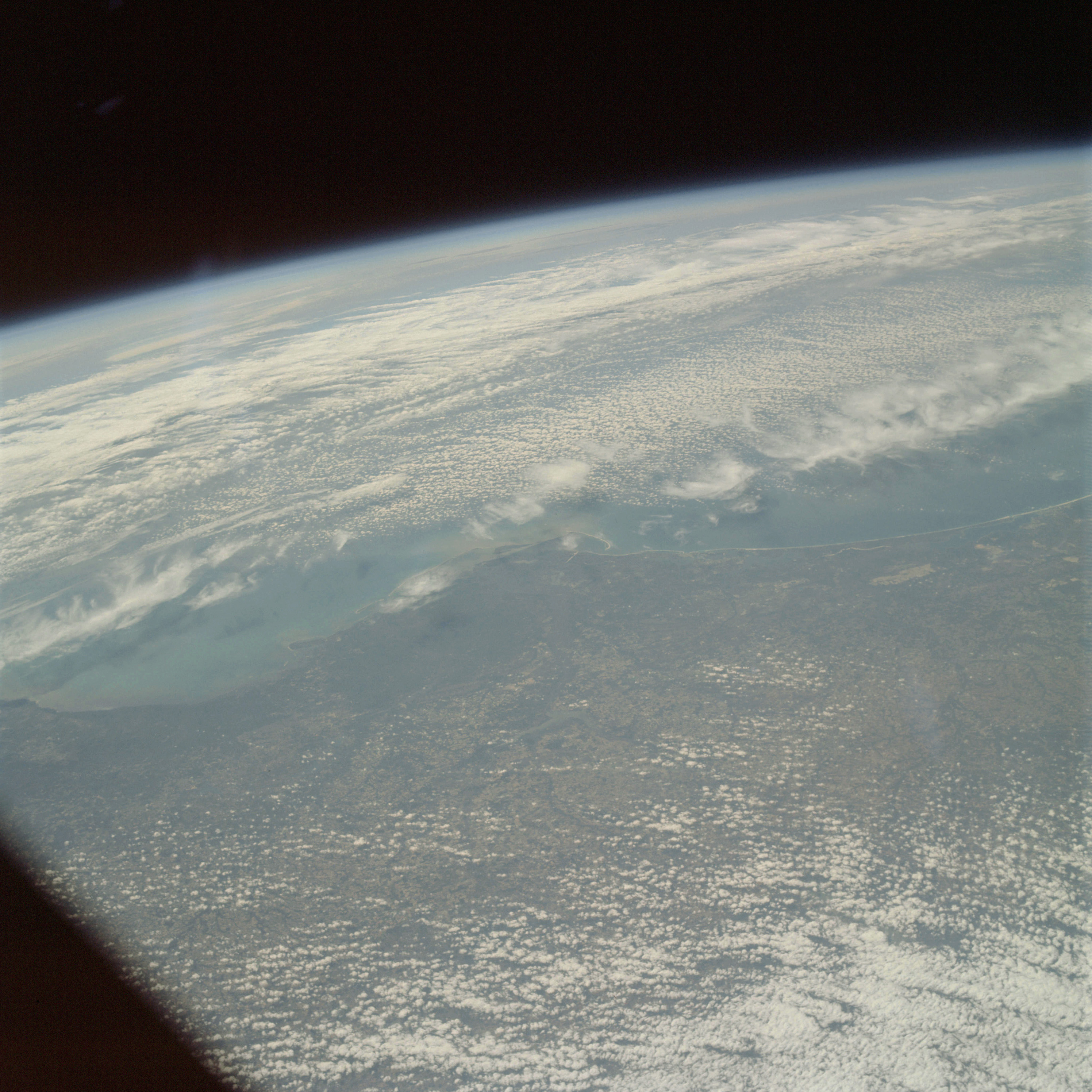 | AS09-22-3414 GEOGRAPHY/CARTOGRAPHY: United States, Alabama, Florida, Georgia, Choctawhatchee and Apalachee Bays, Capa San Blas, Towns of Fort Walton Beach, Panama City, and Apalachicola, City of Tallahassee. GEOLOGY/HYDROLOGY: Coastal plain. AGRICULTURE: Heavy field pattern display. FORESTRY: Mixed pine hardwood with pure stands of each. METEOROLOGY: Cirrus, alto-cumulus, cirrus-stratus. Image credit: Image Science and Analysis Laboratory, NASA-Johnson Space Center. |
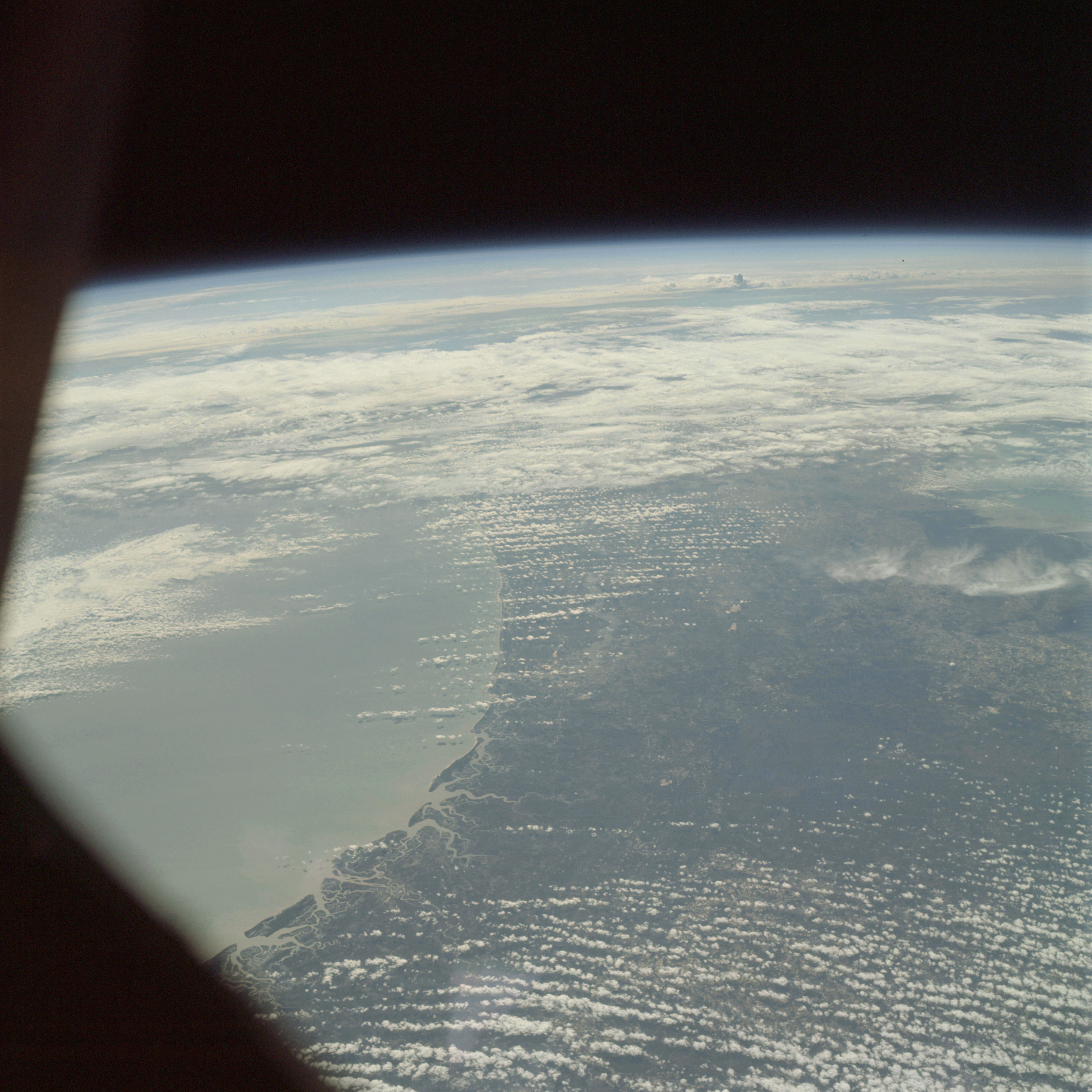 | AS09-22-3415 GEOGRAPHY/CARTOGRAPHY: United States, Georgia, Florida, Sapelo and Cumberland Islands, St. Johns River, Cities of Brunswick and Jacksonville, Towns of Fernandina Beach and Waycross. GEOLOGY/HYDROLOGY: Coastal plain region. AGRICULTURE: Scattered, but heavy field pattern display. FORESTRY: Mixed pine/hardwood forests with pure stands of each. METEOROLOGY: Alto-cumulus, cirrus, cumulus congestus. OCEANOGRAPHY: Atlantic Ocean, sediments visible in nearshore zone. Image credit: Image Science and Analysis Laboratory, NASA-Johnson Space Center. |
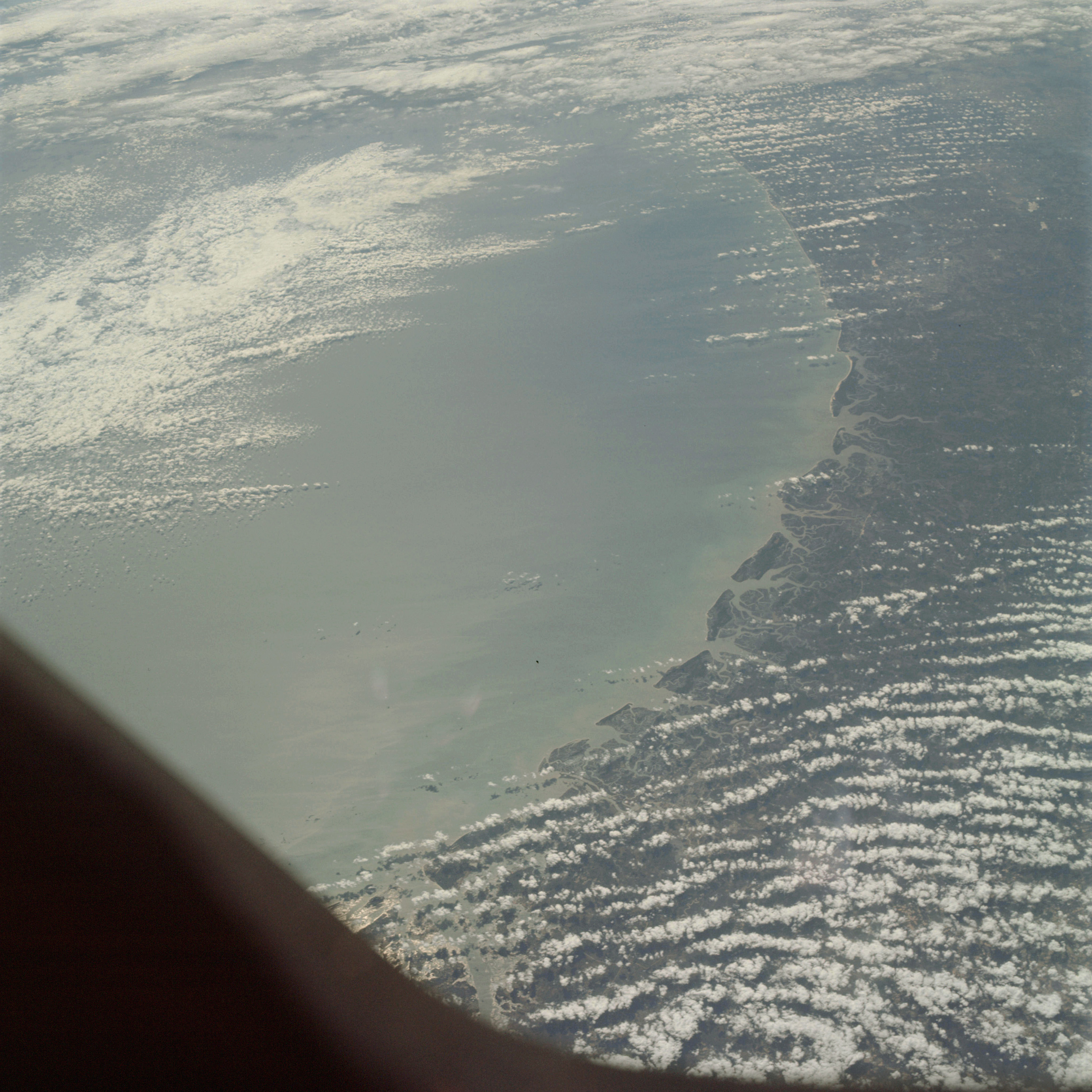 | AS09-22-3416 GEOGRAPHY/CARTOGRAPHY: United States, Georgia, Florida, Little Tybee Ossabaw, St. Catherines, Sepolo, and Cumberland Islands, Cities of Savannah, Brunswick and Jacksonville. GEOLOGY/HYDROLOGY: Coastal plain and compound shoreline. AGRICULTURE: Scattered, irregular shaped field patterns. FORESTRY: Mixed pine/hardwood forests with pure stands of each. METEOROLOGY: Alto-cumulus, cumulus congestus OCEANOGRAPHY: Atlantic Ocean, sediments entering nearshore zone indicate no longshore currant activity. Image credit: Image Science and Analysis Laboratory, NASA-Johnson Space Center. |
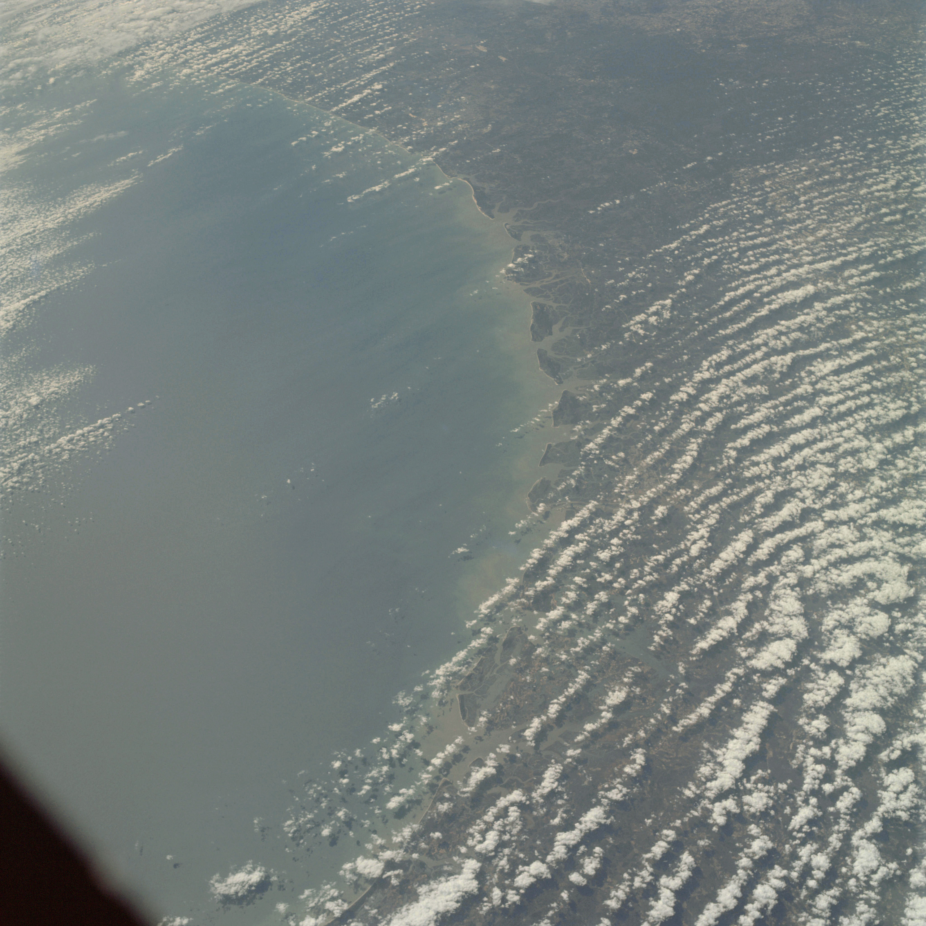 | AS09-22-3417 GEOGRAPHY/CARTOGRAPHY: United States, Georgia, Florida, South Carolina, Hilton Head, St. Catherines, and Cumberland Islands, St. Helens and Port Royal Sounds, Cities of Beaufort, Savannah and Brunswick. GEOLOGY/HYDROLOGY: Coastal plain and compound shoreline. AGRICULTURE: Scattered field patterns. FORESTRY: Mixed pine/hardwood forests with pure stands of each. METEOROLOGY: Alto-cumulus. OCEANOGRAPHY: Atlantic Ocean, sediment patterns in nearshore zone indicate no longshore current activity. Image credit: Image Science and Analysis Laboratory, NASA-Johnson Space Center. |
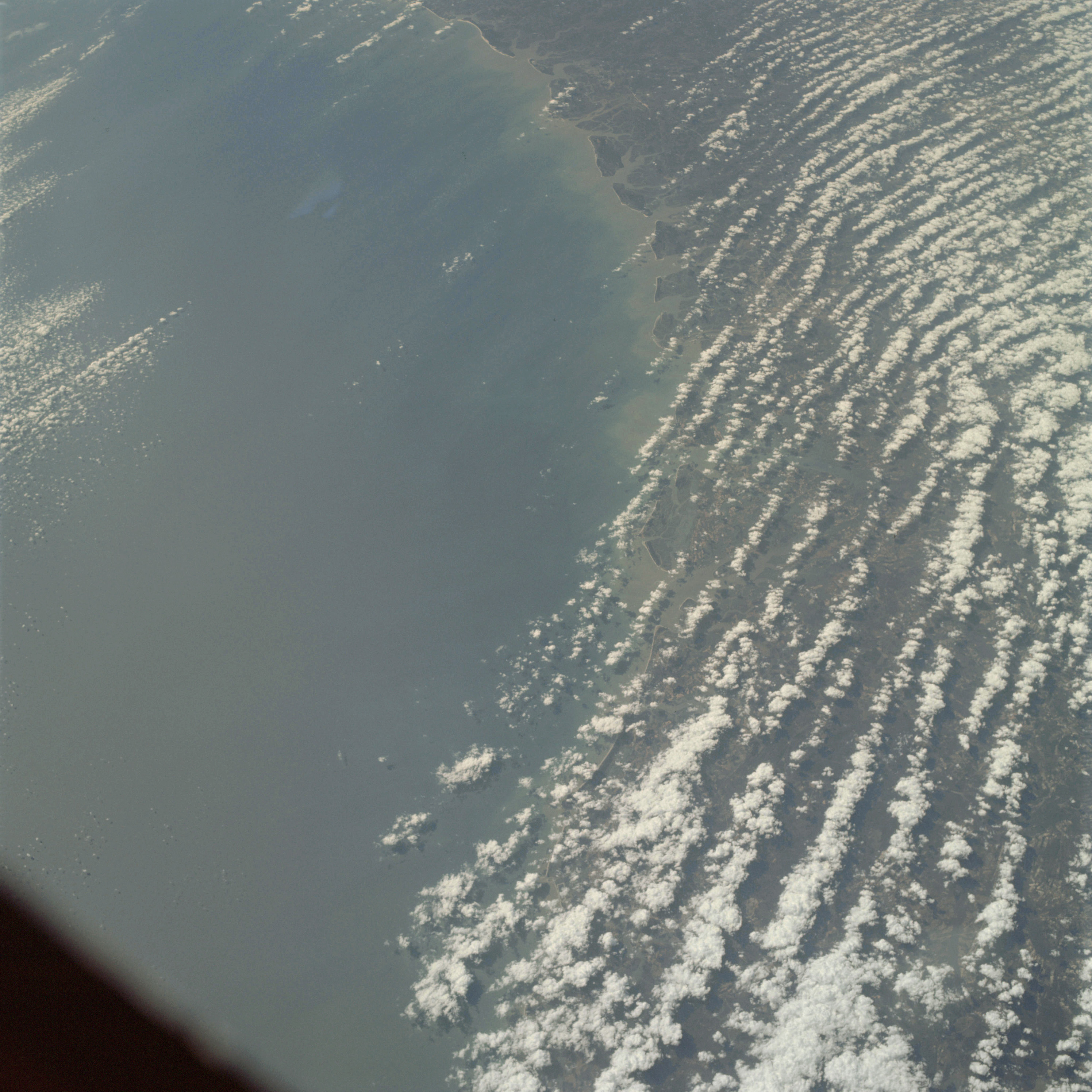 | AS09-22-3418 GEOGRAPHY/CARTOGRAPHY: United States, Georgia, South Carolina, St. Helens and Port Royal Sounds, Cities of Charleston, Beaufort, Savannah and Brunswick. GEOLOGY/HYDROLOGY: Coastal plain and compound shoreline. AGRICULTURE: Scattered field patterns. FORESTRY: Mixed pine/hardwood forests with pure stands of each. METEOROLOGY: Alto-cumulus. OCEANOGRAPHY: Atlantic Ocean, sediment patterns in nearshore zone indicate no longshore current activity. Image credit: Image Science and Analysis Laboratory, NASA-Johnson Space Center. |
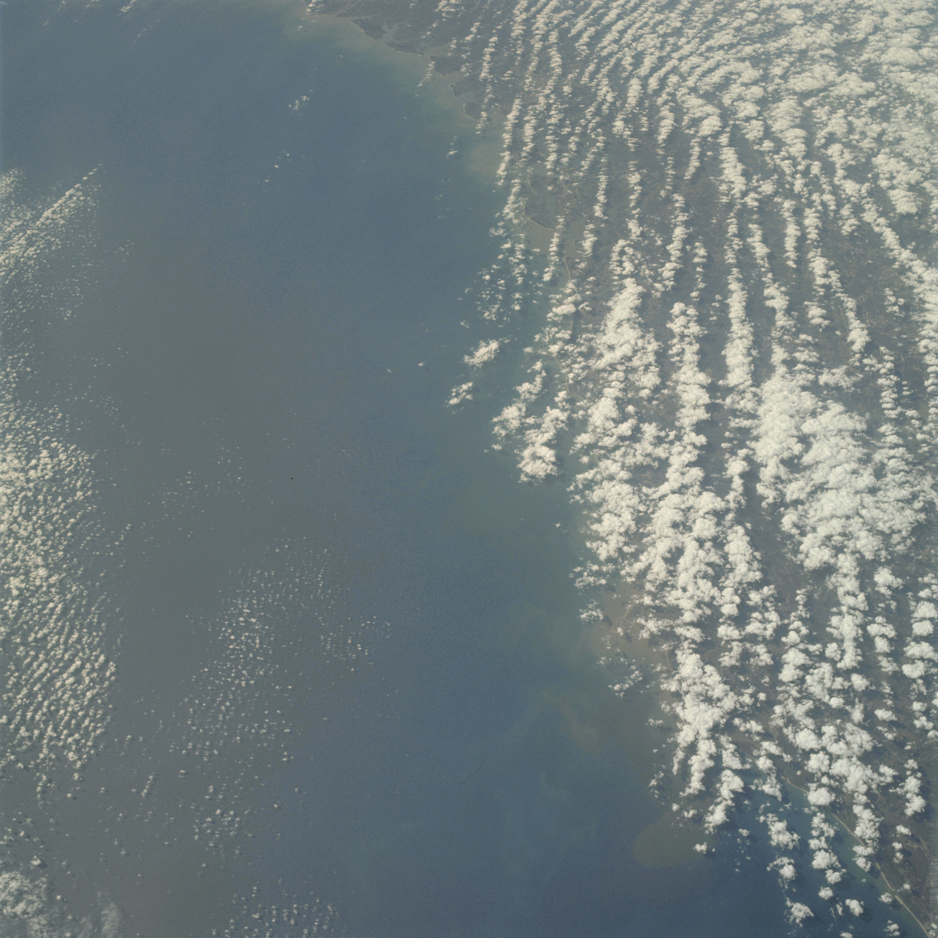 | AS09-22-3419 GEOGRAPHY/CARTOGRAPHY: United States, Georgia, South Carolina, Cities of Charleston, Beaufort, and Savannah. GEOLOGY/HYDROLOGY: Coastal plain and compound shoreline. AGRICULTURE: Scattered field patterns. FORESTRY: Mixed pine/hardwood forests with pure stands of each. METEOROLOGY: Alto-cumulus. OCEANOGRAPHY: Atlantic Ocean, water tonal differences visible in offshore zone. Image credit: Image Science and Analysis Laboratory, NASA-Johnson Space Center. |
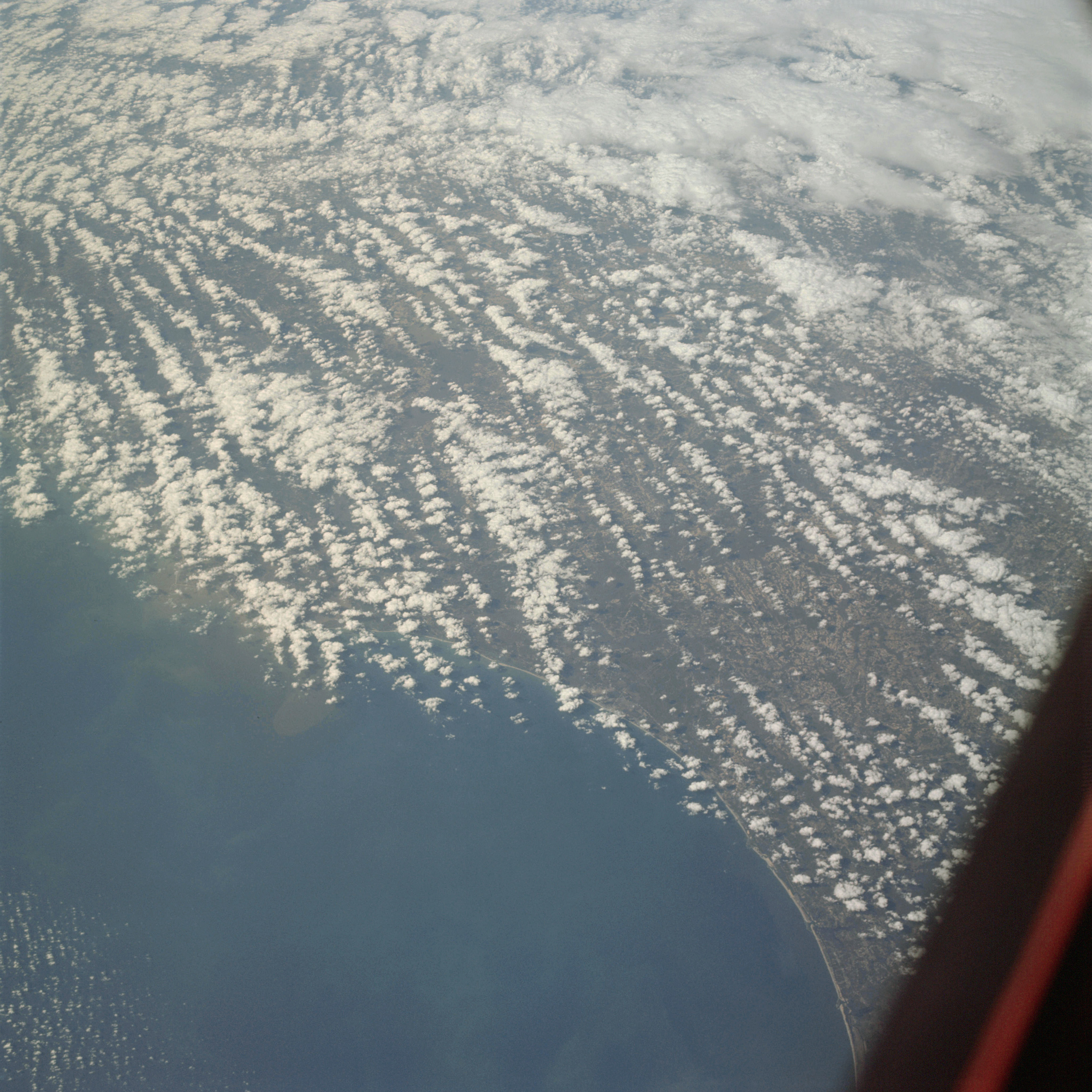 | AS09-22-3420 GEOGRAPHY/CARTOGRAPHY: United States, South Carolina, City of Charleston, Towns of Georgetown and Myrtle Beach. GEOLOGY /HYDROLOGY: Coastal plain region. AGRICULTURE: Scattered field patterns. FORESTRY: Mixed pine/hardwood forests with pure stands of each. METEOROLOGY: Alto-cumulus, cumulus congestus. OCEANOGRAPHY: Atlantic Ocean, water tonal differences visible in offshore zone. Image credit: Image Science and Analysis Laboratory, NASA-Johnson Space Center. |
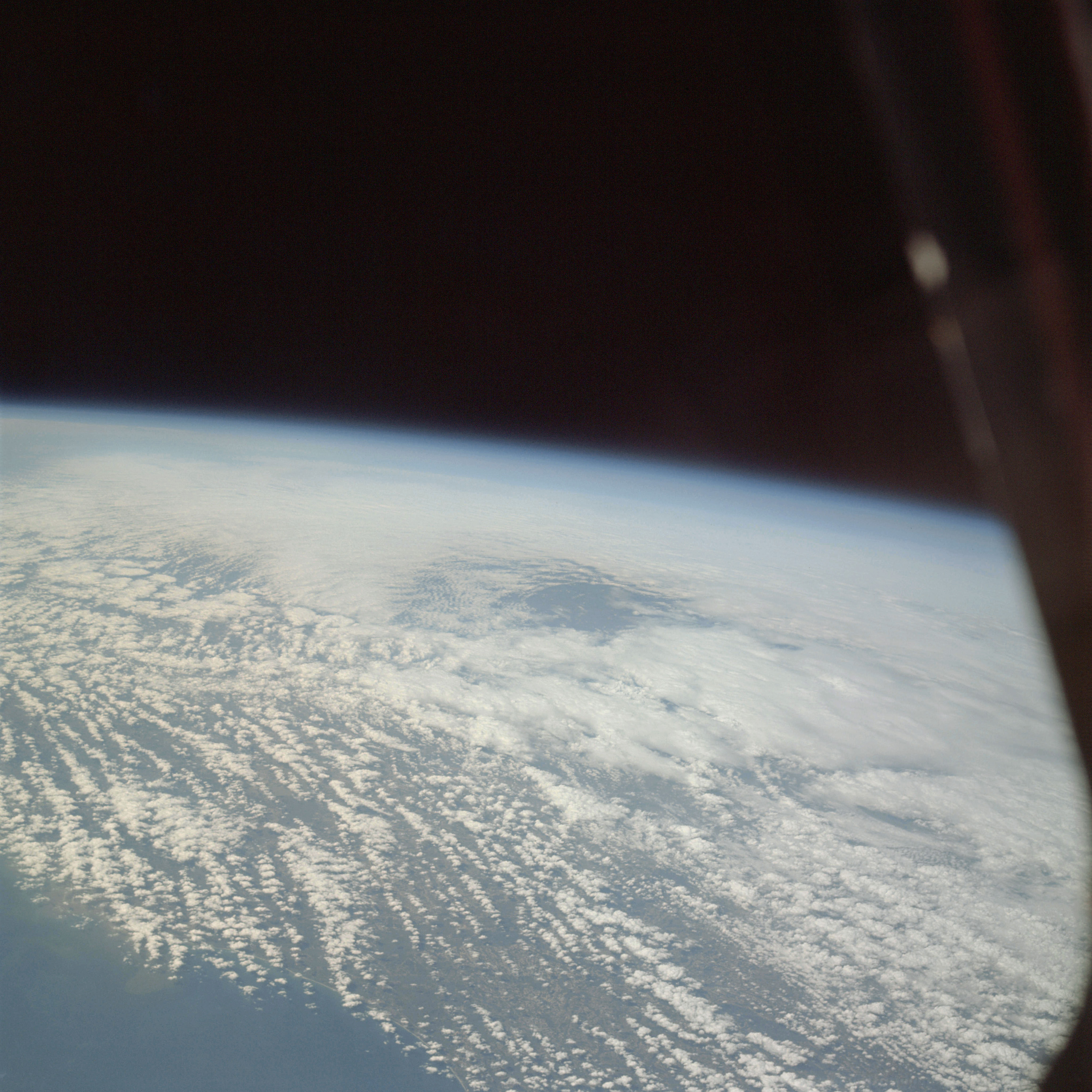 | AS09-22-3421 GEOGRAPHY/CARTOGRAPHY: United States, South Carolina Coast. GEOLOGY /HYDROLOGY: Coastal plain. METEOROLOGY: Alto-cumulus, cumulus congestus. Image credit: Image Science and Analysis Laboratory, NASA-Johnson Space Center. |
 | AS09-22-3422 Inside spacecraft. Image credit: Image Science and Analysis Laboratory, NASA-Johnson Space Center. |
 | AS09-22-3423 Inside spacecraft. Image credit: Image Science and Analysis Laboratory, NASA-Johnson Space Center. |
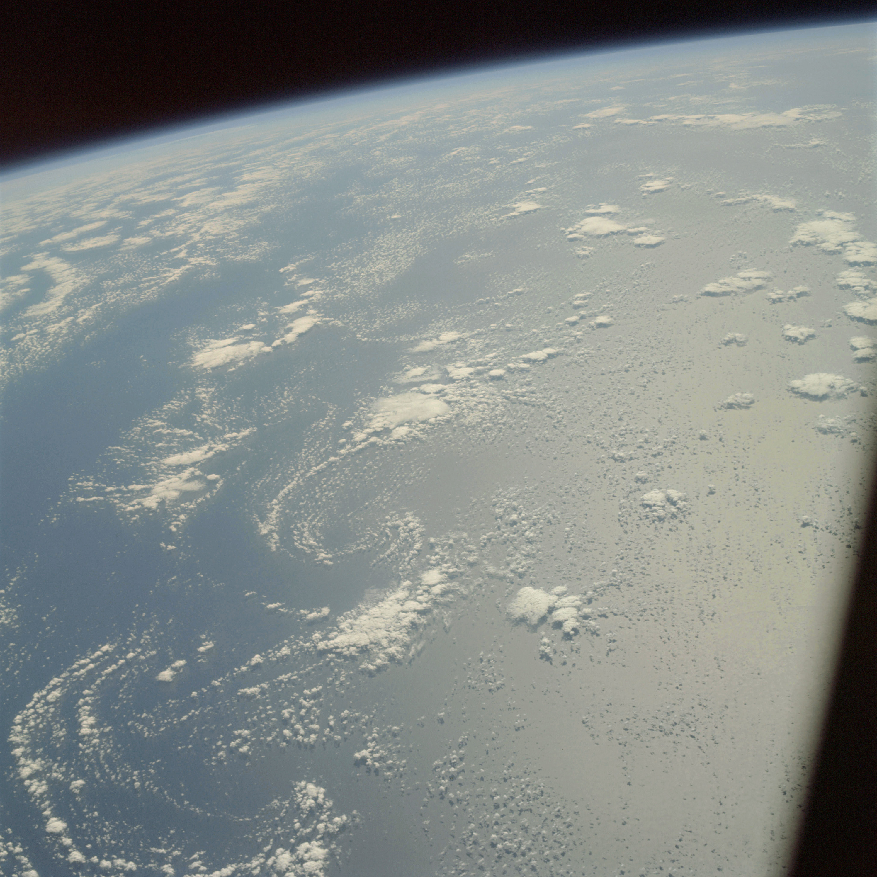 | AS09-22-3424 GEOGRAPHY/CARTOGRAPHY: Atlantic Ocean. METEOROLOGY: Alto-cumulus. OCEANOGRAPHY: Sun glint. Image credit: Image Science and Analysis Laboratory, NASA-Johnson Space Center. |
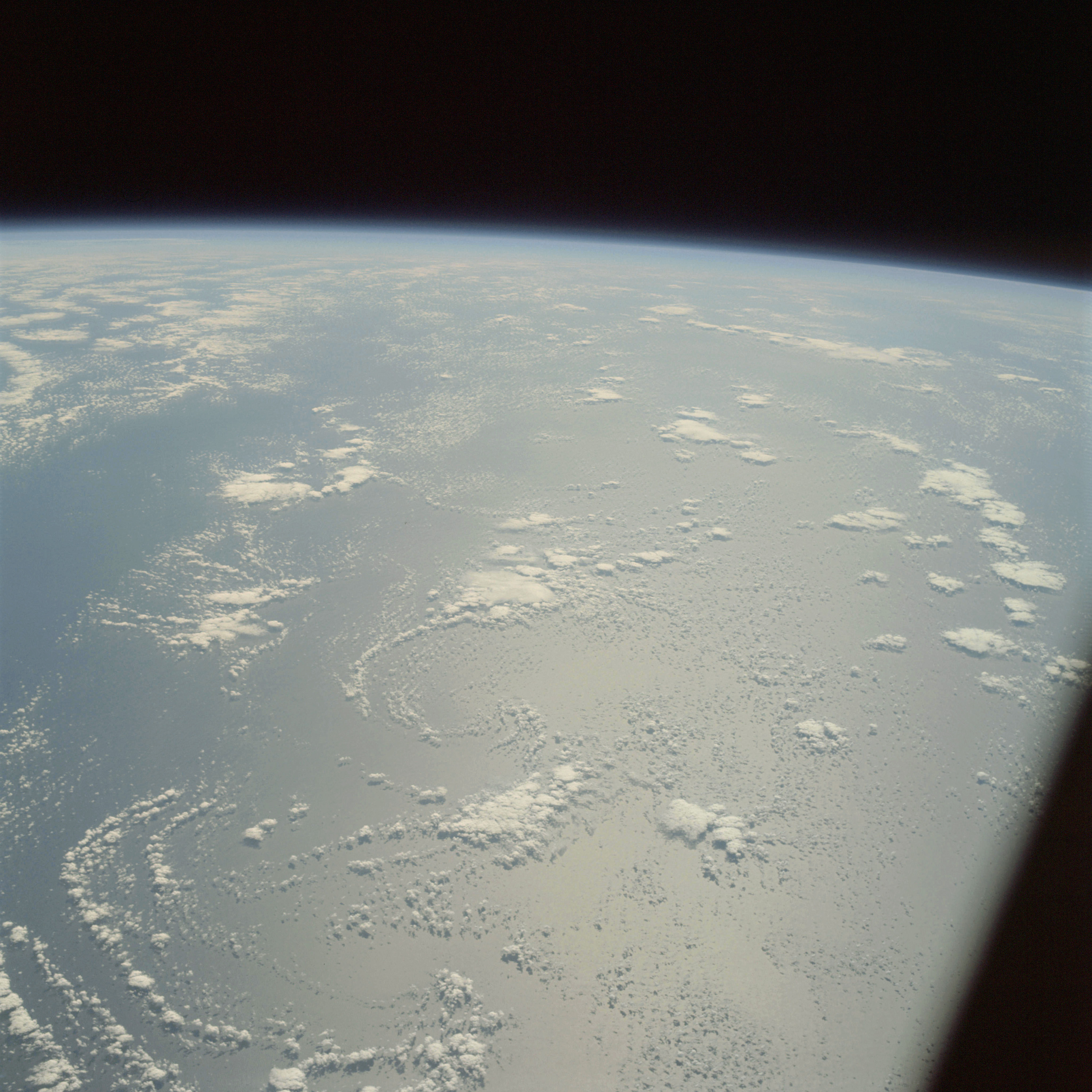 | AS09-22-3425 GEOGRAPHY/CARTOGRAPHY: Atlantic Ocean. METEOROLOGY: Alto-cumulus. OCEANOGRAPHY: Sun glint. Image credit: Image Science and Analysis Laboratory, NASA-Johnson Space Center. |
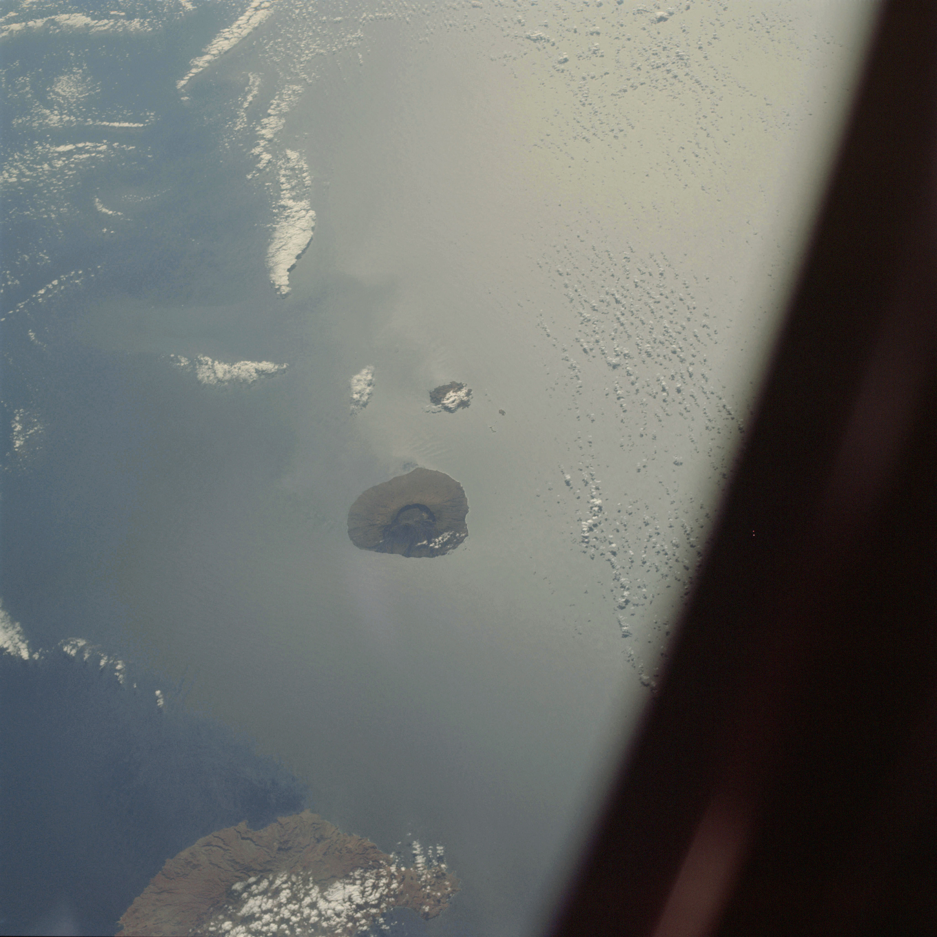 | AS09-22-3426 GEOGRAPHY/CARTOGRAPHY: Cape Verde Islands, Fogo, Braua and Sao Tiago Islands, Villages of Sao Filipe and Tarrafal. GEOLOGY/HYDROLOGY: Volcanic islands. METEOROLOGY: Alto-cumulus, cumulus congestus. OCEANOGRAPHY: Atlantic Ocean, sun glint, some swell and current patterns visible adjacent to the islands. Image credit: Image Science and Analysis Laboratory, NASA-Johnson Space Center. |
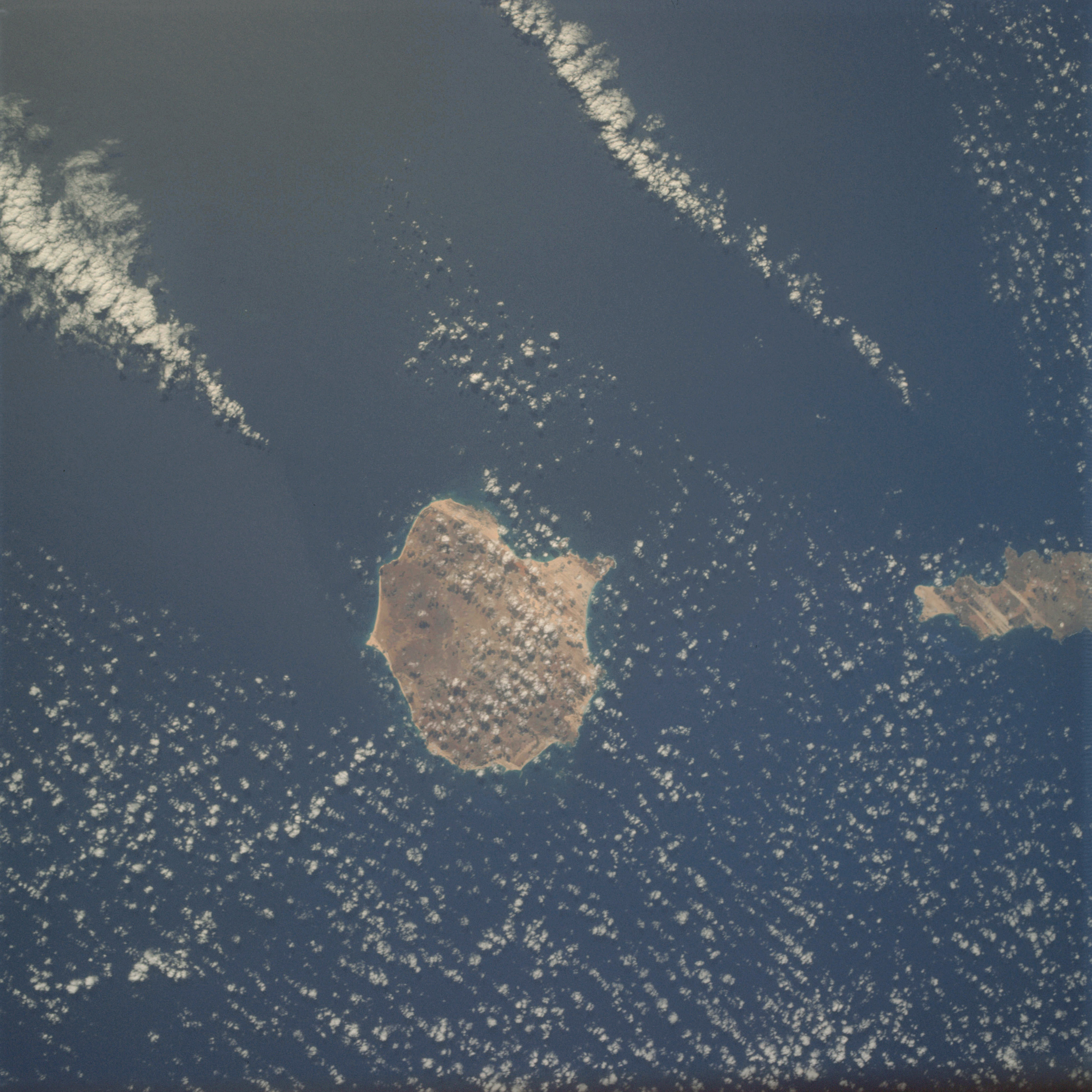 | AS09-22-3427 GEOGRAPHY/CARTOGRAPHY: Cape Verde Islands, Boa Vista and Sal Islands, Villages of Curral Velho, Sal Rei, and Santa Maria. GEOLOGY/HYDROLOGY: Volcanic islands. METEOROLOGY: Alto-cumulus. OCEANOGRAPHY: Atlantic Ocean, some depth variations visible in nearshore zone of the island. Image credit: Image Science and Analysis Laboratory, NASA-Johnson Space Center. |
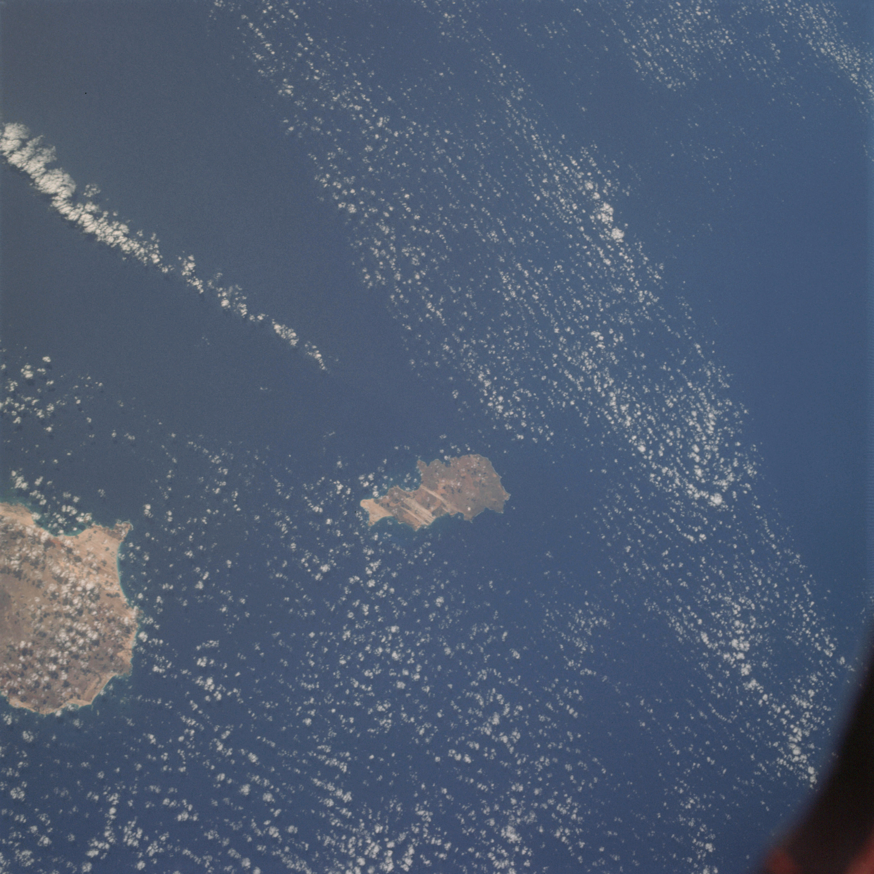 | AS09-22-3428 GEOGRAPHY/CARTOGRAPHY: Cape Verde Islands, Sal and Boa Vista Islands, Villages of Palmeira, Pedra Lume, Santa Maria, and Sal Rei. GEOLOGY/HYDROLOGY: Volcanic islands. METEOROLOGY: Alto-cumulus. OCEANOGRAPHY: Atlantic Ocean, some depth variations visible in the nearshore zone of the islands. Image credit: Image Science and Analysis Laboratory, NASA-Johnson Space Center. |
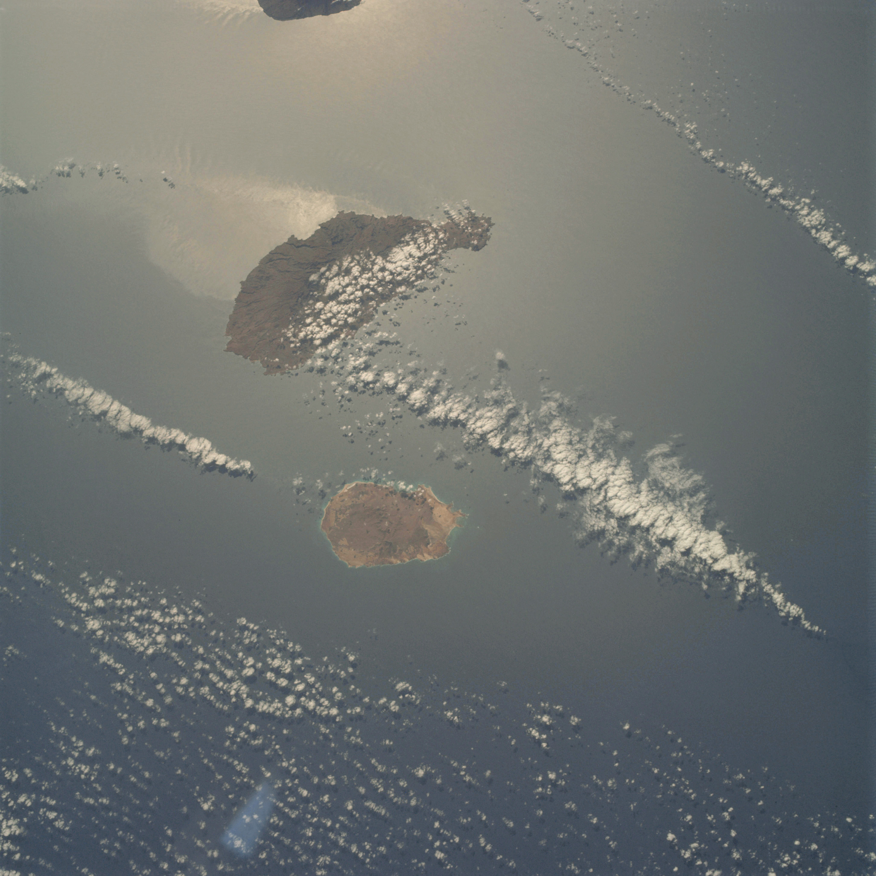 | AS09-22-3429 GEOGRAPHY/CARTOGRAPHY: Caps Verde Islands, Sao Tiago, Maio, and Fogo Islands, Villages of Santo Antonio, Porto Ingles, Sao Tiago, and Praia. GEOLOGY/HYDROLOGY: Volcanic islands. METEOROLOGY: Alto-cumulus. OCEANOGRAPHY: Atlantic Ocean, some strong current patterns visible in the sun glint area. Image credit: Image Science and Analysis Laboratory, NASA-Johnson Space Center. |
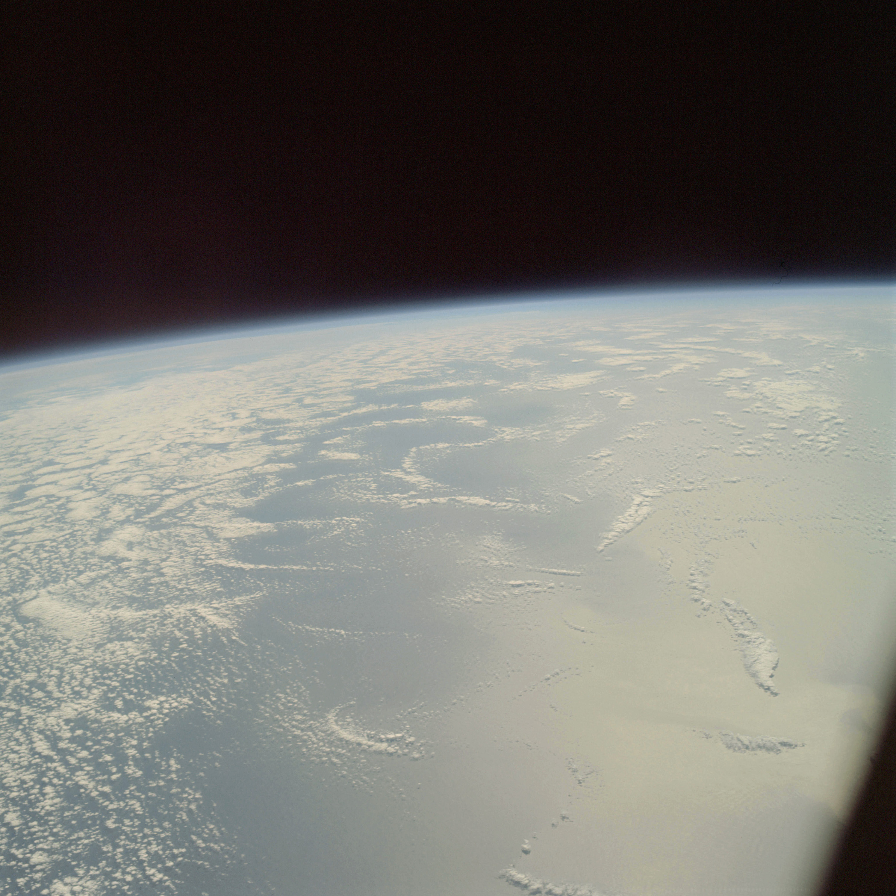 | AS09-22-3430 GEOGRAPHY/CARTOGRAPHY: Atlantic Ocean. METEOROLOGY: Alto-cumulus. OCEANOGRAPHY: Possible swell patterns visible within the sun glint area. Image credit: Image Science and Analysis Laboratory, NASA-Johnson Space Center. |
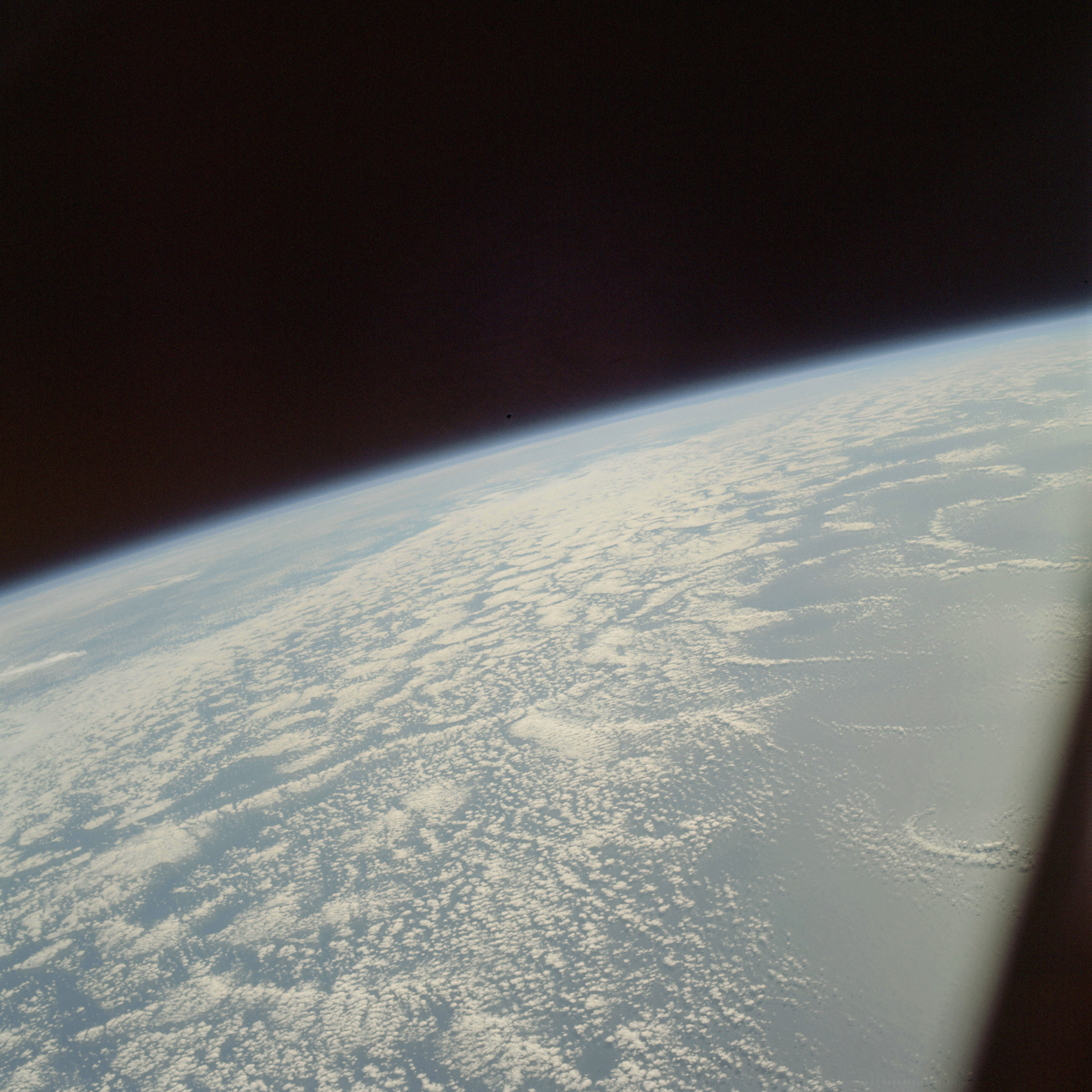 | AS09-22-3431 GEOGRAPHY/CARTOGRAPHY: Atlantic Ocean. METEOROLOGY: Alto-cumulus. OCEANOGRAPHY: Possible swell patterns visible within the sun glint area. Image credit: Image Science and Analysis Laboratory, NASA-Johnson Space Center. |
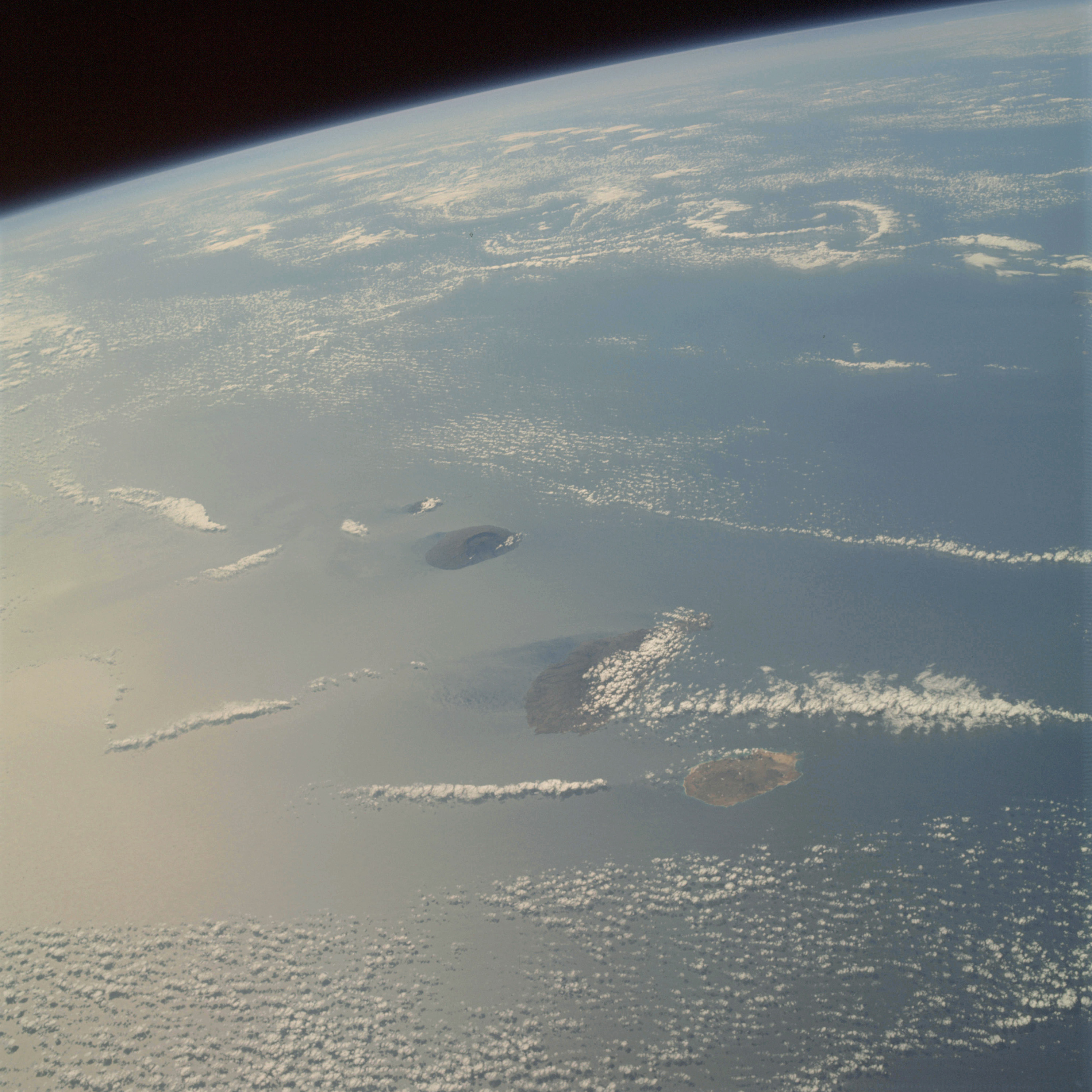 | AS09-22-3432 GEOGRAPHY/CARTOGRAPHY: Cape Verde Islands, Brava, Fogo, Sao Tiago and Maio Islands. GEOLOGY/HYDROLOGY: Volcanic chain of islands. METEOROLOGY: Alto-cumulus. OCEANOGRAPHY: Atlantic Ocean, strong current patterns visible on leeward side of the islands. Image credit: Image Science and Analysis Laboratory, NASA-Johnson Space Center. |
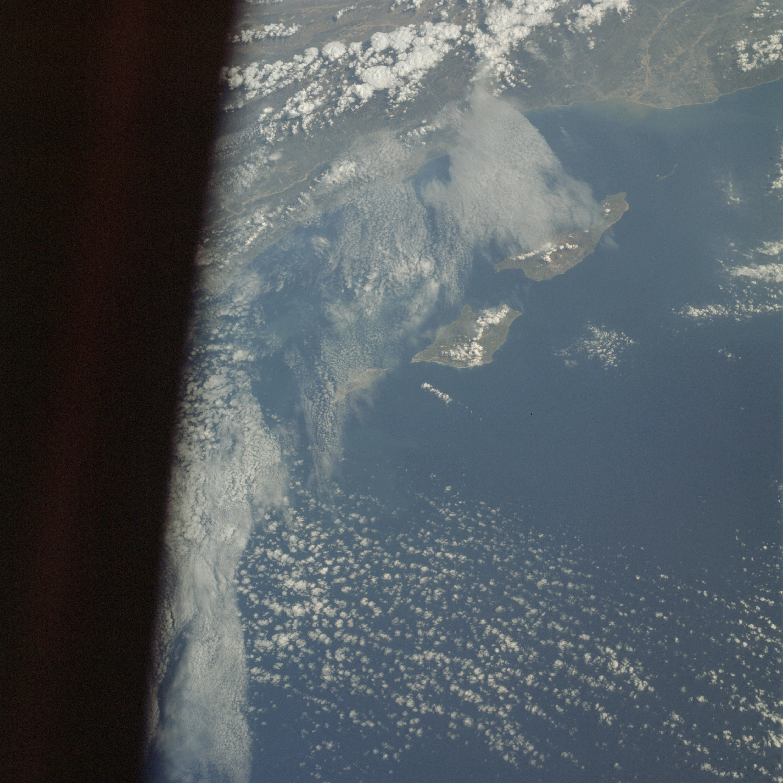 | AS09-22-3433 GEOGRAPHY/CARTOGRAPHY: United States, California, Santa Barbara Channel, San Miguel, Santa Rosa and Santa Cruz Islands, Santa Ynez Mountains, Cities of Santa Barbara and Ventura. GEOLOGY/HYDROLOGY: Complex mountains and coastal plain. FORESTRY: Broadleaf evergreen shrubform. METEOROLOGY: Cirro-cumulus, alto-cumulus, cumulus congestus. OCEANOGRAPHY: Pacific Ocean, sediments from population centers visible in nearshore zone. Image credit: Image Science and Analysis Laboratory, NASA-Johnson Space Center. |
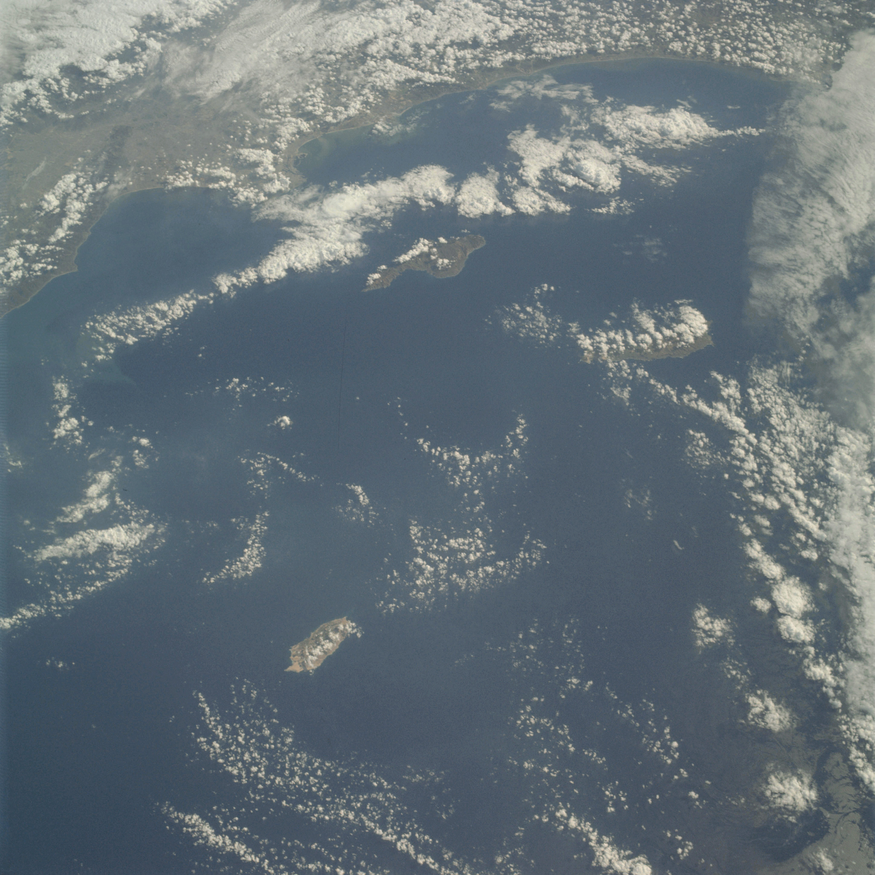 | AS09-22-3434 GEOGRAPHY/CARTOGRAPHY: United States, California, San Pedro Channel, San Nicolas, Santa Catalina, and San Clemente Islands, Gulf of Santa Catalina, Cities of Los Angeles and Long Beach. GEOLOGY/HYDROLOGY: Complex mountains and coastal plain. FORESTRY: Broadleaf evergreen shrubform. METEOROLOGY: Cirro-cumulus, alto-cumulus, cumulus humilis, cumulus congestus. OCEANOGRAPHY: Pacific Ocean, sediments from population centers visible in nearshore zone. Image credit: Image Science and Analysis Laboratory, NASA-Johnson Space Center. |
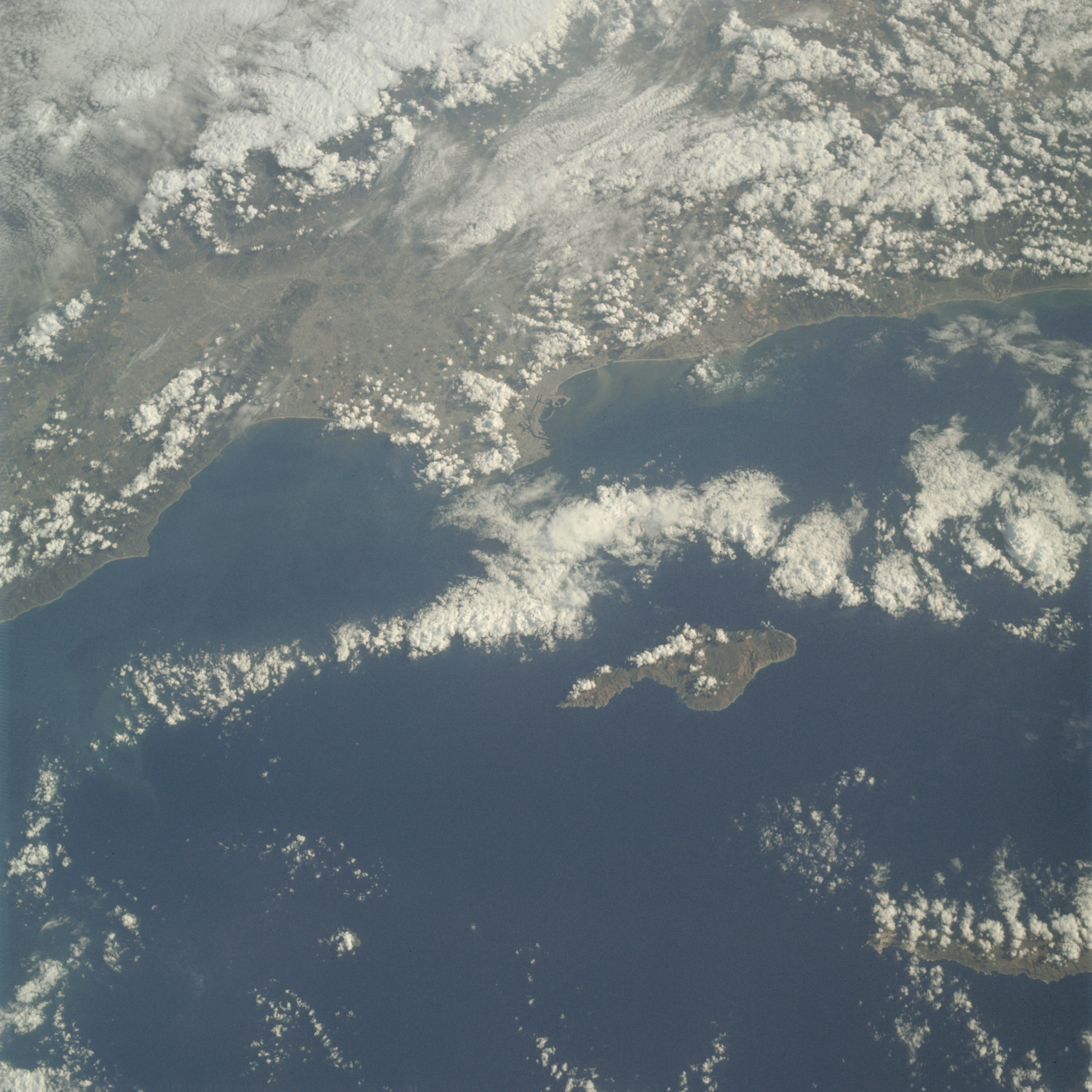 | AS09-22-3435 GEOGRAPHY/CARTOGRAPHY: United States, California, San Pedro Channel, Santa Catalina, and San Clemete Islands, Los Angeles Metropolitan Area. GEOLOGY/HYDROLOGY: Complex mountains and coastal plain. FORESTRY: Broadleaf evergreen shrubform. METEOROLOGY: Nimbo-stratus, cumulus congestus, cumulus humilis, cirro-cumulus, cumulo-nimbus. OCEANOGRAPHY: Pacific Ocean, sediments from population centers are visible in the nearshore zones. Image credit: Image Science and Analysis Laboratory, NASA-Johnson Space Center. |
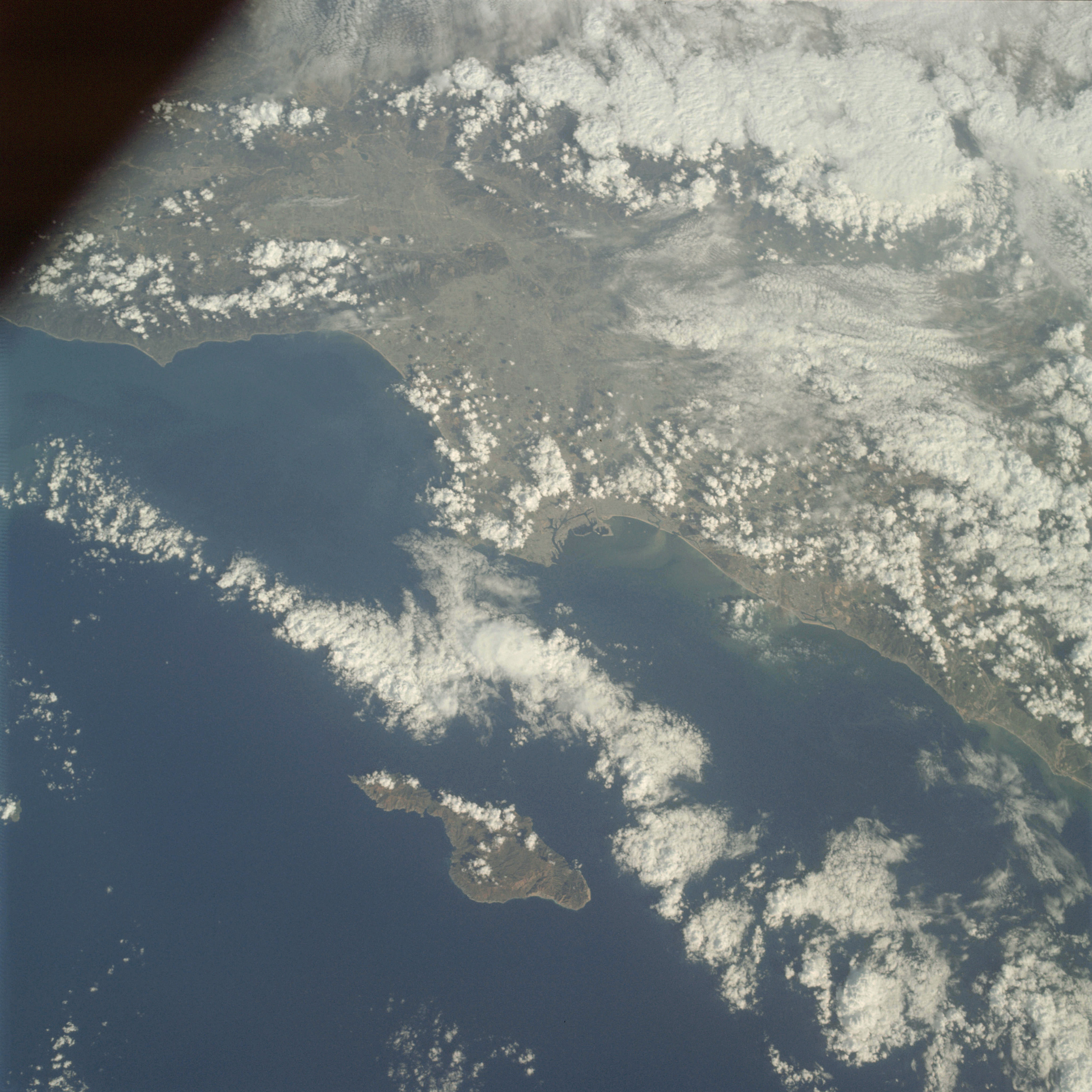 | AS09-22-3436 GEOGRAPHY/CARTOGRAPHY: United States, California, Santa Catalina Island, Los Angeles Metropolitan Area, Town of Oceanside. GEOLOGY/HYDROLOGY: Complex mountains and coastal plain. FORESTRY: Broadleaf evergreen shrubform. METEOROLOGY: Nimbus-stratus, cumulus humilis, cumulus congestus, cumulo-nimbus. OCEANOGRAPHY: Pacific Ocean, sediments from population centers visible in the nearshore zone. Image credit: Image Science and Analysis Laboratory, NASA-Johnson Space Center. |
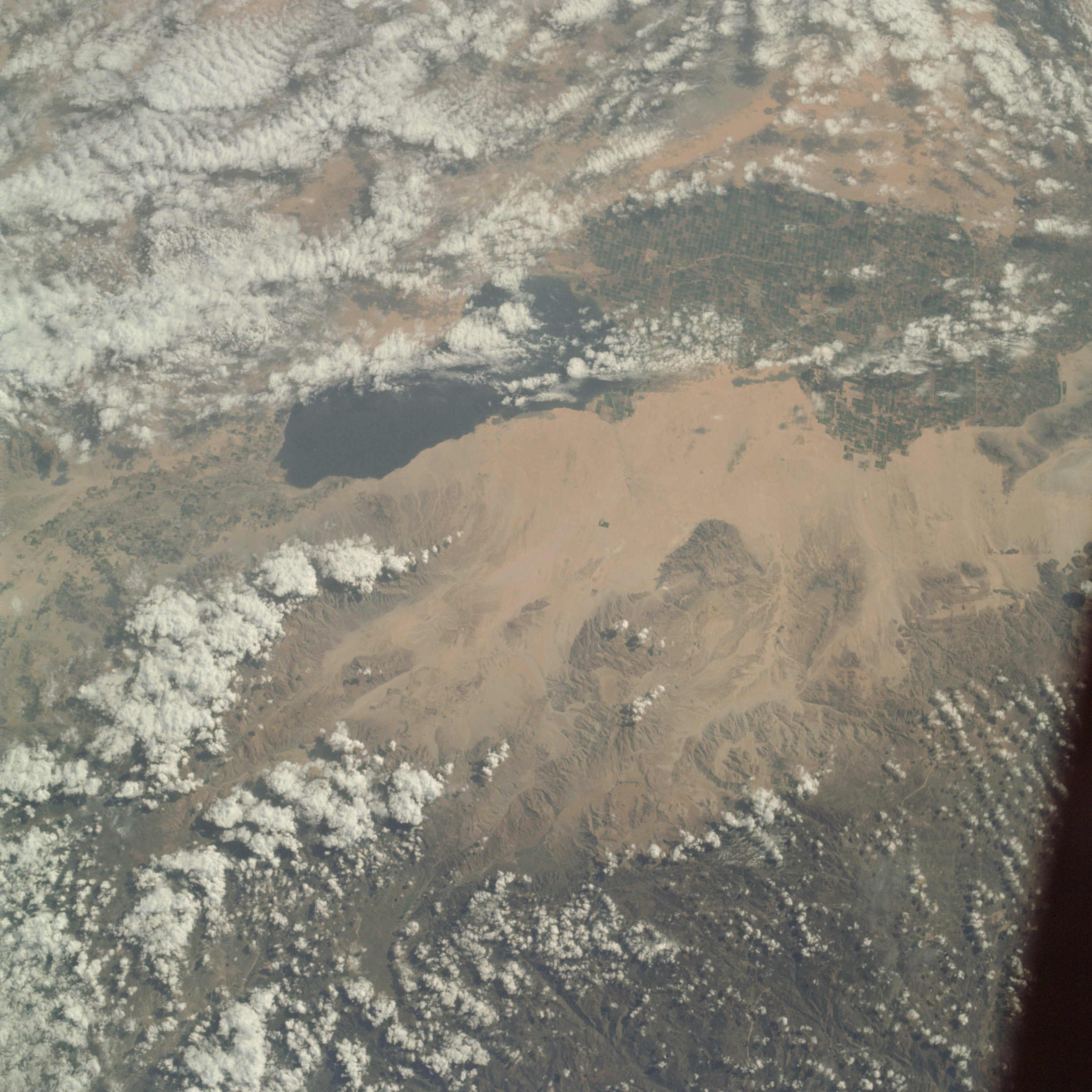 | AS09-22-3437 GEOGRAPHY/CARTOGRAPHY: United States, Mexico,, California, Salton Sea, Imperial and Coachella Valleys, Santa Rosa Mountains, Towns of Indio, Brawley, El Centro and Mexicali. GEOLOGY/HYDROLOGY: Complex ranges and quaternary alluvium. AGRICULTURE: Irrigated farming in areas adjacent to the Salton Sea. FORESTRY: Scattered desert shrubform. METEOROLOGY: Cumulo-nimbus, alto-cumulus, cumulus congestus. Image credit: Image Science and Analysis Laboratory, NASA-Johnson Space Center. |
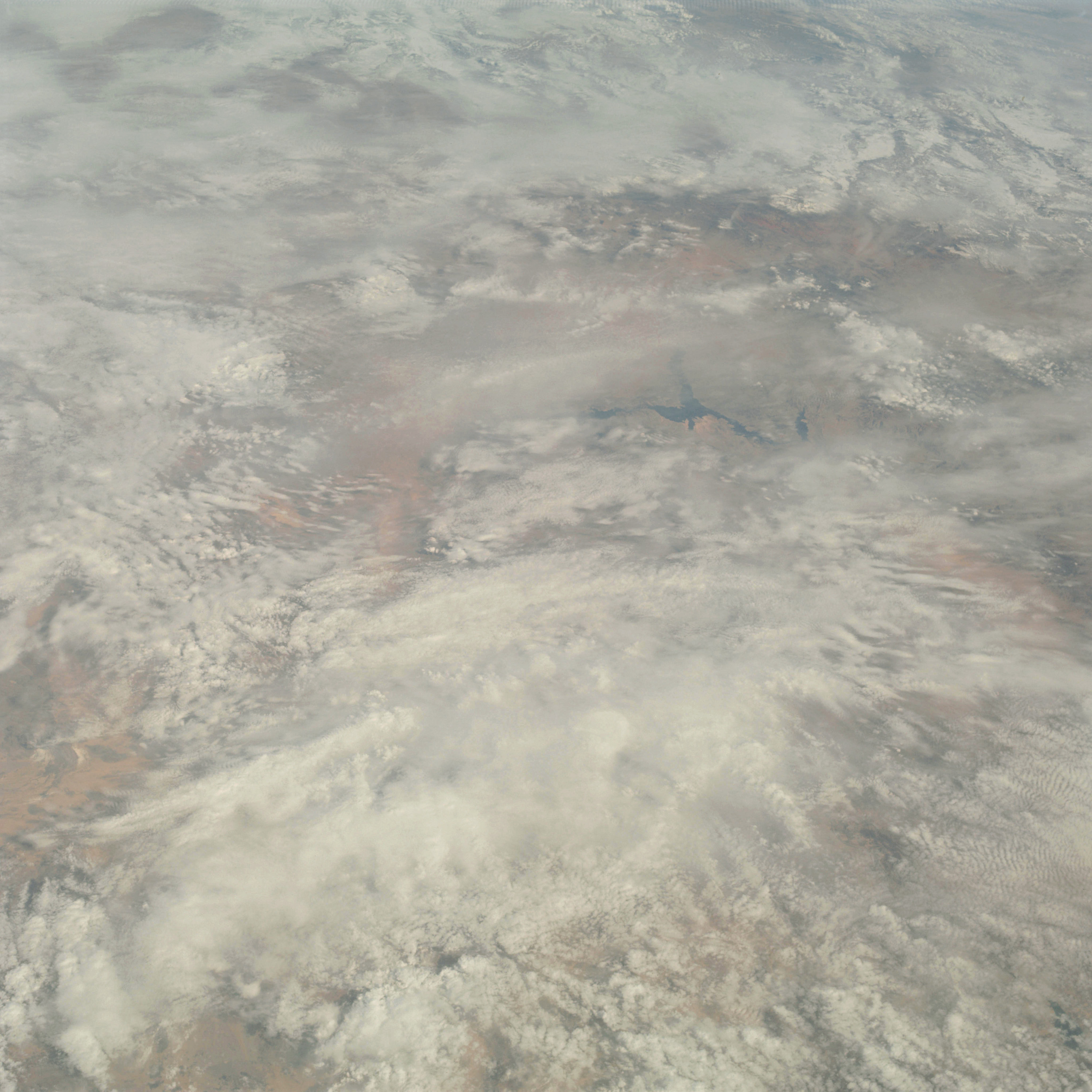 | AS09-22-3438 GEOGRAPHY/CARTOGRAPHY: United States, Arizona, Nevada, Utah, Lake Mead, Great Basin Mountain Ranges, Colorado River, City of Las Vegas. GEOLOGY/HYDROLOGY: Basin and range. METEOROLOGY: Strato-cumulus, alto-stratus, snow cover in mountain and high plateau areas. Image credit: Image Science and Analysis Laboratory, NASA-Johnson Space Center. |
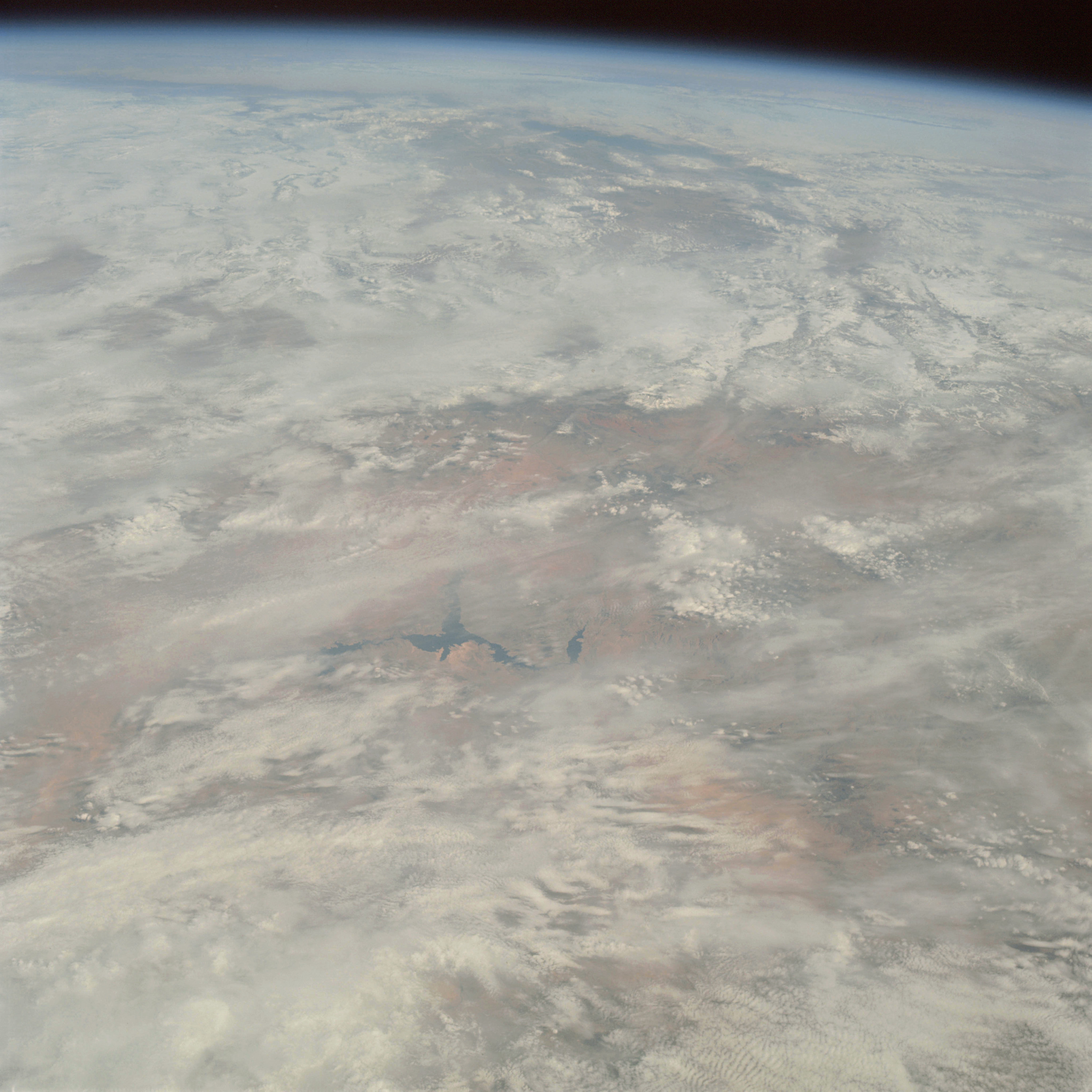 | AS09-22-3439 GEOGRAPHY/CARTOGRAPHY: United States, Nevada, Arizona, Utah, Lake Mead, Colorado River, Coconino Plateau, Great Basin Mountain Ranges, City of Las Vegas, Oblique view of Utah and Great Salt Lakes. GEOLOGY /HYDROLOGY: Basin and Range. METEOROLOGY: Strato-cumulus, alto-stratus, snow cover in mountain and high plateau areas, cirrus. Image credit: Image Science and Analysis Laboratory, NASA-Johnson Space Center. |
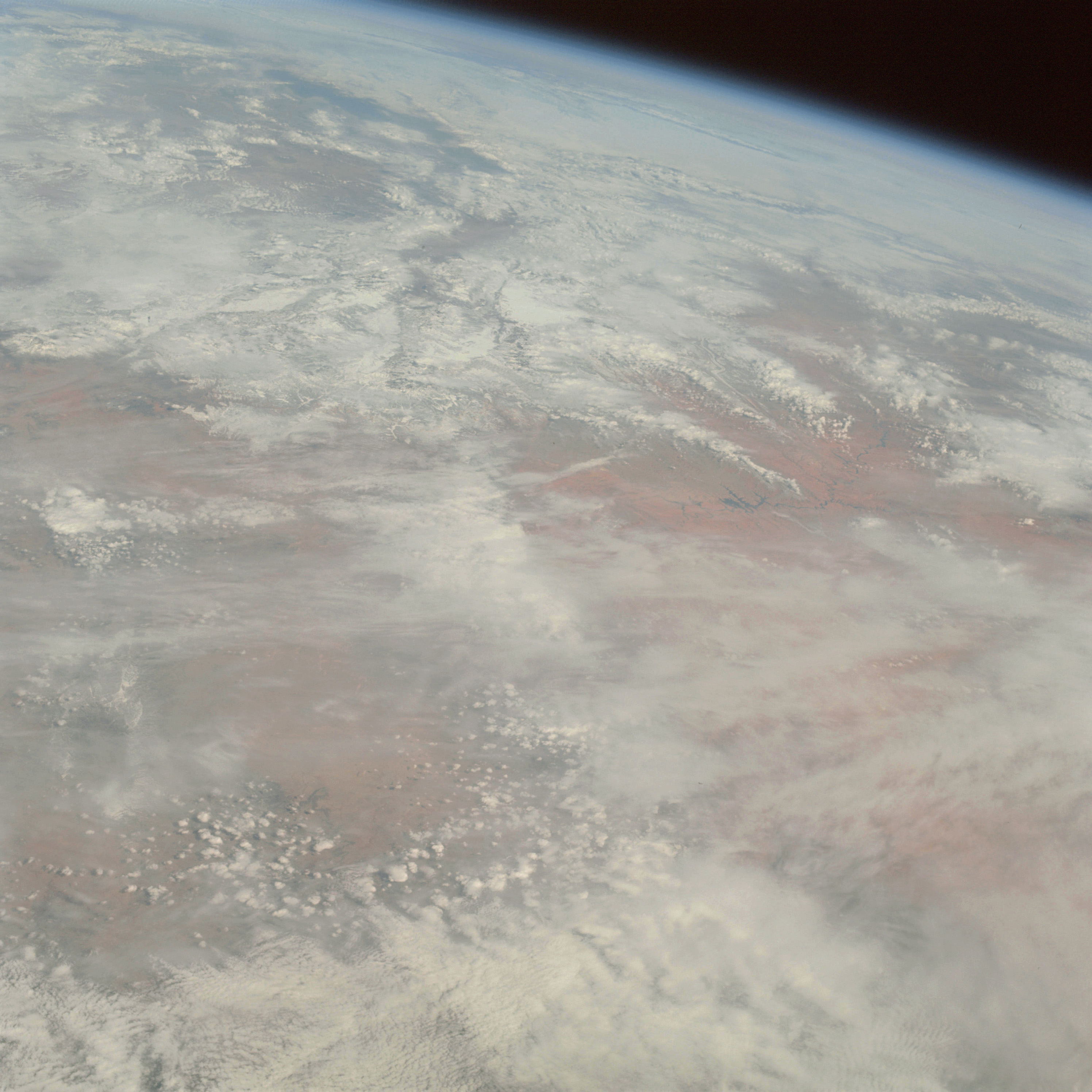 | AS09-22-3440 GEOGRAPHY/CARTOGRAPHY: United States, Arizona, Utah, Grand Canyon, Lake Powell, Coconino Plateau, Oblique view of Utah and Great Salt Lakes and Uinta Mountains. GEOLOGY/HYDROLOGY: Complex mountains and Basin and Range. METEOROLOGY: Strato-cumulus, alto-stratus, snow cover in mountain and high plateau areas, cirrus. Image credit: Image Science and Analysis Laboratory, NASA-Johnson Space Center. |
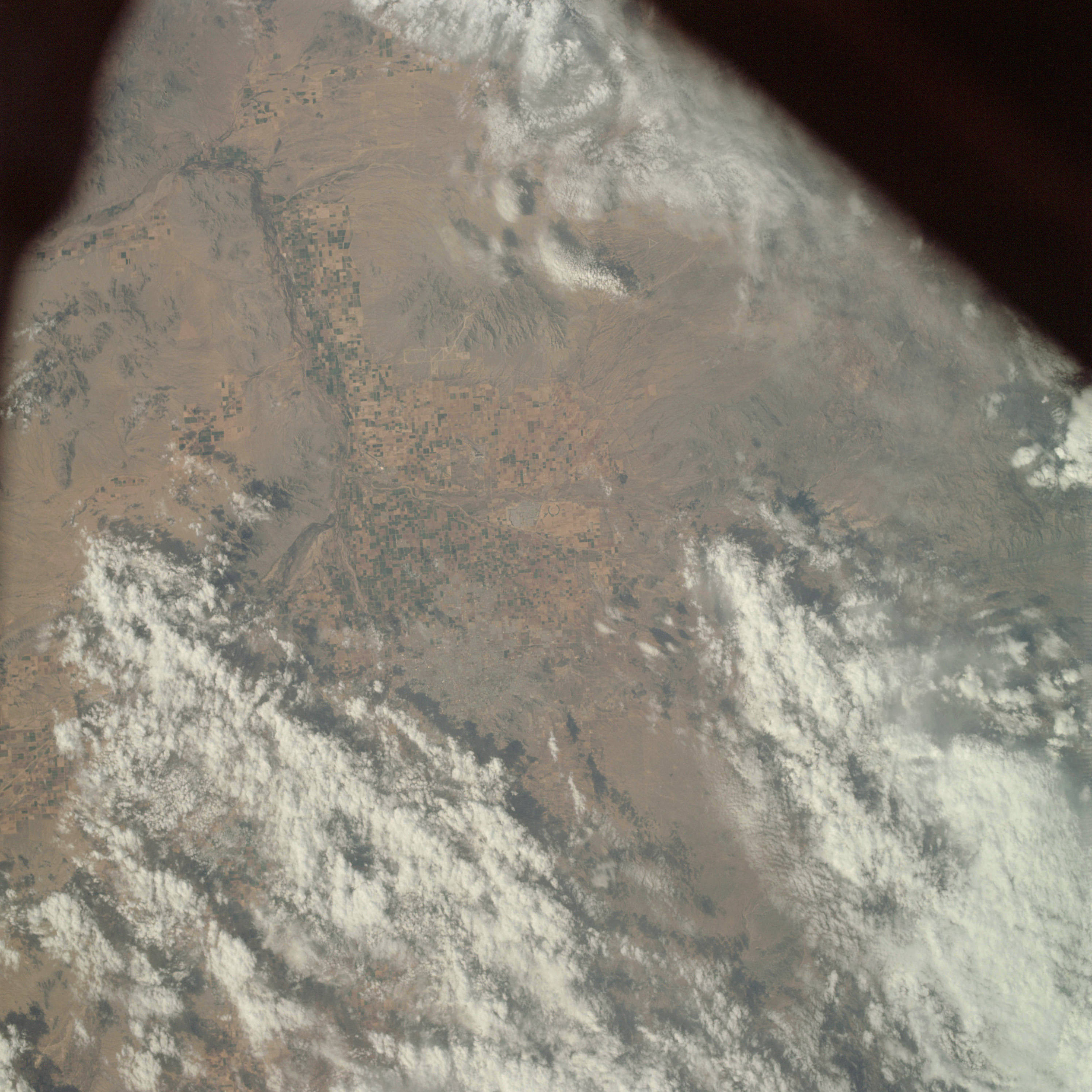 | AS09-22-3441 GEOGRAPHY/CARTOGRAPHY: United States, Arizona, Phoenix Metropolitan Area. GEOLOGY/HYDROLOGY: Basin and Range Province. AGRICULTURE: Heavy concentration of field patterns. FORESTRY: Desert shrubform. METEOROLOGY: Strato-cumulus, alto-cumulus. Image credit: Image Science and Analysis Laboratory, NASA-Johnson Space Center. |
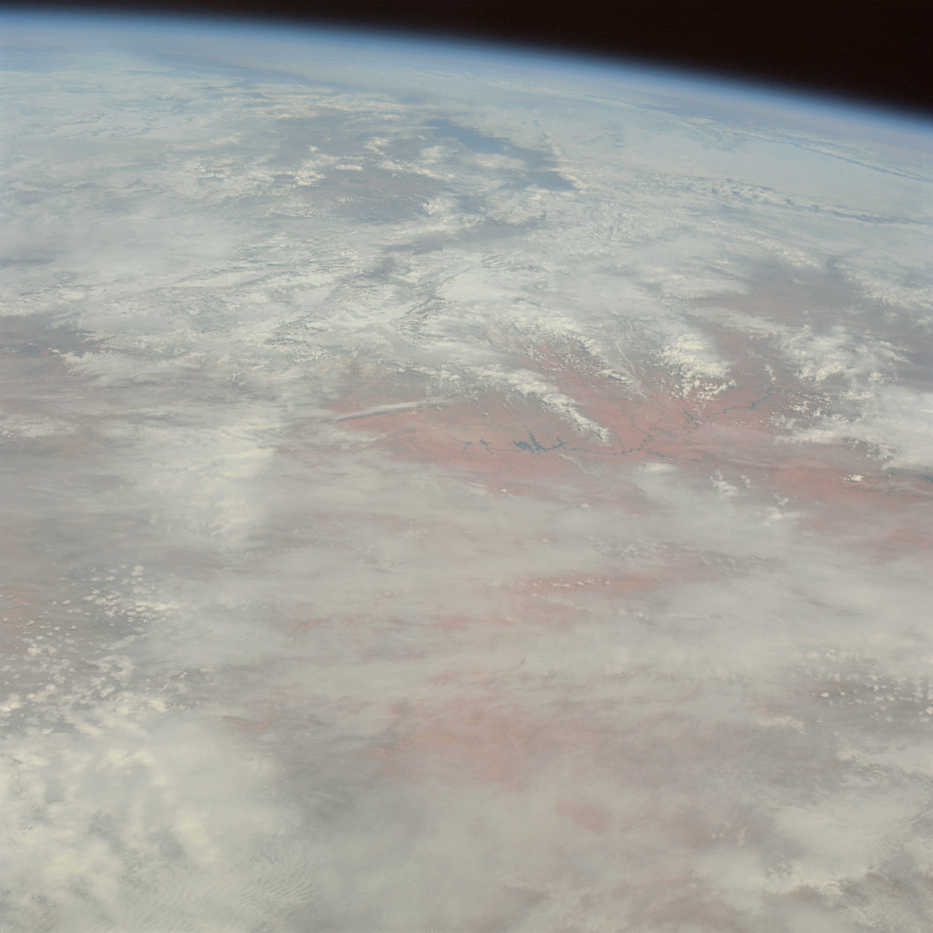 | AS09-22-3442 GEOGRAPHY/CARTOGRAPHY: United States, Arizona, Utah, Colorado, Colorado Plateau, Lake Powell, oblique view of Utah and Great Salt Lakes and Unita Mountains. GEOLOGY/HYDROLOGY: Complex mountains and Basin and Range Province. METEOROLOGY: Cirrus spissatus, alto-stratus, strato-cumulus. Image credit: Image Science and Analysis Laboratory, NASA-Johnson Space Center. |
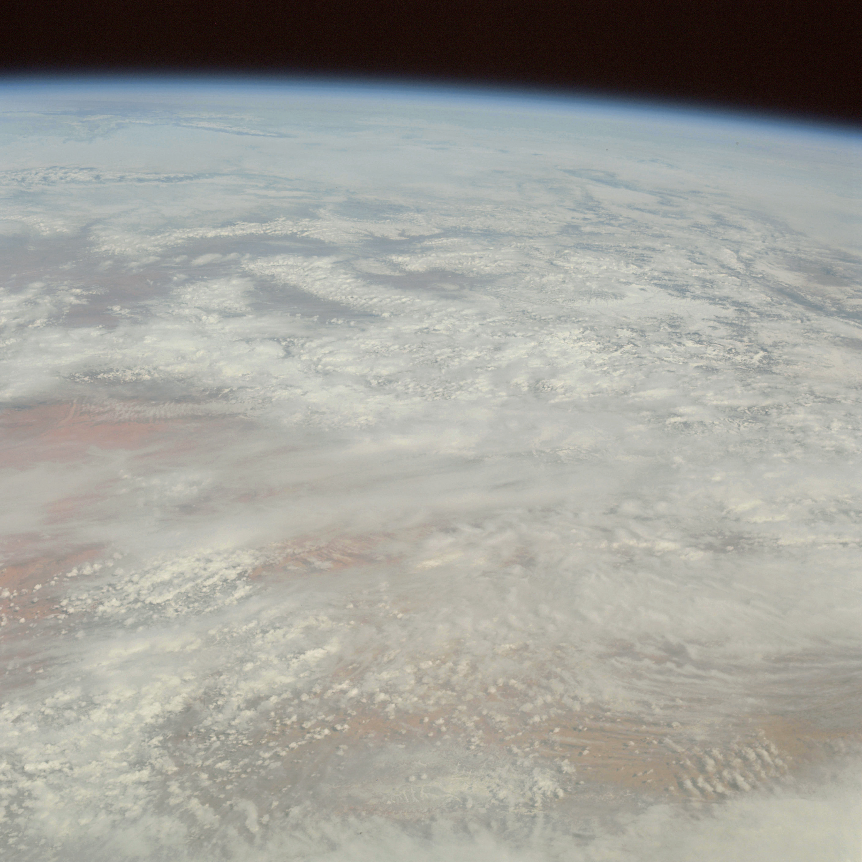 | AS09-22-3443 GEOGRAPHY/CARTOGRAPHY: United States, Arizona, Utah, Colorado, Colorado Plateau, San Juan Mountains. GEOLOGY/HYDROLOGY: Complex mountains, and Basin and Range Province. METEOROLOGY: Strato-cumulus, cirrus spissatus, snow cover in mountain and high plateau areas. Image credit: Image Science and Analysis Laboratory, NASA-Johnson Space Center. |
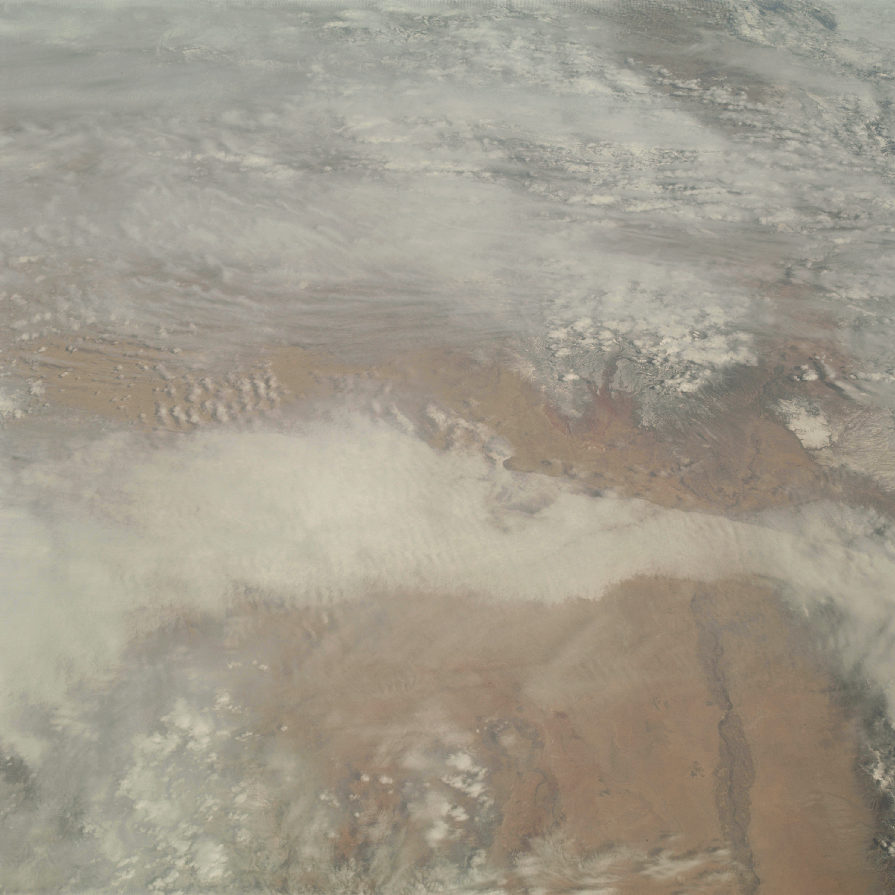 | AS09-22-3444 GEOGRAPHY/CARTOGRAPHY: United States, New Mexico, Rio Grande Valley, Manzano, Sandia, and Jemez Mountains, Cities of Albuquerque and Santa Fe. GEOLOGY/HYDROLOGY: Quaternary alluvium basin deposit. AGRICULTURE: Field patterns along Rio Grande River. FORESTRY: Desert shrubform, mixed deciduous and evergreen at higher elevations. METEOROLOGY: Cirro-stratus, strato-cumulus. Image credit: Image Science and Analysis Laboratory, NASA-Johnson Space Center. |
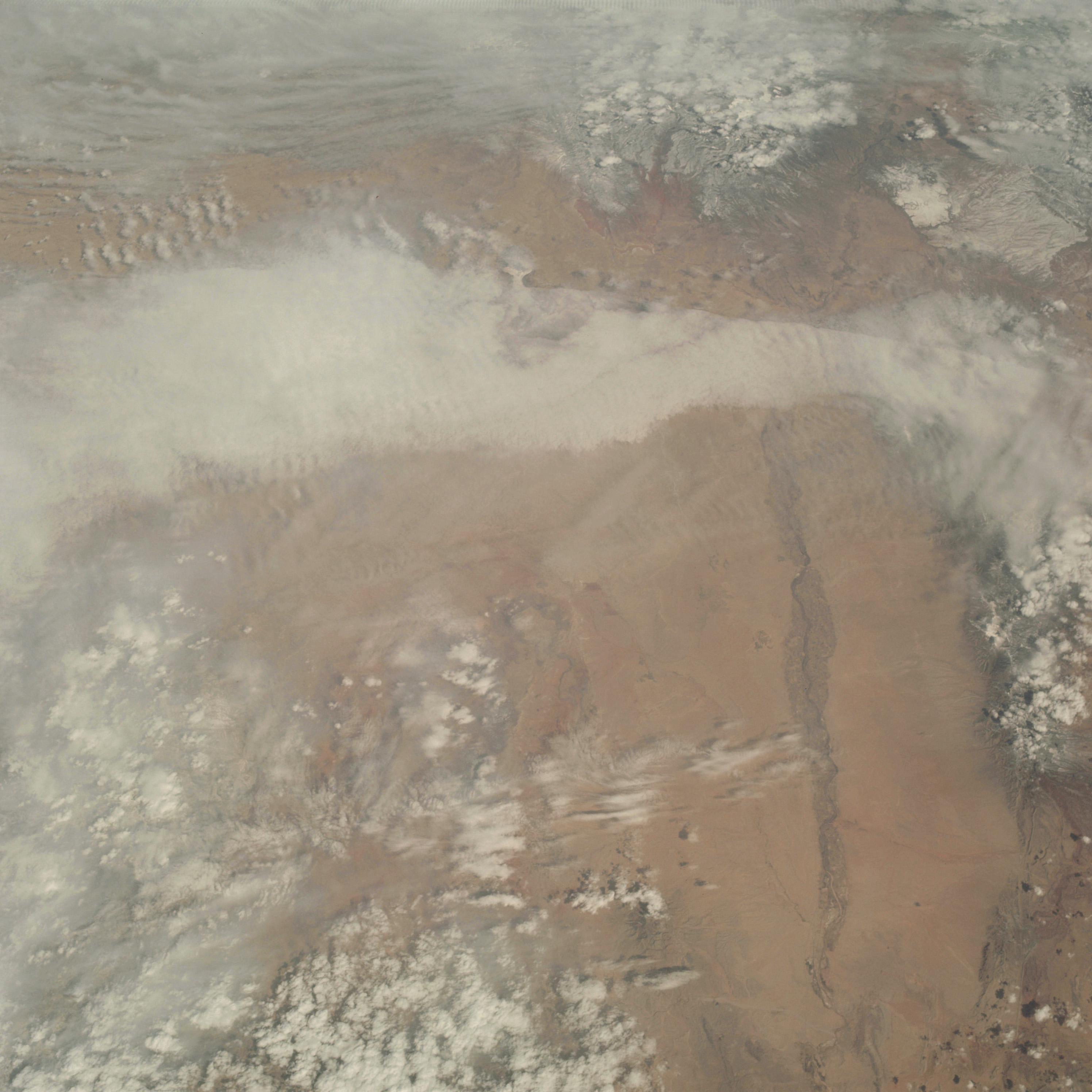 | AS09-22-3445 GEOGRAPHY/CARTOGRAPHY: United States, New Mexico, Rio Grande Valley, Manzano, Sandia, and Jemez Mountains, Cities of Albuquerque and Santa Fe. GEOLOGY/HYDROLOGY: Quaternary alluvium basin deposit. AGRICULTURE: Field patterns along Rio Grande River. FORESTRY: Desert shrubform with mixed conifers at higher elevations. METEOROLOGY: Cirro-stratus, strato-cumulus. Image credit: Image Science and Analysis Laboratory, NASA-Johnson Space Center. |
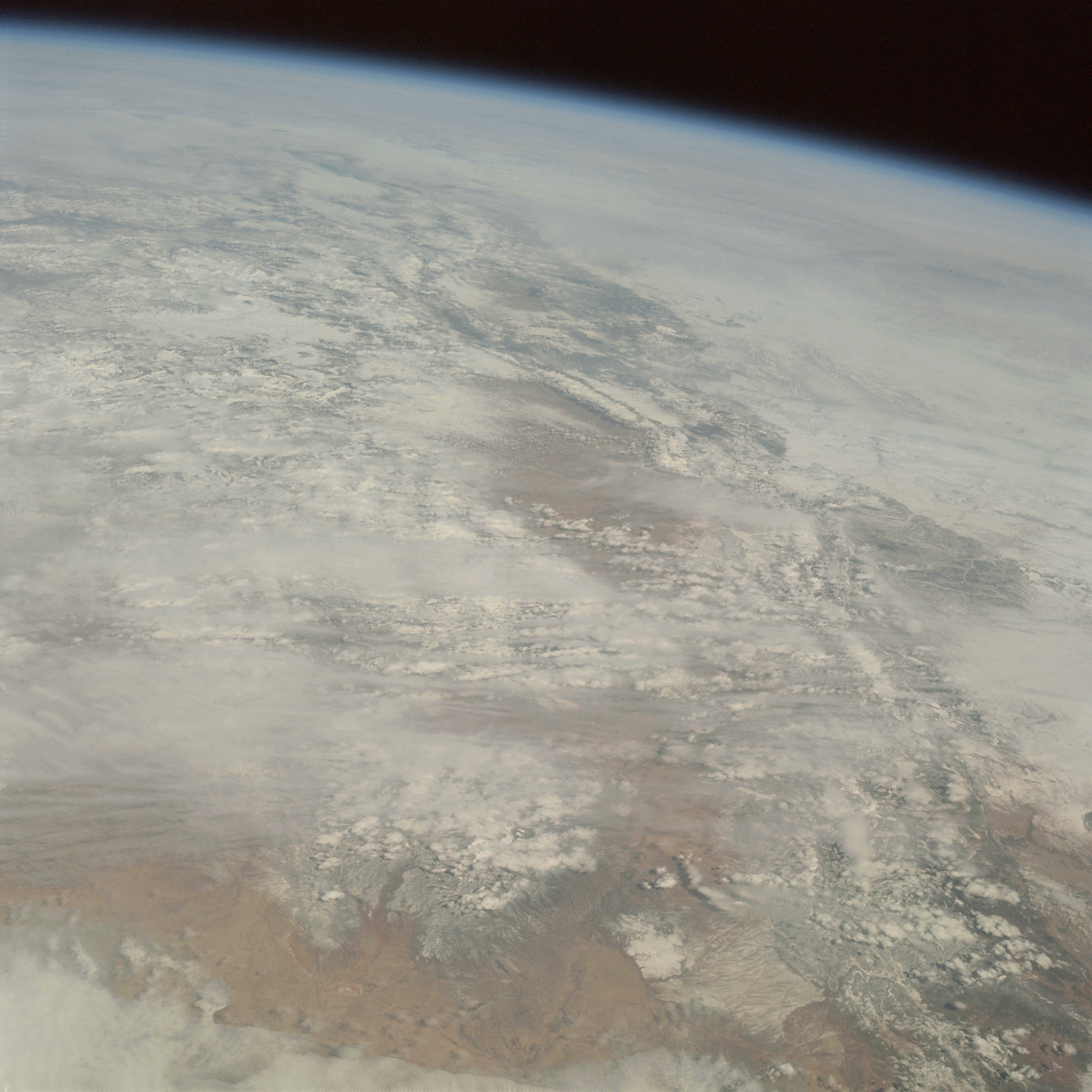 | AS09-22-3446 GEOGRAPHY/CARTOGRAPHY: United States, Oblique view looking north from New Mexico into Colorado, Wyoming, Nebraska, and South Dakota, Rio Grande, Rocky Mountains, High Plains, Santa Fe GEOLOGY/HYDROLOGY: Complex mountains and alluvium deposits. METEOROLOGY: Cirro-stratus, strato-cumulus, extensive snow cover in mountain areas and high plains region. Image credit: Image Science and Analysis Laboratory, NASA-Johnson Space Center. |
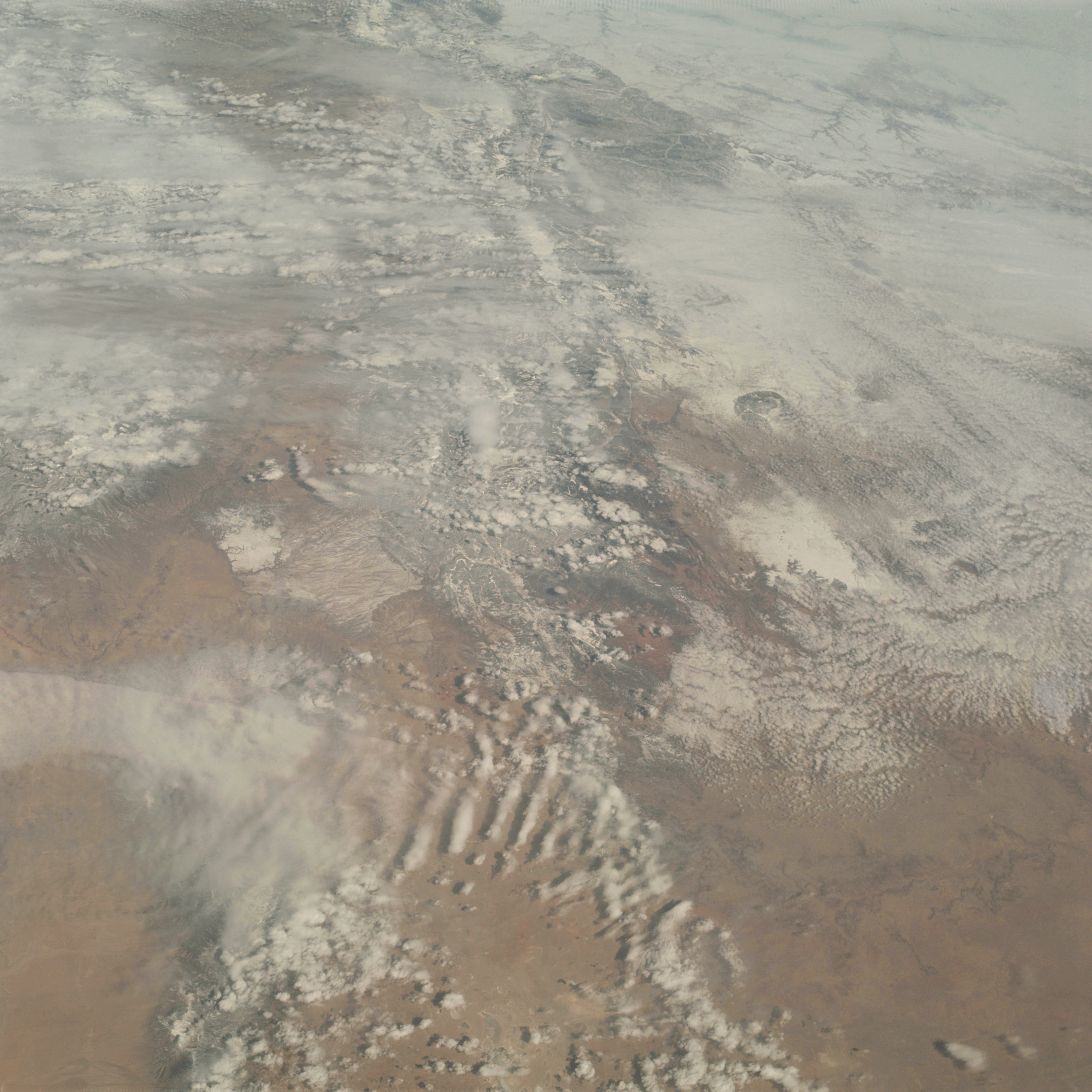 | AS09-22-3447 GEOGRAPHY/CARTOGRAPHY: United States, New Mexico, Colorado, Sandia Mountains, Sangre de Cristo Mountains, Rio Grande Valley, Cities of Santa Fe and Pueblo. GEOLOGY/HYDROLOGY: Complex mountains and alluvium deposits. AGRICULTURE: Scattered field patterns along Rio Grande Valley. FORESTRY: Desert shrubform with mixed conifers at higher elevations. METEOROLOGY: Cirro-stratus, strato-cumulus, alto-cumulus. Image credit: Image Science and Analysis Laboratory, NASA-Johnson Space Center. |
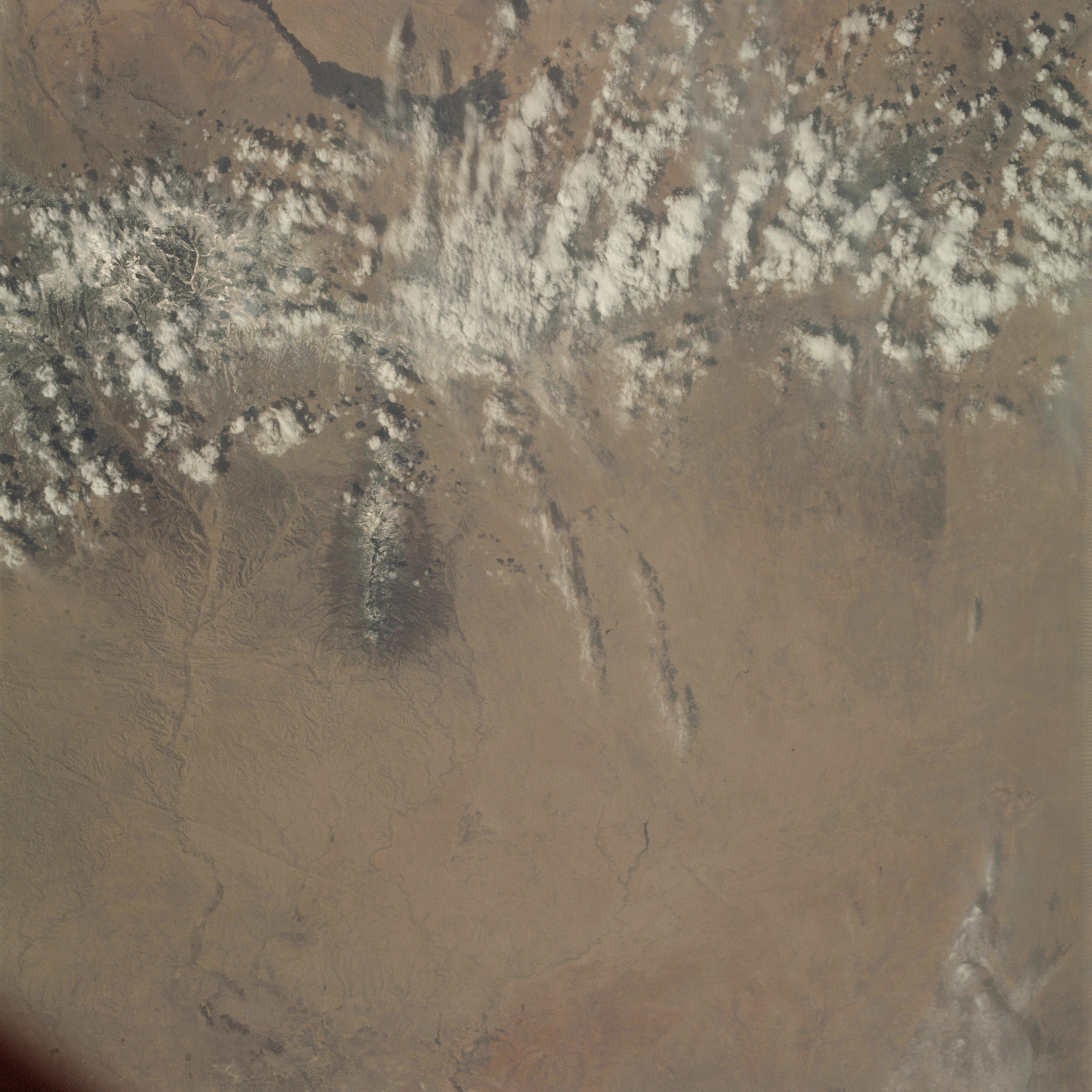 | AS09-22-3448 GEOGRAPHY/CARTOGRAPHY: United States, New Mexico, Sacramento Mountains, Rio Honde River, Capitan Peak GEOLOGY/HYDROLOGY: Basin and. Range Province, quaternary alluvium, plains region. AGRICULTURE: Field patterns visible near Roswell, along Pecos River. FORESTRY: Desert shrubform with mixed conifers at higher elevations. METEOROLOGY: Cumulus humilis, snow cover in higher elevations of mountains. Image credit: Image Science and Analysis Laboratory, NASA-Johnson Space Center. |
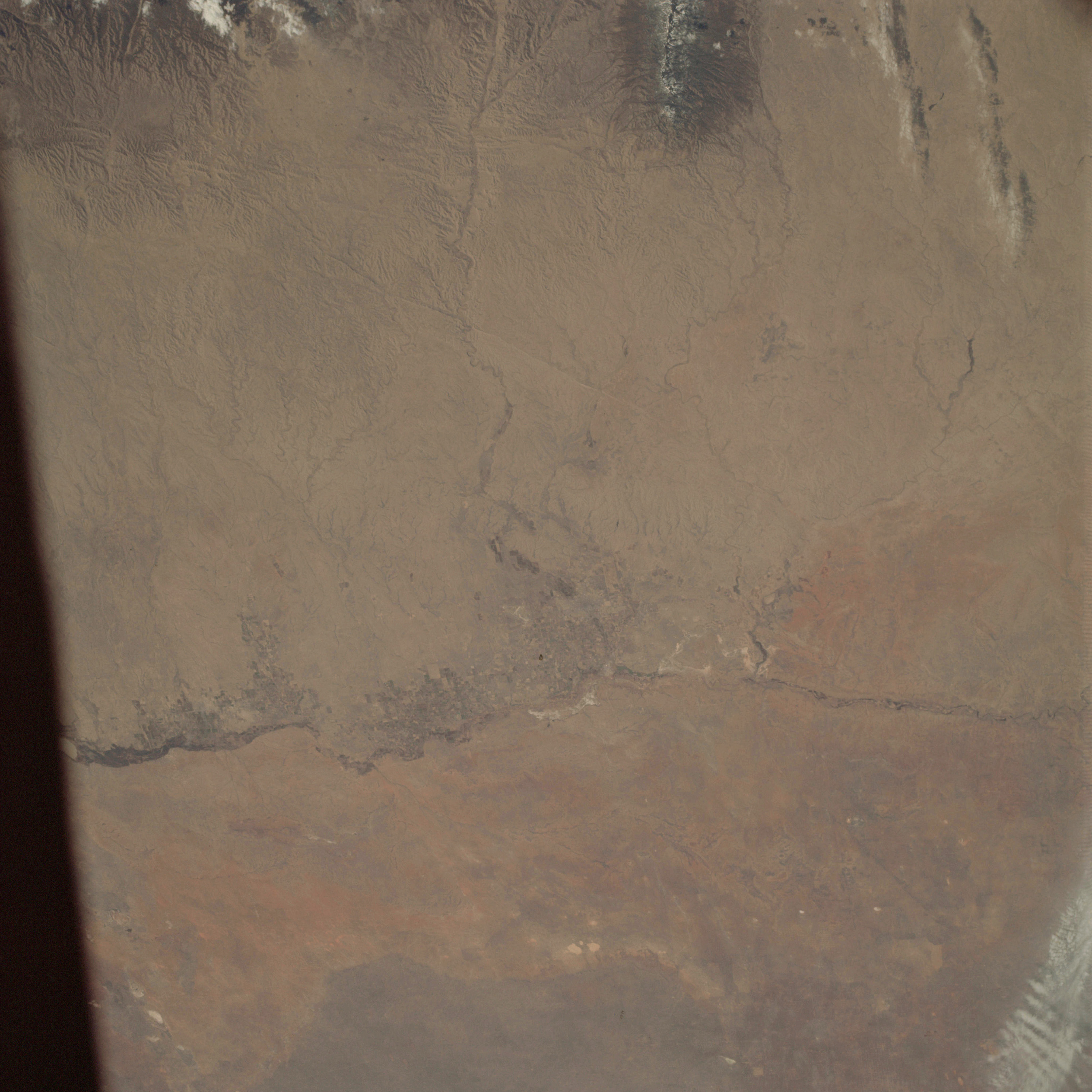 | AS09-22-3449 GEOGRAPHY/CARTOGRAPHY: United States, New Mexico, Pecos and Rio Honde Rivers, Capitan Peak, Town of Roswell. GEOLOGY/HYDROLOGY: Great Plains province and limestone plateau caprock platform. AGRICULTURE: Heavy concentration of field patterns along Pecos River. FORESTRY: Desert, shrubform with conifers at higher elevations. METEOROLOGY: Cirro-cumulus, snow cover at Capitan Peak. Image credit: Image Science and Analysis Laboratory, NASA-Johnson Space Center. |
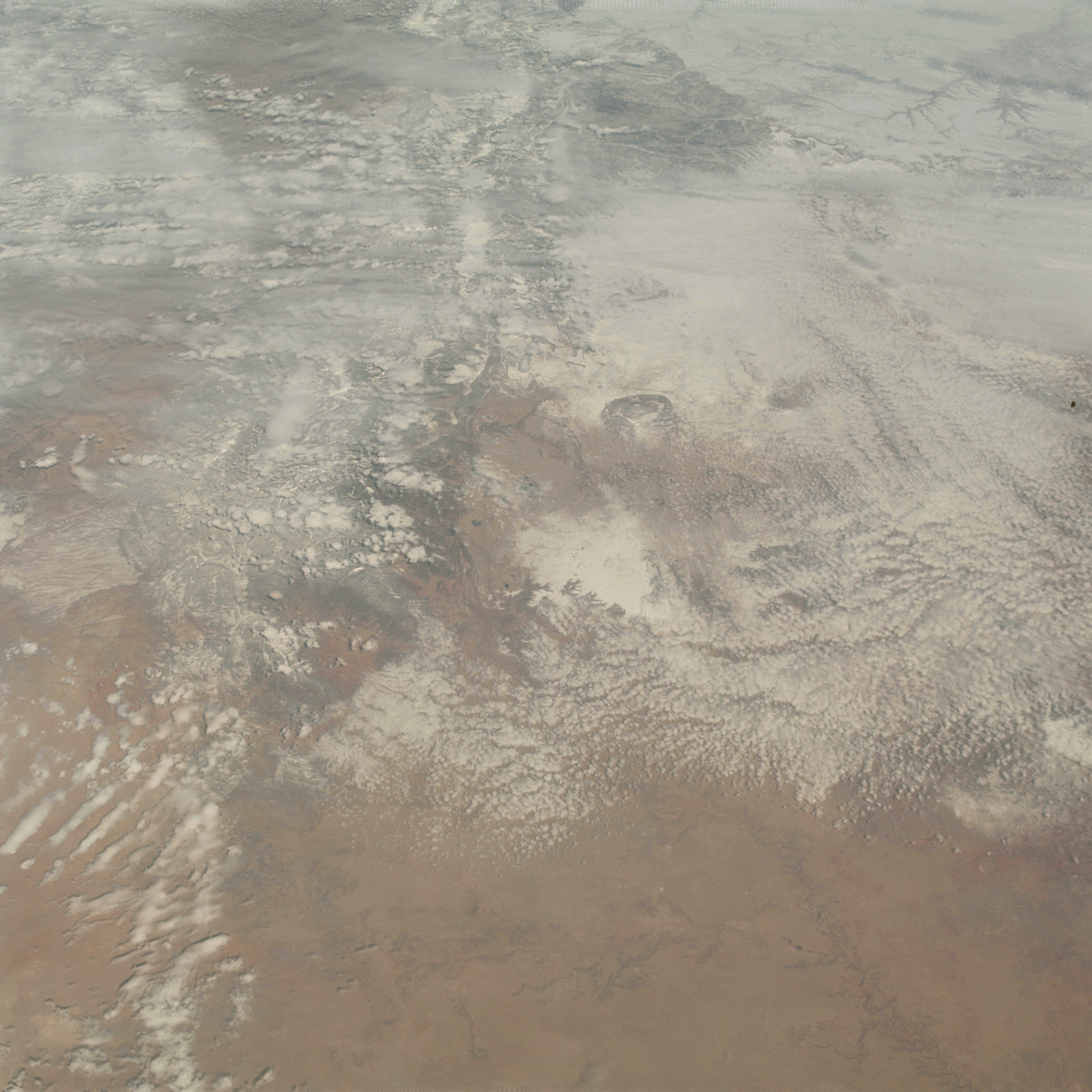 | AS09-22-3450 GEOGRAPHY/CARTOGRAPHY: United States, View looking north from New Mexico, and Texas into Colorado, Oklahoma, and Kansas, Sangre de Cristo Mountains, Estacado Plains, High Plains, City of Pueblo. GEOLOGY/HYDROLOGY: Central Plains region. AGRICULTURE: Range lands. FORESTRY: Desert shrubform with conifers at higher elevations. METEOROLOGY: Cumulus humilis, alto-cumulus, snow cover in mountain areas and High Plains region. Image credit: Image Science and Analysis Laboratory, NASA-Johnson Space Center. |
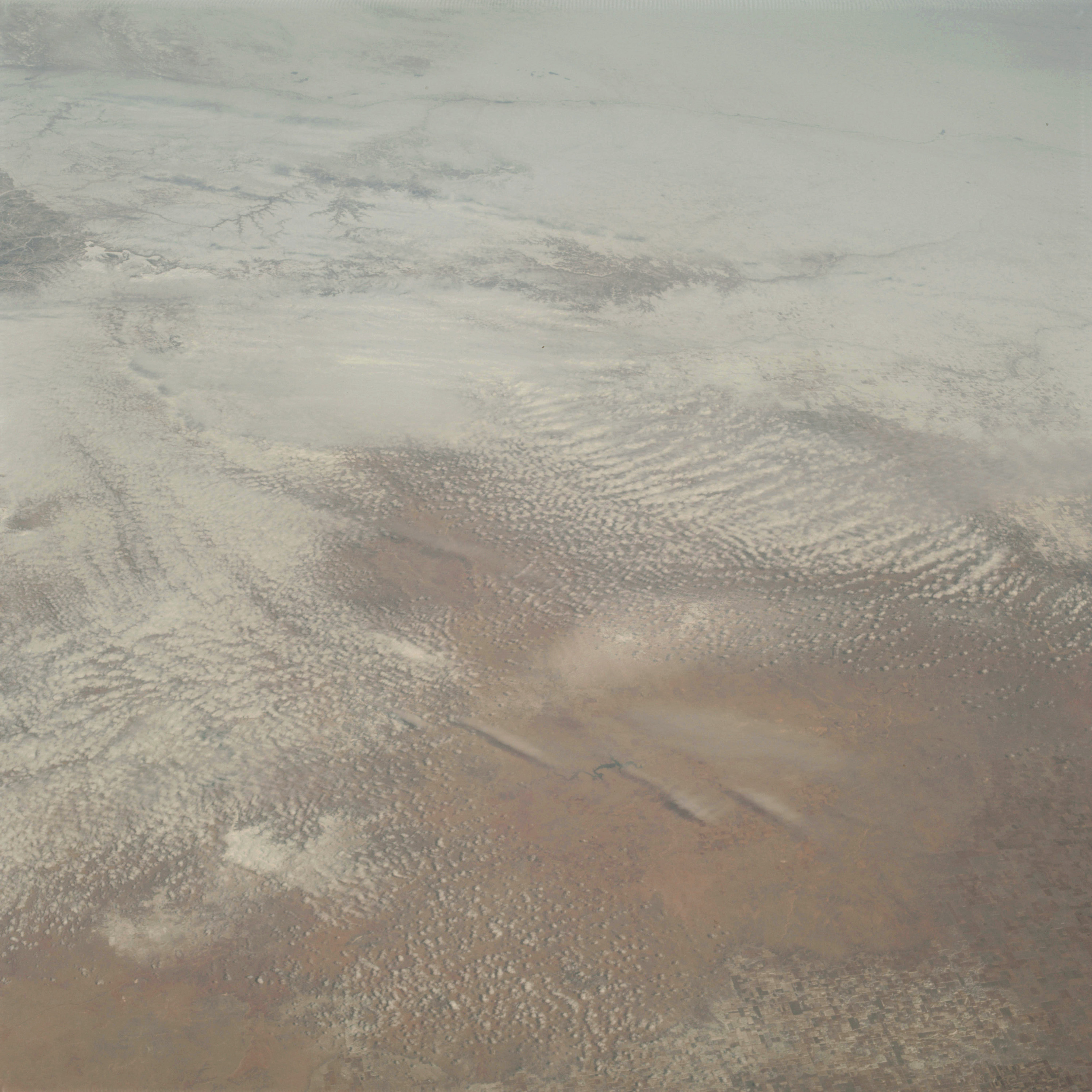 | AS09-22-3451 GEOGRAPHY/CARTOGRAPHY: United States, view looking north from New Mexico and Texas into Oklahoma, Kansas and Colorado, High Plains, Red Hills, Arkansas River, Amarillo, Buffalo Lake. GEOLOGY/HYDROLOGY: Central Plains region. AGRICULTURE: Heavy concentration of field patterns, some snow covered. FORESTRY: Desert shrubform with range grasses METEOROLOGY: Cirrus, alto-cumulus, extensive snow cover in High Plains. Image credit: Image Science and Analysis Laboratory, NASA-Johnson Space Center. |
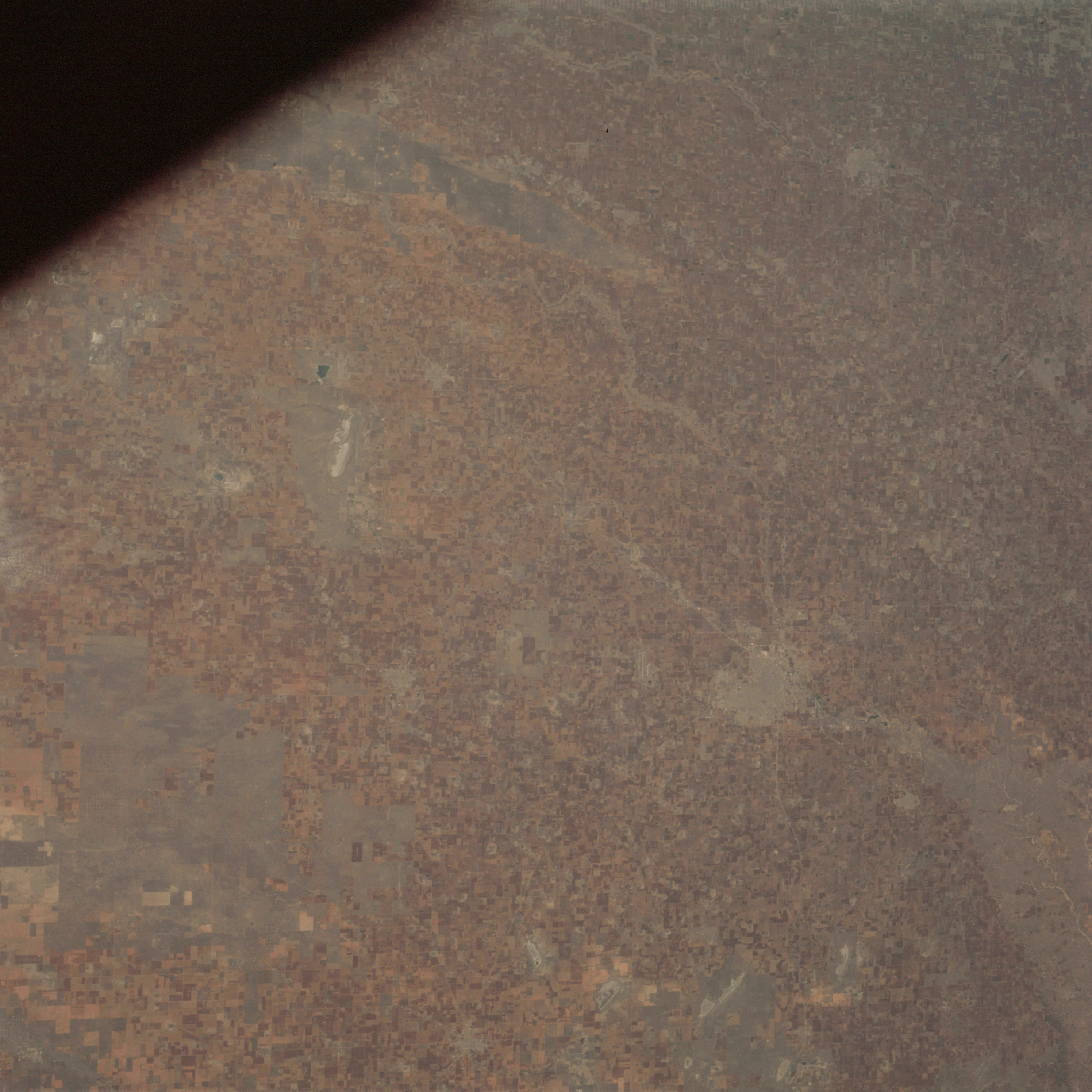 | AS09-22-3452 GEOGRAPHY/CARTOGRAPHY: United States, Texas, Lubbock, Estacado Plains. GEOLOGY/HYDROLOGY: Limestone plains region. AGRICULTURE: Extensive dryland field patterns and pasture lands. FORESTRY: Deciduous shrubform with range grasses. Image credit: Image Science and Analysis Laboratory, NASA-Johnson Space Center. |
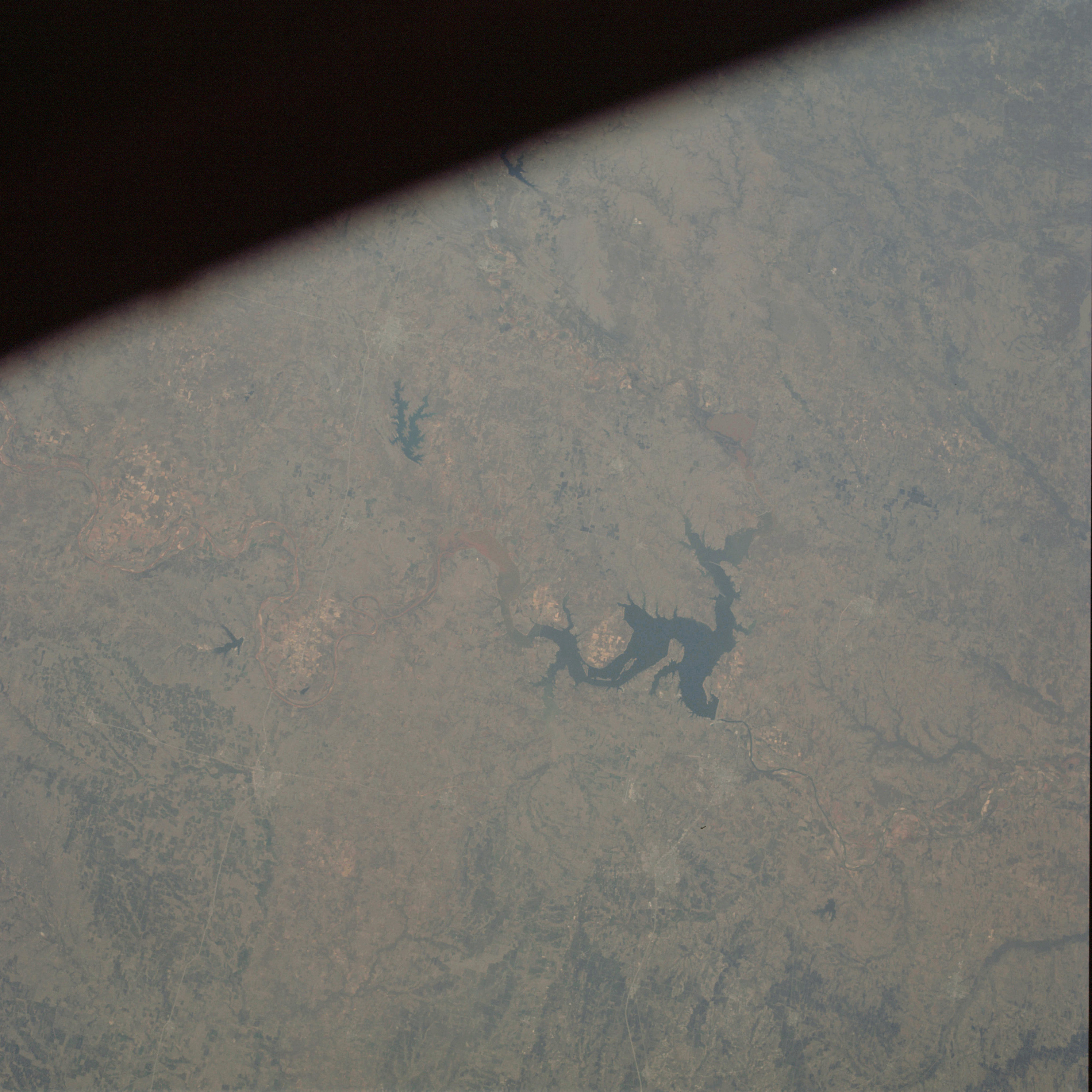 | AS09-22-3453 GEOGRAPHY/CARTOGRAPHY: United States, Texas, Oklahoma, Lake Texoma, Red River, Towns of Durant, Denison, and Sherman. GEOLOGY/HYDROLOGY: Central Plains region. AGRICULTURE: Scattered areas of heavy cultivation. FORESTRY: Deciduous shrubform changing to intermediate size hardwood stands along drainage. Image credit: Image Science and Analysis Laboratory, NASA-Johnson Space Center. |
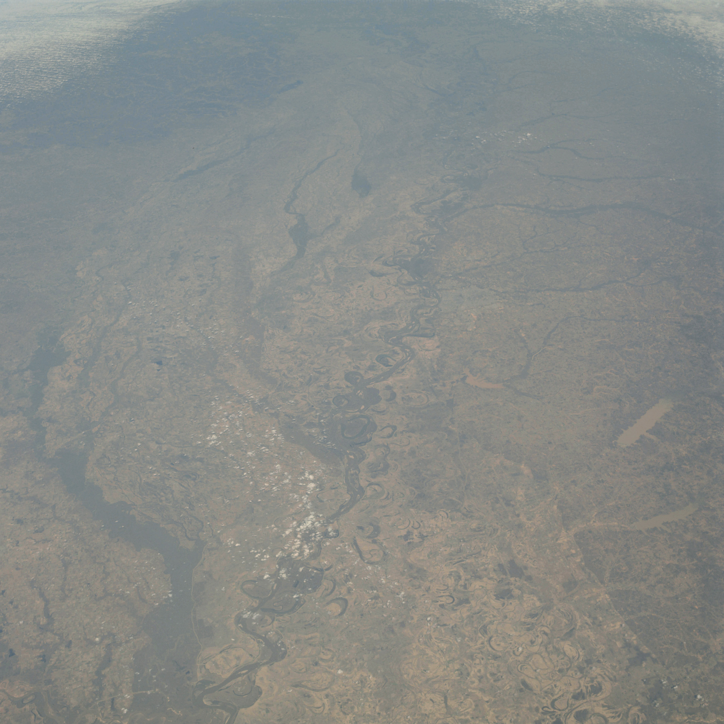 | AS09-22-3454 GEOGRAPHY/CARTOGRAPHY: United States, view looking from Arkansas and Mississippi, north up the Mississippi River Valley into Illinois and Missouri, Lakes Sardis and Enid, City of Memphis, Towns of Clarksdale and Blytheville. GEOLOGY/HYDROLOGY: Floodplain region and Central Plain. AGRICULTURE: Extremely heavy cultivation, field patterns of variable size and shape. FORESTRY: Mixed pine/hardwood uplands, hardwood bottomlands. METEOROLOGY: Cumulus. Image credit: Image Science and Analysis Laboratory, NASA-Johnson Space Center. |
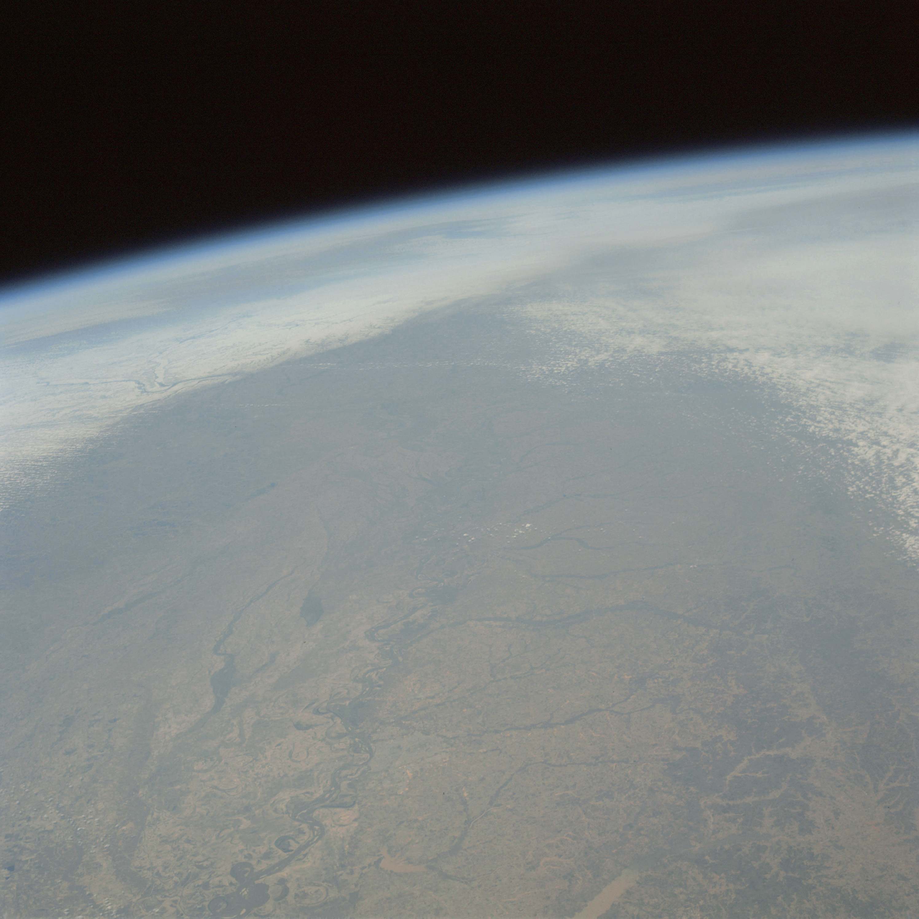 | AS09-22-3455 GEOGRAPHY/CARTOGRAPHY: United States, view looking from Arkansas and Mississippi north up the Mississippi River Valley into Illinois and Missouri, Junctions of the Missouri, Illinois and Ohio Rivers with the Mississippi River is visible, Cities of Memphis and St Louis. GEOLOGY/HYDROLOGY: Flood plain deposit and Central Plains. AGRICULTURE: Heavy cultivation, numerous field patterns. FORESTRY: Mixed pine/hardwood uplands with hardwood bottomlands. METEOROLOGY: Alto-cumulus, snow cover north of St, Louis through south-central Illinois. Image credit: Image Science and Analysis Laboratory, NASA-Johnson Space Center. |
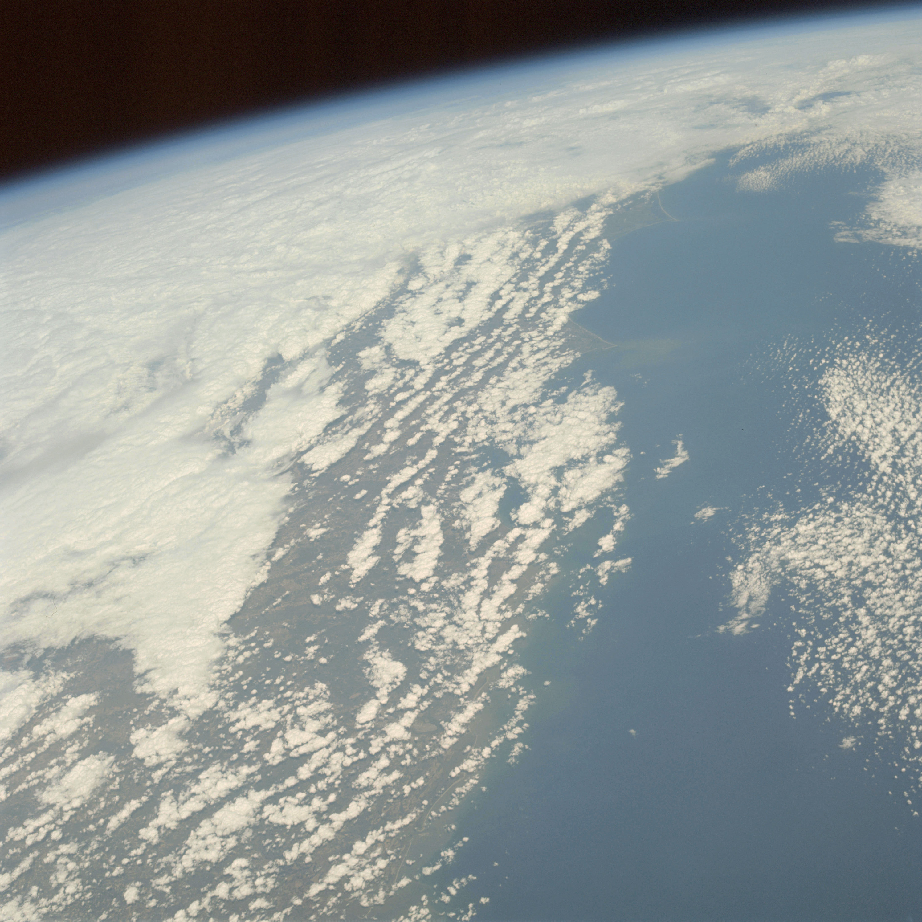 | AS09-22-3456 GEOGRAPHY/CARTOGRAPHY: United States, view looking northwest along East Coast from near Savannah, Georgia, Capes Fear and Lookout. GEOLOGY/HYDROLOGY: Coastal plain region. METEOROLOGY: Nimbus-stratus, alto-cumulus. OCEANOGRAPHY: Atlantic Ocean, water tonal variations extends into offshore zone. Image credit: Image Science and Analysis Laboratory, NASA-Johnson Space Center. |
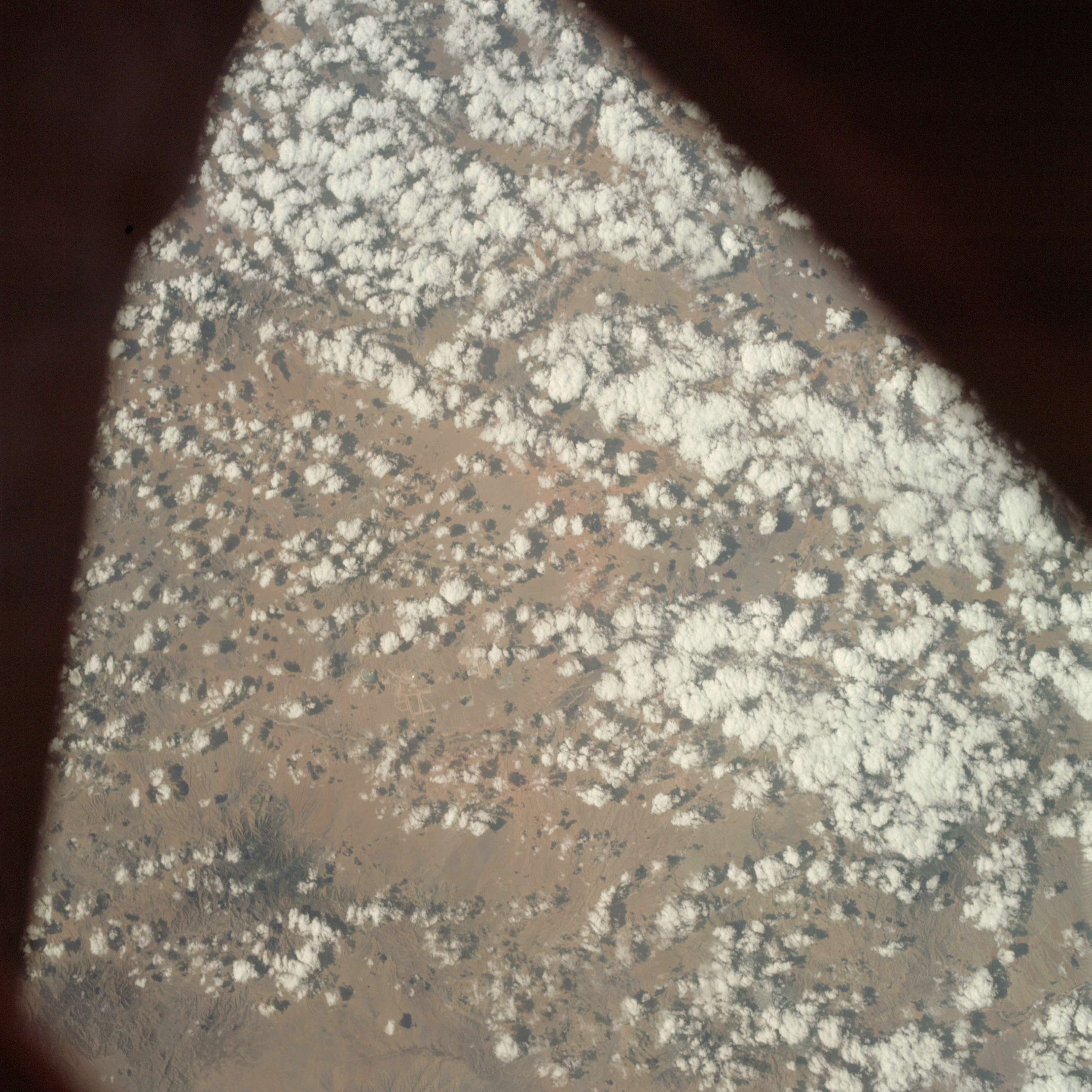 | AS09-22-3457 GEOGRAPHY/CARTOGRAPHY: United States, Arizona Area south of Tucson, Town of Sahuarita and Continental. GEOLOGY/HYDROLOGY: Basin and Range Province. AGRICULTURE: Isolated field patterns visible through clouds. FORESTRY: Desert shrubform. METEOROLOGY: Cumulus humilis. Image credit: Image Science and Analysis Laboratory, NASA-Johnson Space Center. |
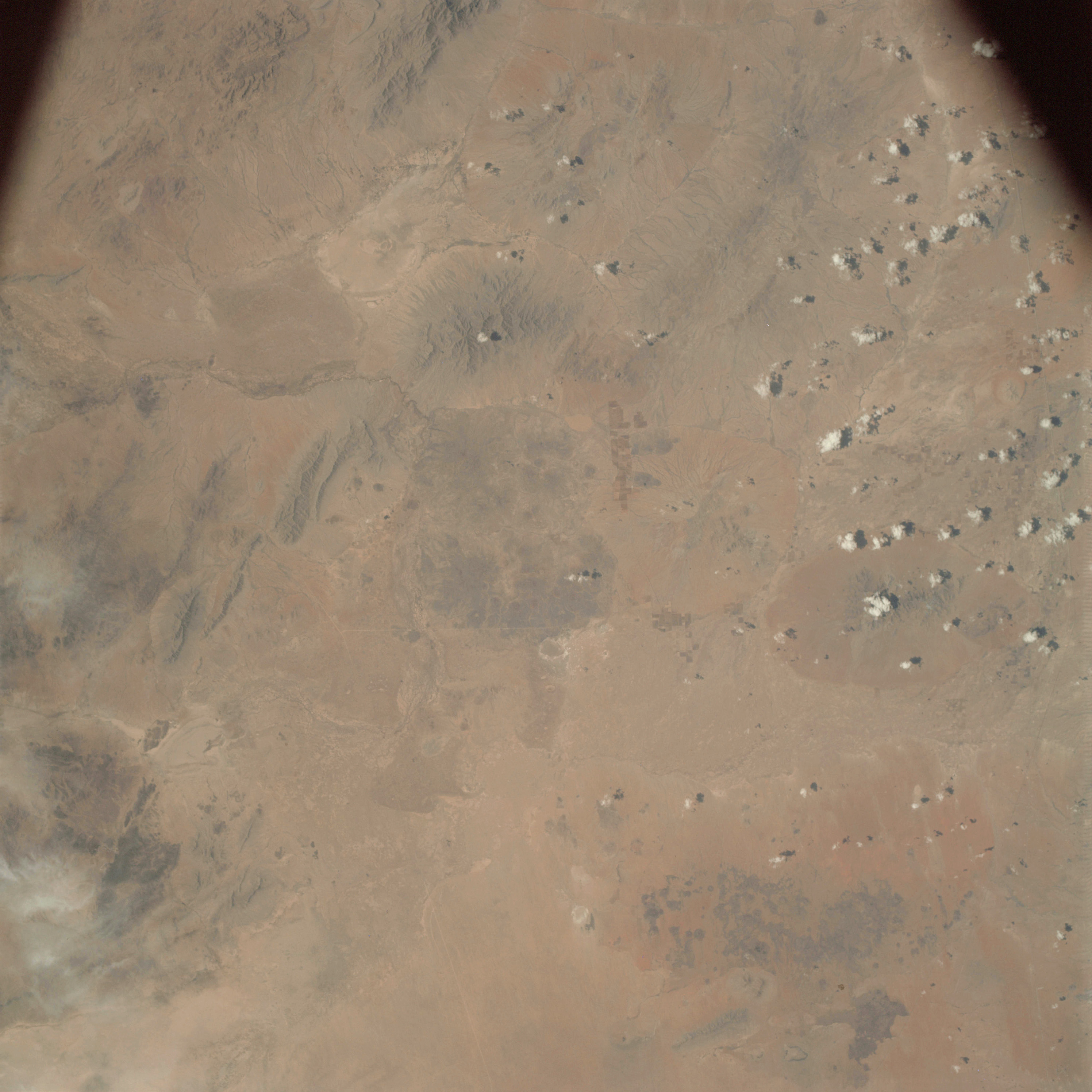 | AS09-22-3458 GEOGRAPHY/CARTOGRAPHY: United States, Mexico, New Mexico, Cedar Mountains, Towns of Columbus and Palomas. GEOLOGY/HYDROLOGY: Basin and Range Province of tertiary volcanics and quaternary alluvium. AGRICULTURE: Isolated areas of moderately heavy cultivation, rectangular field patterns. FORESTRY: Desert shrubform. METEOROLOGY: Cumulus humilis, cirrus fibratus. Image credit: Image Science and Analysis Laboratory, NASA-Johnson Space Center. |
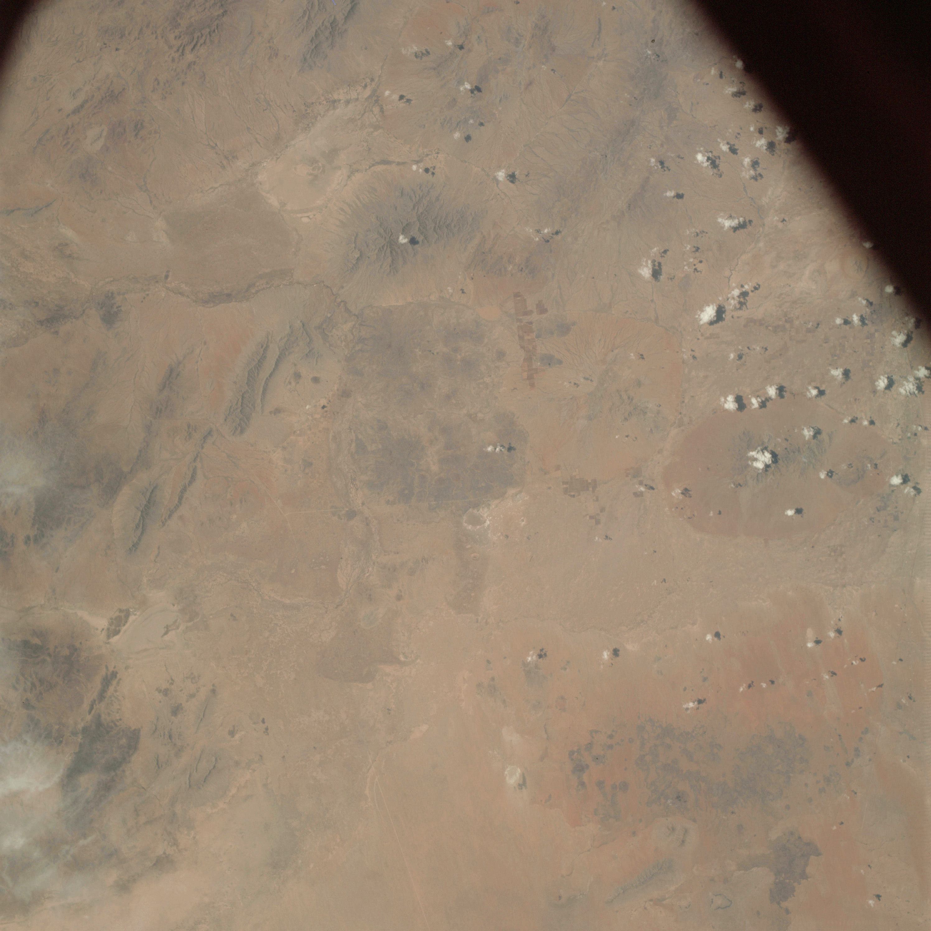 | AS09-22-3459 GEOGRAPHY/CARTOGRAPHY: United States, Mexico, New Mexico, Towns of Columbus and Palomas. GEOLOGY/HYDROLOGY: Basin and Range Province of tertiary volcanics and quaternary alluvium. AGRICULTURE: Isolated areas of moderate to heavy cultivation, large rectangular field patterns. FORESTRY: Desert shrubform. METEOROLOGY: Cumulus humilis, cirrus fibratus. Image credit: Image Science and Analysis Laboratory, NASA-Johnson Space Center. |
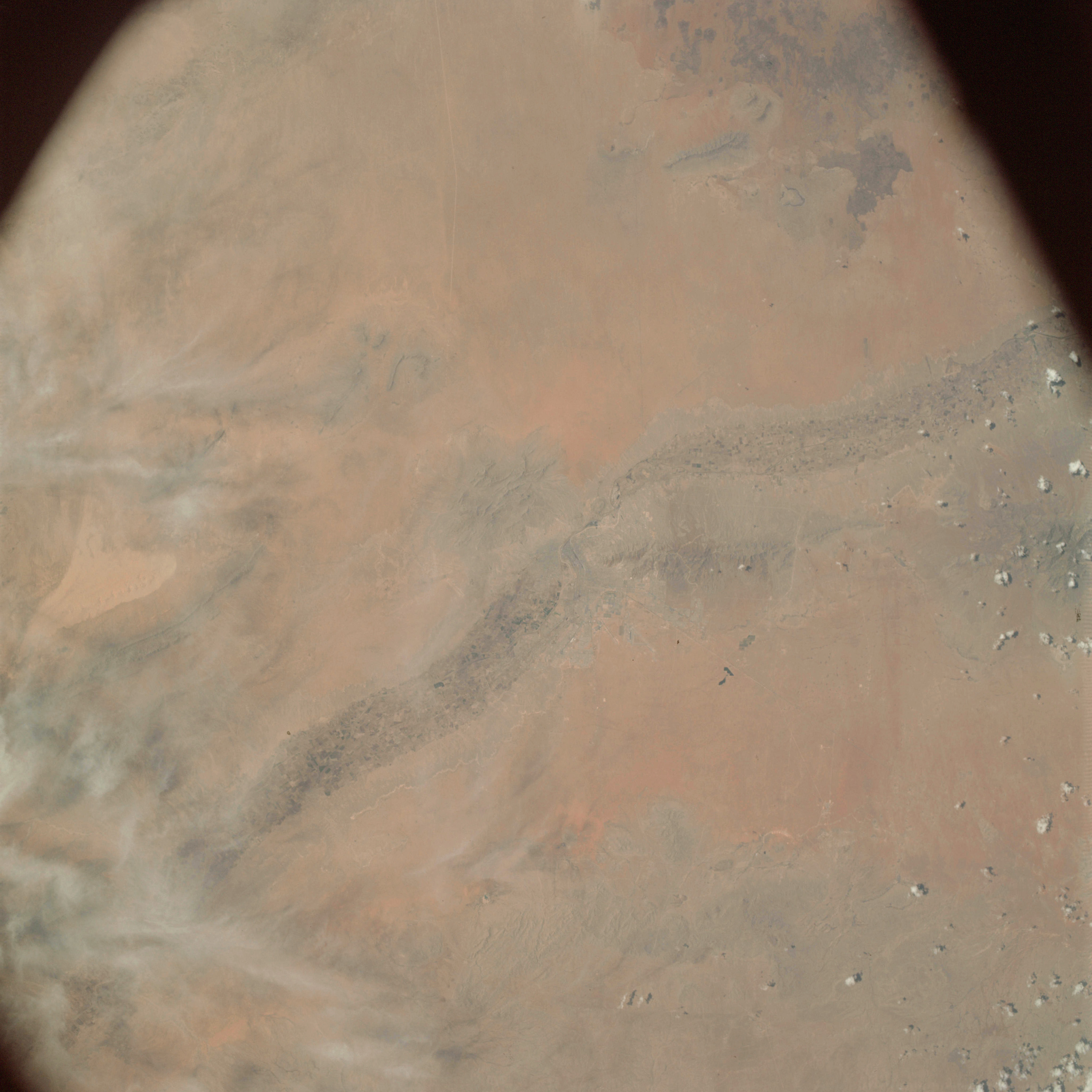 | AS09-22-3460 GEOGRAPHY/CARTOGRAPHY: United States, Mexico, Texas, New Mexico, San Andres Mountains, City of El Paso, Rio Grande Valley. GEOLOGY/HYDROLOGY: Rio Grande floodplain, and Basin and Range Province. AGRICULTURE: Heavy cultivation along Rio Grande River. FORESTRY: Desert shrubform. METEOROLOGY: Cumulus humilis, cirrus fibratus. Image credit: Image Science and Analysis Laboratory, NASA-Johnson Space Center. |
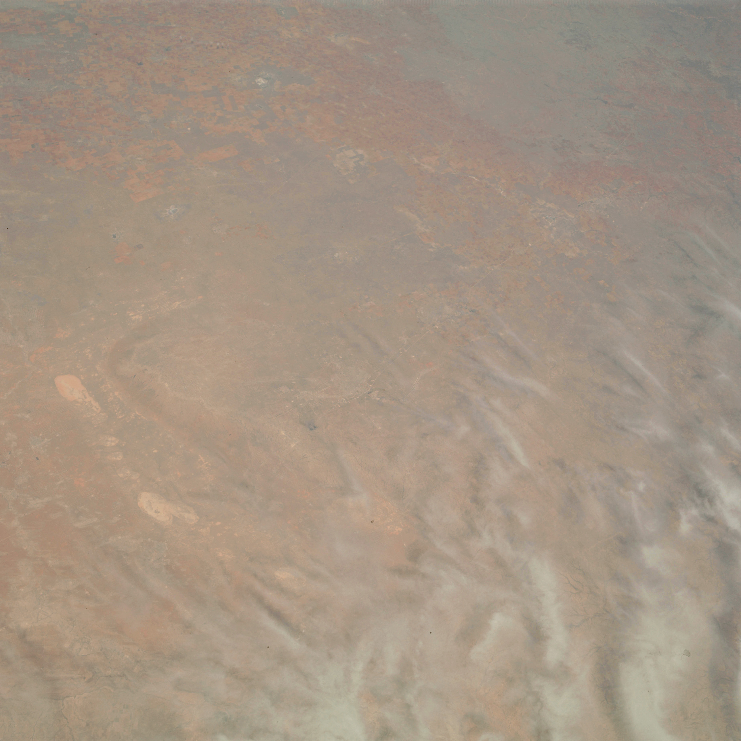 | AS09-22-3461 GEOGRAPHY/CARTOGRAPHY: United States, Texas, Towns of Odessa, Midland, Big Spring, Sweetwater, Lamesa, and Lubbock, Caprock Escarpment. GEOLOGY/HYDROLOGY: Central Basin Platform within the plains region. AGRICULTURE: Heavy concentration of field patterns, primarily range lands. FORESTRY: Deciduous shrubform. METEOROLOGY: Cirrus fibratus. Image credit: Image Science and Analysis Laboratory, NASA-Johnson Space Center. |
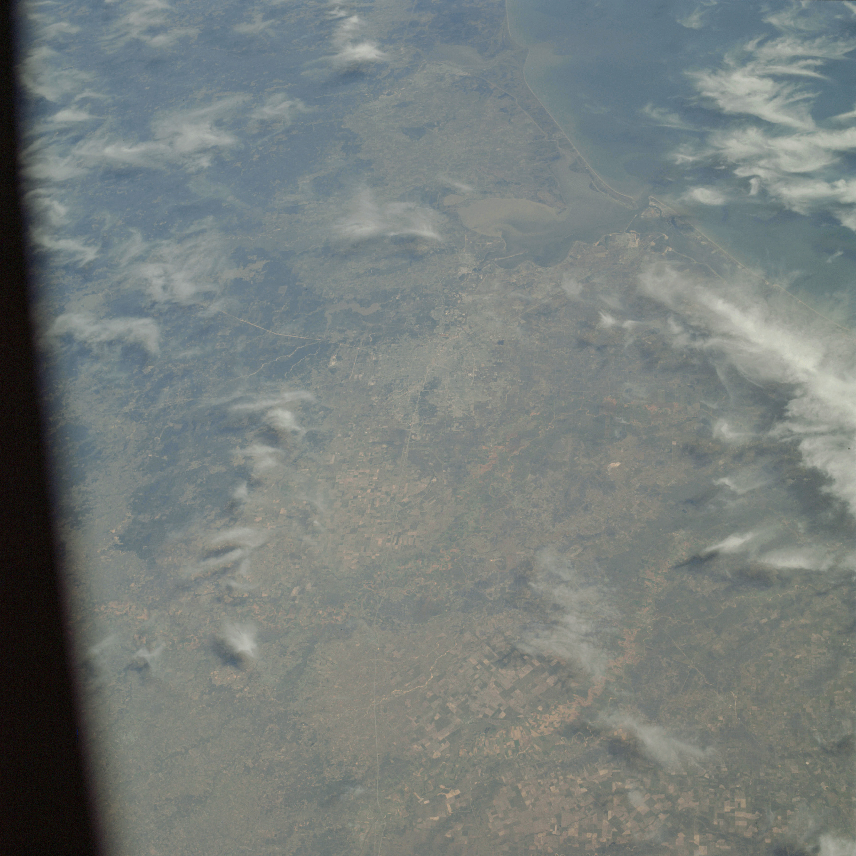 | AS09-22-3462 GEOGRAPHY/CARTOGRAPHY: United States, Texas, Gulf of Mexico, Houston and Galveston Metropolitan areas, Galveston Bay, Beaumont. GEOLOGY/HYDROLOGY: Gulf Coast Plain. AGRICULTURE: Heavy concentration of field patterns, some areas presently under winter cultivation. FORESTRY: Deciduous forests, changing to mixed pine/hardwood with range grass. METEOROLOGY: Cirrus fibratus. OCEANOGRAPHY: Sediments visible in the nearshore zone and Galveston Bay. Image credit: Image Science and Analysis Laboratory, NASA-Johnson Space Center. |
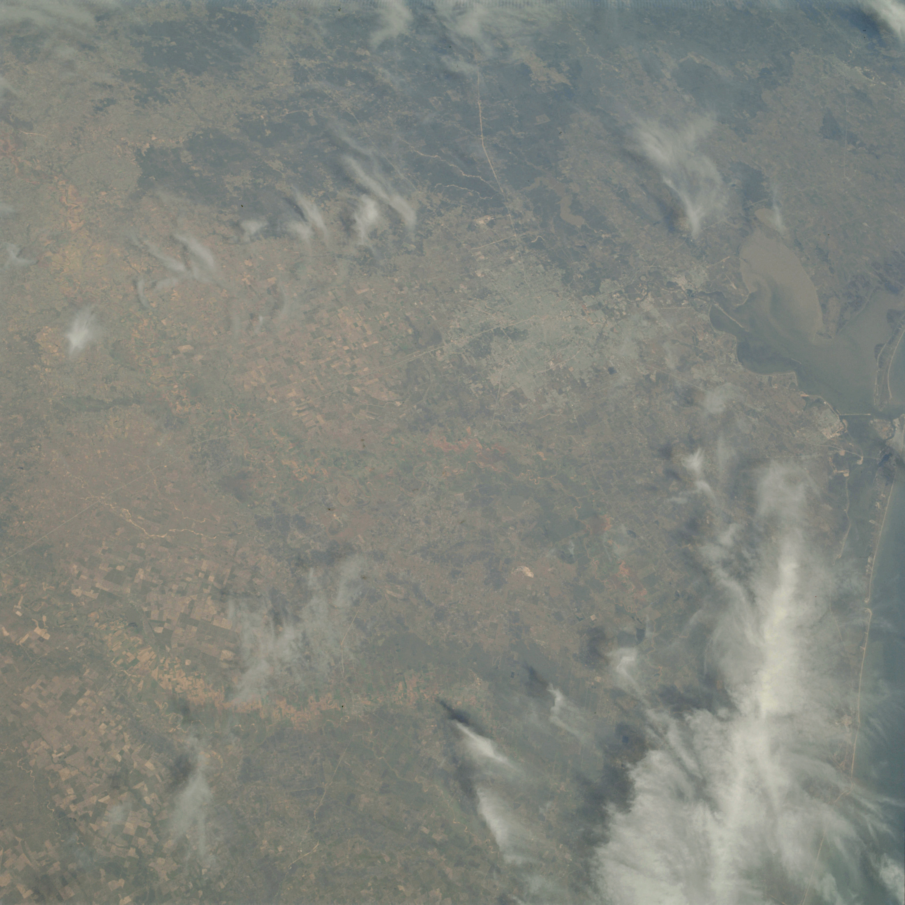 | AS09-22-3463 GEOGRAPHY/CARTOGRAPHY: United States, Texas, Houston and Galveston Metropolitan areas, Galveston and Trinity Bays. GEOLOGY/HYDROLOGY: Gulf Coastal plain. AGRICULTURE: Heavy concentration of field patterns, some under winter cultivation. FORESTRY: Range land with deciduous stands along drainage, changing to mixed pine/hardwood forests. METEOROLOGY: Cirrus fibratus. Image credit: Image Science and Analysis Laboratory, NASA-Johnson Space Center. |
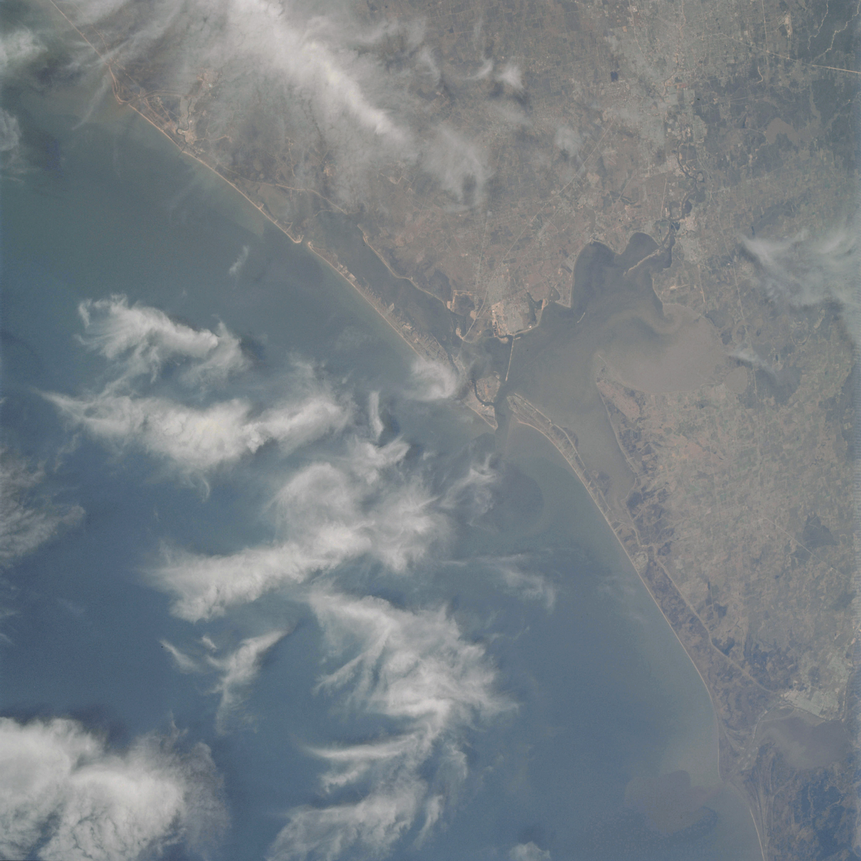 | AS09-22-3464 GEOGRAPHY/CARTOGRAPHY: United States, Texas, Cities of Houston, Galveston and Beaumont, Galveston and Trinity Bays, Sabine Lake, Town of Freeport. GEOLOGY/HYDROLOGY: Coastal Plain and shoreline of emergence. AGRICULTURE: Heavy concentration of field patterns, some under winter cultivation, range grasses. FORESTRY: Intermediate deciduous forests along drainage, mixed pins/hardwood forests. METEOROLOGY: Cirrus fibratus. OCEANOGRAPHY: Gulf of Mexico, possible depth variations visible. Image credit: Image Science and Analysis Laboratory, NASA-Johnson Space Center. |
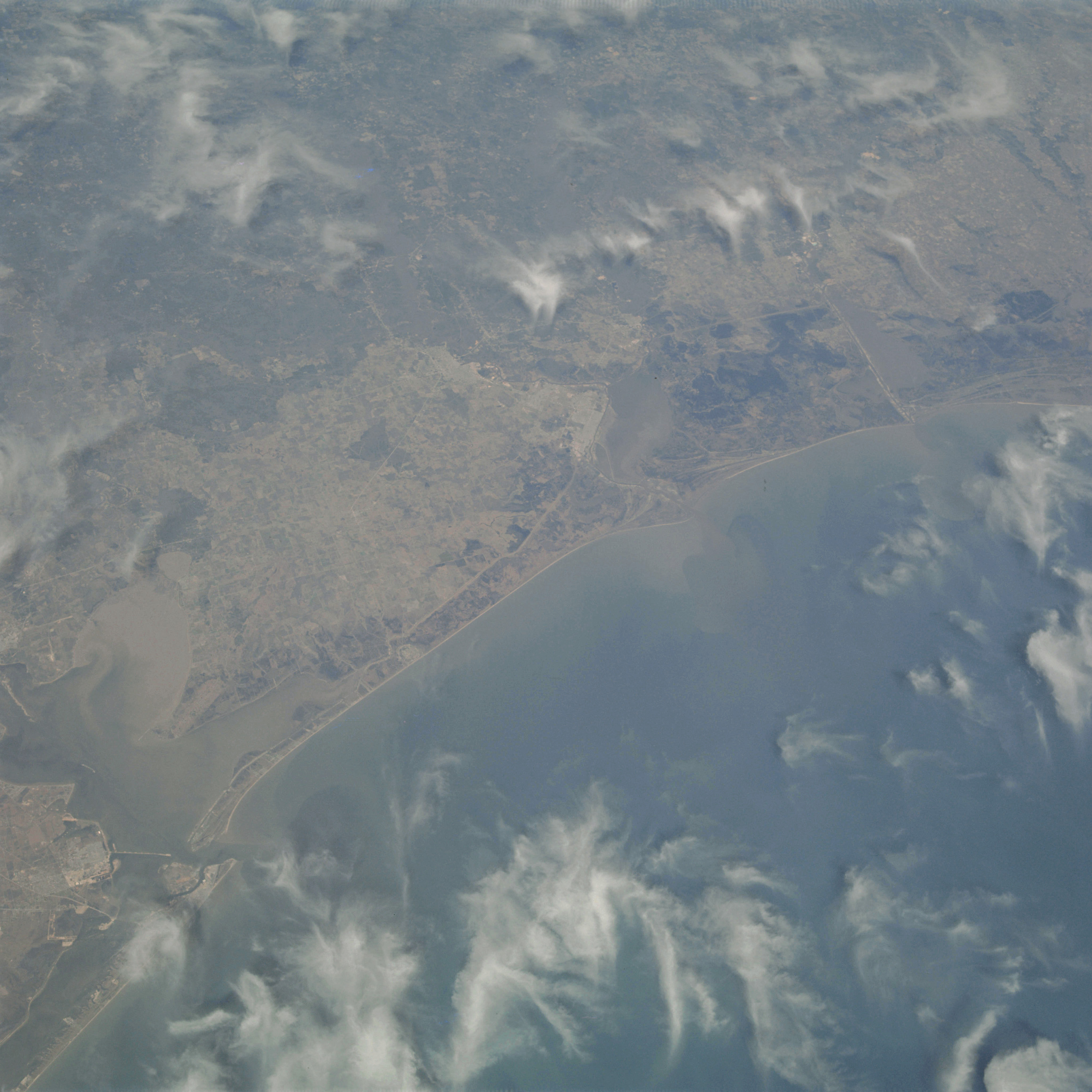 | AS09-22-3465 GEOGRAPHY/CARTOGRAPHY: United States, Texas, Louisiana, Galveston and Trinity Bays, Sabine and Calcasieu Lakes, Galveston, Beaumont, Port Arthur, and Lake Charles. GEOLOGY/HYDROLOGY: Coastal Plain and shoreline of emergence. AGRICULTURE: Heavy field pattern concentration. FORESTRY: Mixed pine/hardwood inland, deciduous forests with range grass along coast. METEOROLOGY: Cirrus fibratus. OCEANOGRAPHY: Gulf of Mexico, possible depth variations visible in the nearshore zone. Image credit: Image Science and Analysis Laboratory, NASA-Johnson Space Center. |
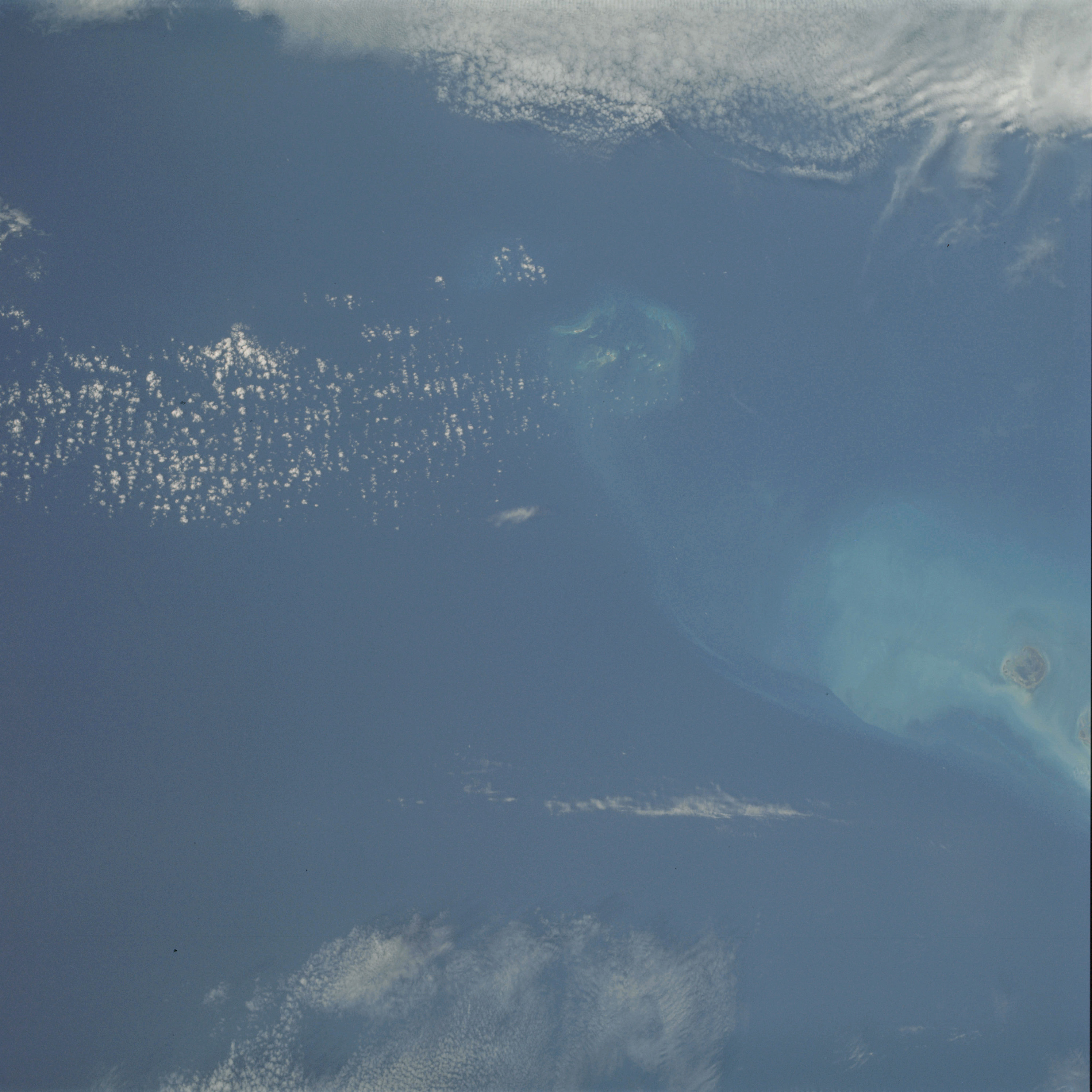 | AS09-22-3466 GEOGRAPHY/CARTOGRAPHY: United States, Florida, Keys, Grand Boca Channel, Marquesas Keys. GEOLOGY/HYDROLOGY: Coral, reefs. METEOROLOGY: Cumulus humilis, cirro-cumulus. OCEANOGRAPHY: Coral reef and coral heads and water color changes in relation to depths. Image credit: Image Science and Analysis Laboratory, NASA-Johnson Space Center. |
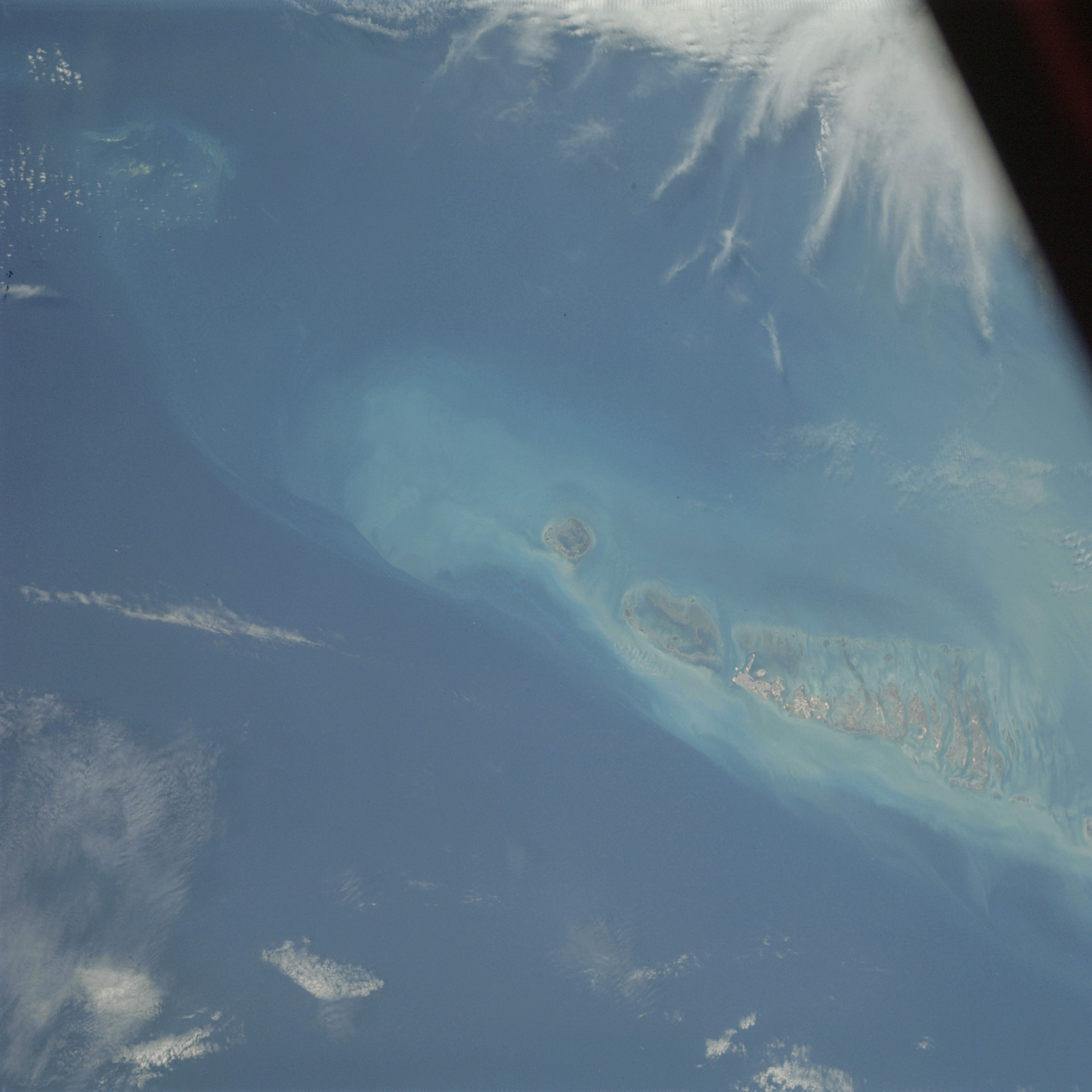 | AS09-22-3467 GEOGRAPHY/CARTOGRAPHY: United States, Florida, Keys, Key West, Marquesas Keys, Grand Boca Channel. GEOLOGY/HYDROLOGY: Coral, reefs. METEOROLOGY: Cumulus humilis, cirro-cumulus. OCEANOGRAPHY: Coral reef and coral heads and water color changes in relation to depths. Image credit: Image Science and Analysis Laboratory, NASA-Johnson Space Center. |
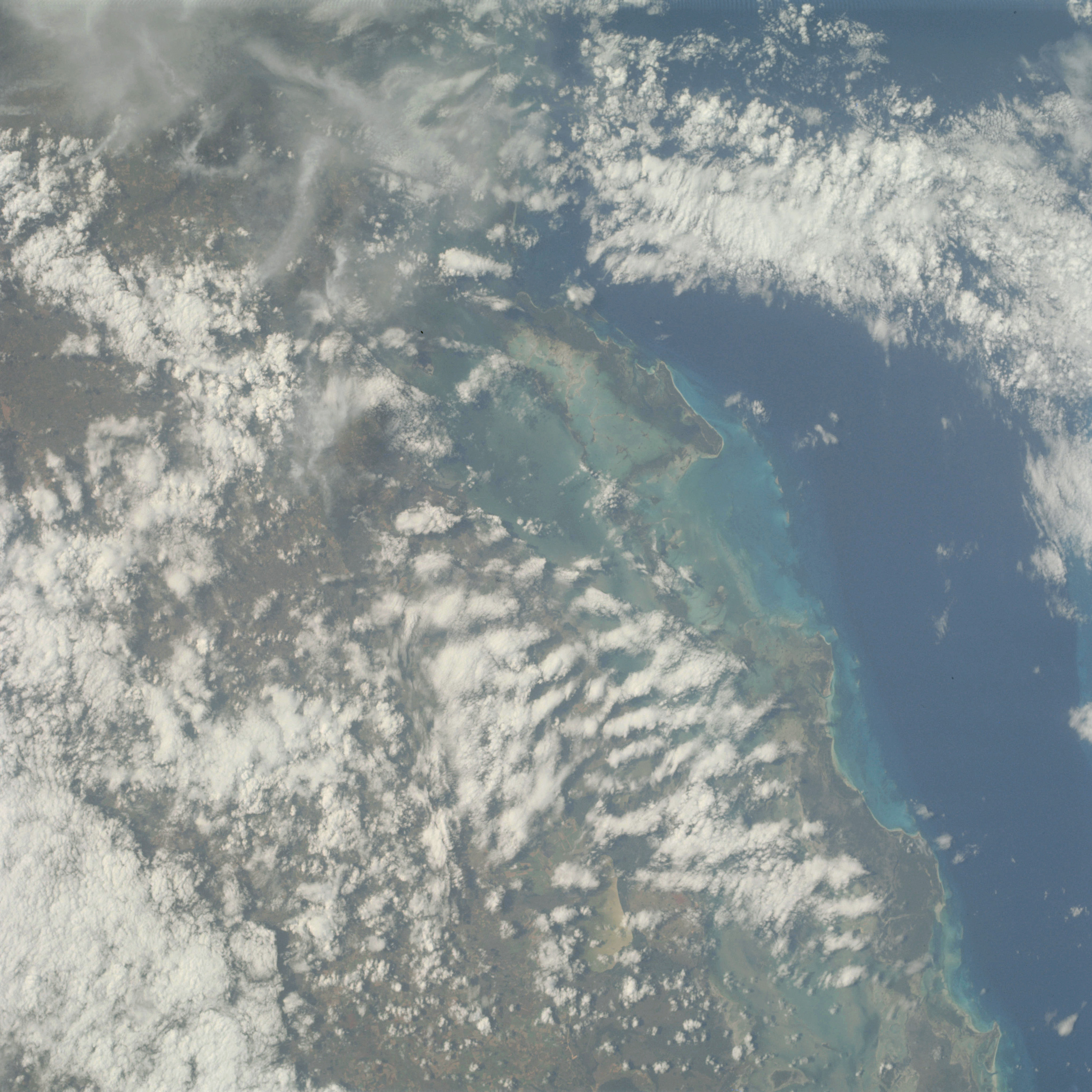 | AS09-22-3468 GEOGRAPHY/CARTOGRAPHY: Cuba, Camaguey, Archipelago, Coco Reef, Rumano Reef, Bay of Jiguey, Town of Moron. GEOLOGY/HYDROLOGY: Coastal plain, coral reefs, and elevated plateau. AGRICULTURE: Numerous large field patterns along coast. FORESTRY: Semi-deciduous broadleaf, broadleaf evergreen and broadleaf deciduous. METEOROLOGY: Cirro-cumulus, cumulus congestus. OCEANOGRAPHY: Caribbean Sea, Old Bahama. Channel, depth variations and coral reef visible. Image credit: Image Science and Analysis Laboratory, NASA-Johnson Space Center. |
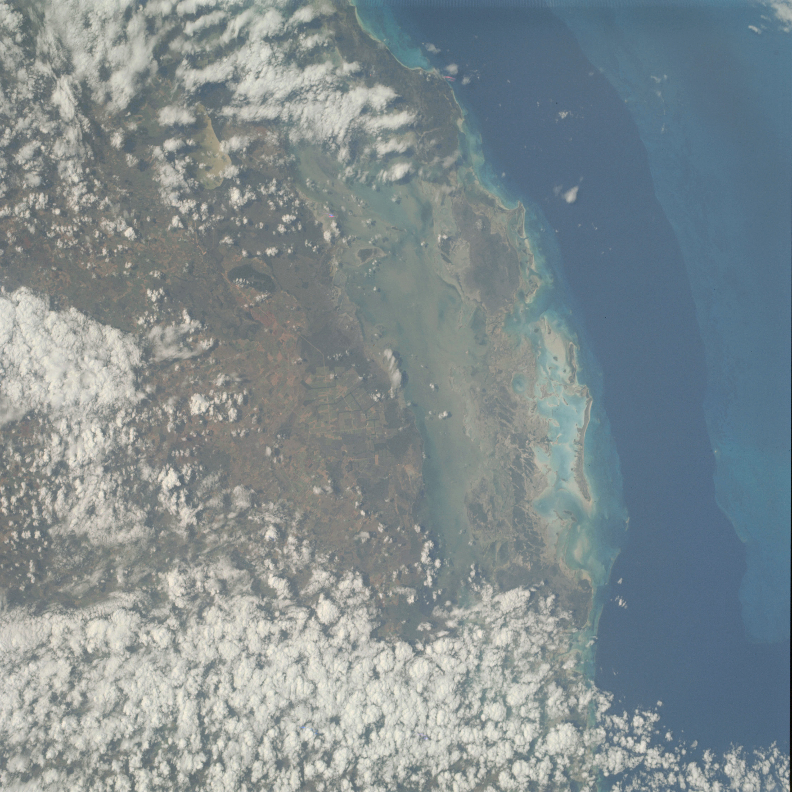 | AS09-22-3469 GEOGRAPHY/CARTOGRAPHY: Cuba, Camaguey, Archipelago, Romano Reef, Bay of Jiguay, Old Bahama Channel. GEOLOGY/HYDROLOGY: Coral reef, coastal plain and interior plateau. AGRICULTURE: Numerous large field patterns along coast. FORESTRY: Semi~deciduous broadleaf, broadleaf evergreen and broadleaf deciduous. METEOROLOGY: Cumulus congestus. OCEANOGRAPHY: Caribbean Sea, Old Bahama Channel, submarine features and color changes with increasing depths visible. Image credit: Image Science and Analysis Laboratory, NASA-Johnson Space Center. |
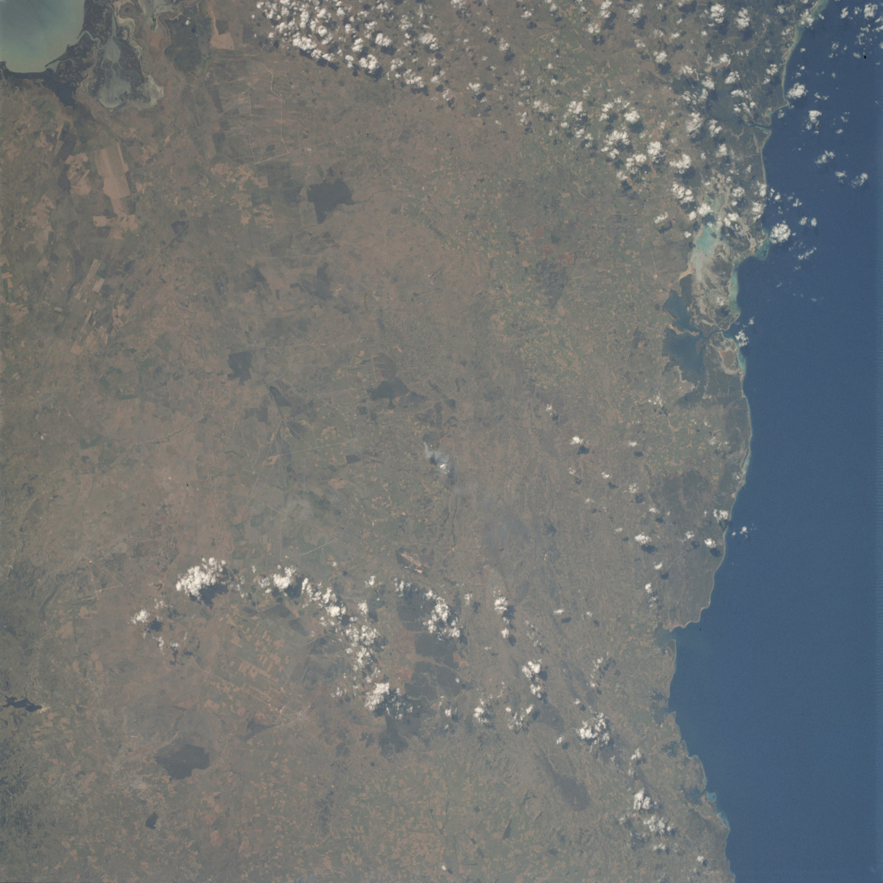 | AS09-22-3470 GEOGRAPHY/CARTOGRAPHY: Cuba, Oriente Province Towns of Holguin and Bayamo. GEOLOGY/HYDROLOGY: Interior plateau. AGRICULTURE: Heavy concentration of field patterns, variable in size and shape. FORESTRY: Mixed broadleaf, deciduous and evergreen. METEOROLOGY: Cumulus humilis. OCEANOGRAPHY: Caribbean Sea, some nearshore areas visible indicating steep gradients. Image credit: Image Science and Analysis Laboratory, NASA-Johnson Space Center. |
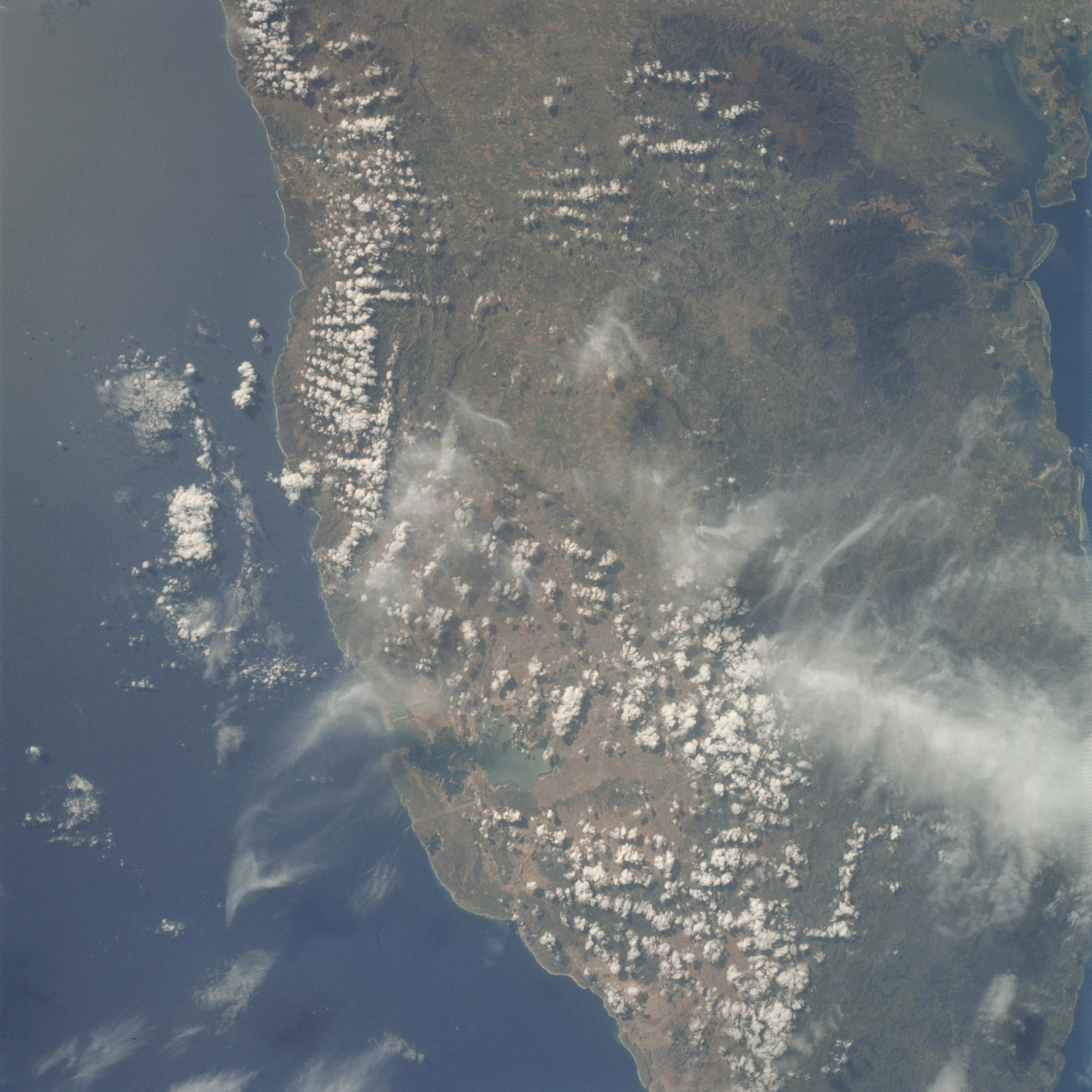 | AS09-22-3471 GEOGRAPHY/CARTOGRAPHY: Cuba, Oriente Province, Guantanamo Bay, Cities of Santiago de Cuba and Guantanamo. GEOLOGY/HYDROLOGY: Complex mountains and elevated plateau region. AGRICULTURE: Heavy concentration of field patterns, variable in size and shape. FORESTRY: Mixed broadleaf, deciduous and evergreen. METEOROLOGY: Cirrus fibratus, cumulus humilis, cumulus congestus. OCEANOGRAPHY: Caribbean Sea, steep nearshore gradients indicated by coastline topography and narrow or non-existent beaches. Image credit: Image Science and Analysis Laboratory, NASA-Johnson Space Center. |
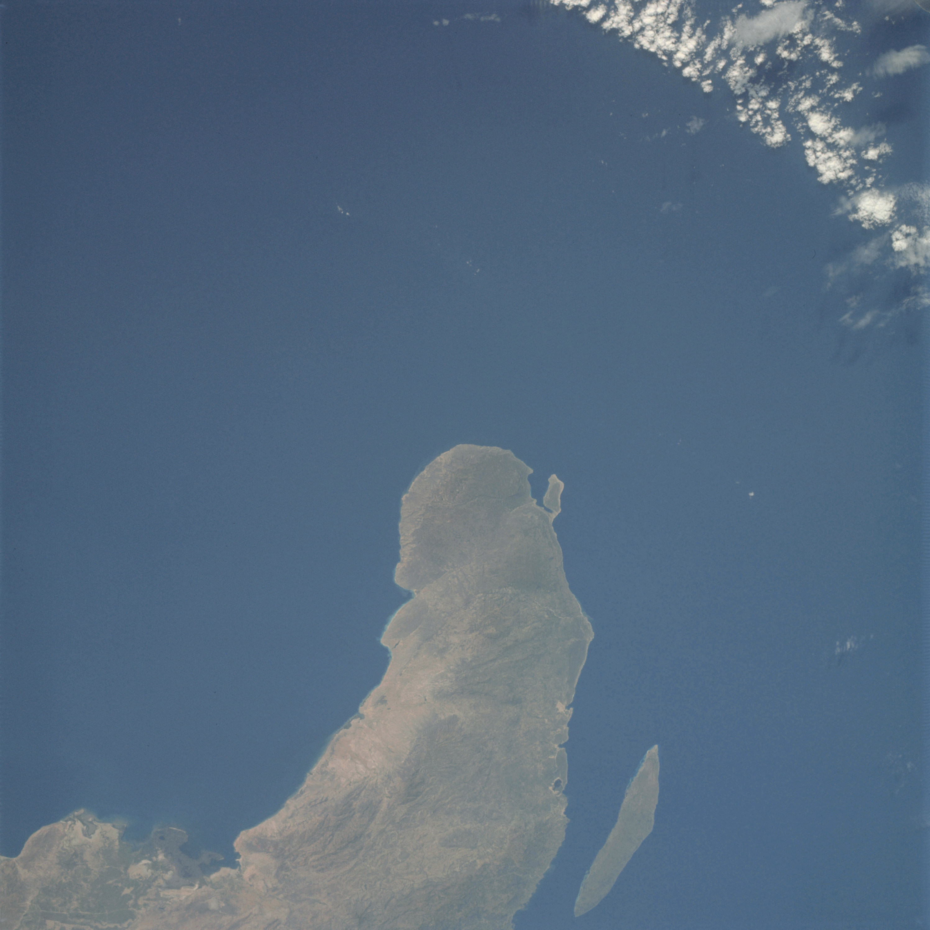 | AS09-22-3472 GEOGRAPHY/CARTOGRAPHY: Haiti, Cape-A-Foux, Torture Island, Windward Passage, Towns of Gonaives, Bombardopolis, and Jean Rabel. GEOLOGY/HYDROLOGY: Complex mountains and coastal plain. AGRICULTURE: Small isolated field patterns, mostly along coast. FORESTRY: Mixed broadleaf, deciduous and evergreen forests. METEOROLOGY: Cumulus humilis. OCEANOGRAPHY: Caribbean Sea, steep nearshore zone indicated by coastal features and little submarine detail. Image credit: Image Science and Analysis Laboratory, NASA-Johnson Space Center. |
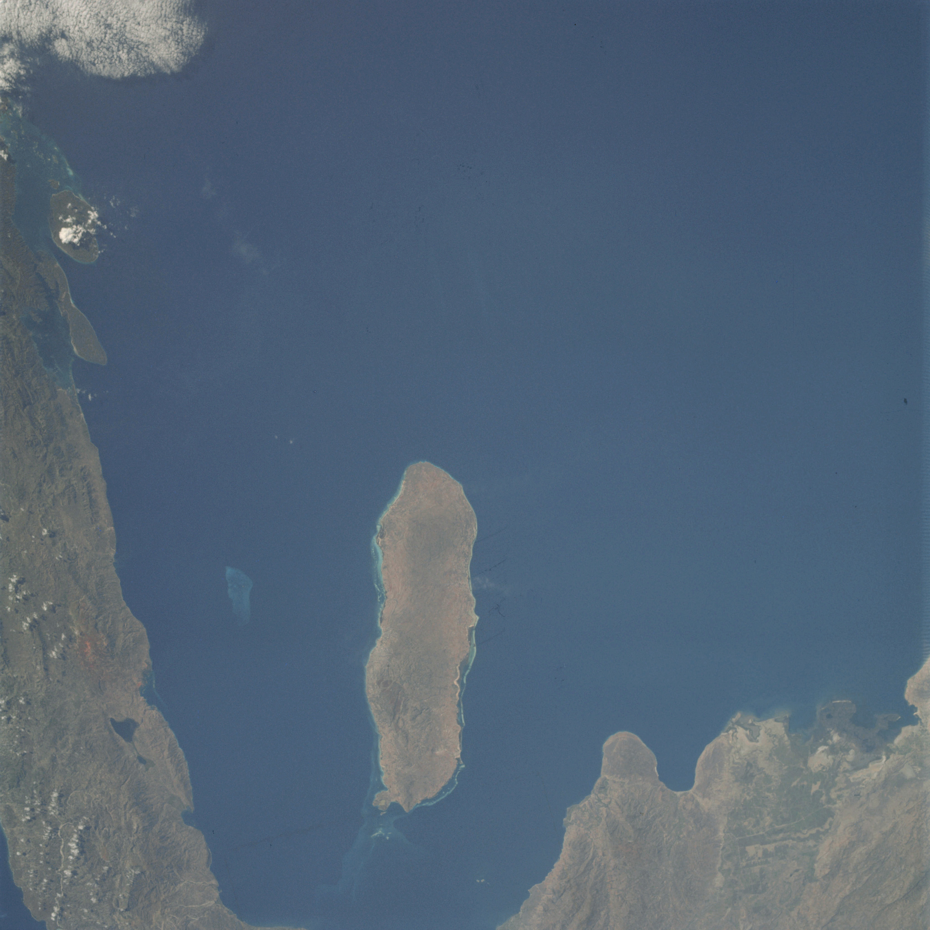 | AS09-22-3473 GEOGRAPHY/CARTOGRAPHY: Haiti, Gonave Island, St. Mark and Sud Canals, Town of St. Mark. GEOLOGY/HYDROLOGY: Complex mountains and coastal plain. AGRICULTURE: Field patterns visible near Gonaives. FORESTRY: Mixed broadleaf, deciduous and evergreen. METEOROLOGY: Cirro-cumulus. OCEANOGRAPHY: Caribbean Sea, coral reefs and heads. Image credit: Image Science and Analysis Laboratory, NASA-Johnson Space Center. |
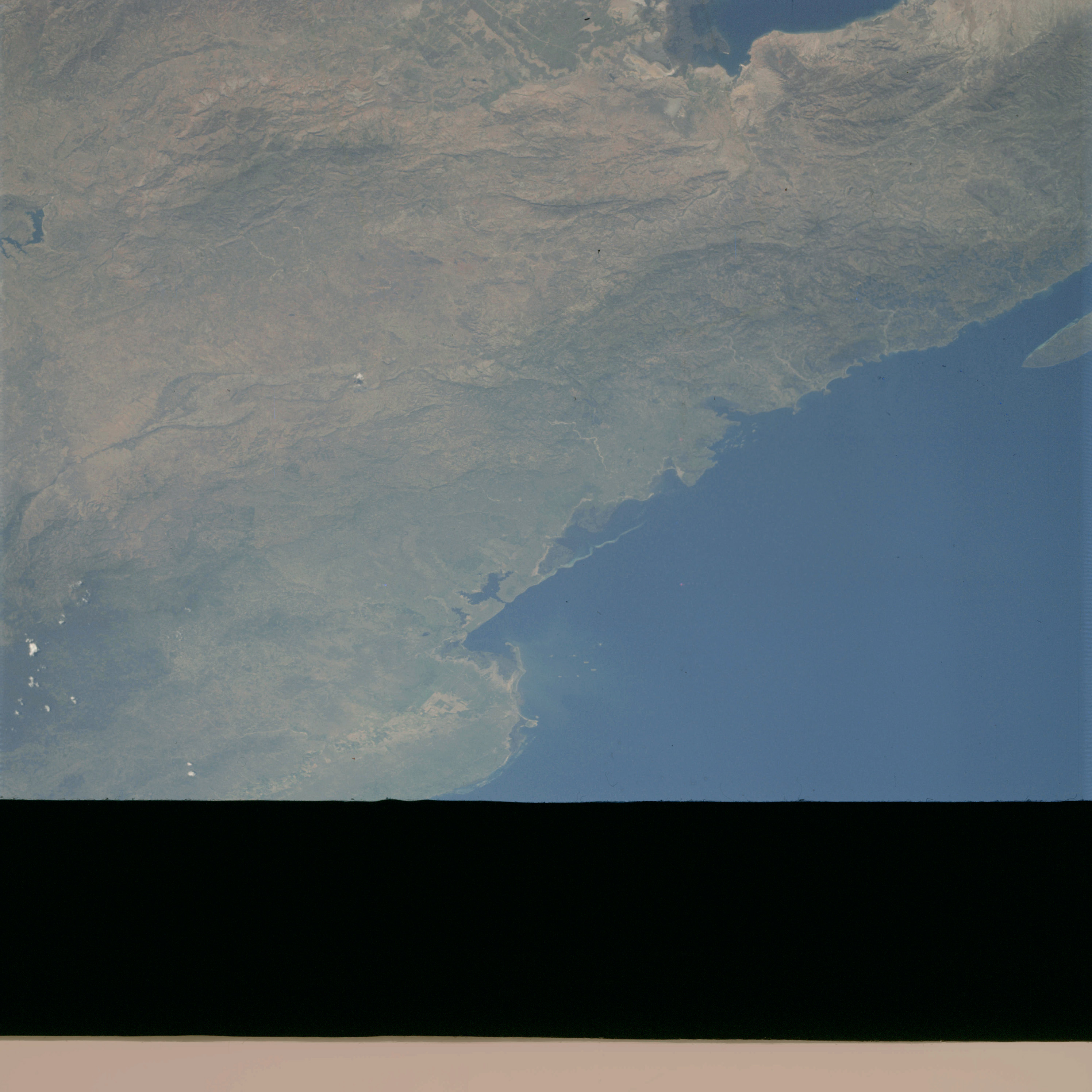 | AS09-22-3474 GEOGRAPHY/CARTOGRAPHY: Haiti, Dominican Republic, Torture Island, Manzanillo Bay, Towns of Cape Haitien and Gonaives. GEOLOGY/HYDROLOGY: Complex folded mountains and coastal plain region. AGRICULTURE: Field patterns near Gonaives and Monti Cristi. FORESTRY: Mixed broadleaf, deciduous and evergreen. METEOROLOGY: Cumulus humilis. OCEANOGRAPHY: Caribbean Sea, depth variations indicated by color differences. Image credit: Image Science and Analysis Laboratory, NASA-Johnson Space Center. |
|
|
|
| 70-mm magazine B - AS09-21-3178 to 3323 |
Photography Index | 70-mm magazine D - AS09-23-3475 to 3618 |